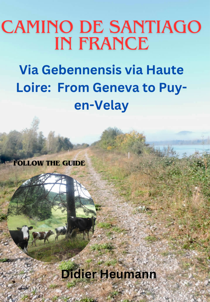
From one forest to another
DIDIER HEUMANN, ANDREAS PAPASAVVAS

We divided the course into several sections to make it easier to see. For each section, the maps show the course, the slopes found on the course, and the state of the route (paved or dirt roads). The courses were drawn on the « Wikilocs » platform. Today, it is no longer necessary to walk around with detailed maps in your pocket or bag. If you have a mobile phone or tablet, you can easily follow routes live.
For this stage, here is the link:
https://fr.wikiloc.com/itineraires-randonnee/des-setoux-a-la-papeterie-par-le-gr65-74166541
| Not every pilgrim feels comfortable using GPS devices or navigating on a phone, especially since many sections still lack reliable internet. To make your journey easier, a book dedicated to the Via Gebennensis through Haute-Loire is available on Amazon. More than just a practical guide, it leads you step by step, kilometre after kilometre, giving you everything you need for smooth planning with no unpleasant surprises. Beyond its useful tips, it also conveys the route’s enchanting atmosphere, capturing the landscape’s beauty, the majesty of the trees and the spiritual essence of the trek. Only the pictures are missing; everything else is there to transport you.
We’ve also published a second book that, with slightly fewer details but all the essential information, outlines two possible routes from Geneva to Le Puy-en-Velay. You can choose either the Via Gebennensis, which crosses Haute-Loire, or the Gillonnay variant (Via Adresca), which branches off at La Côte-Saint-André to follow a route through Ardèche. The choice of the route is yours. |
 |
 |
If you only want to consult lodging of the stage, go directly to the bottom of the page.
Since the previous stage, you’ve understood that Haute-Loire doesn’t just offer peaceful countryside paths. Here, the hills rise with character, sculpting a landscape that, while not mountainous, presents its own set of challenges. And today will be no exception! The first part of the journey will test your endurance: a real dance between demanding ascents and strategic descents, a game of skill through the woods, where every step is a victory. Less grueling than the previous day, certainly, but still a challenge to overcome. Then, in the second part, the landscape opens up to a welcome gentleness: a harmonious alternation between coniferous forests and groves of deciduous trees, where maples and ash trees reign supreme. Along the paths and pastures, these majestic trees do not simply adorn the landscape; they are its soul. For centuries, ash and sycamore maples have nourished both humans and animals, their leaves once used for fodder or bedding. While their agricultural role has diminished with the rise of corn, they have lost none of their nobility. Even today, their precious wood, shaped by the hands of cabinetmakers and craftsmen, continues a story where nature and craftsmanship blend with elegance.
The true countryside, primarily represented here by meadows, is sparse in crops, often punctuated by modest fields of corn. This region of Pilat you’re passing through was once a thriving industrial center, dominated by textiles since the time of Francis I. Silk spinning was established here in the late 16th century, harnessing the power of waterfalls to drive its hydraulic wheels on old wheat and oil mills. By the early 19th century, this region had nearly a thousand businesses, thriving in sericulture, spinning, weaving, and ribbon-making. Steam-powered railway lines were developed to facilitate transport, but today only the modest Velay tourist train remains in Pilat. With the advent of synthetic fibers and the loss of colonial markets in the 20th century, the textile industry declined. The oil shocks then delivered the final blow. Today, despite the potential revival of high-quality textiles in France, the water mills will never turn again.
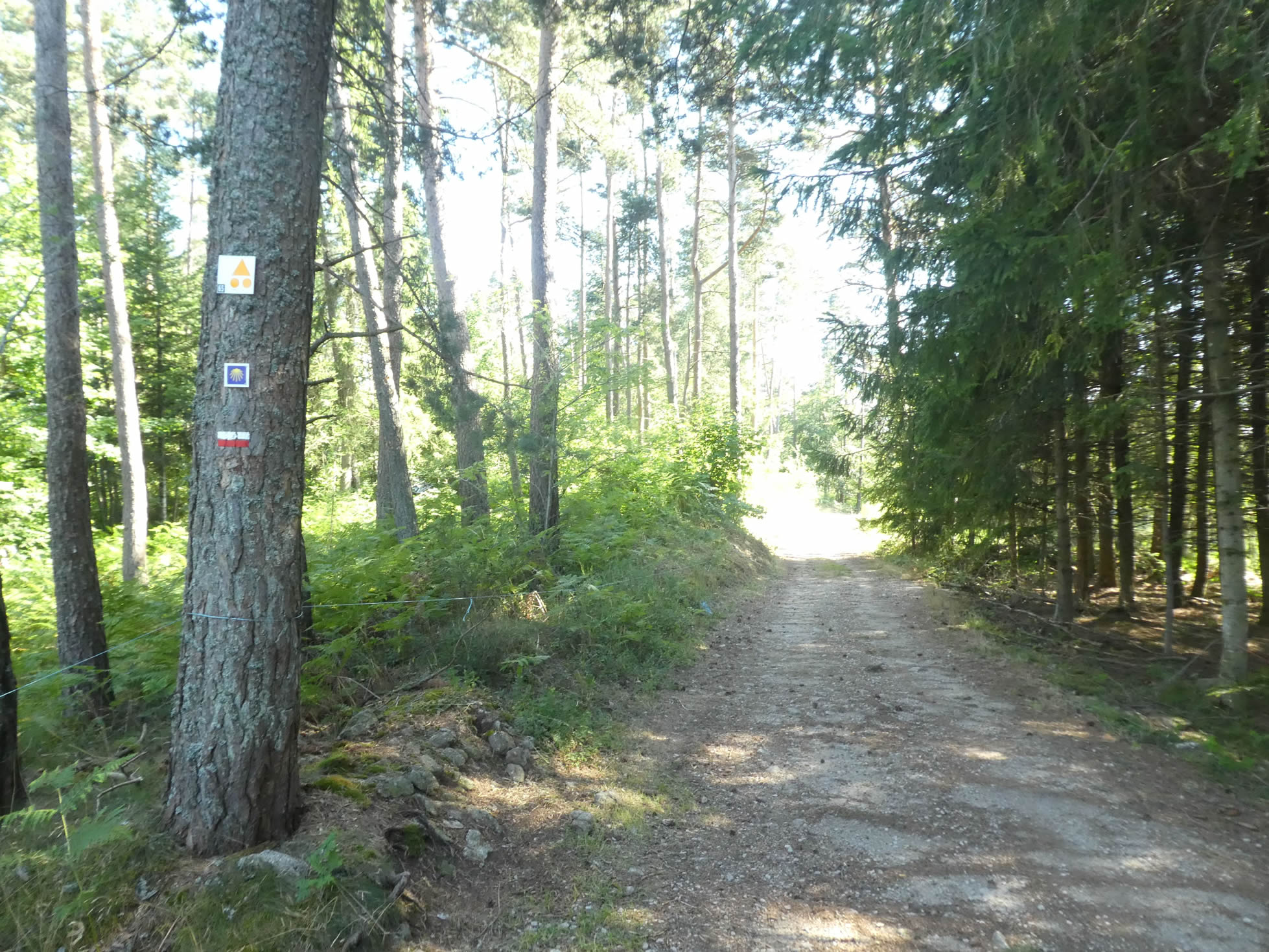
A note must be made here about the signage for the long-distance hiking trails (GR). When there’s only one in the region, it’s easy. But when there are two or even three, it’s a bit of a mess. The red/white markings of the GR never indicate which GR you are walking on. So, you may sometimes take unnecessary detours. The only solution is to choose the right one at the start, but that’s not always easy. Here, you will have the great pleasure of encountering the GR430, a major source of confusion for pilgrims on the Way of St. James Pay close attention to the directional signs on this stage. This is a delicate stage from this point of view, reminding you once again that your route is the GR65, only the GR65.

.

Difficulty level: The elevation changes (+578 meters/-888 meters) are marked today, and the stage is quite long. Here, you descend more than you climb, all day long. The first part is difficult, with three successive hills, each with over 100 meters of positive elevation gain. And sometimes, though rarely, the paths are stony, occasionally extremely rocky. In rainy weather, this area becomes a real treat. This obstacle course lasts until you reach Montfaucon-en-Velay. Beyond Montfaucon, the undulations are light and sometimes barely noticeable after experiencing the difficulties of the first part of the route.
State of the GR65: Today, paths clearly outweigh paved roads, which is rare on the French Camino de Santiago:
- Paved roads: 4.7 km
- Dirt roads : 20.7 km
Sometimes, for reasons of logistics or housing possibilities, these stages mix routes operated on different days, having passed several times on these routes. From then on, the skies, the rain, or the seasons can vary. But, generally this is not the case, and in fact this does not change the description of the course.
It is very difficult to specify with certainty the incline of the slopes, whatever the system you use.
For those seeking « true elevations » and enthusiasts of genuine altimetric challenges, carefully review the information on mileage at the beginning of the guide.

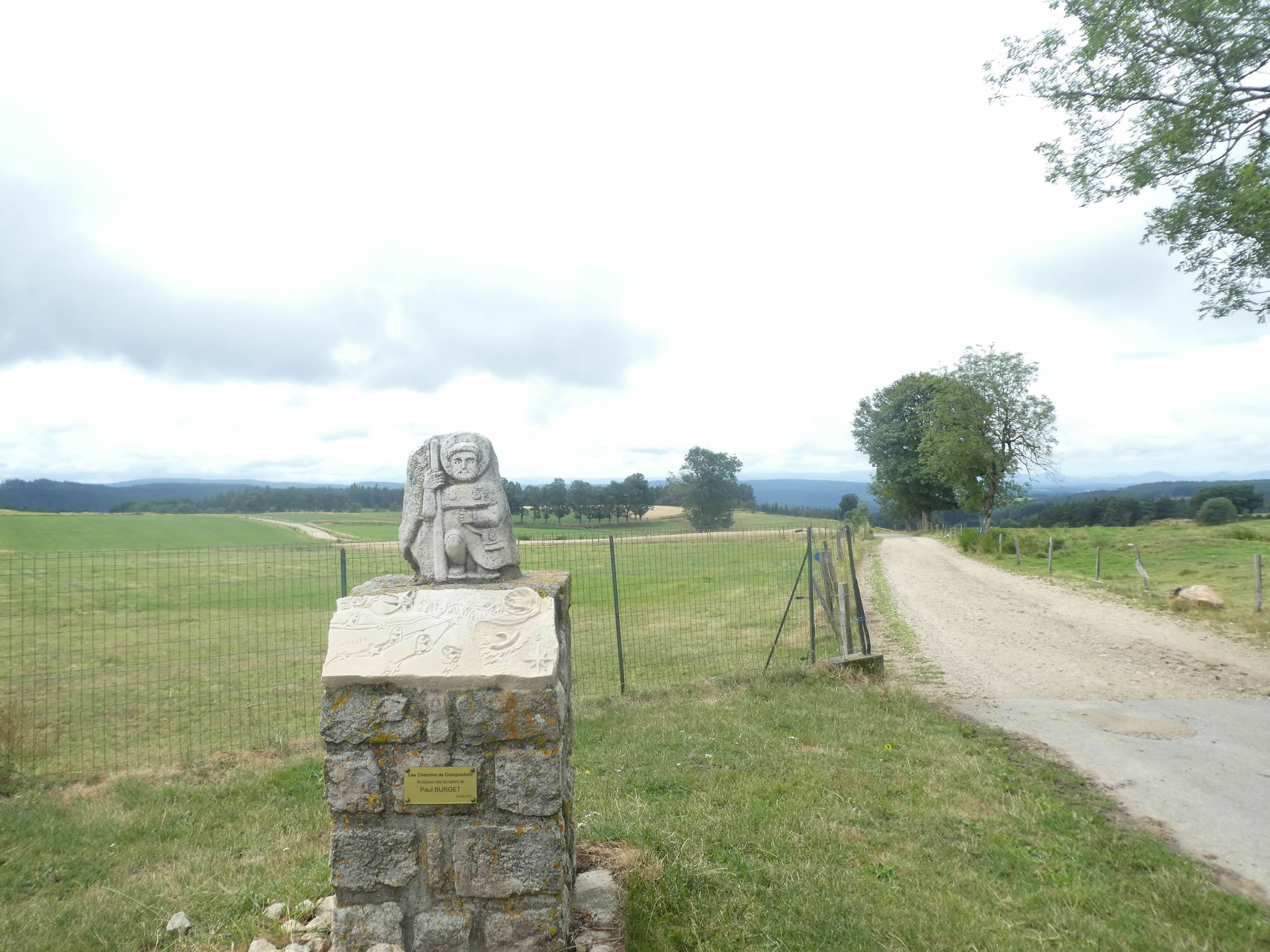
Section 1: Descending into the forest of white firs

Overview of the route’s challenges: Initially, the descent is gentle, but later there are slopes exceeding 15% for over two kilometers.

|
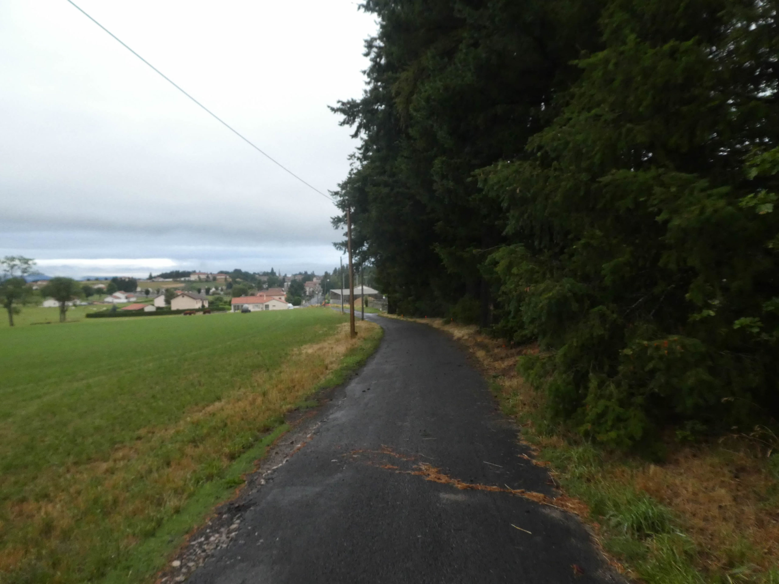
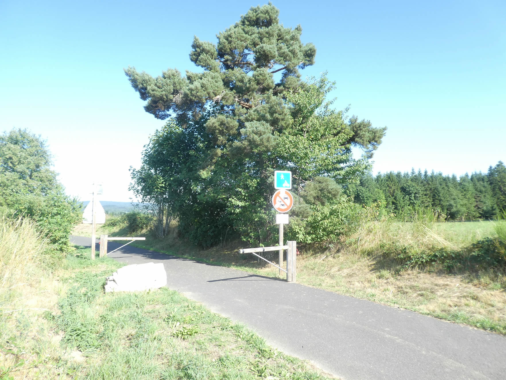
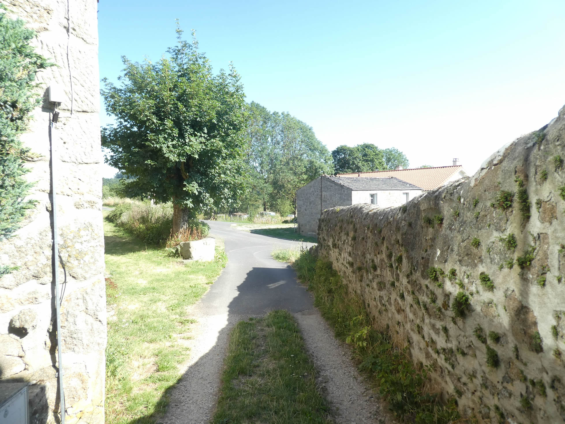
The GR65 emerges from the tranquil Sétoux gîte, gradually leaving behind the last remnants of civilization.
|
 |
 |
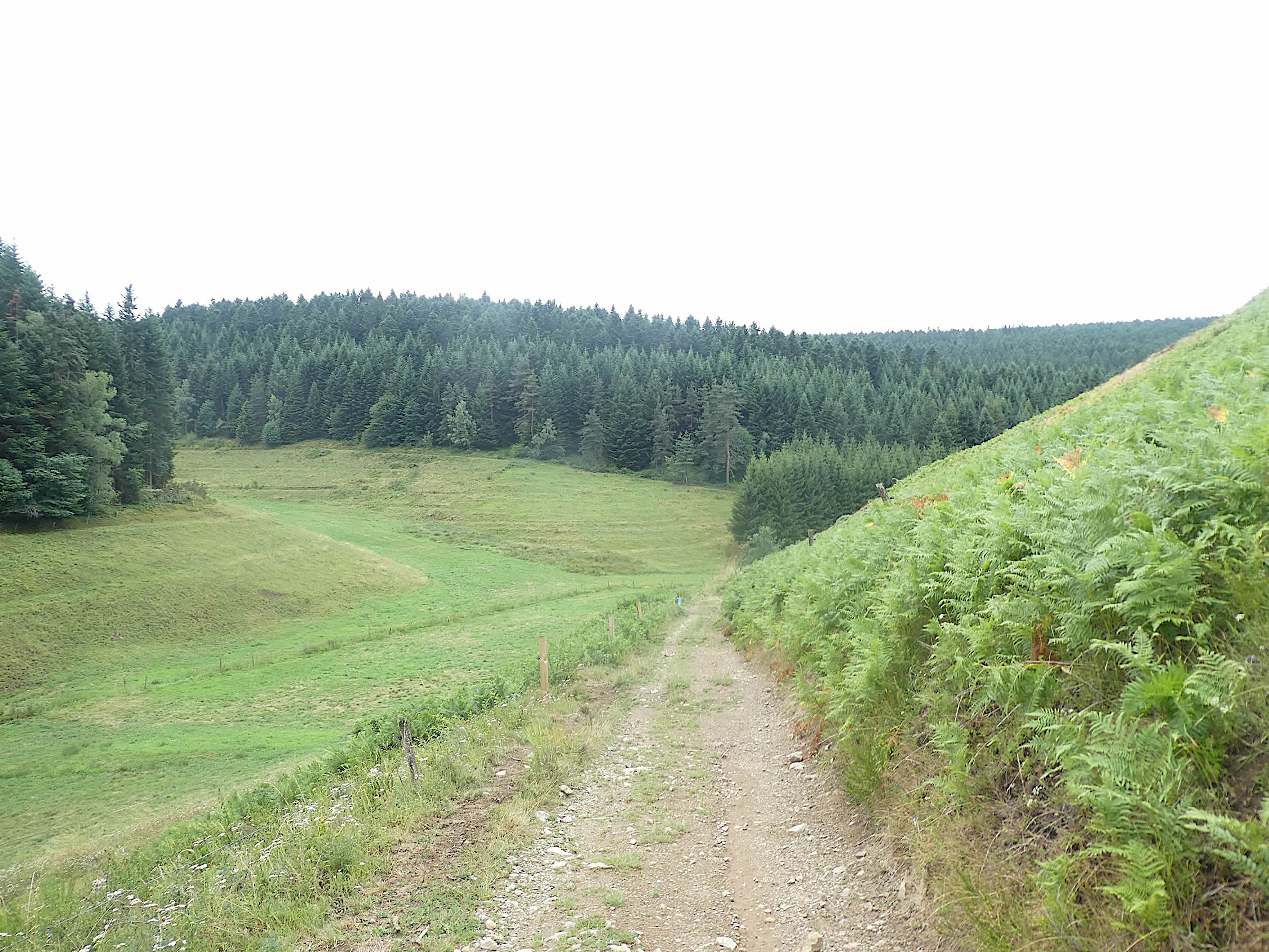
| A wide dirt path slopes down through the meadows, winding down the gentle, broad hillside. |
 |
 |
| The almost imperceptible slope guides the path toward the edge of the forest. Here, the space is vast, offering animals the perfect terrain to roam freely. The embankments are adorned with mosses, lichens, and other plants that colonize the edges of the path, adding a living texture to the environment. |
 |
 |
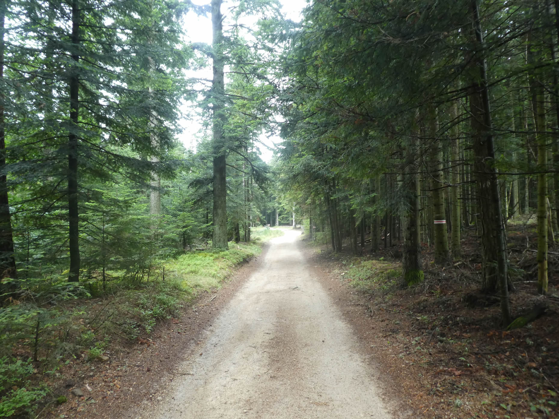
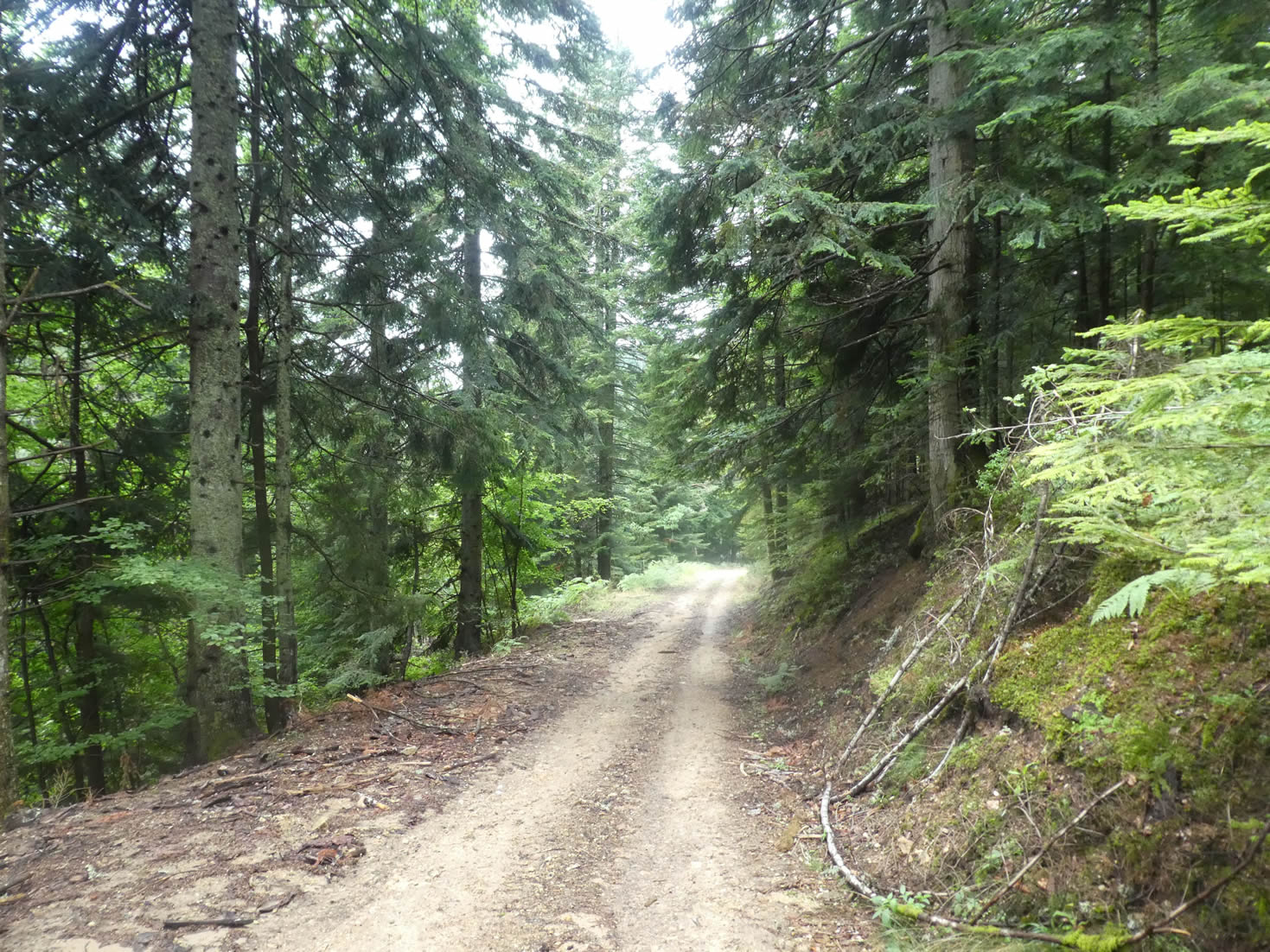
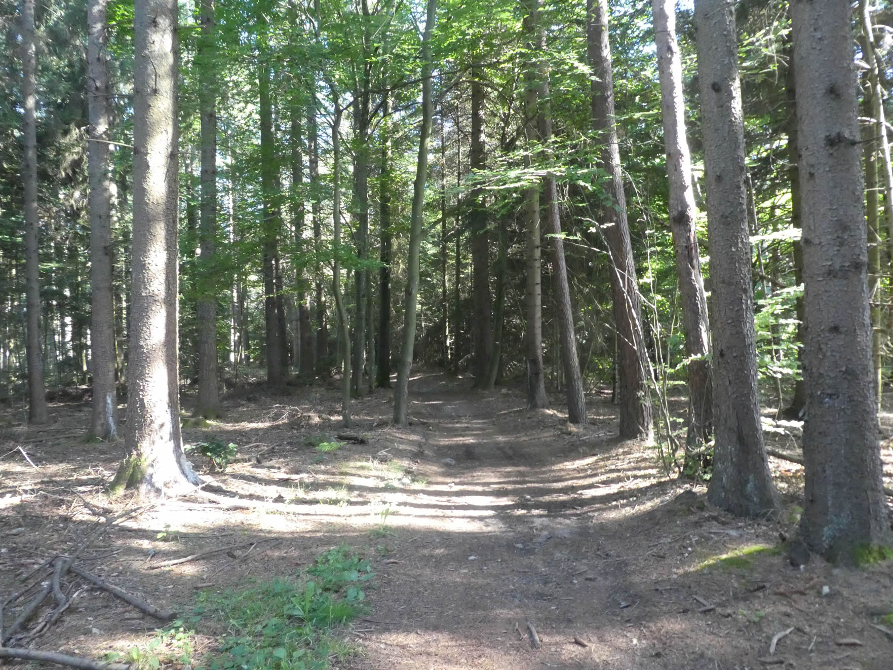
| However, it is at the entrance to the immense Taillard Forest that the true enchantment reveals itself. Majestic fir trees rise like unchanging columns, their slender silhouettes stretching toward an infinite sky. |
 |
 |
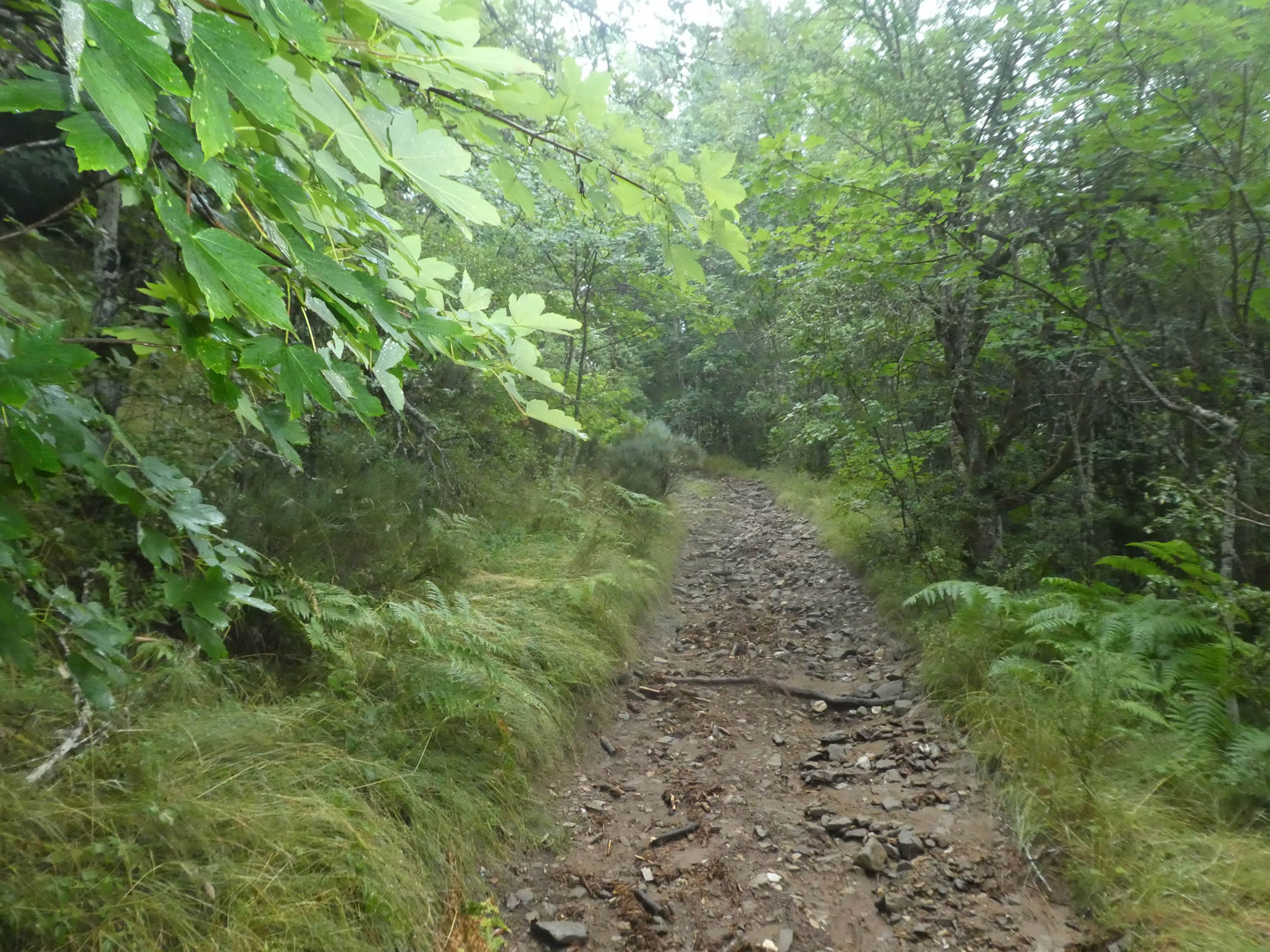
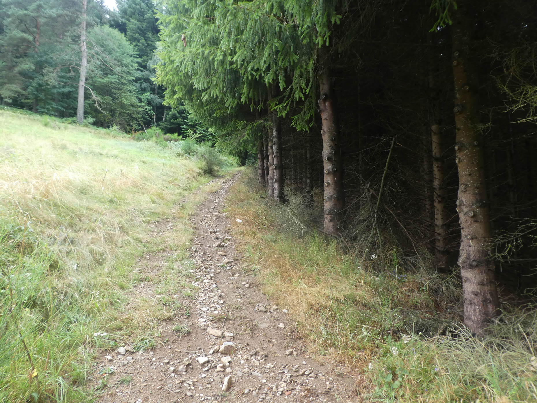
| For nearly a kilometer, the path flattens through this wooded realm, where the fir trees stand in perfect rows on a bed of moss. The traces of recent rains form fleeting patterns on the ground, a temporary testament to the beauty and strength of this forest. It is a forest that welcomes passage with infinite gentleness, as if each step uncovers a new parcel of tranquility and mystery, where nature reigns as the immutable sovereign. |
 |
 |
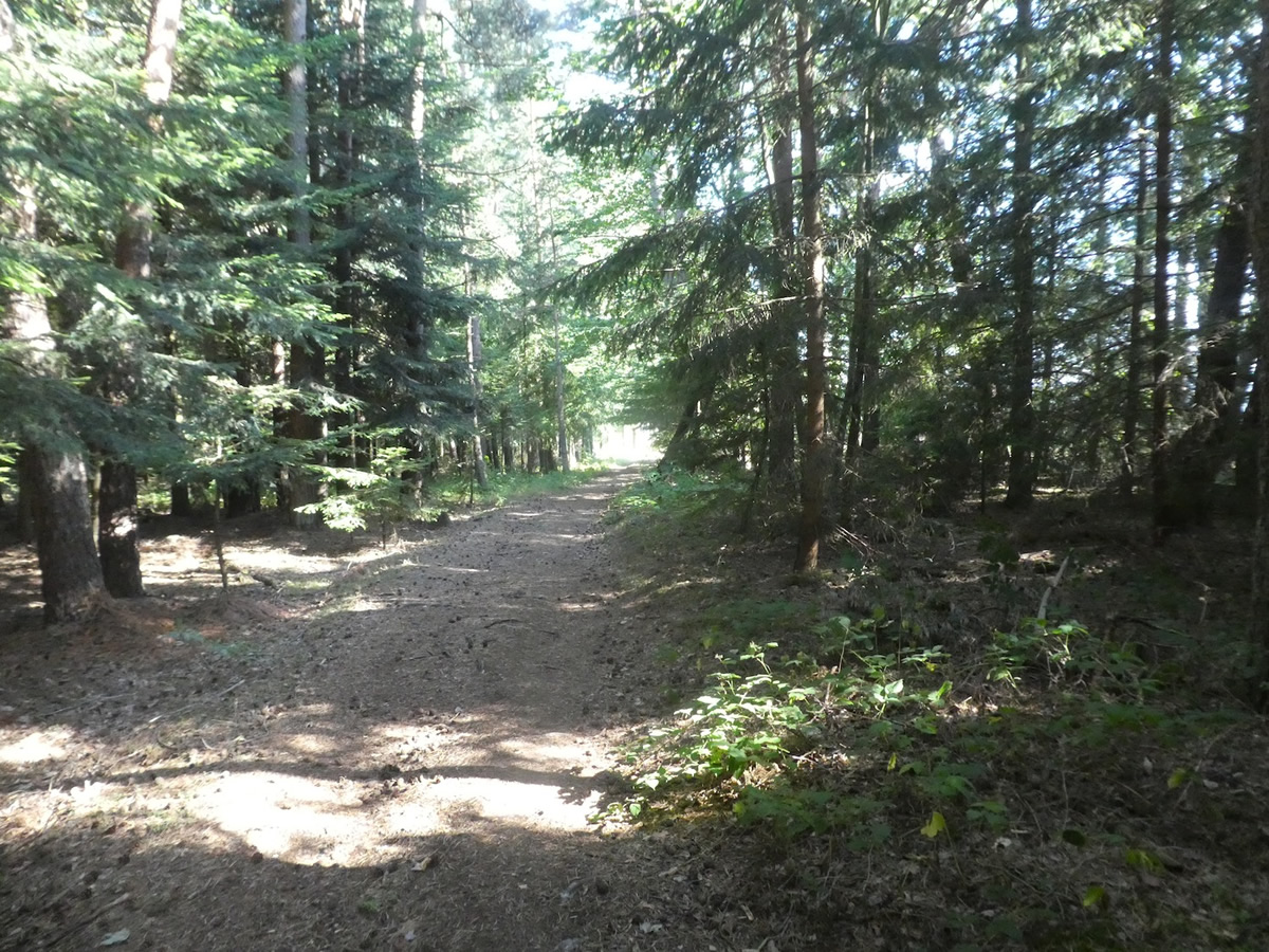
| Then, the slope steepens, exceeding a 10% incline, yet the path continues smoothly along this wide route. The firm ground underfoot ensures easy progress despite the marked descent. |
 |
 |
| Soon, the path emerges from the forest and encounters a fork where a trail leads to a nearby arboretum, abandoned in its isolation. The GR65 resolutely heads toward Lhermet. Discreet markers on the surrounding trees silently testify to a forgotten past: the pilgrimage routes leading to the crash sites of bombers and the landing zones of distressed parachutists. It is an ancient history, whose memories have likely faded with time. It is best to follow the scallop shells of the Camino de Santiago to avoid getting lost in these buried tales. |
 |
 |
| The path then quickly passes through the picturesque hamlet of Lhermet, where the light stone houses stand proudly around the washhouse, still fed by a source of fresh, pure water. |
 |
 |
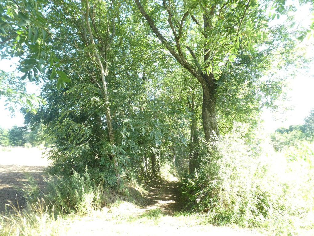
| Descending along the edge of the meadows on a wide, fairly stony path, through a woodland where tall grasses dominate, the environment is largely populated by ash and maple trees, which seem to have eclipsed the other broadleaf species. The conifers, momentarily absent, are destined to reclaim their place in this well-established ecological dynamic. |
 |
 |
| The descent into the dale becomes steeper, with the lush vegetation sometimes interrupted by the unusual presence of hornbeams and tall ferns. The slopes can reach inclinations sometimes exceeding 15%, making progress difficult but exciting with every step. |
 |
 |
| Lower down, as the firs and spruces gradually reappear, emerging above the tall ferns, the landscape regains its characteristic local conifer dominance, offering an enchanting tableau of dense greenery and forest silence. |
 |
 |
Section 2: A scenic gymkhana through the forests
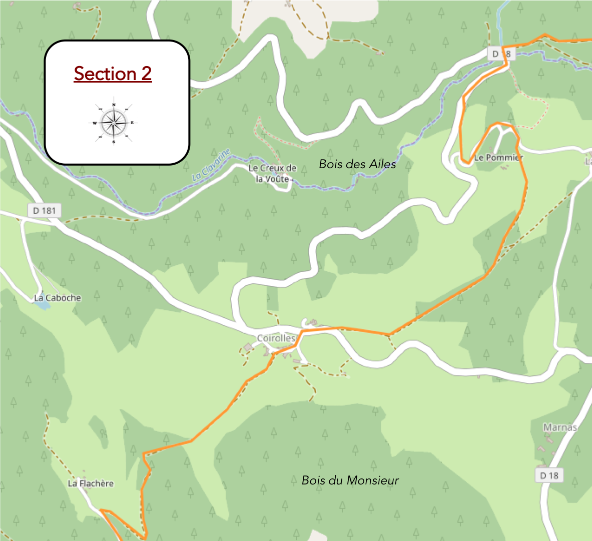
Overview of the route’s challenges: a demanding route with steep slopes, both uphill and downhill.

| The slope intensifies mercilessly as you delve deeper into the dale. The tall, sturdy trees form a verdant canopy that seems to swallow the sunlight, plunging the trail into a gentle twilight. The roots, like gnarled hands, cling to the loose soil, creating natural obstacles that test the hikers. The descent is steep, yet never dizzying. |
 |
 |
| At the heart of the dale, the path carves its way through the Clavarine, a murmuring stream hidden beneath lush vegetation. Giant ferns and vines entwine the trees, creating a landscape of wild beauty, almost impenetrable. The small road that emerges from the bridge, faithfully followed by the GR65, climbs with a 20% incline, as if defying gravity itself. Here, every step is a conquest, every breath a victory. |
 |
 |
| Shortly after, a path branches off from the main road, climbing into the undergrowth, offering an equally charming alternative. The silence is almost tangible, interrupted only by the wind rustling through the branches and the occasional crack of a twig underfoot. It’s a sanctuary of tranquility. The road and the path will eventually converge higher up, but each offers a unique perspective of this mixed forest. Tall silver firs still dominate, their needles forming a soft carpet underfoot. Pines and spruces, though rarer, add touches of dark green and shadow. The deciduous trees, though in the minority, are beginning to gain ground. |
 |
 |
| The GR65 finally joins the winding road that climbs through the majestic firs of the Bois des Ailes. Here, the modern world seems to have forgotten this remote corner. Not a single vehicle disturbs the tranquility of this place, where nature reigns as the absolute master. |
 |
 |
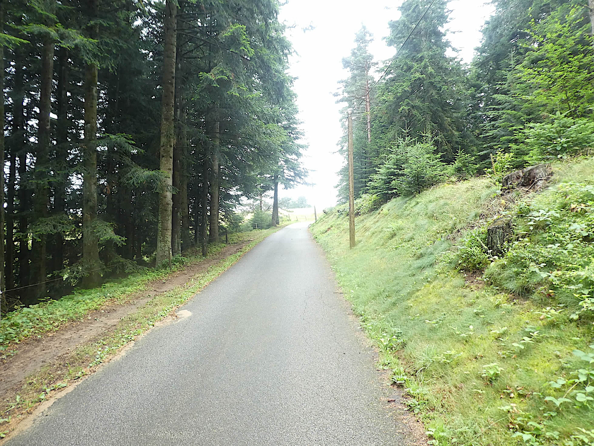
| The route follows the dark road for a while, beneath the towering white firs, their crowns brushing the sky, creating an imposing natural vault. The air is cool, almost biting, and the conifer needles cushion the pilgrims’ steps, making their progress almost silent. The road seems endless, a straight line that fades into the darkness of the woods, inviting meditation and introspection. |
 |
 |
| Soon after, the GR65 diverges from the road, taking a trail that slopes up with a newfound gentleness. The trail winds through mysterious undergrowth, where light plays with shadows. It leads to the farm of the Pommier hamlet, solitary and majestic, perched at the edge of the woods like a sentinel of stone and wood, a silent witness to the passing seasons. |
 |
 |
| However, the effort is not over. The slope steepens again, as the firs and spruces close in around the path, forming a dense and impenetrable forest. A horse with a tousled mane watches the pilgrims with calm curiosity. It is like an apparition, an ethereal guardian of the forest passage. |
 |
 |
| The trail then leaves the darkness of the forest to lose itself in the wild meadows. These meadows, dotted with a few solitary conifers and sturdy ash trees, offer a striking contrast to the dense woods. Occasionally, scattered livestock can be seen, adding a touch of life to this almost pristine landscape. |
 |
 |
|
Then the slope softens, the path widens, and reaches the ridge. The landscape opens up to a nature resembling a sleeping steppe. You feel as though you are walking on the back of a slumbering giant, each step echoing in the vastness. At the top of this first rise, a break is in order. You may savor the victory, having climbed nearly one hundred meters since the bridge over the Clavarine, mentally preparing for the upcoming ascents.
|
 |
 |
| The GR65 then begins a gentle descent through fields of wheat and meadows, with the compacted earth giving way to faded, rough tarmac, adding a note of harshness to the rural setting. The hamlet of Coirolles appears in the distance, like a promise. Here, the more fertile soil allows the cereals to thrive, adding a golden hue to the landscapes. |
 |
 |
| Coirolles is a cluster of beautiful stone houses, nestled along a small road. Some pilgrims choose to stop here, drawn by the possibility of lodging in this secluded hamlet, far from the bustle of civilization. Seemingly lost by chance in this untouched nature, Coirolles offers a haven of peace, a restful stop before continuing on the route. |
 |
 |
| A trail descends steeply from the hamlet, winding through the meadows under the protective shade of ash and maple trees. Broom, lush ferns, thick bushes, and wild grasses border the path, creating a living, moving carpet of greenery. Each step is an immersion into wild, unspoiled nature. |
 |
 |
| A few sheep lazily rest under a centuries-old maple, its vast crown offering a welcoming shade. Beyond this pastoral scene, vast coniferous forests rise, forming a natural barrier on the horizon, a dark and imposing line that calls for adventure. |
 |
 |
As you continue, you pass by a majestic ash tree, a silent witness to the passage of centuries. Its age remains a mystery, but its stature and presence command respect.

| At the bottom of the dale, hidden beneath the tall grasses, a tributary of the Clavarine softly murmurs, invisible yet audible. Ahead, the Bois de Monsieur extends its arms, inviting the route to lose itself within, promising discoveries and mysteries at every turn. |
 |
 |
| Soon, a fairly wide path climbs steeply up the other side of the valley, plunging into the dense forest of white firs. The slope is steep and demanding, but the beauty of the landscape and the serenity of the surroundings encourage the effort. |
 |
 |
| The steep section is short, and calm quickly returns. In these forests, where the firs huddle close together for warmth, they lose some of their lush foliage. Only at the forest’s edge do they compete in elegance, proudly displaying their verdant branches like true lords of the forest. |
 |
 |
| The path then opens onto a clearing, meandering along the edge of the woods. Before you stands the large farm of La Flachère, imposing and rustic. Here, a herd of young cows becomes quite excited at your passing. So, few people pass by here that their playful curiosity is understandable, these lively creatures adding a touch of gaiety to the bucolic scene. |
 |
 |
| At the end of the clearing, the path passes near the large stone farmhouse of La Flachère, seemingly lost in the middle of nowhere, as if emerging from another time. The ancient stone, witness to so many stories, radiates an austere beauty. The silence here is almost palpable, broken only by the distant echoes of the surrounding nature. |
 |
 |
Section 3: The gymkhana intensifies near the Saint-Bonnette stream

Overview of the route’s challenges: a highly demanding route with steep slopes, both uphill and downhill.

| Beyond the farm at La Flachère, a road climbs steeply through the fir trees, with a few scattered deciduous trees adding their graceful silhouettes to the landscape. The climb is challenging, each step feeling heavier than the last, but the fresh, pure air motivates the effort. |
 |
 |
| At a clearing, the GR65 leaves the road for a steep path that climbs at over 20% through a forest of tightly packed firs, plunging the trail into almost complete darkness. This short but intense climb demands every ounce of strength, with each root and stone presenting a new obstacle to overcome. |
 |
 |
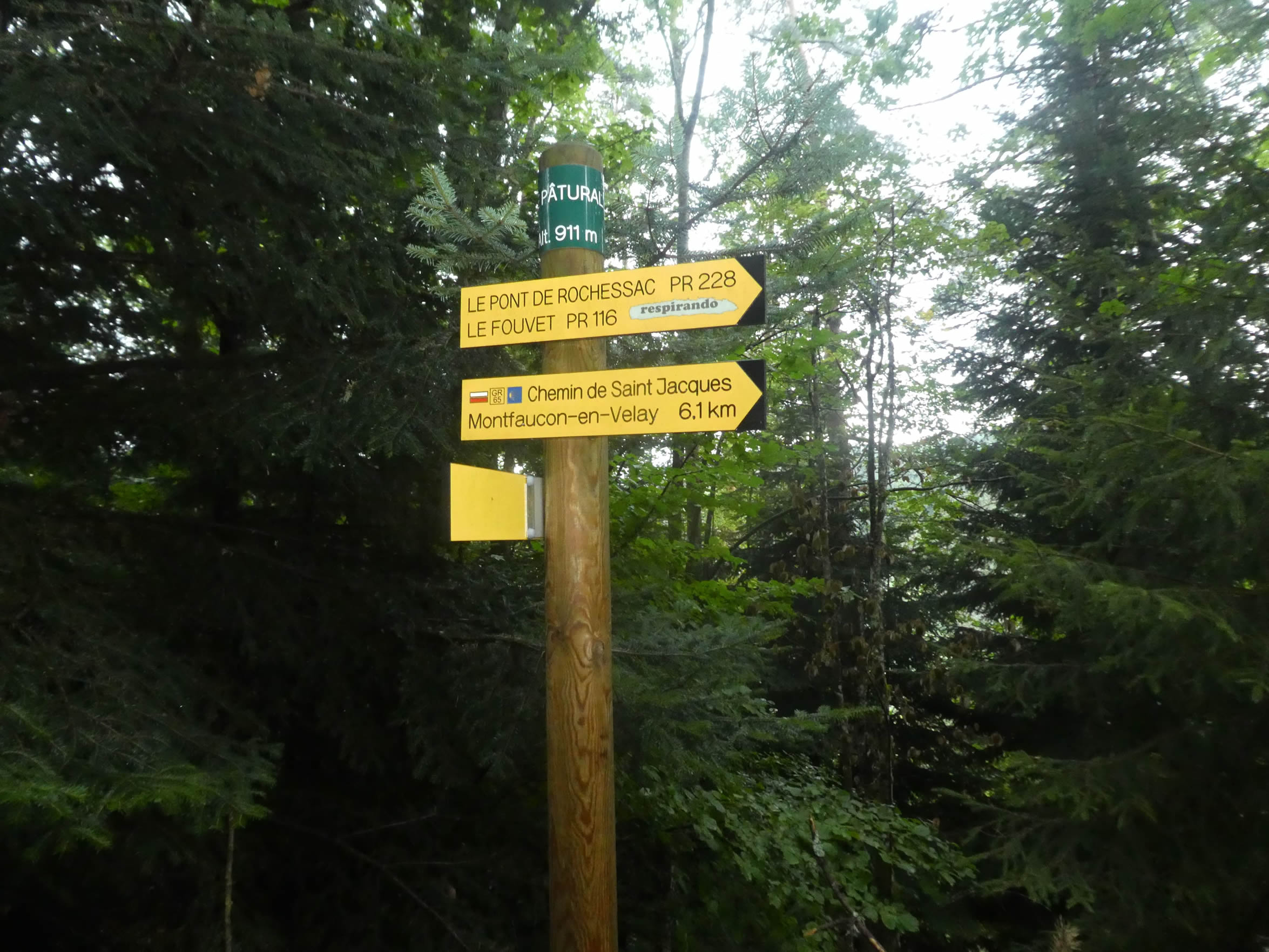
| Further up, the slope eases again amid the tall firs, and another opening appears in the forest. Here, at over 1,000 meters in altitude, you reach the summit of the second « trough/crest » segment. Once again, you’ve gained over 100 meters in altitude since the Clavarine tributary. A similar stretch awaits before reaching Montfaucon, highlighting the rugged geography of this part of Haute-Loire, with its succession of valleys and hills, nestled within immense forests. |
 |
 |
| Next comes a peaceful stretch beneath the fir trees, where the serenity of the towering trees envelops hikers in a gentle tranquility. In season, blueberries carpet the forest floor, offering moments of wild indulgence and a reason to linger. The silence is broken only by the soft rustling of needles underfoot, making this section particularly enjoyable. |
 |
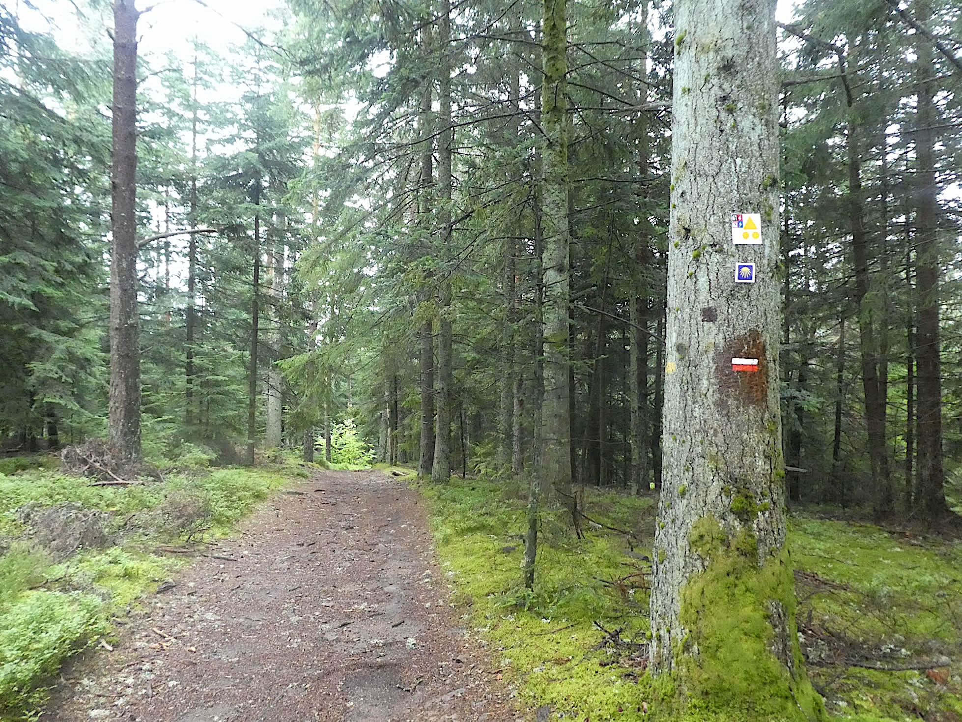 |
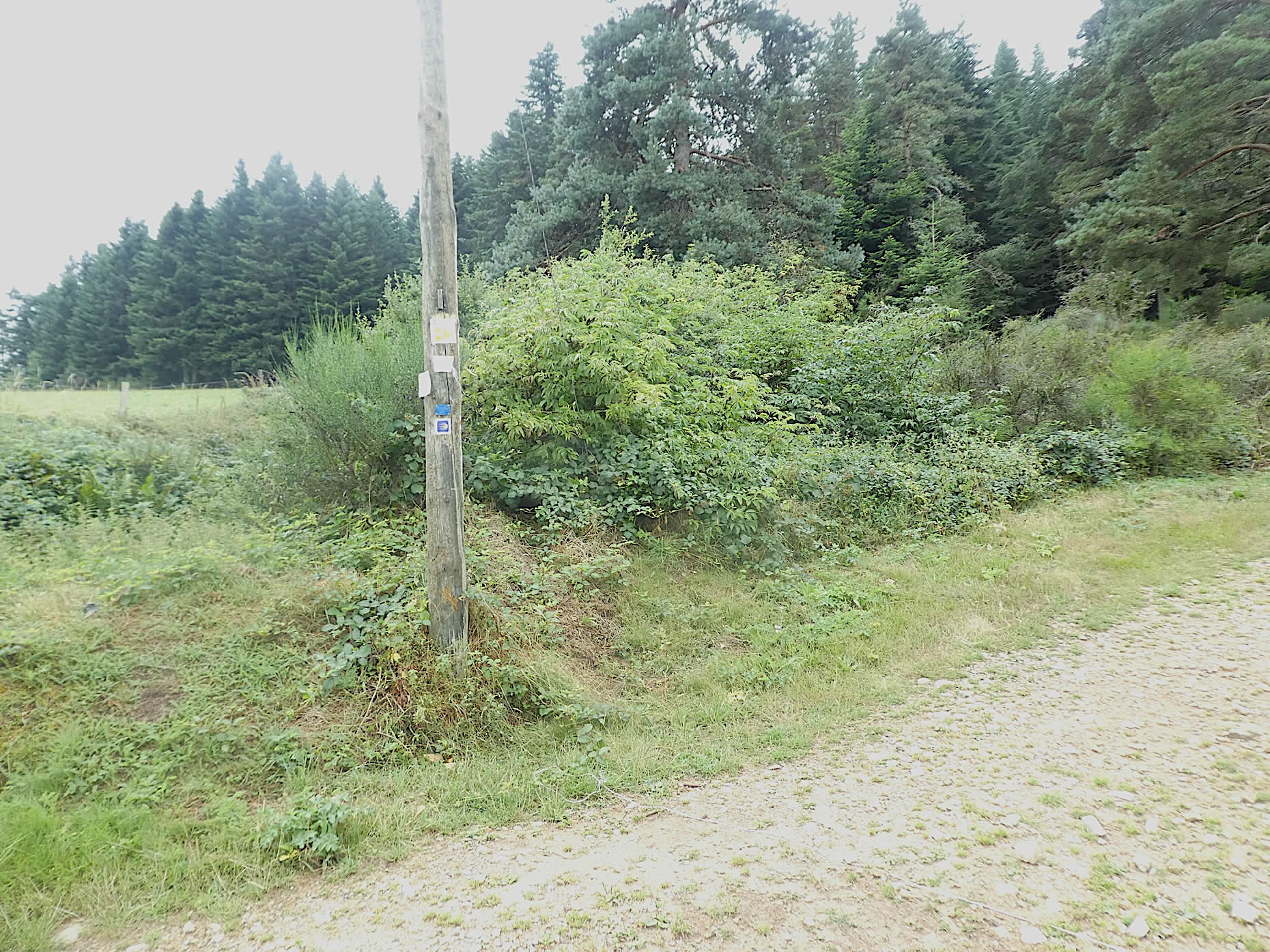
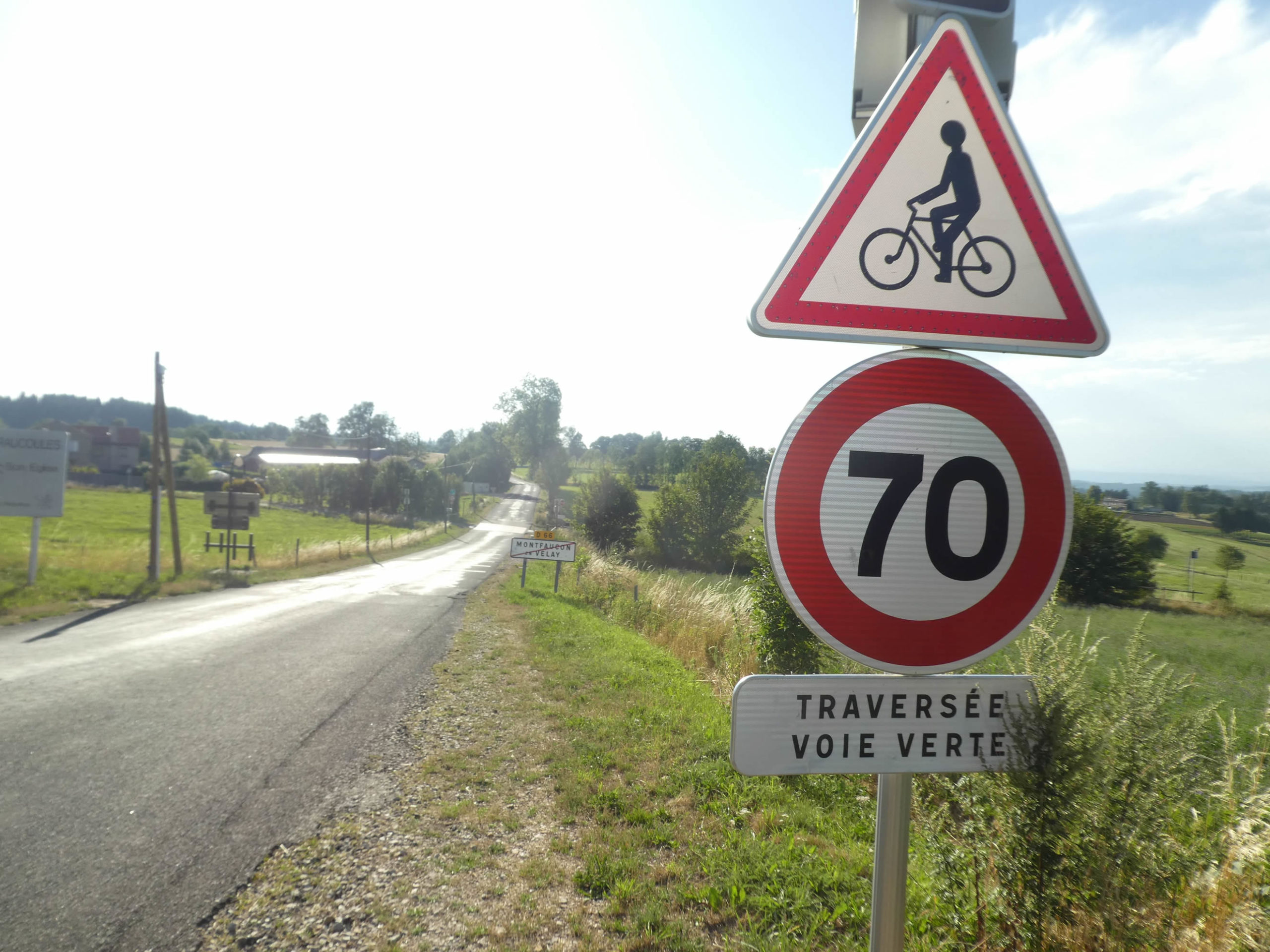
The slope steepens again as you leave the forest and descend into the meadows toward a small road, which is also crossed by the GR430, the St. Regis Way. Here, the directional signs catch your attention with their peculiarities. The GR65 is clearly marked—this is the path to follow. However, the GR430 sign can be somewhat confusing, as this trail can be taken in either direction. What will those returning from Saint-Jean-Bonnet-le-Froid do if they wish to continue their journey? Do they all know they must follow the GR65 to reach Montfaucon?

It’s worth noting the challenges of marking long-distance trails (GR). When there’s only one in the area, it’s straightforward. But when multiple GR trails intersect, it can become a real muddle. The familiar red and white markers don’t always indicate which GR you’re on, potentially leading to unnecessary detours. The key is to choose your path carefully from the start, but that’s not always easy. Here, the message is muddled. The GR65 leads to Montfaucon, as does the GR430, though the latter first detours through Dunières before returning to Montfaucon. To make matters more confusing, at Montfaucon, the GR430 re-joins the GR65, which heads in the opposite direction. Simple, right?

| For you, it’s straightforward: take a right onto the GR65. Here, the two GR trails run together until they cross the Saint-Bonnette River below. They follow the road for a short distance before veering off again into the meadows at the edge of the woods, continuing their dance with nature. |
 |
 |
| The slope, harsh and relentless, varies between 10% and 15%, requiring constant effort to reach the small asphalt road winding at the bottom of the valley, skirting the river. |
 |
 |
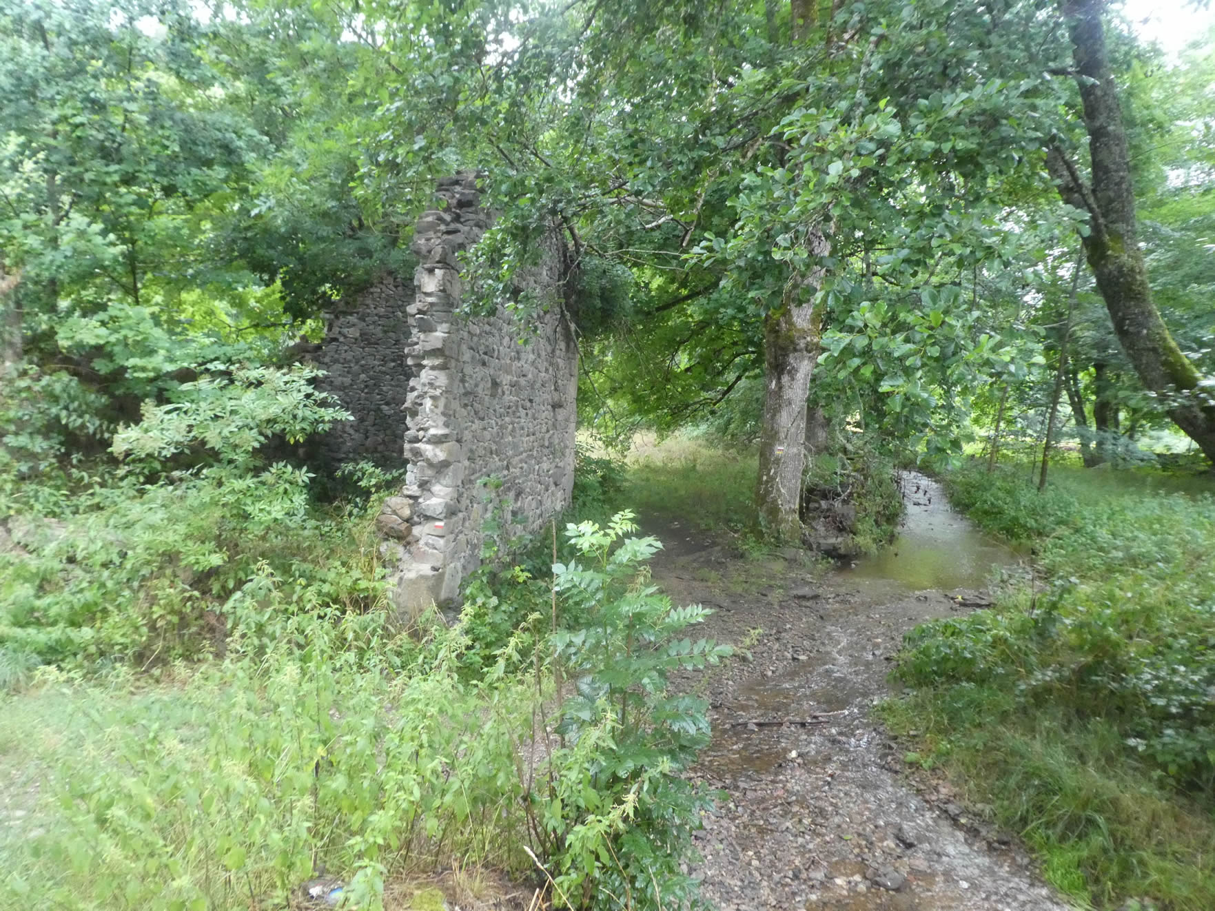
| The dale, damp and enclosed, reveals its wild character. This landscape, far from being always divine, is nonetheless enchanting in its diversity and raw beauty. The road weaves through this lush setting, and the GR65 leads you to the Rochesac Bridge complex on the Saint-Bonnette. . |
 |
 |
| Two streams converge here, adding a melodic note to this natural tableau. The first is easily crossed, but the second presents a balancing act. Two narrow concrete strips, thrown over the water like an improvised bridge, become a real trap in rainy weather. Caution is crucial to avoid plunging into the deep, turbulent waters of the stream. |
 |
 |
| A bad trail, a true battlefield strewn with rocks and roots, plunges into the woods. Here, small maples, stunted oaks, slender ashes, hornbeams, and tangled bushes create a lush green haven. The rain, an unexpected companion, turns this ascent into an even more epic challenge. Each step forward is hard-won, often followed by an almost equal backward slide. |
 |
 |
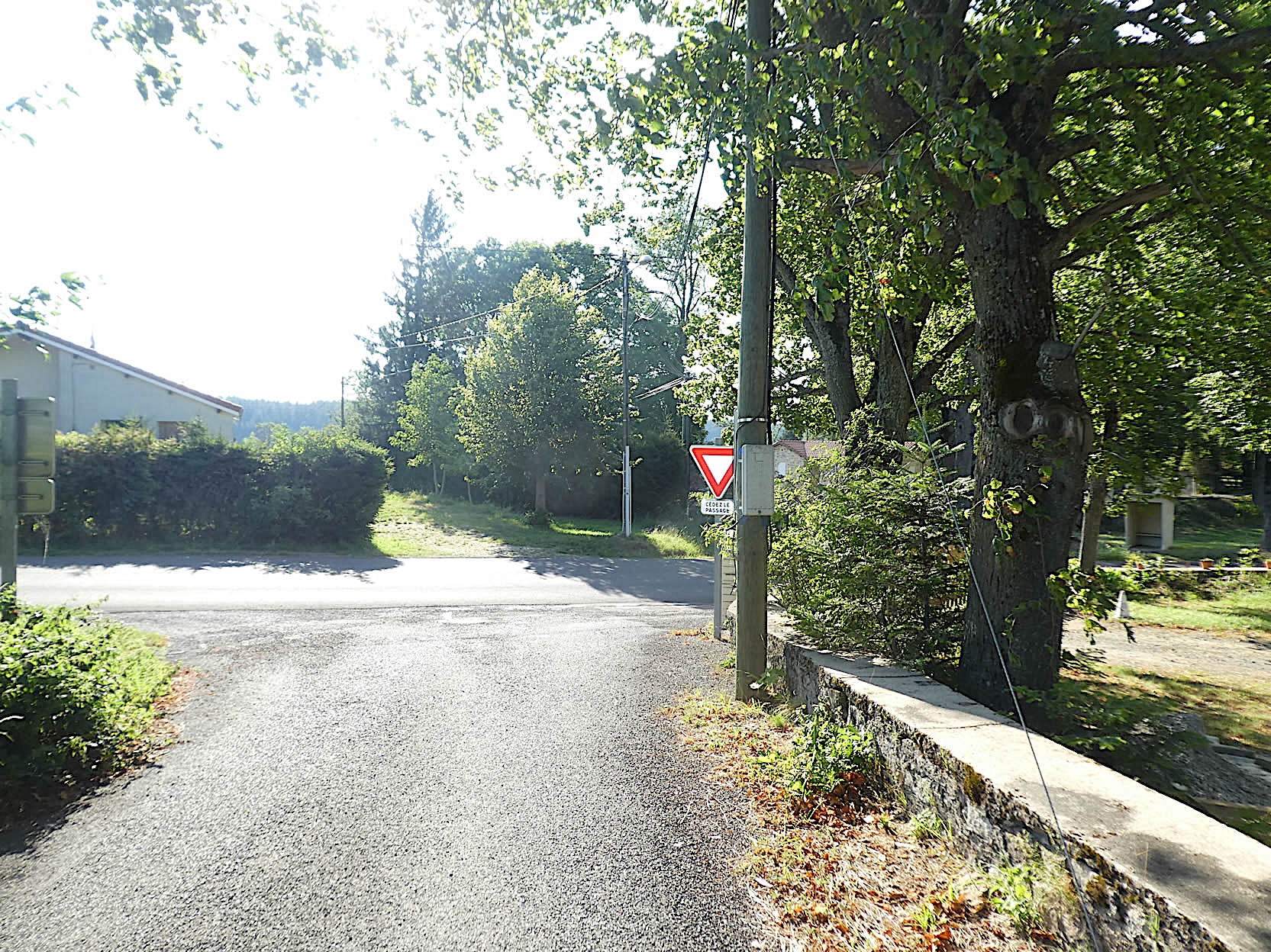
A little higher up, in a winding turn, the path reveals a crucial fork. Here, it’s imperative to follow the GR65 and not the St. Regis Way, which climbs higher toward Dunières.
| From this junction, a barren, eroded trail, often covered in sticky mud during rain, ascends with a vertiginous slope of more than 15% over a distance of more than 500 meters. This path winds through the heart of the forest, where tall white firs mix with hornbeams, creating a canopy so dense that light struggles to penetrate. Fortunately, as the climb progresses, the stones become scarce, making the passage less arduous. Traversing this landscape is like stepping into a living painting, where nature, in all its glory, dictates its pace and moods. |
 |
 |
| Further up, the slope eases, fluctuating between 10% and 15%. The deep black soil betrays a pervasive humidity, while tall ferns carpet the undergrowth, adding a touch of mystery to this forested landscape. |
 |
 |
Section 4: In the forests of Montfaucon-en-Velay

Overview of the route’s challenges: no significant difficulties encountered, despite long descents.

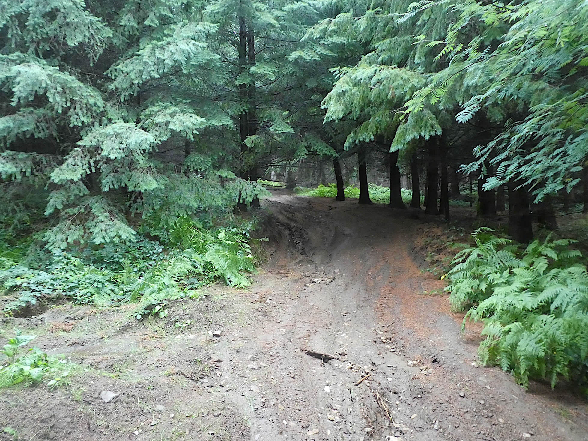
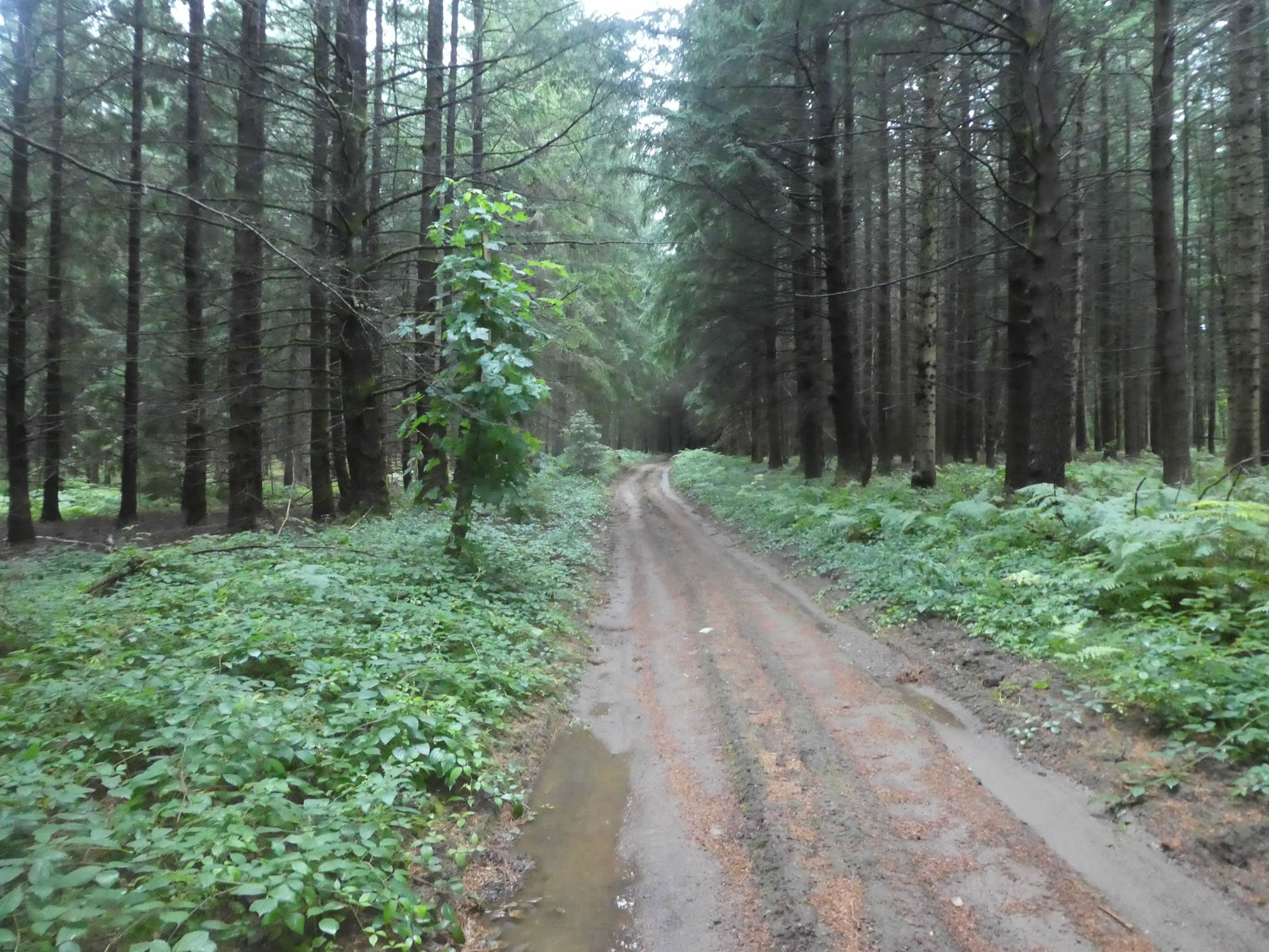
| You have now left behind the labyrinth of dips and bumps that characterized the first part of the route. A broad path unfolds beneath the fir trees, aligned like silent sentinels. These majestic trees rise like natural pillars, guiding your steps with solemn austerity. When it rains, the impermeable soil struggles to absorb the water, turning the path into a course dotted with persistent puddles, where the sun struggles to break through. |
 |
 |
| The ground, relatively smooth, evokes the consistency of clay, soft and compact, interspersed with a few stones that break the monotony of the path. These stones, like minor obstacles, serve as a reminder that even in the most harmonious places, nature retains its right to unpredictability. |
 |
 |
| This path winds through the forest of white firs for a long stretch. In good weather, this walk is a blessing, offering kindly shade and soothing coolness. But under the rain, the narrative shifts: the slippery ground becomes treacherous, giving way underfoot, and each step forward requires caution and determination. |
 |
 |
| Further along, the path crosses a small road, which it quickly traverses before plunging back into the shadow of the forest. Here, moisture is omnipresent, nurturing ferns that reach toward the sky, adding a touch of wild and primitive luxuriance to the atmosphere. |
 |
 |
| Gradually, the density of the forest lessens, the trees space out, allowing a soft, diffuse light to filter through. This transition toward brightness brings a sense of renewal, as if emerging from a deep dream. |
 |
 |
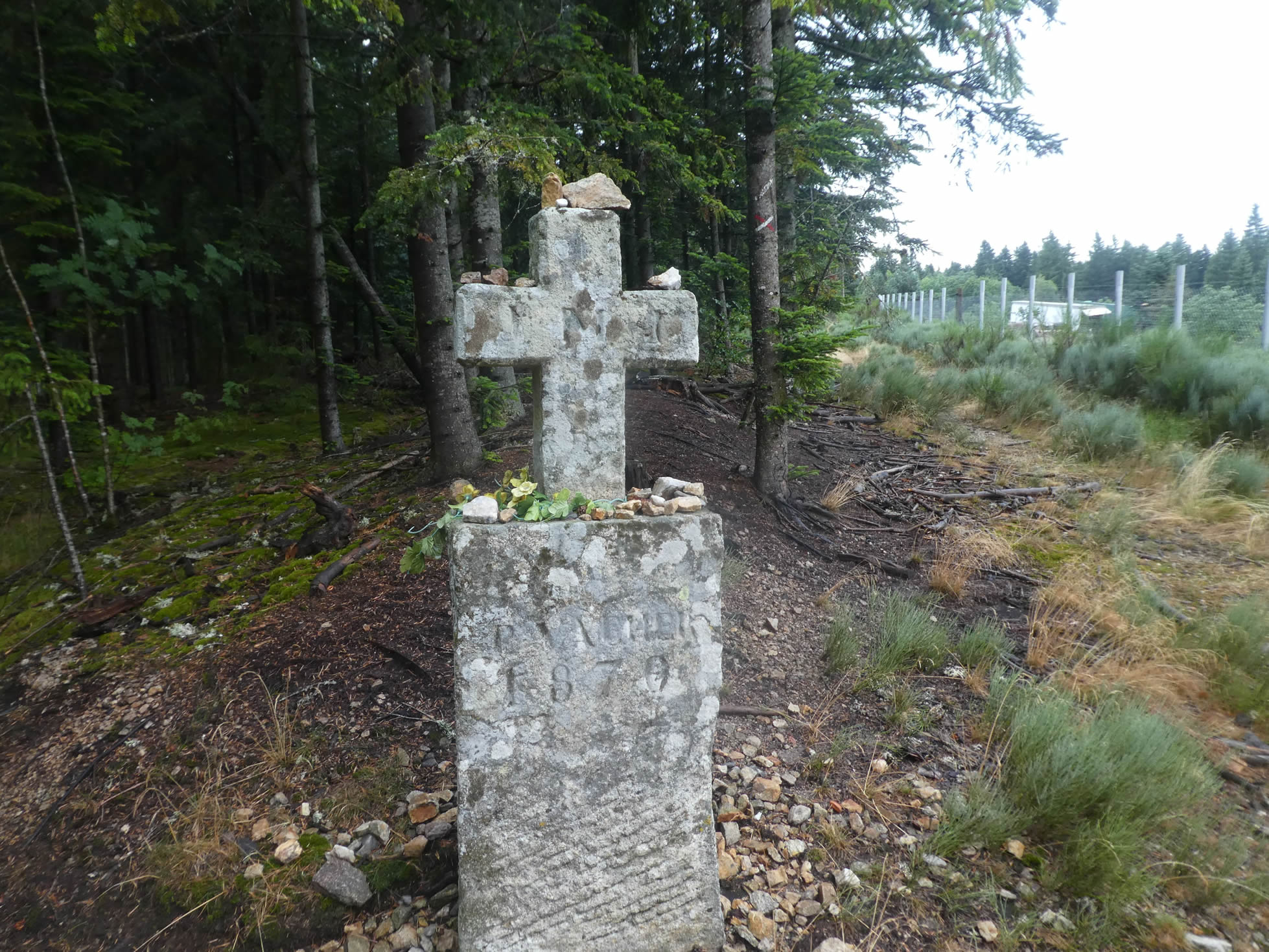
| You finally arrive near a magnificent granite cross, an immutable witness to centuries past. It stands at the edge of a clearing where a fenced-in park lies. |
 |
 |
| The fence protects a herd of free-range pigs. These enclosures do not stifle the spirit of nature, allowing the animals to live under an open sky, imbued with the pure, fresh air of the countryside. |
 |
 |
| Near the pig farm, the GR65 crosses a small departmental road before diving back under the canopy of fir trees, whose thick branches brush the ground. The dense forest gradually thins out, offering a natural passage toward more open horizons. |
 |
 |
| The path then winds from clearing to clearing, punctuated by massive islands of white firs that dot the landscape with their majesty. These clearings are havens of light where the sun’s rays gently caress the earth. |
 |
 |
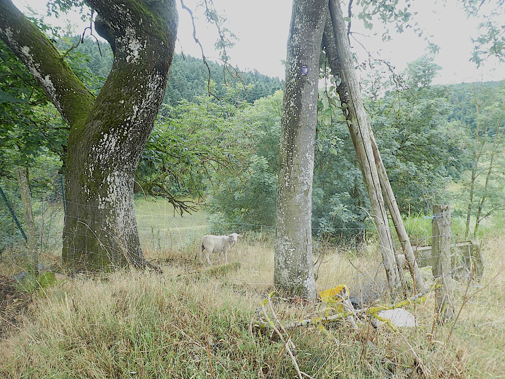
| Occasionally, sheep frolic in the verdant meadows, adding a note of life and movement to this pastoral scene. Their presence breathes a gentle animation into this peaceful nature. |
 |
 |
|
The path then leaves the fir trees behind, crosses another small road, and continues flat, winding through the tender grass beneath the maples. This section is particularly pleasant, offering a tranquil walk in a semi-wild setting, where the maples, with their broad, shady leaves, create an enchanting environment.
|
 |
 |
| As you traverse the countryside, the path reveals a varied landscape, alternating between meadows and cereal fields. Today, the rain-soaked earth is dotted with puddles that expand before your eyes, making the trail slippery and muddy. The conditions are challenging, but in dry weather, this rural passage unveils its full splendor, inviting hikers to fully enjoy the beauty of unspoiled nature. |
 |
 |
| Along the way, near a stone farmhouse, a fork marked by a shell indicates the Camino de Santiago. Is it really necessary to deviate from the GR to follow this iconic route? In reality, you can simply stay on the GR65, especially in bad weather, thus avoiding getting bogged down in the mud. On that day, the path was so flooded that we opted to stay on the GR65. |
 |
 |
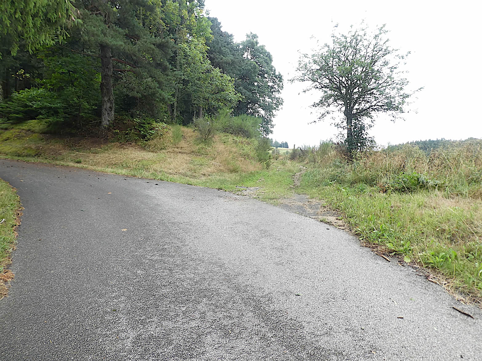
| The GR65 then joins a small paved road that loops to the hamlet of Suchets. This portion of the route, though less picturesque, offers a more practical alternative in case of rain. |
 |
 |
| Beyond this loop, the GR65 and the Camino de Santiago converge again near Montfaucon. While we can only admire the meticulous work of the Friends of Santiago in marking this delicate route, it can sometimes be difficult to navigate with three marked paths. Even a slight lapse in attention can lead to hesitation, especially when each fork seems crucial. Nevertheless, here your objective is clear: to reach Montfaucon, which is just a short distance ahead. |
 |
 |
Section 5: Crossing Montfaucon-en-Velay and its outskirts
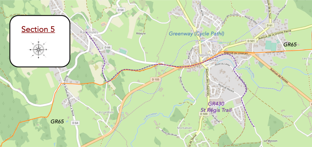
Overview of the route’s challenges: no significant difficulties, despite some inclines.

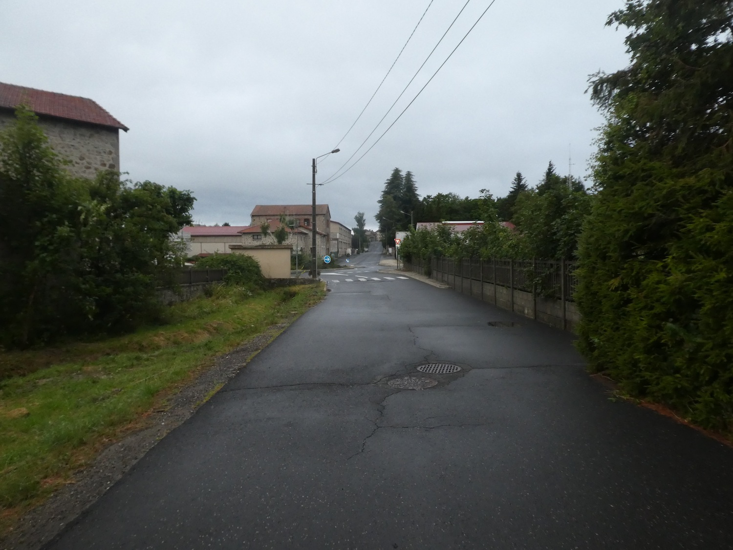
| The road leads you to the entrance of Montfaucon-en-Velay. Here, you witness images depicting a very rainy climate.. |
 |
 |
| At the entrance to the town, you’ll find the St. Régis Trail, a landmark for pilgrims of the Camino de Santiago, often a source of confusion. The GR430, also known as the St. Régis Trail, which you encountered earlier near Pont de Rochesac, diverges toward Dunières and Raucoules before reaching Montfaucon. Your route, the GR65, passes through the town in the opposite direction of the GR430. The meandering paths seem designed to complicate the hikers’ journey, as the St. Régis Trail also leads to Le Puy-en-Velay, but via more scenic detours through the volcanic landscape. |
 |
 |
| The road reaches the top of the town, where a poignant monument stands, dedicated to the heroes of both World Wars. It then descends towards the main street, leading to the church.
Unfortunately, a sudden downpour prevents any photography. Let us reimagine this route under a clear, sunny sky. |
 |
 |
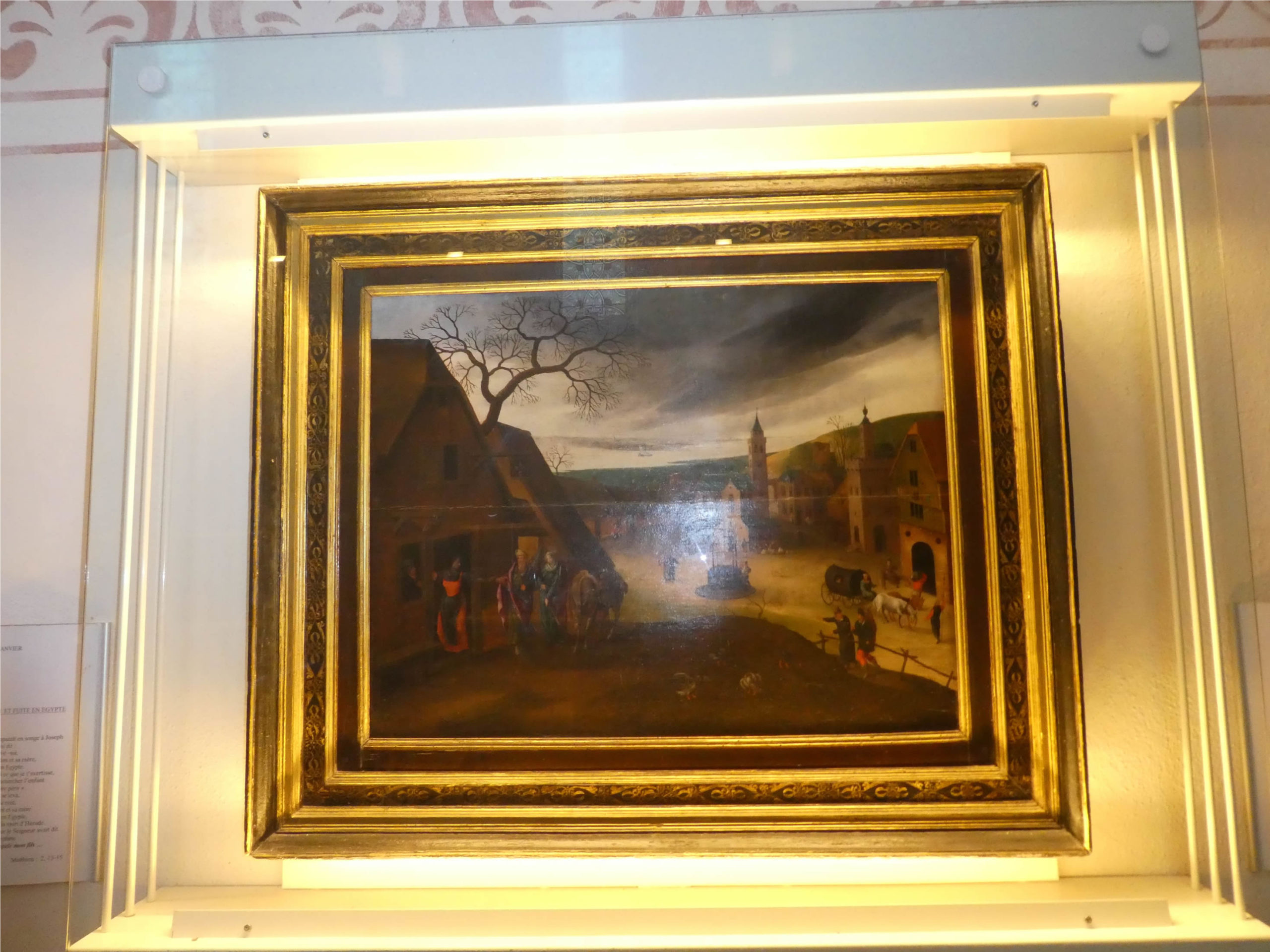
| The road heads to St Peter’s Church, a 19th-century neo-Romanesque building. Upon entering, you might feel as though you’ve stepped into the Rijksmuseum in Amsterdam. An astonishing collection of paintings is housed here, signed by Abel Grimmer, a contemporary of Brueghel. Although Grimmer never visited this region, his works are displayed here thanks to a local marquis, a former ambassador to Brussels. The collection, mysteriously rediscovered during the Revolution, even attracts Dutch visitors. . |
 |
 |
| Leaving the town, the road intersects with the greenway leading to Raucoules, also known as the Via Fluvia. This cycling route had already accompanied you the previous day in St. Sauveur-en-Rue before your ascent towards Les Sétoux. But this is not your route, yet another source of confusion for the dreamy pilgrim. |
 |
 |
| The GR65 then meanders for a while under the kindly shade of large maples before turning onto a dirt road that winds through lush meadows. |
 |
 |
| This dirt road quickly joins a small paved road. It has become a routine near towns, this alternating between pavement and dirt paths, often quite unnecessary. |
 |
 |
| The GR430 continues along the small road from Raucoules to Montfaucon, while the GR65 plunges into the undergrowth. What a relief to see these clear signs indicating the directions and distances ahead. Today, the GR430 stops accompanying you, but it’s only a farewell for now, as you will reunite with it tomorrow. |
 |
 |
| The path then alternates between clearings and woods, without truly settling. At times, you walk among ash trees and maples bathed in light; other times, you traverse dark woods where tall white firs stand like soldiers in tight ranks. |
 |
 |
| Soon after, as you exit the woods, the route opens onto meadows. It then follows a road that traces the former path of the Velay Express, which passed through here not so long ago. In the Montfaucon region, you will find yourself alternating between asphalt and dirt paths without transition. This is undeniably a particularly complex stage for the pilgrim. |
 |
 |
Here stands another magnificent granite cross. If you have ever taken the Gillonay variant, you passed through Saint-Agrève, the other terminus of the train in Ardèche. On this side, the line extended to Dunières, a little further north, where the GR432 runs. This final section was closed in 2015, and now the train stops a little lower down at the Raucoules-Brossette station.

| As you walk along these often-enchanting paths, you will realize how invaluable it is to have clear and effective directional signs. The route of the GR65 frequently meanders in winding loops, weaving between lush meadows and dense forests. We must thank the people of Haute-Loire for their dedication to preserving these woodlands—authentic remnants of a once-omnipresent nature that many other regions have sadly seen disappear under the weight of modernity. Now, the GR65 stretches gently along a paved road, shaded by the protective canopy of maple trees, before turning onto a dirt path that ventures once again into the heart of the forest. |
 |
 |
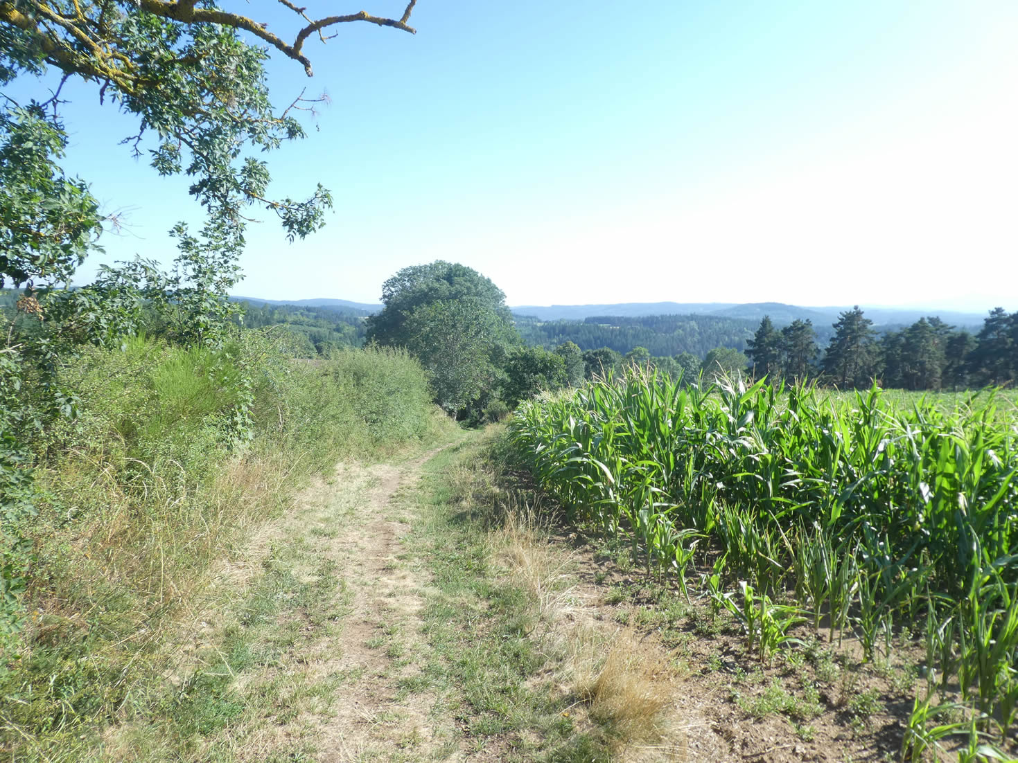
| However, this immersion in the forest is only partial. The wide dirt path skirts the meadows, lined with maize fields, under the protective shade of tall ash trees. A few cattle graze here and there, adding a touch of quiet, rustic life to the scene. Haute-Loire remains, above all, a land of livestock farming and forestry. |
 |
|
| Further on, as if weary of its journey, the path plunges into the dense forest. The towering white firs, packed tightly together, form a dark, impenetrable mass, like a landscape drawn from forgotten tales. |
 |
 |
| Yet, this dense forest hides unexpected treasures: small clearings occasionally open up, where maples spread their majestic branches, challenging the towering height of the white firs. These unexpected openings in the thick shadow bring a soft, golden light, creating a striking contrast with the surrounding forest. |
 |
 |
| Then, the slope softens, leveling out in a small valley where the path winds, inviting a peaceful walk. |
 |
 |
| On the other side, the ascent is gradual, revealing vast open pastures where cows graze peacefully, adding a bucolic touch to this idyllic landscape. The serenity of these places, the beauty of the meadows, and the majesty of the trees make this route a true ode to preserved nature. |
 |
 |
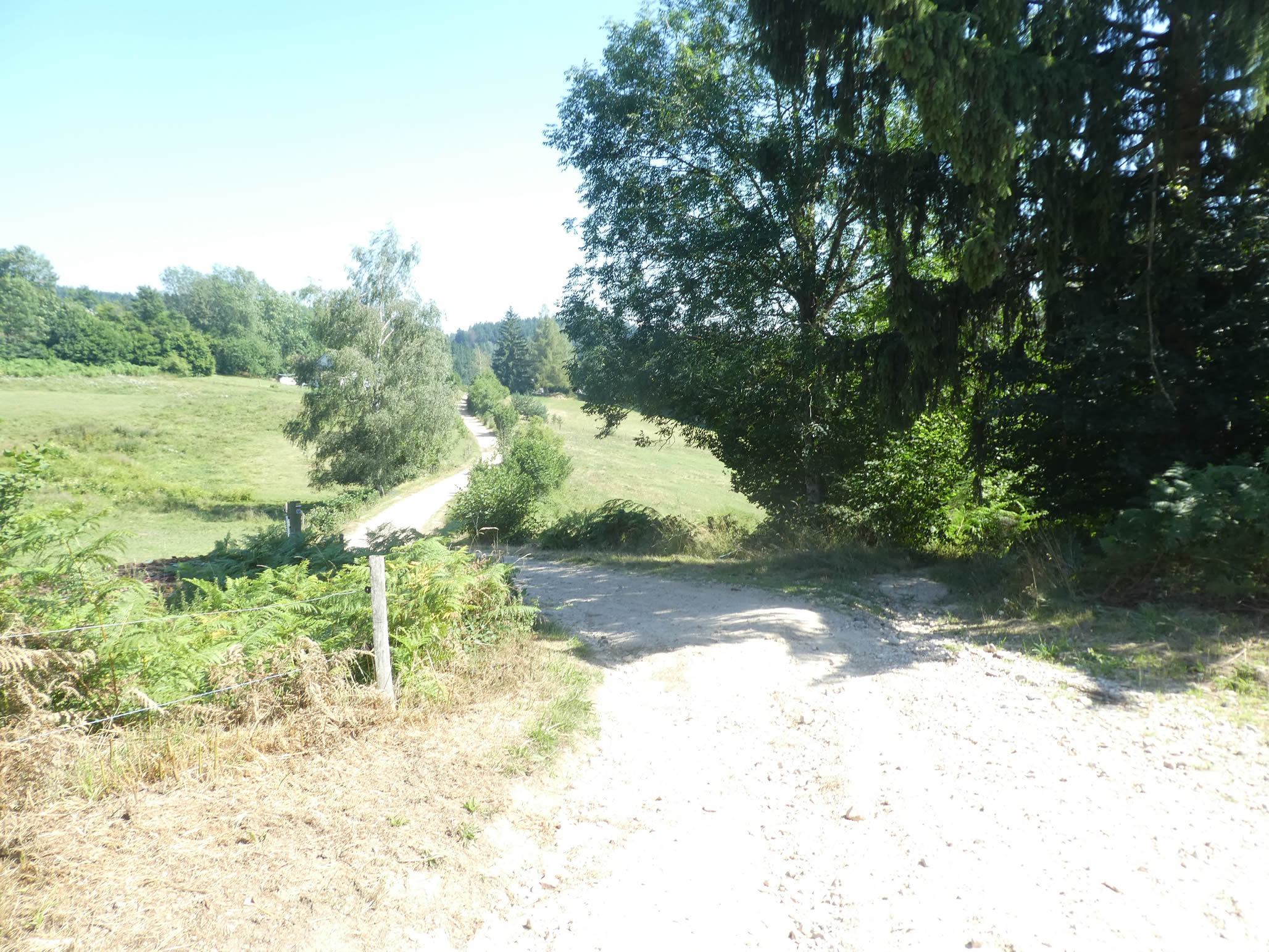
Section 6: Undulations from one forest to another
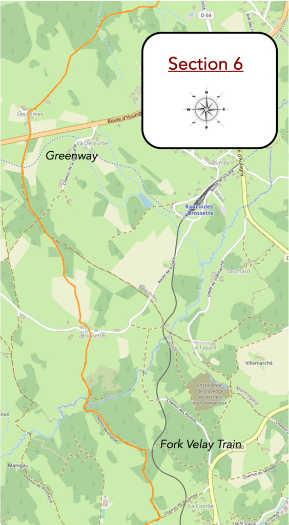
Overview of the route’s challenges: no significant difficulties, despite some inclines.

|
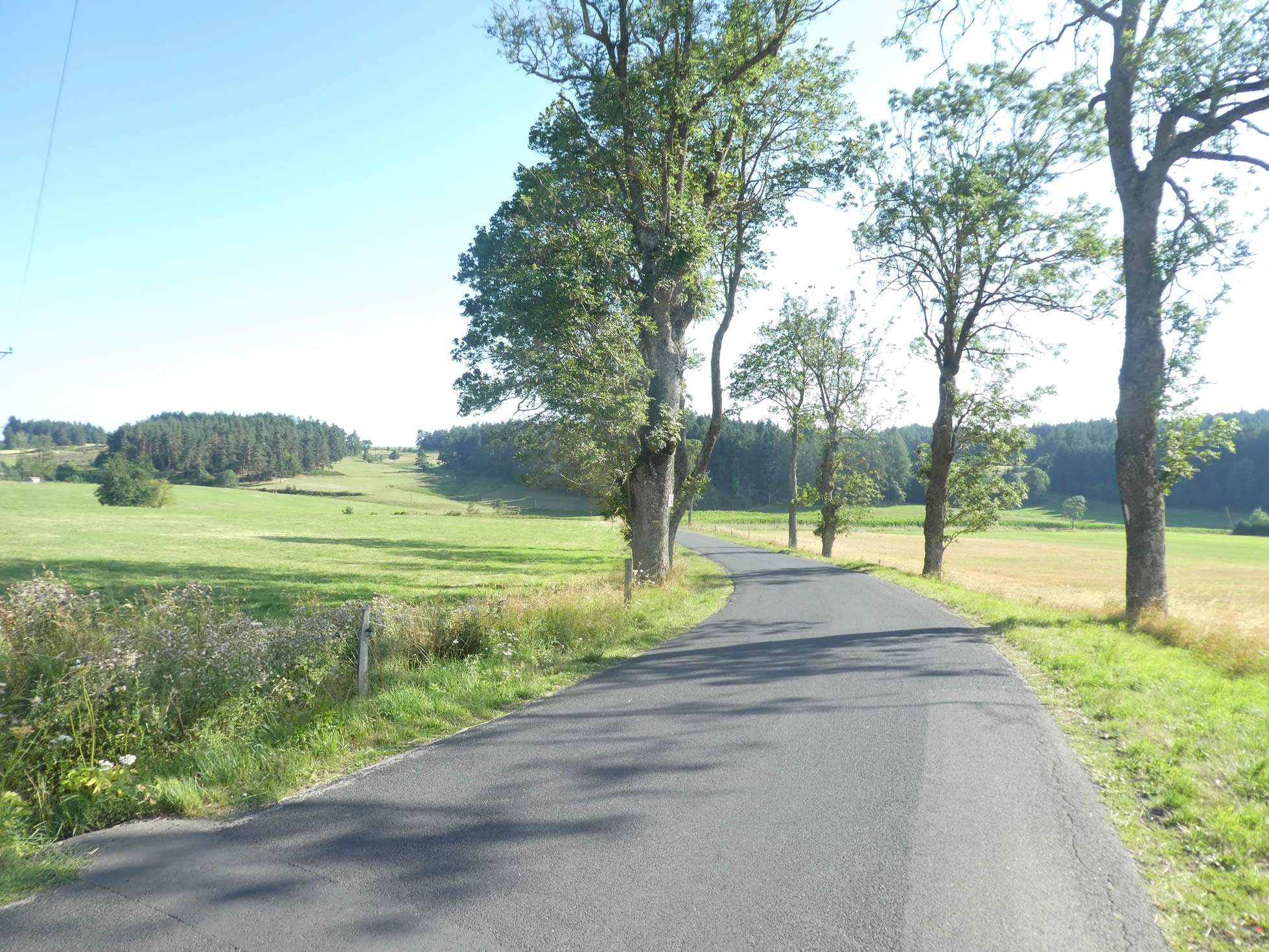
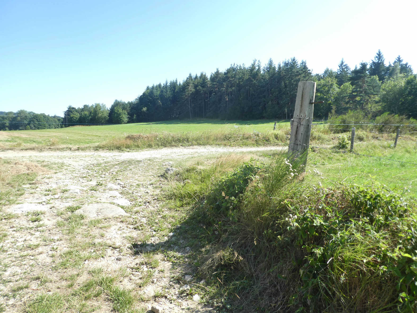
A long, straight dirt path, dotted with sometimes massive stones, gently winds through bare meadows, offering a scene of rustic simplicity and bucolic calm.
|
 |
 |
|
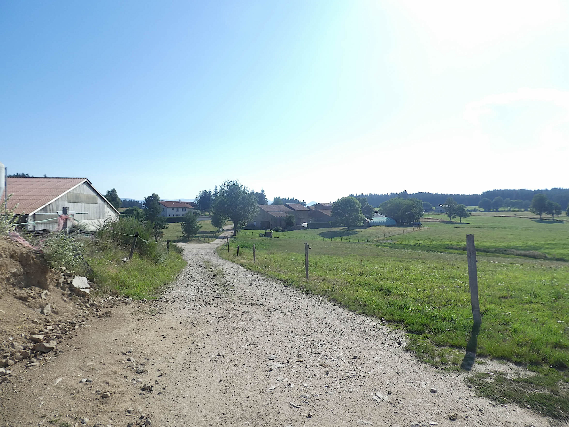
The path delicately slopes down from the hill towards the farming village of Les Olmes, where beautiful stone houses stand proudly. Their blocks, in varying shades of white and gray, give each home a unique identity while maintaining visual harmony. In this region, sandstone blends with granite, creating a mineral patchwork of raw, authentic beauty.
|
 |
 |
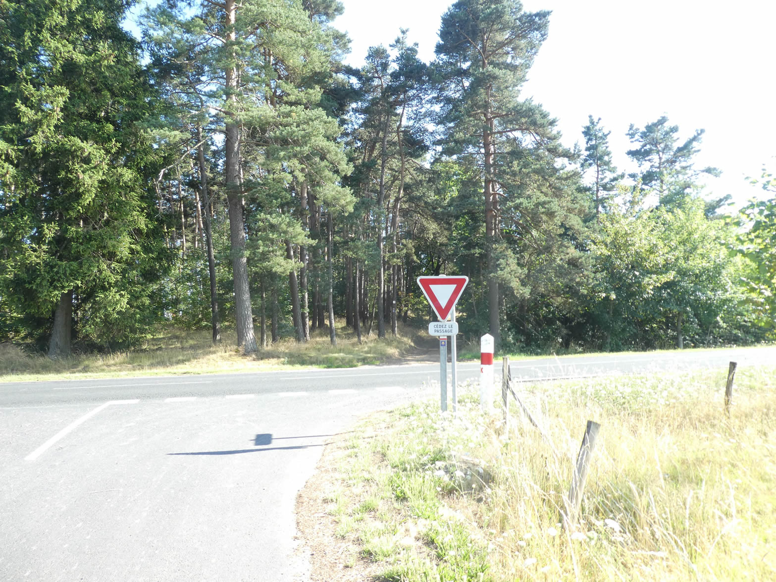
| Leaving the village, the GR65 crosses a major departmental road, an essential artery connecting to St Étienne, before plunging resolutely on a path into a grove of fir trees. This wood is quickly traversed, giving way to vast meadows stretching towards the forest, a promise of shade and coolness. |
 |
 |
| Here, the path crosses the greenway again, that winding ribbon that snakes through the countryside. However, the GR65 doesn’t linger, avoiding the enchanting allure of these green paths that tempt pilgrims with their tranquil charm. The path resumes its route, heading determinedly towards the forest. |
 |
 |
| On the Camino de Santiago, fir trees have become less common, generally giving way to spruce. Yet, in this specific spot, majestic white firs dominate the landscape. Their tight rows, like sentinels, stand side by side, intertwined and inseparable, forming a wall where light struggles to find its way. The density of their foliage creates an almost nocturnal atmosphere, as if night had fallen in the middle of the day. |
 |
 |
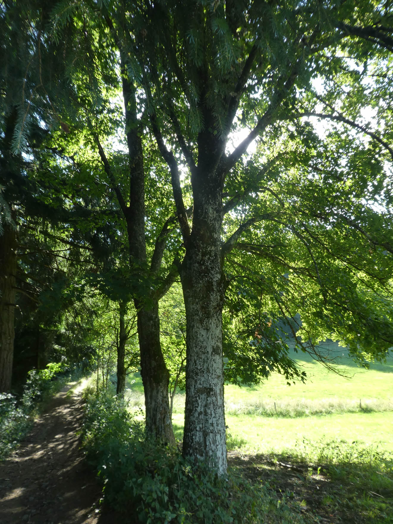
But sometimes, when the light returns, a majestic maple stands proudly, having found refuge here for hundreds of years, driven by the whim of chance.

| The path then plays a game of hide-and-seek with the landscape, alternately passing from dense fir forests to clearings bathed in light, while skirting the broom that borders the forest. |
 |
 |
| Further on, the path emerges from the woods into a vast clearing. Here, farmers have cleared the land to plant corn and cereals. This is almost the first cultivated field encountered today, an island of human activity in this sea of greenery. . |
 |
 |
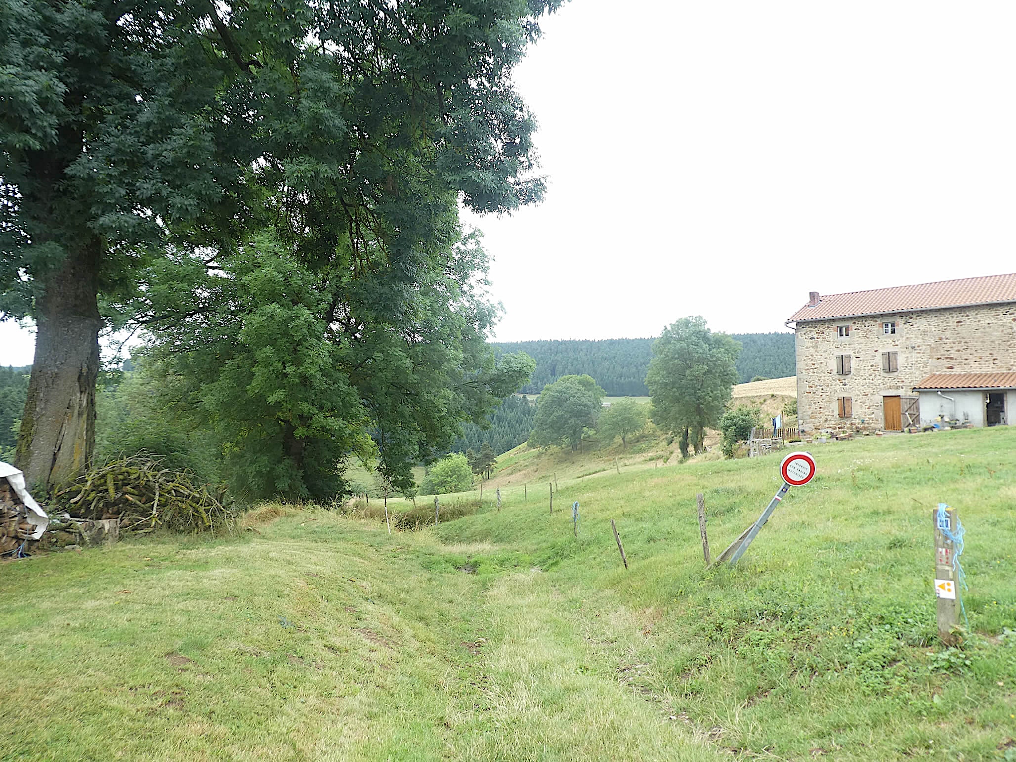
| The path then plunges back into another forest, where sturdy ash trees stand tall, eventually arriving at Brossette. This place exudes a unique charm, a blend of agriculture and wild nature. |
 |
 |
| It is yet another of those enchanting villages in Haute-Loire, with its solid and uniform farms, as if designed by the same architect, built from large blocks of light stone, reflecting light and history. |
 |
 |
| From the hamlet, the path descends, winding and steep, under a canopy of majestic hedges formed by ash trees and maples, true natural masterpieces. The beauty of the landscape stretches as far as the eye can see, with lush meadows surrounded by graceful and enchanting woods, each grove seemingly competing in charm with the last. It feels like stepping into a living painting, where nature displays its most sumptuous attire. |
 |
 |
| At the end of this bucolic descent, the Brossettes stream murmurs gently, bringing a welcome freshness. The old, disused mill, covered in moss, adds a touch of mystery and poetry to this idyllic scene. Under the tall trees, the air is fresh and pure, with each droplet of sparkling water seeming to sing an ode to serenity. It is a true haven of peace, an open-air joy. |
 |
 |
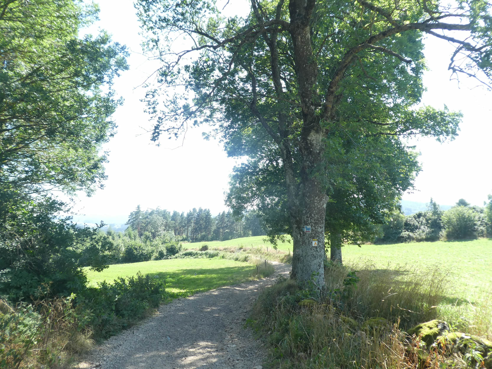
| Throughout this stage, the feeling of being enveloped by the forest never leaves you. The transitions between different woods are almost imperceptible, with only the changing tree species revealing the passage from one grove to another. Maples, ashes, and white firs dominate the landscape. From the stream, the path climbs again through a deciduous forest, where fir trees gradually give way to a diversity of species. Everywhere, forestry is flourishing, a testament to a harmonious and environmentally respectful forest management. |
 |
 |
| Here, an isolated house is revealed, nestled in the heart of nature, probably accessible only by a dirt road, as no road crosses this remote part. The trail seems to lose itself once again in the thickness of the forest, continuing its secret journey. |
 |
 |
| You then enter a deciduous undergrowth before emerging into a clearing where maples and ashes predominate. Oaks, however, are conspicuously absent, giving this region a distinctive appearance. A few pines emerge here and there, while firs have temporarily disappeared, though one can still glimpse their imposing masses on the horizon. |
 |
 |
| As you approach a dense forest of fir trees, a crucial turn lies ahead. The famous scallop shell of the Camino de Santiago, discreetly nailed to an old chestnut tree, seems to indicate the way. What does it tell you? To go straight ahead, of course, because in France, the fan of the shell always points in the direction you should follow. However, you now reach the end of the path… and there is no trail continuing straight. So, where to go? Right or left? Many have lost their way here. A moment of inattention, and one might be tempted to turn left, drawn by the charm of the little Velay steam train, whose tracks lead to the Raucoules-Brossettes station, now its terminus. But this route would take you back toward Montfaucon, off your intended path! No, the correct route goes to the right. In Haute-Loire, it is always wise to carry detailed maps, whether printed or digital, to avoid getting lost in these vast forests with their sometimes-misleading trails. One could even criticize the organizers of the GR65 for the lack of clear signage, making navigation occasionally tricky. |
 |
 |
| Then, unsurprisingly, the path plunges back into the thick deciduous forest, continuing its winding journey through this enchanting landscape. |
 |
 |
Section 7: A famous old mill and a beautiful river

Overview of the route’s challenges: no significant difficulties, though there are occasionally steeper inclines.

| The GR65 reveals its splendors with a discreet elegance, where each step resonates with an enveloping serenity and subtle beauty. As you traverse these landscapes, the soul is enchanted by the bucolic diversity and richness of the rural scenes that unfold before the pilgrim’s eyes. Here, the path gently winds among deciduous trees, with a notable predominance of maples. This region of France seems to be the ultimate haven for these majestic trees, imparting an almost enchanted aura to the pilgrims’ route. The maples, with their dense and colorful foliage, create a protective canopy under which you walk with a sense of rare privilege. |
 |
 |
| Soon, the path emerges from the woods to cross the picturesque village of La Brosse, a place where time seems to have stood still. Here, the character of yesteryear persists with touching intensity. The stone houses, solid and dignified, tell stories of generations of farmers who shaped this land. The authenticity of La Brosse is palpable, with every stone and path bearing witness to a rural life that remains vibrant and respected. |
 |
 |
| The path continues through the village before briefly taking a stretch of asphalt. This transition, though short, is a reminder of the modernity that coexists with the centuries-old traditions of the region. |
 |
 |
| The GR65 quickly regains its original nature as a dirt path. Around a bend, a magnificent granite cross stands tall and silent, weathered by time. Mosses, clinging tenaciously to it, add a touch of mystery and life to this monument of faith and history. |
 |
 |
| The charm is reignited as the path then stretches between the grand maples bordering the meadows. This bucolic walk, where nature displays its splendor with unparalleled generosity, leaves the hiker in awe. The air is so pure, the landscape so captivating, that each moment spent here is an ode to the simple and majestic beauty of the French countryside. These intoxicating passages nourish the heart and soul, inviting contemplation and daydreaming. |
 |
 |
| Shortly after, the path plunges more steeply, descending under the dense canopy of trees. Broom and ferns carpet the ground, creating an undergrowth atmosphere filled with coolness and mystery. |
 |
 |
| Soon, the path reaches the hamlet of Le Mounas. Here, the houses show a relative modernity compared to other hamlets in the region, without detracting from the rural charm that surrounds them. |
 |
 |
| Leaving Le Mounas, the path dives back into the undergrowth. The steep slope, with its 15% gradient, traverses a harmonious mix of deciduous and coniferous trees, creating a setting that is both diverse and serene. |
 |
 |
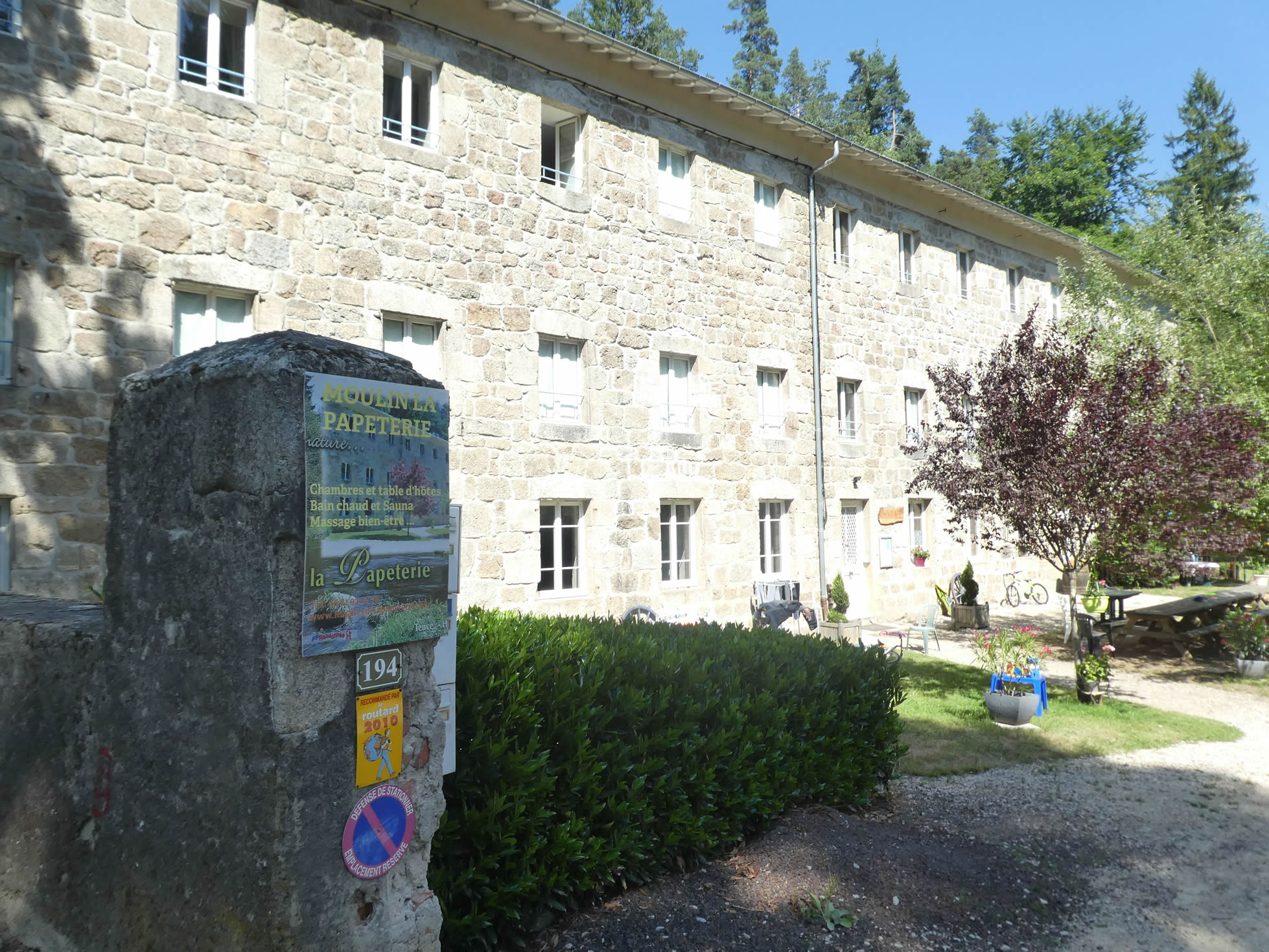
| At the end of this descent, the path arrives at La Papeterie. A majestic stone building, rising two stories high, stands there, bearing witness to a rich and ancient history. The Papeterie de Tence is not just an old mill; it represents a significant chapter in French industrial history. Established by the Montgolfier family, ancestors of the famous hot air balloon inventors, this factory was once the first paper mill in France. Its hydraulic wheels, powered by the nearby Basset stream, which flows into the Lignon river, symbolized ingenuity and mastery of hydraulic energy. |
 |
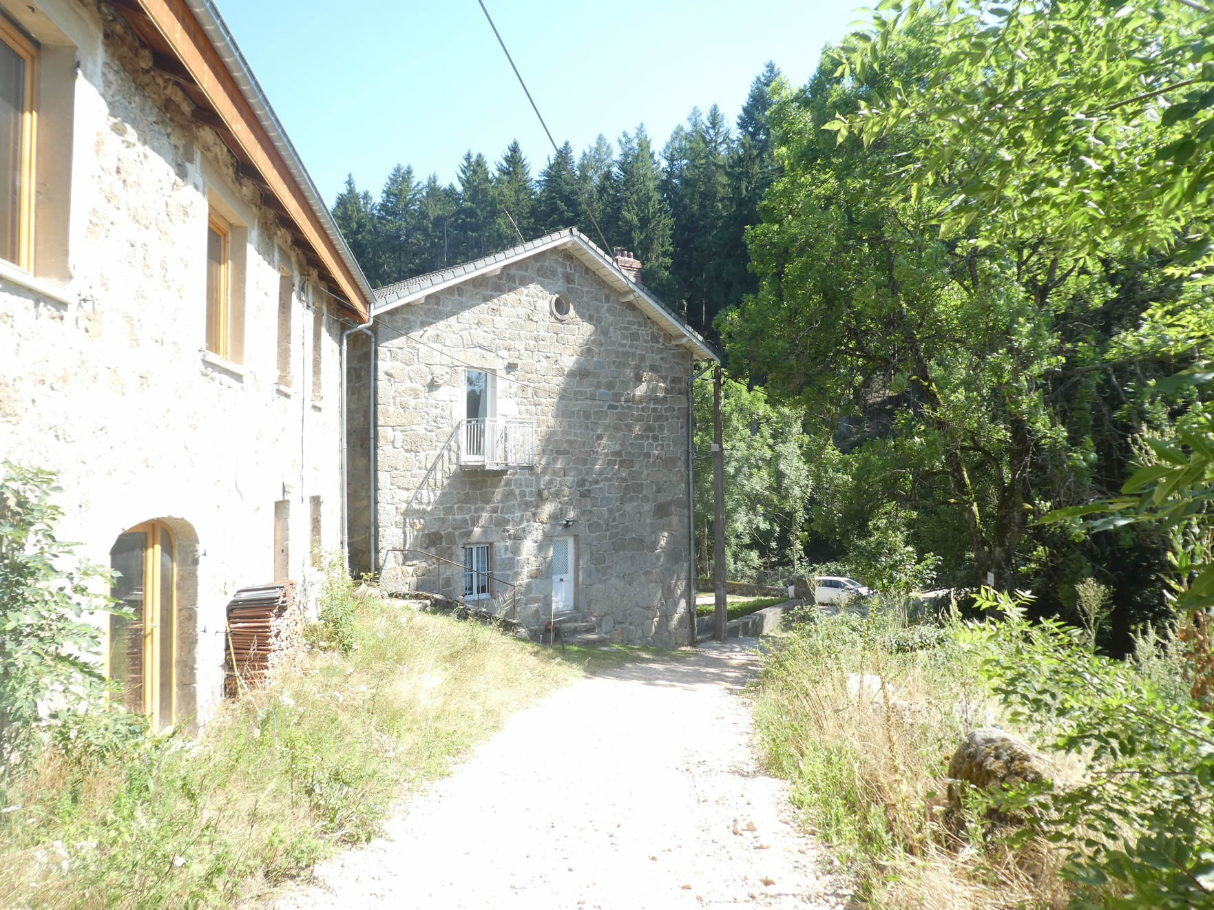 |
In the 19th century, the Papeterie reinvented itself as a silk-spinning mill, building on the foundations of the original paper mill. Tence, with its multiple silk-spinning factories, gained fame for its silks and felts before this industry naturally declined. The Papeterie, after this period of prosperity, was successively transformed into a summer camp and then a guesthouse, attracting numerous visitors during the high season.
Just a few steps away, the Lignon river flows peacefully, a river you will explore more as you head towards Tence the next day. The guesthouse offers generous hospitality, but in case of high demand or closure, it is wise to plan accommodation in Tence, located three kilometers away. Booking your lodging in advance on the Via Gebennensis is essential to avoid any unpleasant surprises.
Logements officiels sur la Via Gebennensis
- Gîte, Montfaucon-en-Velay; 04 71 59 95 73 ; Gîte, repas, petit déj.
- Le Jardin de Mirandou, 30 Avenue de la Gare, Montfaucon-en-Velay; 06 32 73 35 01 ; Gîte, repas, petit déj.
- Hôtel Les Platanes, Montfaucon-en-Velay; 04 71 59 92 44 ; Hôtel, repas, petit déj.
- Hôtel L’Avenue, 23 Avenue des Maisonnettes, Montfaucon-en-Velay ; 04 71 59 90 16 ; Hôtel, repas, petit déj.
- Gîte, la Papeterie, La Papeterie/Tence; 06 85 88 52 21 ; Gîte et Ch. d’hôte, repas, petit déj.
Accueils jacquaires (voir introduction)
Si l’on fait l’inventaire des logements, le logement est délicat. Il n’y a pas de grandes possibilités de trouver un logement en fin d’étape. Mais le gîte de la Papeterie est spacieux. Sinon, Tence et à deux pas. Réservez par sécurité. Le guide des Amis de Compostelle tient le registre de toutes ces adresses, ainsi que des bars, restaurants ou boulangeries sur le tracé.
N’hésitez pas à ajouter des commentaires. C’est souvent ainsi que l’on monte dans la hiérarchie de Google, et que de plus nombreux pèlerins auront accès au site.
|
 |
Etape suivante : Etape 13: De La Papeterie à Queyrières |
|
 |
Retour au menu |
Official accommodations on the Via Gebennensis
- Gîte, Montfaucon-en-Velay; 04 71 59 95 73; Gîte, dinner, breakfast
- Le Jardin de Mirandou, 30 Avenue de la Gare, Montfaucon-en-Velay; 06 32 73 35 01; Gîte, dinner, breakfast
- Hôtel Les Platanes, Montfaucon-en-Velay; 04 71 59 92 44; Hôtel, dinner, breakfast
- Hôtel L’Avenue, 23 Avenue des Maisonnettes, Montfaucon-en-Velay; 04 71 59 90 16; Hotel, dinner, breakfast
- Gîte, la Papeterie, La Papeterie/Tence; 06 85 88 52 21; Gîte & Guestroom, dinner, breakfast
Pilgrim hospitality/Accueils jacquaires (see introduction)
If one takes inventory of the accommodations, lodging is tricky. There aren’t many options for finding accommodation at the end of the stage. However, the gîte at La Papeterie is spacious. Otherwise, Tence is just a short distance away. Book to be safe. The guide of the Friends of Compostela keeps a record of all these addresses, as well as bars, restaurants, or bakeries along the route.
Feel free to add comments. This is often how you move up the Google hierarchy, and how more pilgrims will have access to the site.
|
|
Next stage : Stage 13: From La Papeterie to Queyrières |
|
|
Back to menu |