In the heart of rural heritage
DIDIER HEUMANN, ANDREAS PAPASAVVAS
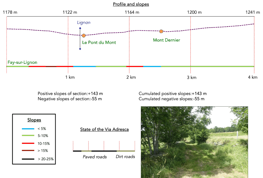
We divided the course into several sections to make it easier to see. For each section, the maps show the course, the slopes found on the course, and the state of the route (paved or dirt roads). The courses were drawn on the « Wikilocs » platform. Today, it is no longer necessary to walk around with detailed maps in your pocket or bag. If you have a mobile phone or tablet, you can easily follow routes live.
For this stage, here is the link:
https://fr.wikiloc.com/itineraires-randonnee/de-fay-sur-lignon-a-bigorre-par-la-via-gebennensis-adresca-33138197
| Not every pilgrim feels comfortable using GPS devices or navigating on a phone, especially since many sections still lack reliable internet. To make your journey easier, a book dedicated to the Via Gebennensis through Haute-Loire is available on Amazon. More than just a practical guide, it leads you step by step, kilometre after kilometre, giving you everything you need for smooth planning with no unpleasant surprises. Beyond its useful tips, it also conveys the route’s enchanting atmosphere, capturing the landscape’s beauty, the majesty of the trees and the spiritual essence of the trek. Only the pictures are missing; everything else is there to transport you.
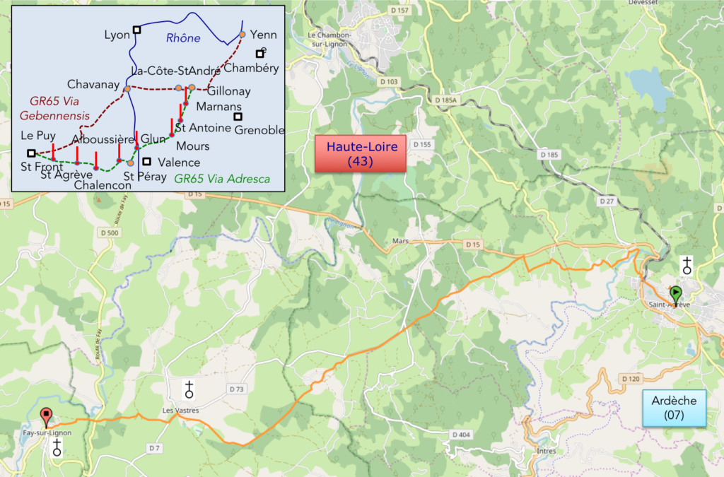
We’ve also published a second book that, with slightly fewer details but all the essential information, outlines two possible routes from Geneva to Le Puy-en-Velay. You can choose either the Via Gebennensis, which crosses Haute-Loire, or the Gillonnay variant (Via Adresca), which branches off at La Côte-Saint-André to follow a route through Ardèche. The choice of the route is yours. |
 |
 |
If you only want to consult lodging of the stage, go directly to the bottom of the page.
The route continues its approach toward Le Puy-en-Velay. Today, it leads across the final stretch of the grand plateau and the gentle hills near St Agrève, before plunging tomorrow toward Le Puy-en-Velay. At this point, the organizers of the Camino de Santiago’s Via Gebennensis have bypassed the route to Bigorre, as it lies slightly off the main route. However, the detour to Bigorre is well worth it. Along the way, you’ll first encounter the picturesque village of St Front. Like Bigorre, it is a gem, with its winding streets and volcanic stone houses nestled around a church, evoking a distinctly medieval atmosphere.
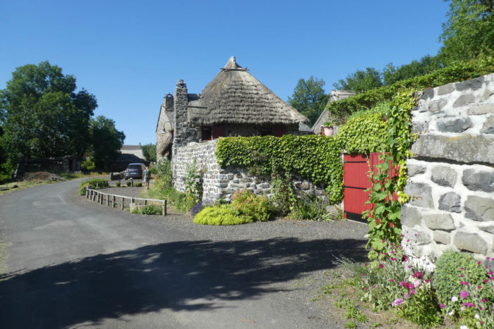
Bigorre is even more enchanting, despite not being a traditional village. It is a classified hamlet of thatched cottages, about twenty volcanic stone houses with steep roofs covered in thatch or, when restored, slate tiles. These homes and roofs are specifically designed to withstand the harsh winters typical of this region. In Bigorre, you’ll meet passionate heritage enthusiasts who devote their free time to restoring these small architectural masterpieces.
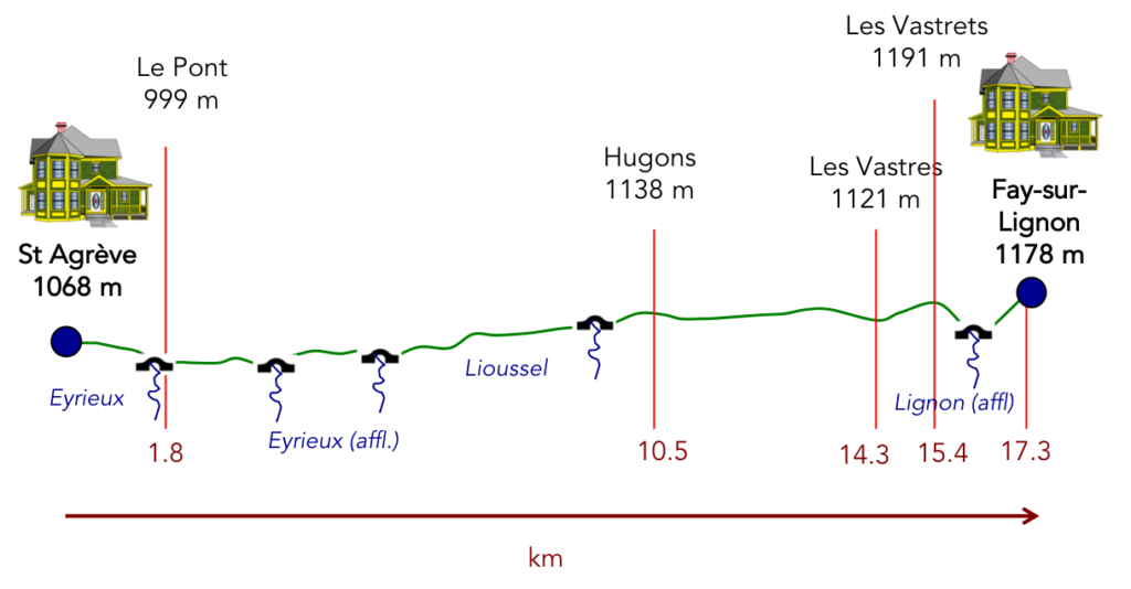
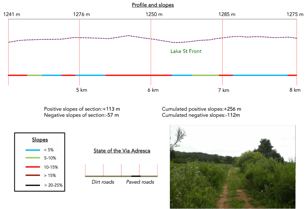
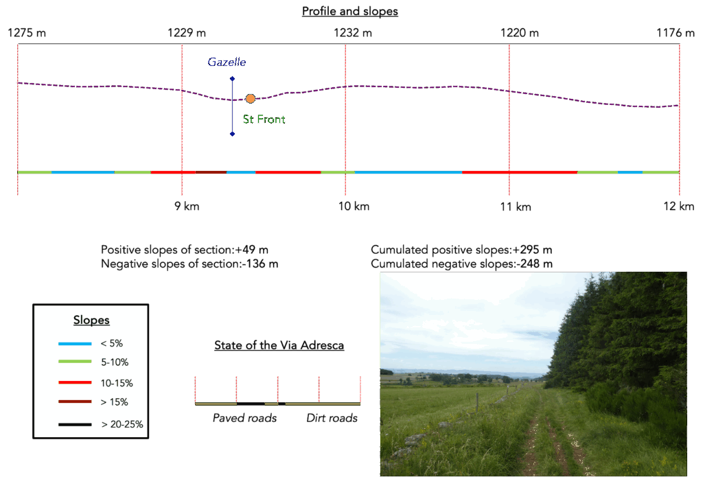
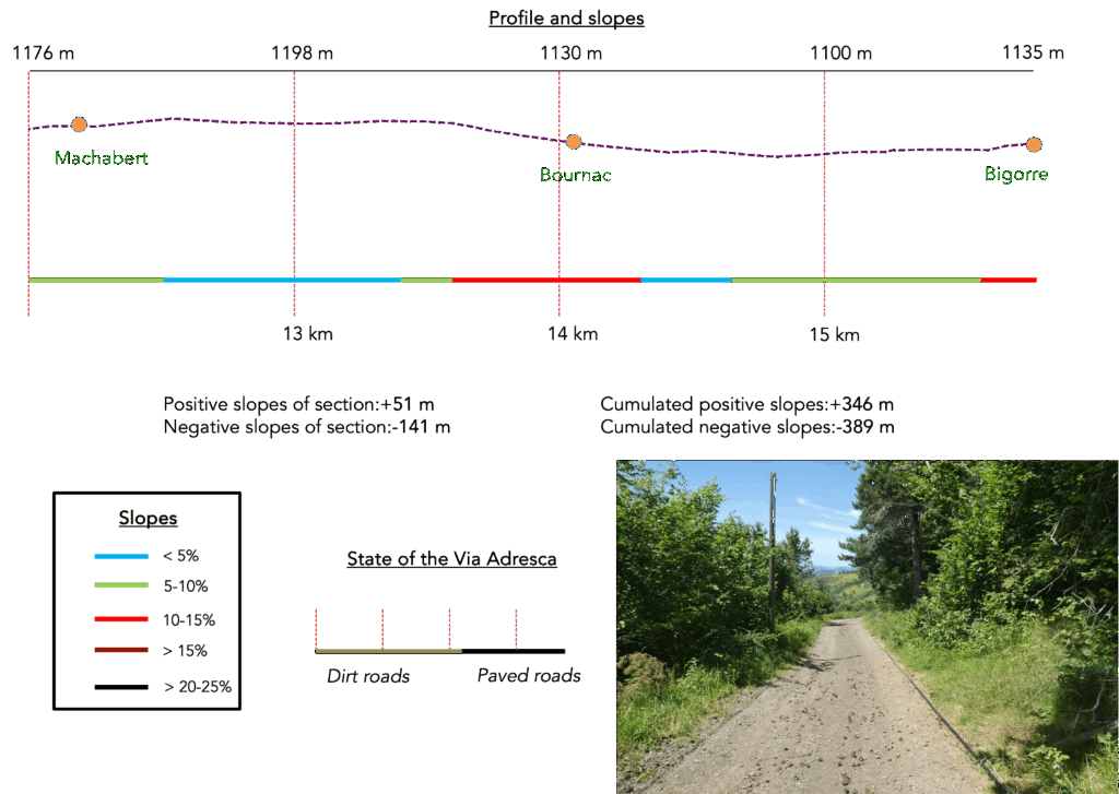
Difficulty level: The elevation changes today are modest (+346 meters / -389 meters). It’s an easy stage, with gentle slopes. Any steeper gradients are mostly in descent.
State of the Via Adresca: In this stage, the balance strongly favors paths over paved roads:
- Paved roads: 4.7 km
- Dirt roads : 11.0 km
Sometimes, for reasons of logistics or housing possibilities, these stages mix routes operated on different days, having passed several times on these routes. From then on, the skies, the rain, or the seasons can vary. But, generally this is not the case, and in fact this does not change the description of the course.
It is very difficult to specify with certainty the incline of the slopes, whatever the system you use.
For those seeking « true elevations » and enthusiasts of genuine altimetric challenges, carefully review the information on mileage at the beginning of the guide.

Section 1: Along the tranquil Lignon
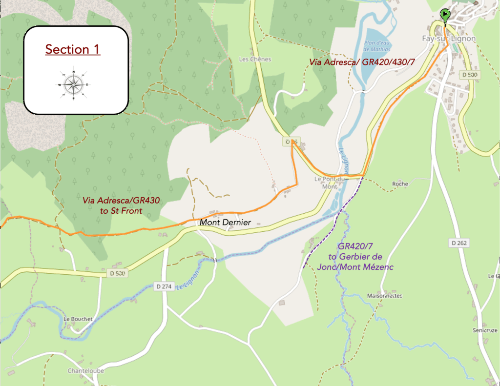
Overview of the route’s challenges: a route with no challenges.
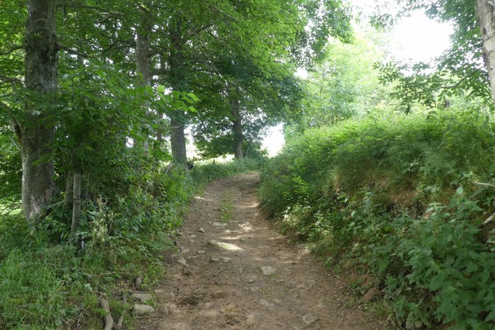
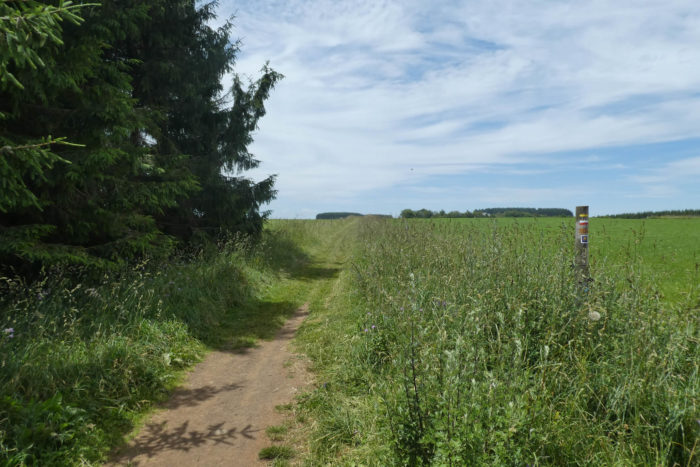
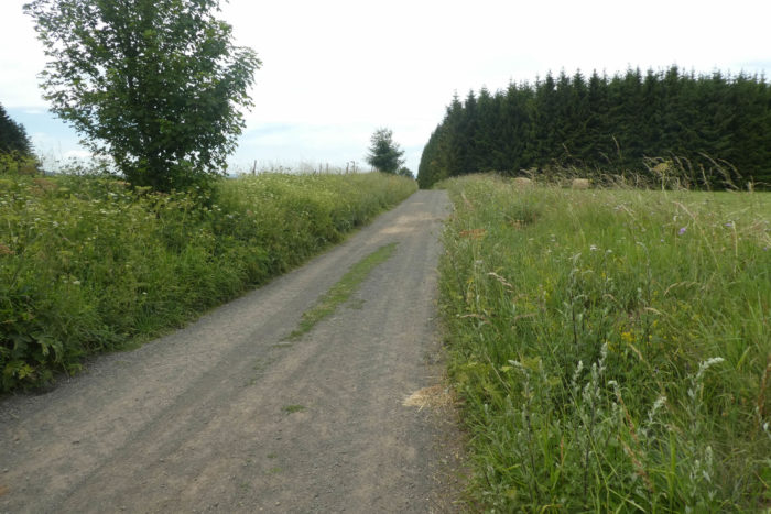
| In this region, it is fascinating to see how the Via Adresca is far more clearly marked than most other major hiking trails, such as the GR7, GR420, or GR430, which meander around the Massif du Mézenc and the Gerbier de Jonc. While these routes are meant to immerse walkers in the volcanic nature of the area, it seems that few choose to hike them. Instead, most visitors drive to viewpoints near the volcanoes, take a few steps on foot, and then return to their vehicles. The Via Adresca, however, departs the village along a scenic route titled “Between Pines and Beeches”, descending beneath the village along the Path of the Lignon, a discreet and tranquil paved road. |
 |
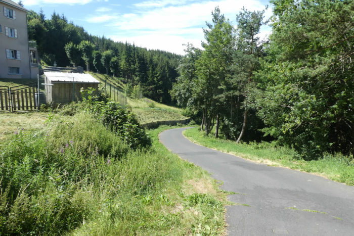 |
| The paved road skirts a campground where even in summer, the influx of vacationers seems modest and almost subdued. It stretches out, slow and peaceful, toward the plain where the river flows. |
 |
 |
| The Lignon, a modest yet significant river, has its source not far from here at the foot of Mont Mézenc. In this region, it is still a daring stream, winding across the terrain, but it gains strength as it traverses the lands of Velay, eventually merging with the Loire. In Tence, if one follows the Via Gebennensis, the Lignon becomes a familiar companion, but here, it seems just to be discovering itself, growing at its own pace. |
 |
 |
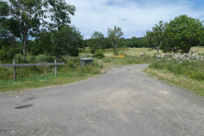
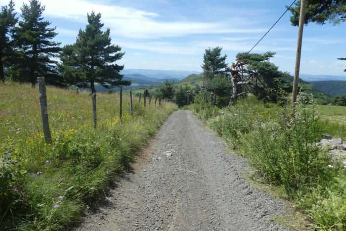
| The paved road slopes up along the river’s course to a bridge, where the D500 crosses the Lignon, escaping Fay-sur-Lignon. At this very spot, paths diverge. The GR7/420 boldly ventures to explore the volcanoes of Haute-Loire, while the Via Adresca, more discreetly, heads toward Le Puy-en-Velay, leaving behind memories of the volcanic country for a new horizon. |
 |
 |
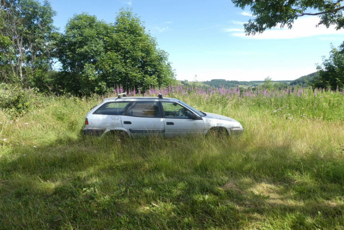
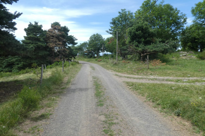
| At the crossroads, the Via Adresca follows the small D26 road, slipping past a forgotten corner and passing a car cemetery. This cemetery, seemingly lost in time, with rusting vehicle shells in slow decay, evokes the rural depths of France, swallowed by wild grasses and silence. The route then follows the paved road to a junction, where a small paved road gently ascends toward Mont Haut. This is also the direction of some GR trails, but the Via Adresca, faithful to its own path, takes it with the tranquility of an old path forgotten by trail markers. |
 |
 |
 |
 |
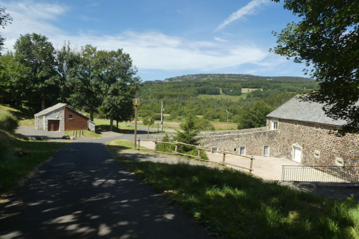
| The paved road winds past the rare and magnificent basaltic stone houses of Mont Haut. These houses, ancient sentinels of another era, are adorned with the rugged and solid volcanic stone that builds their walls like testaments of a bygone time. Here, builders abandoned granite to explore the infinite palette of volcanic stones: from luminous white to deep black, with reddish hues that seem almost leafy. Contrary to common belief, volcanic rocks are not limited to black basalt; they are vibrant minerals with infinite colors and textures. |
 |
 |
| The paved road ends in a dead end, where the landscape turns wild, hamlets fade into the hills, and paths vanish into the woods. Here, in this peaceful and slightly forgotten region, the Lignon meanders gently in a serene valley, flowing quietly at the bottom. This countryside, discreet yet full of life, unfolds around you like a well-kept secret of the region. |
 |
 |
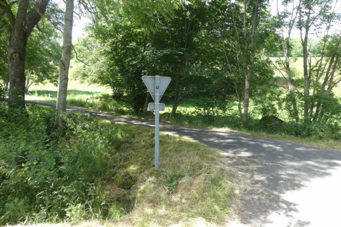
| The next stop is Mont Dernier. The path reaches this quiet hamlet, where a stretch of asphalt runs through the village before vanishing once again into the grass. It is here that all routes meet, cross, but sometimes also separate, as in this stage. A valuable piece of advice, as throughout the Ardéchois route: follow the shells of the Via Adresca, as they are the only reliable guide. |
 |
 |
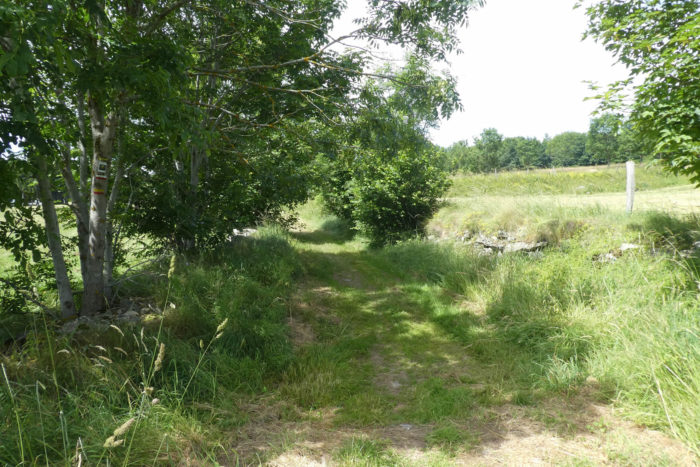
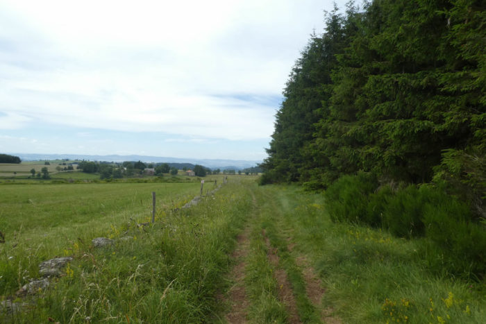
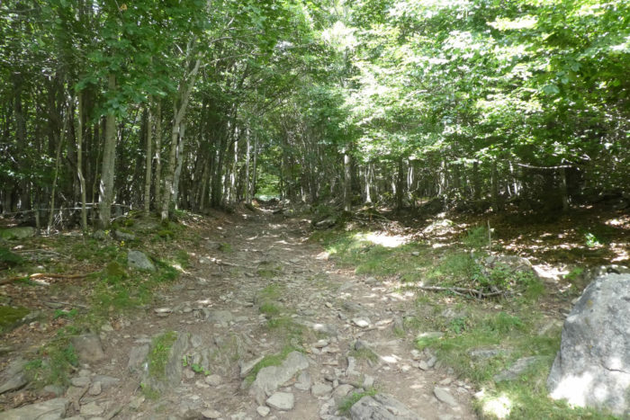
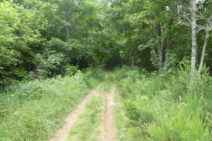
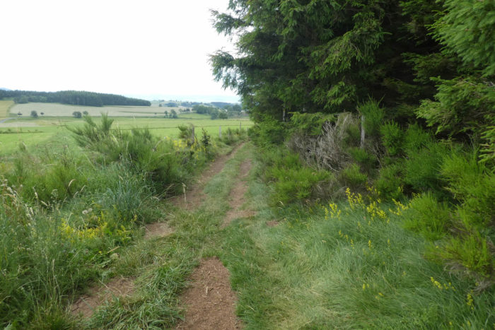
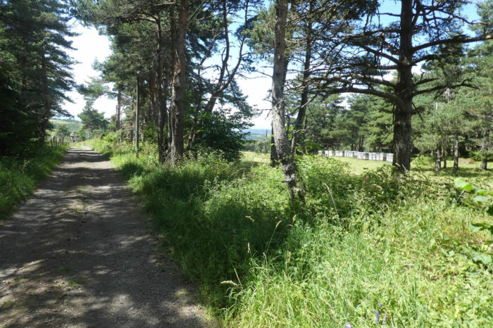
| The path, often paved with polished granite, then enters the Bois de la Bâtie. The climb is long and steady, sliding between meadows and hedgerows of undergrowth until the forest thickens. While basalt is the emblematic material of local houses, underground is another world: granite and gneiss coexist in the earth’s depths as relics of an ancient time. These stones, both granitic and volcanic, are products of the same geological forces, shaped differently under the pressures of deep layers during their formation. |
 |
 |
| The route, called here “Between Beeches and Pines”, dates back to a much older time, an ancient Roman road whose passage left faint traces in the ground. While pines dot the landscape, it is primarily spruces that dominate. The beeches, modest in presence, are not alone here. Ash trees, tall and strong, add their quiet presence to the scene, while a few chestnut trees strive to survive far from their native Ardèche. The diversity of vegetation and the beauty of the trees remind us that nature, in its simplicity, remains the most beautiful creation. |
 |
 |
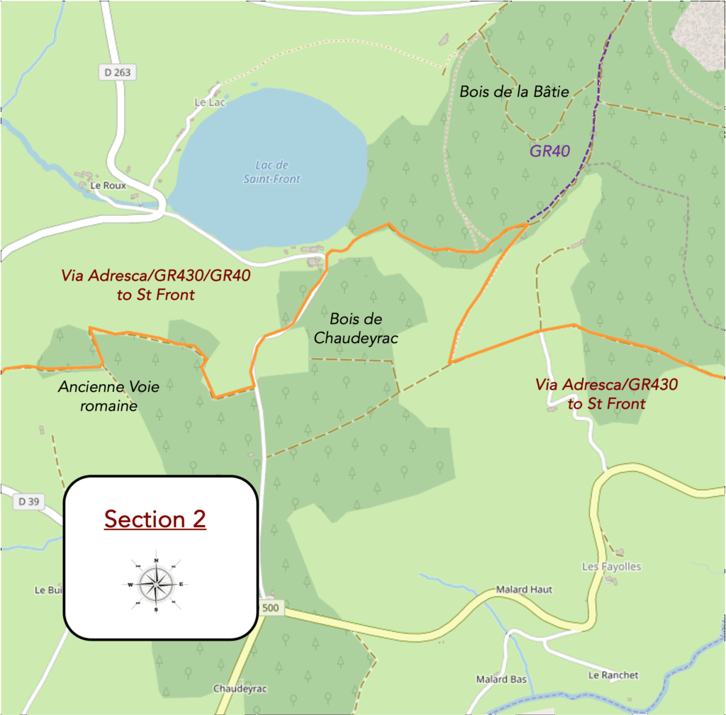
Section 2: Between forest, pastures, and lake
Overview of the route’s challenges: a route with no major challenges, though there are occasionally steeper inclines.
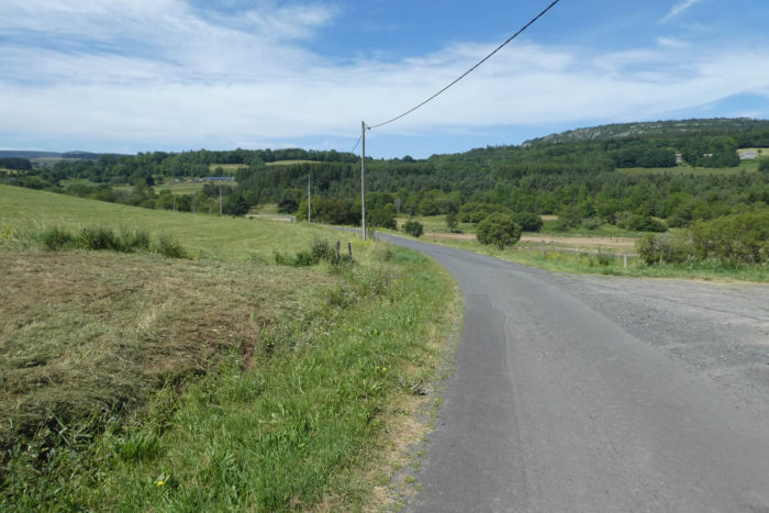
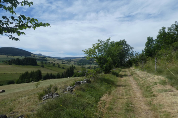
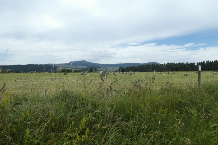
| When the undergrowth finally opens, a beautiful view unfolds. The hills stretch out, gentle and soothing, like a soft murmur. Cows, heavy and peaceful, amble leisurely in meadows still fresh from the recent rains. And there, in the distance, like a majestic figure, Mont Mézenc rises on the horizon, implacable and noble, overseeing the scene like a benevolent but distant lord. |
 |
 |
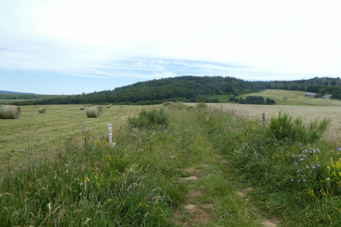
| A little farther on, the path leaves the Bois de la Bâtie and opens onto a landscape of simple beauty, one of those panoramas that seem to belong on a postcard. But that would overlook the gentle charm of the nature that unfolds here: calm skies, meadows dressed in soft hues, and vegetation that feels almost tender, stretching as far as the eye can see. The path meanders along the edge of the forest, slipping between proud spruces and vibrant broom shrubs, fragrant and luminous. |
 |
 |
| Shortly after, the path resumes its rhythm, alternating between dense woods and open clearings, broad spaces of freedom where light dances with shadow. |
 |
 |
| Suddenly, it opens onto a vast, silent clearing, as though carved out of the landscape to offer a breath, a moment of pause. |
 |
 |
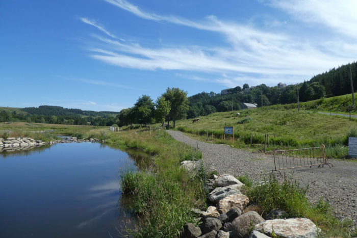
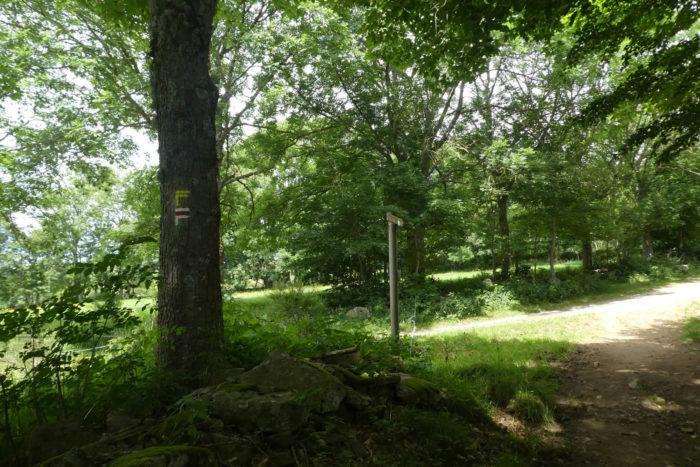
At a fork, the path pauses. This marks the end of the « Between Pines and Beeches » trail. Here, two options appear: one circles the lake, the other crosses it. If you’re unsure, follow the Via Adresca, which, true to its spirit, also leads toward the lake, as indicated by clear directional arrows. The other path, more direct, avoids the tranquility of the waters.

| The path resumes, this time across vast meadows, changing direction as though retracing its steps toward the Bois de la Bâtie. Soon, the lake comes into view, discreetly hidden beneath the soft curves of the hills. |
 |
 |
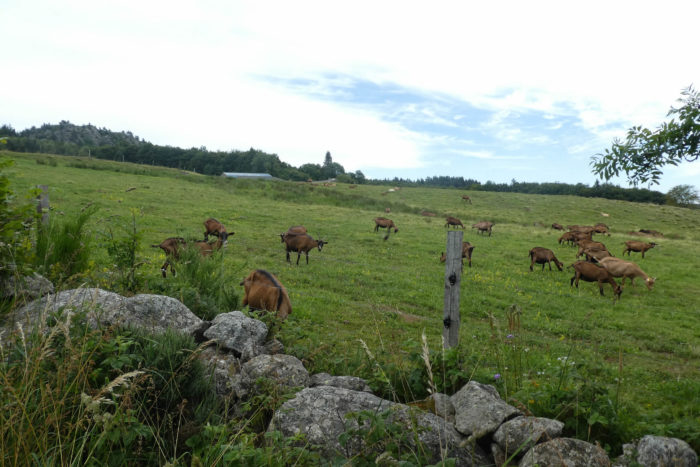
| The path then climbs gently, weaving between broom shrubs and granite walls, heading toward a forest that grows denser and wilder. Here, silent companions, cows and goats, also seem to appreciate the solitude of the place. |
 |
 |
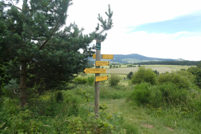
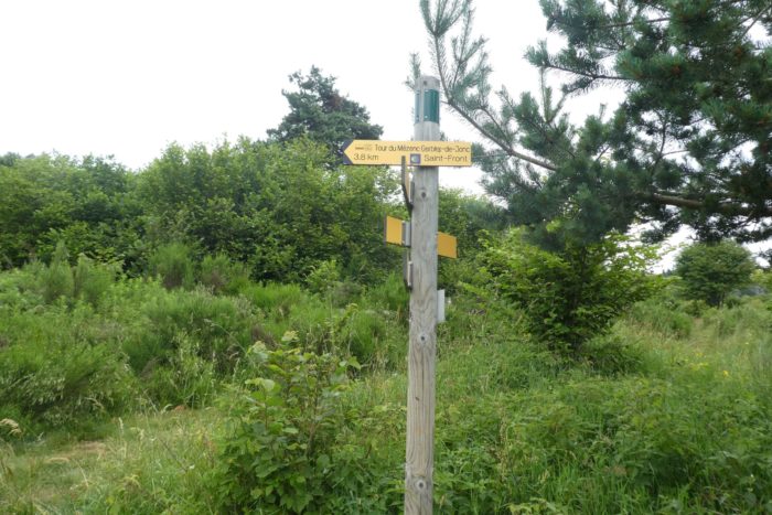
| At the forest’s edge, paths multiply, far outnumbering the hikers who traverse them. They intertwine and cross, but your path remains the one leading straight toward Mont Mézenc, 3.8 kilometers from Saint-Front. A word of caution: don’t get lost, as the network of trails in this region can confuse even the most attentive walkers. |
 |
 |
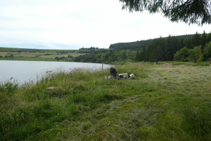
| The path then descends toward the lake. In this almost secret hollow of the landscape lies the lake of St Front. This lake, suspended like a jewel at the heart of nature, is privately owned. It recalls the vast lakes of the Laurentians in Quebec, where one could rent water rights for a mere dollar a year. Here, the price is undoubtedly higher, but the place remains a haven of peace for the privileged few. |
 |
 |
| Arriving at the lakeshore, you discover an ancient volcanic crater now filled with calm, mysterious water. A summer camp is located here, but it’s surprising how well the area remains untouched by tourism. The lake, tranquil and charming, feels like a timeless interlude. Fishing likely takes place here, but under the watchful eye of its owner. This part of Haute-Loire, far from the chaos of mass tourism, belongs instead to volcano enthusiasts. These aficionados, though numerous, are discreet in their admiration for this still-preserved land. |
 |
 |
| A small paved road climbs from the lake for nearly a kilometer, winding toward the forest of Chaudeyrac. Higher up, a path, the PR61, slopes up gently and circles back above the lake, offering a fresh perspective on the hidden expanse of water nestled beneath the hills. |
 |
 |
| The path, wide and inviting, runs alongside a long stretch of pine and spruce forest, a veritable green sea that, on one side, overlooks the lake. The sunlight filtering through the treetops creates a play of light and shadow, mesmerizing the gaze. The landscape, steeped in poetry, offers a moment suspended in time. |
 |
 |
Section 3: Passing through the beautiful village of St Front
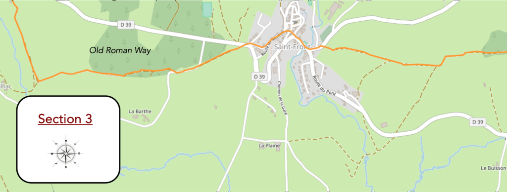
Overview of the route’s challenges: a straightforward route with no major challenges.
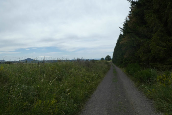
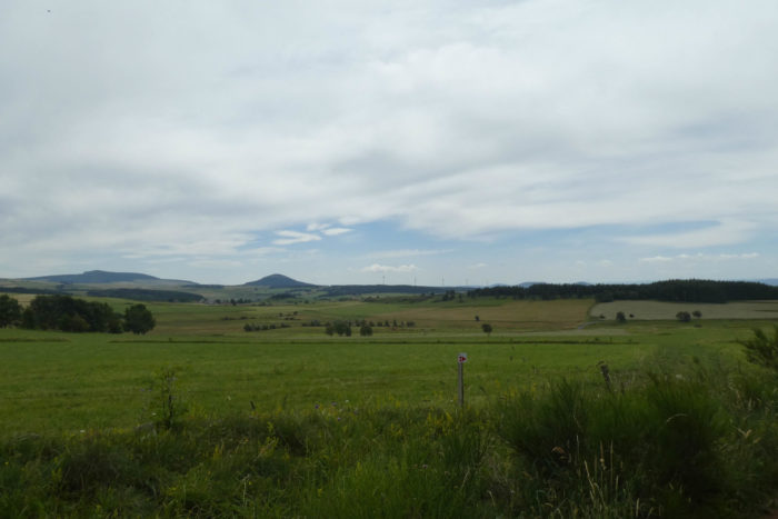
| The lake gently recedes, absorbed by the undulating terrain and the dense canopy of trees. Ahead, Mont Mézenc looms ever larger, its massive silhouette shrouded in mist, seeming to draw closer with every step, as if watching over you. Surrounding it, smaller volcanoes of Haute-Loire emerge sporadically, like dormant sentinels guarding this mineral landscape of serene tranquility. The path dances across varied terrain: here, sunbaked ochre soil; there, open meadows framed by tall hedges of spruce trees that obscure the horizon with their dense, dark greenery, contrasting sharply with the radiant light flooding the fields. |
 |
 |
| Underfoot, the path is a loyal companion, leading effortlessly through these vast expanses where the air feels lighter. In the distance, St Front begins to take shape, initially blurry and indistinct, then gradually clearer, revealing itself like a watercolor perched at the edge of the plateau, its gray contours set against the vivid green of the meadows. |
 |
 |
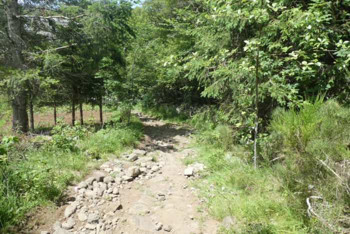
| As you approach, the path shifts character. Once gentle, it transforms into a steep, uneven descent strewn with loose stones, demanding care and focus. Rounding a final bend, the village appears in all its unpretentious charm. St Front, uniform in its volcanic gray, seems sculpted directly from the rock, a mineral chameleon blending perfectly with its surroundings. |
 |
 |
| Below, the road crosses the Gazelle stream, a slender ribbon of water slipping quietly among scattered stones. Its modest, meandering course feels almost hesitant, as if humbled by the towering presence of Mont Mézenc and the encircling hills. Here, everything exudes restraint, a whispered harmony with nature. |
 |
 |
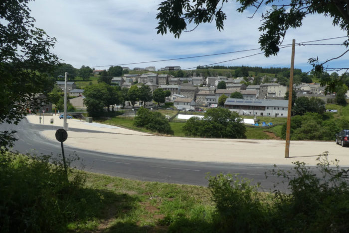
| At the village entrance stands a large guesthouse, a generously proportioned building that, in summer, contrasts with the surrounding calm. The lively laughter and playful shouts of holiday campers bring an infectious energy to this secluded corner. Narrow, winding cobblestone lanes lead gently toward the village center, nestled on a small hill as if shielded by its slightly elevated position. |
 |
 |
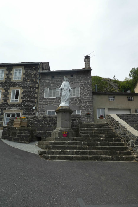
| S Front unfolds in all its authenticity. This village of about 400 residents exudes a timeless charm, inviting leisurely exploration. Its lanes, lined with thick-walled volcanic stone houses, speak of an enduring past. The black basalt dominating the architecture lends a somber tone, softened by the flowers adorning balconies and small plazas. A statue of the Virgin, facing the church, watches over the village with serene benevolence. |
 |
 |
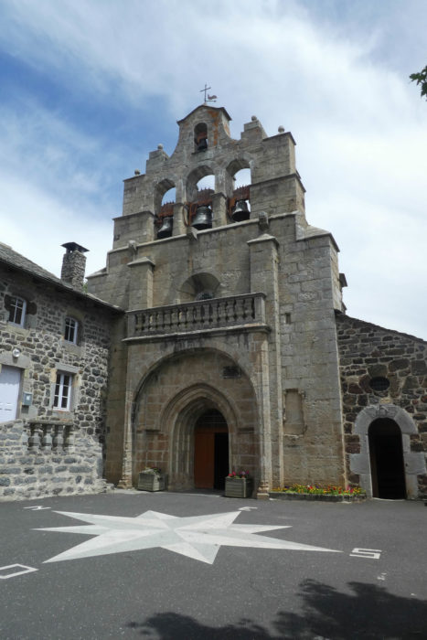
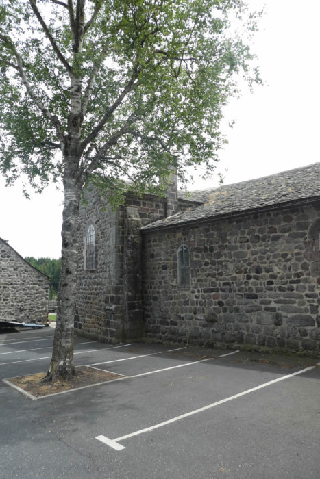
| The 12th-century Romanesque church is the village’s crowning jewel. Built from volcanic stone, it radiates a quiet strength, perfectly balancing the rusticity of its material with the elegance of its design. A later stone annex blends respectfully into the structure, preserving the site’s harmony. The bell tower, a typical « clocher en peigne » of the region, reaches skyward with its graceful openings. Inside, the church is austere and contemplative, its bare walls inviting a spirituality free of ornamentation. |
 |
 |
| Nearby, a 16th-century stone cross draws attention. Carved from a single block, it ascends skyward with austere grace, defying time’s passage. Its impressive height lends it a monumental quality, encapsulating the village’s history, a blend of resilience, aspiration, and faith deeply rooted in stone. |
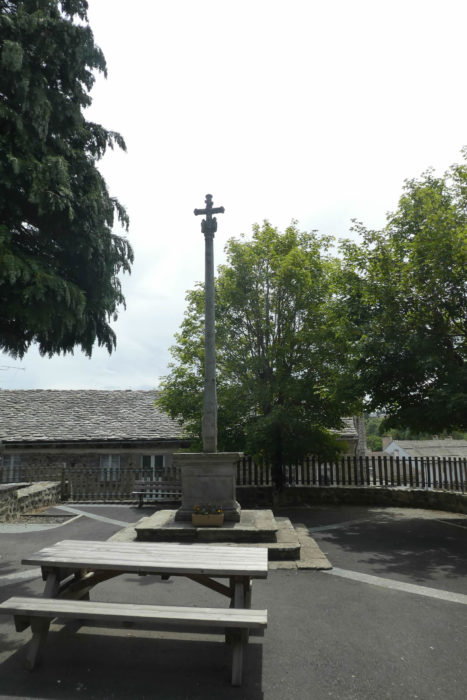 |
 |
| For those lingering in St Front, the village offers the respite of a peaceful night, with its quiet lanes and warm-hearted residents. Yet, the intrepid might consider pressing on to Bigorre, a hamlet just five kilometers away. This choice, while requiring a touch more energy, eases the next stage, decision many seasoned hikers appreciate. That day, St Front was quiet, its summer campers off on an excursion, leaving the road ahead clear toward a crossroads on the plateau. |
 |
 |
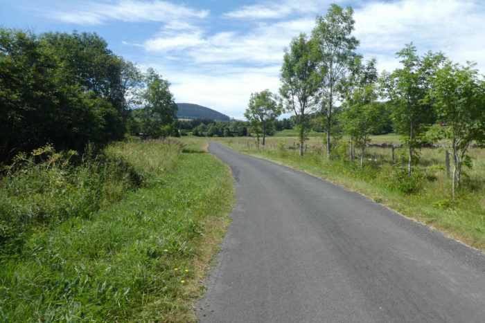
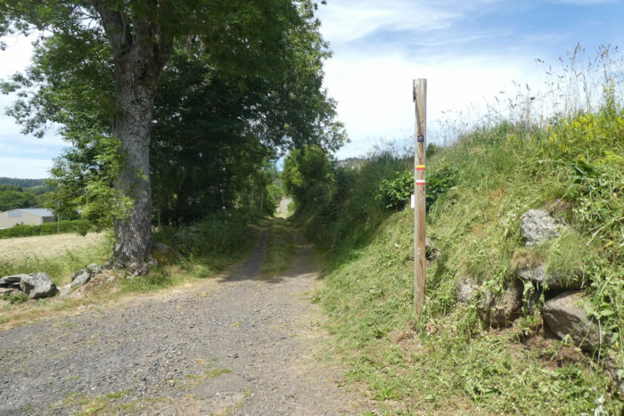
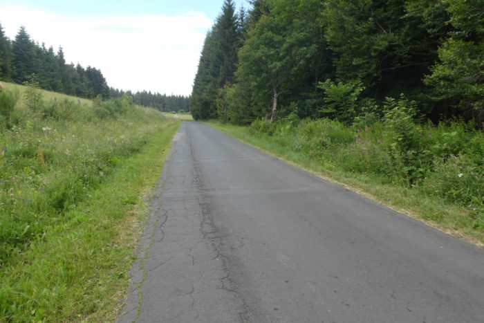
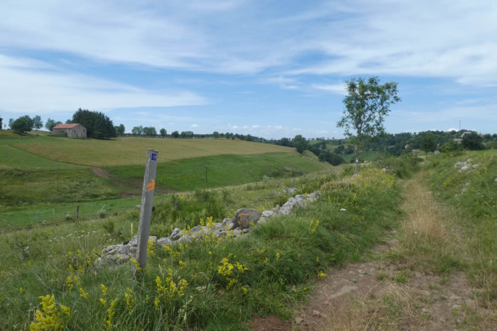
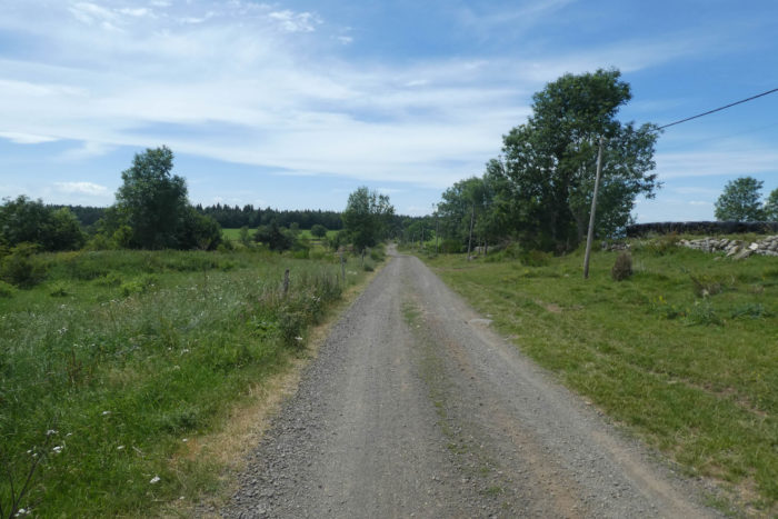
| The Via Adresca briefly follows the departmental road D39, linking St Front to Le Puy-en-Velay. Here, the journey finds a new rhythm. Leaving the GR trails, you transition to PR (« petite randonnée ») routes, marked with yellow waymarks. The scallop shell symbols of the Camino de Santiago discreetly guide your way. |
 |
 |
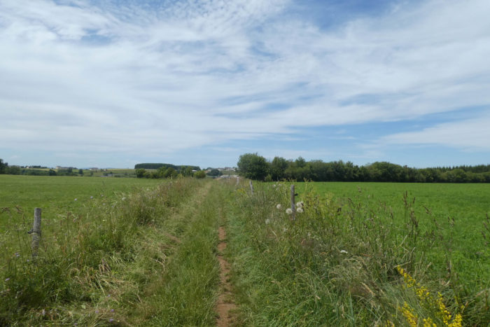
| Soon, the asphalt gives way to a straight, seemingly endless dirt road, a vein etched across the expansive plateau. Flanked by spruce forests, the route stretches toward the horizon, accompanied by the ever-present silhouette of Haute-Loire’s majestic volcanoes. These towering forms, constant yet unattainable, serve as steadfast companions, though exploring the smaller Velay volcanoes requires branching onto the Via Gebennensis. |
 |
 |
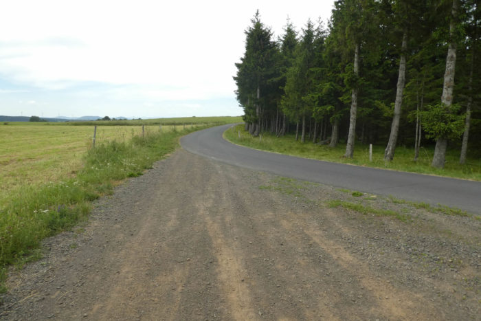
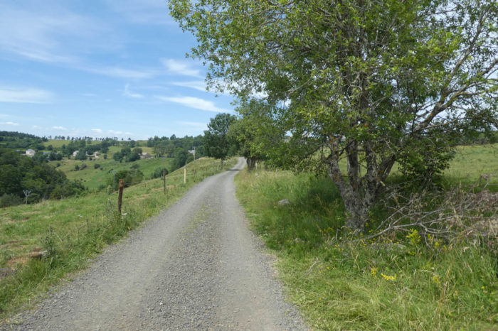
| Farther along, the dirt road transitions to a paved road that continues to skirt the forest. Feet accustomed to uneven terrain adjust to the unexpected regularity, while the scent of conifers and the gentle rustling of trees invite moments of quiet reflection. |
 |
 |
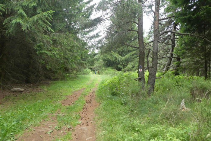
| Before long, the path leaves the asphalt once more, plunging into the shadowy depths of the spruce forest. On this day, the laughter of children playing medieval adventure games echoed among the trees, infusing the woods with unexpected vitality. |
 |
 |
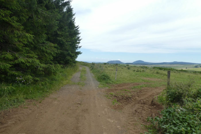
| Yet the forest never holds its visitors for long. The path suddenly emerges, unveiling a landscape that feels like a liberating breath. Ahead, the plateau stretches endlessly, a sea of grasses where towering white wind turbines punctuate the horizon, their slow, majestic rotations captivating the gaze. Beyond them, Mont Alambre rises, a discreet yet commanding neighbor to Mont Mézenc. The air, so pure and luminous, seems almost to shimmer with vitality. |
 |
 |
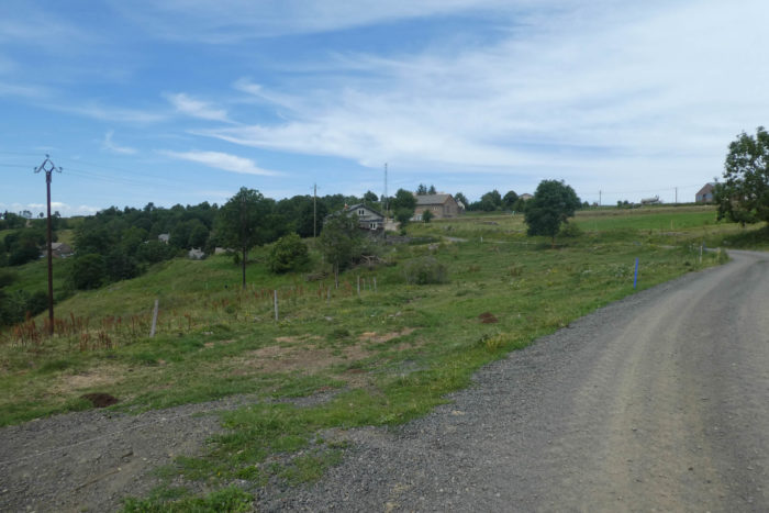
| In this almost otherworldly setting, the path winds gently through a serene, soothing landscape. Soft grass cushions each step, while ancient granite walls, silent guardians of these lands, line the way. Beneath the shade of welcoming ash trees, the dirt path resumes its reign. Then, amidst this exceptional scenery, Machabert comes into view, a tiny village perched like a hidden gem upon the hill. |
 |
 |
Section 4: Ups and downs to Bigorre
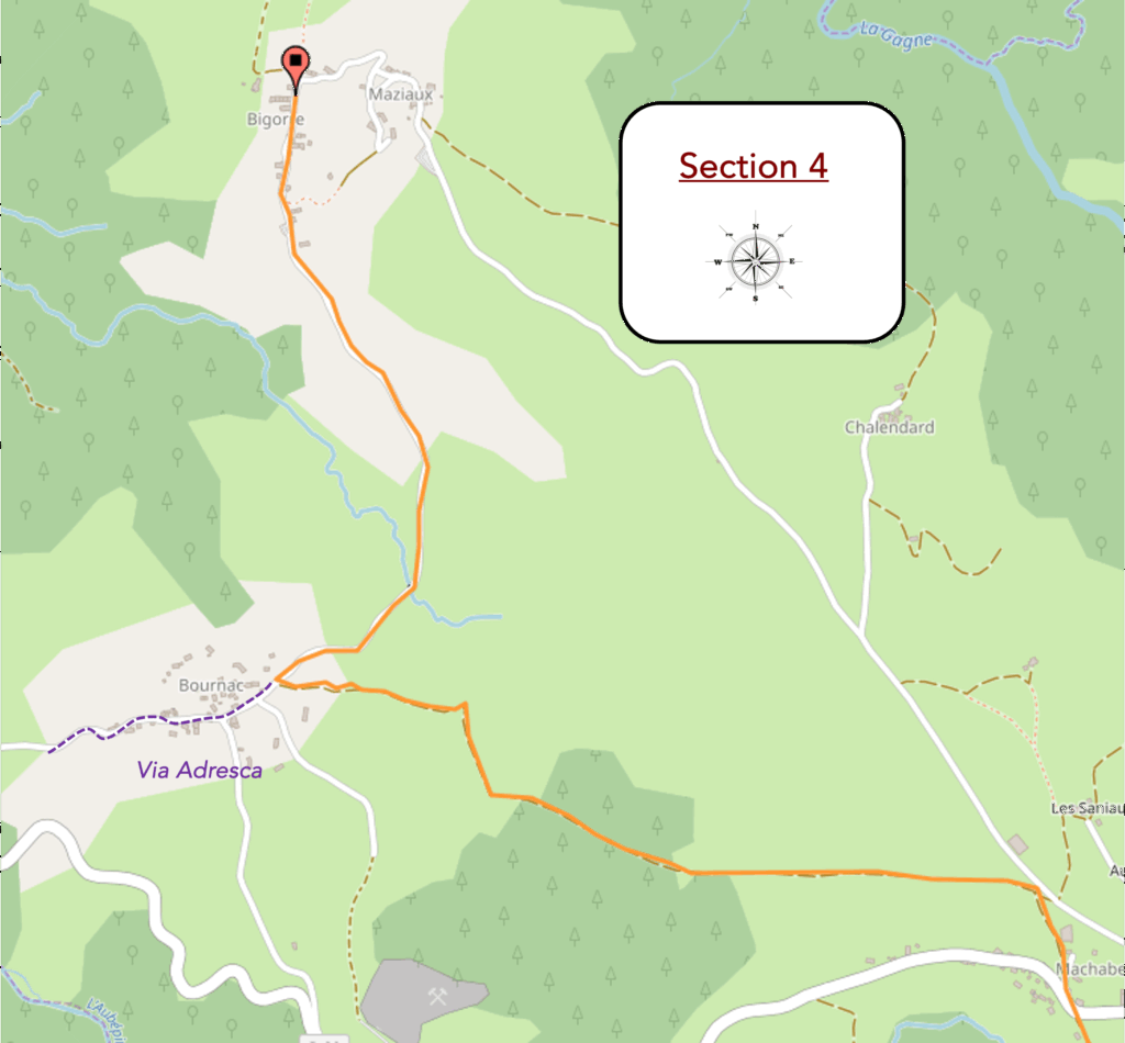
Overview of the route’s challenges : easy route.
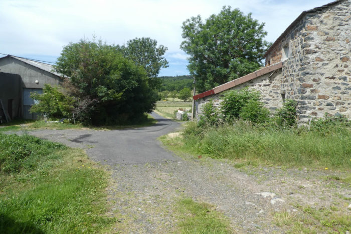
| The dirt path, a faithful companion to walkers, joins the D36 at the entrance to the village of Machabert. |
 |
 |
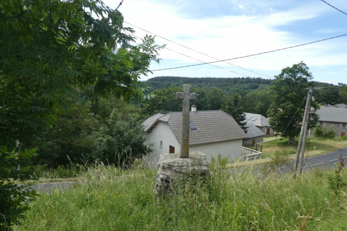
| Here, a granite cross rises proudly, an immutable witness to an ancient faith and a stonemasonry art that spans the ages. But the route does not linger: it bypasses the village, discreetly, and invites one to continue the adventure without getting caught in its silent alleys. |
 |
 |
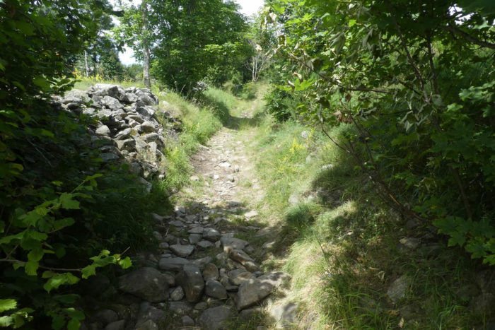
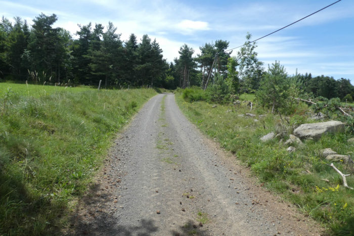
| A wide path resumes, carved into the ochre earth of the plateau, where nature presents a subtly rich tableau. Stout and robust pines stand alongside spruces, their branches swaying with the lightness of spaniel tails. Higher up, the maples stretch their crowns, and the ash trees, tall like sentinels, seem to resist the assaults of time. Far from the lands infected by the destructive fungus, these trees seem to hold a secret, an intimate remedy that the forest jealously guards. |
 |
 |
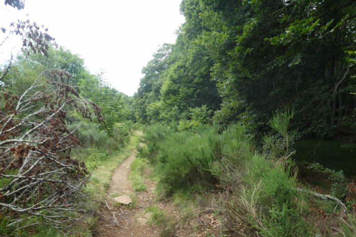
| The path then plunges into the Bois de la Fayolle, a light, almost theatrical forest in its beauty, where each trunk and glade seems designed to captivate the eye. Granite emerges in places, its rough and eroded blocks contrasting with the softness of the undergrowth. |
 |
 |
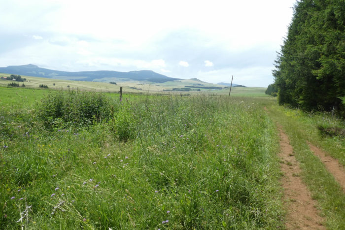
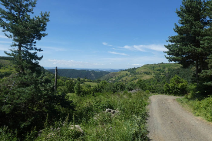
| There, beyond the puys of Velay, the undulations of the Massif Central take shape: the Dévès, the Margeride, and further still, the Aubrac. These names resonate like promises of vast spaces, ancient routes, such as the Via Podiensis that runs from Le Puy-en-Velay. Here, the honey must be pure, a nectar extracted from a flora spared by modern poisons. |
 |
 |
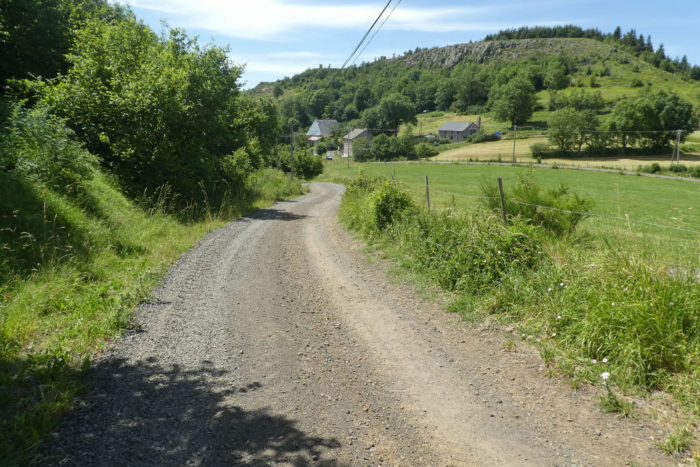
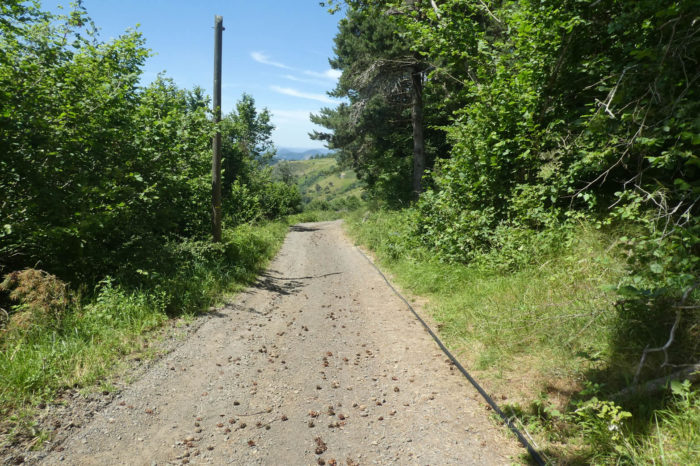
| The path, now wider, almost a carriage road, begins its descent towards the village of Bournac. The slope, gentle and measured, crosses a carpet of pine cones, crunching underfoot. Around it, a valley extends beneath the hills, calm and peaceful, offering a landscape of simple and honest beauty. |
 |
 |
It is at Bournac that a fork towards Bigorre appears. If you choose this route, the detour is modest, barely a kilometer. One must resist the call of Bournac’s alleys, leave the village, and take a road that gently descends into the valley before climbing back up to Bigorre. This short route is a transition, a passage to a place almost out of time.

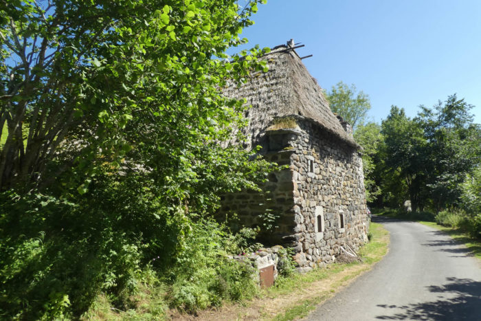
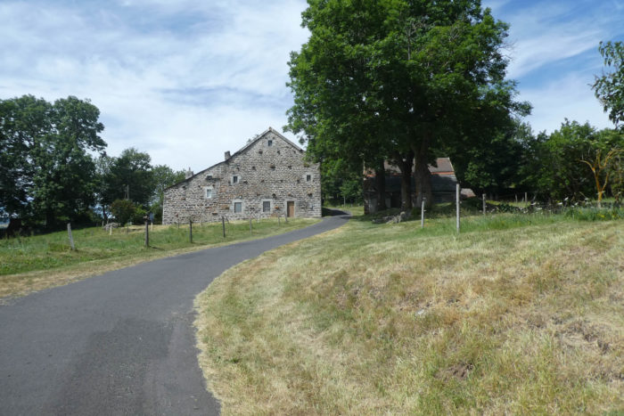
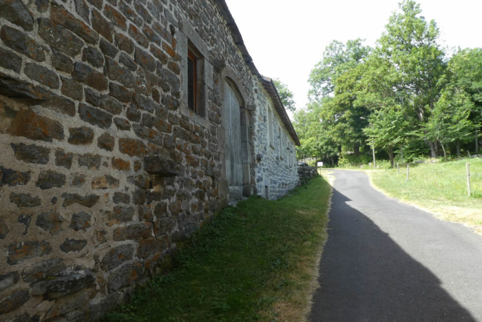
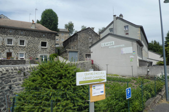
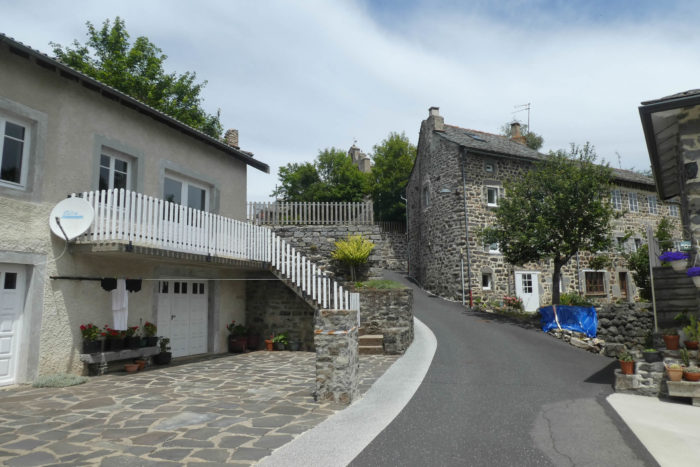
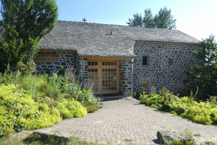
| Bigorre finally reveals itself, a hamlet where heritage is embodied in its basalt houses with thatched roofs, beautifully preserved or under renovation. Rye straw, a traditional material, still crowns many buildings, although some have yielded to the call of slate, which, in its austere elegance, offers a sustainable alternative. This place, a true open-air museum, also houses a heritage museum, as if to better anchor this collective memory in the present. |
 |
 |
| But Bigorre is also L’Herminette, this promise of sincere hospitality and simple joy. This place embodies the spirit of the region: a haven where every stone, every detail, whispers stories of the men and women who shaped these lands. A stop here is not just a pause; it is an immersion into a life woven with traditions and toil. |
 |
 |
Official accommodations on the Via Adresca
- Les Mille Fleurs, Bonnefond, St Front; 04 71 59 50 22/06 26 71 54 84; Gîte, dinner, breakfast
- Auberge- hôtel L’Herminette, Bigorre; 04 71 59 57 58; Hotel, dinner, breakfast
Pilgrim hospitality/Accueils jacquaires (see introduction)
On the Via Adresca, accommodation options are almost always limited. This is not the touristy southern Ardèche. Lodging is scarce, even on platforms like AirBnB, where addresses are often not available. The list only includes places to stay that are directly on the route or within one kilometer of the route. The guide from the Friends of Compostela provides a more complete list, covering all available accommodations, as well as bars, restaurants, and bakeries along the route, even those located several kilometers off the route. In St Front, you will find places to eat, along with a small grocery store. However, for accommodation, you’ll need to continue to Bigorre, a remarkable village located one kilometer off the route after Bournac. It is essential to book in advance.
Feel free to add comments. This is often how you move up the Google hierarchy, and how more pilgrims will have access to the site.
|
 |
Next stage : Stage 18: From Bigorre to Puy-en-Velay |
|
 |
Back to menu |