From the Ardèche to the Haute-Loire
DIDIER HEUMANN, ANDREAS PAPASAVVAS
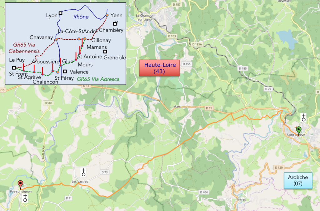
We divided the course into several sections to make it easier to see. For each section, the maps show the course, the slopes found on the course, and the state of the route (paved or dirt roads). The courses were drawn on the « Wikilocs » platform. Today, it is no longer necessary to walk around with detailed maps in your pocket or bag. If you have a mobile phone or tablet, you can easily follow routes live.
For this stage, here is the link:
https://fr.wikiloc.com/itineraires-randonnee/de-st-agreve-a-fay-sur-lignon-par-la-via-gebennensis-adresca-33100158
| Not every pilgrim feels comfortable using GPS devices or navigating on a phone, especially since many sections still lack reliable internet. To make your journey easier, a book dedicated to the Via Gebennensis through Haute-Loire is available on Amazon. More than just a practical guide, it leads you step by step, kilometre after kilometre, giving you everything you need for smooth planning with no unpleasant surprises. Beyond its useful tips, it also conveys the route’s enchanting atmosphere, capturing the landscape’s beauty, the majesty of the trees and the spiritual essence of the trek. Only the pictures are missing; everything else is there to transport you.
We’ve also published a second book that, with slightly fewer details but all the essential information, outlines two possible routes from Geneva to Le Puy-en-Velay. You can choose either the Via Gebennensis, which crosses Haute-Loire, or the Gillonnay variant (Via Adresca), which branches off at La Côte-Saint-André to follow a route through Ardèche. The choice of the route is yours. |
 |
 |
If you only want to consult lodging of the stage, go directly to the bottom of the page.
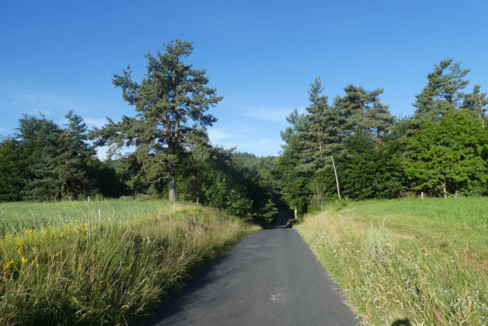
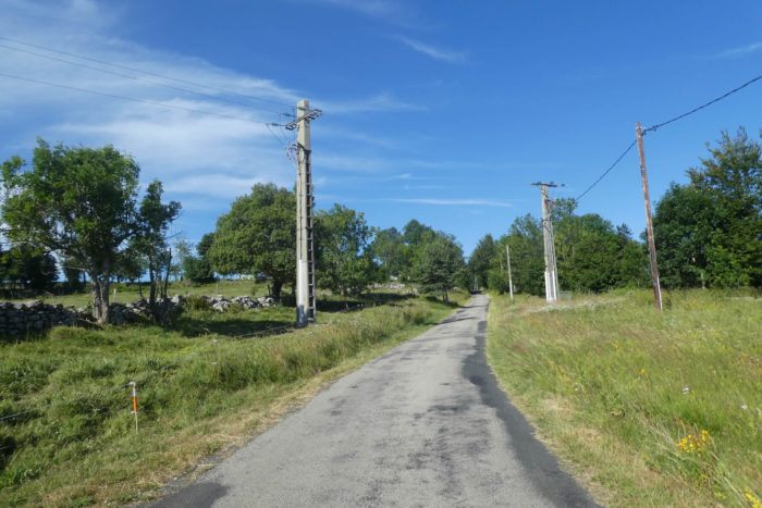
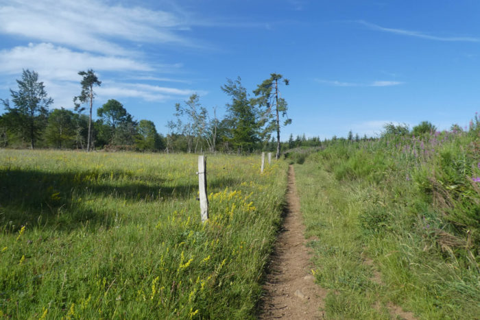
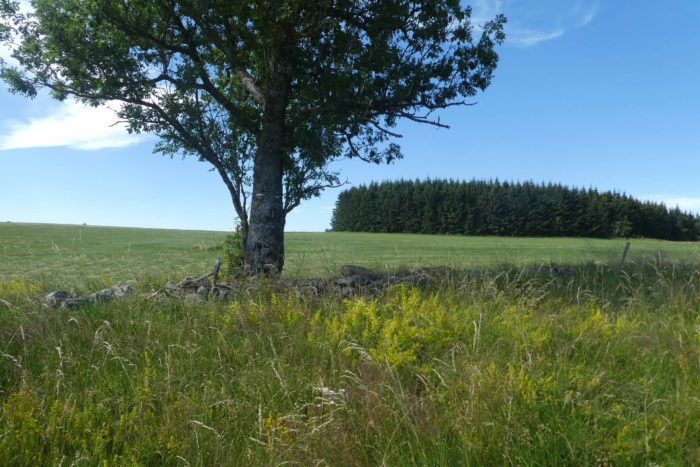
The plateau of St Agrève, at an altitude of 1,000 meters, alternates between forests and meadows, blending wide-open landscapes with more intimate spaces. It evokes an image of tranquil highland pastures. The summits and slopes are mostly covered in grasslands, while the lowlands are dotted with groves dominated by conifers, particularly spruces and Douglas firs. In some places, the scenery becomes truly extraordinary, where the forests merge seamlessly with the pastures. Walking here feels like traversing a natural balcony, with the edge of the plateau dropping dramatically into the valley below. Throughout, the emblematic and peculiar silhouette of Mont Mézenc remains a distant companion, symbolizing openness, depth, and even mystery. Volcanic landscapes have always held a special fascination. Today’s route transitions from the Ardèche into the Haute-Loire without interruption. The terrain and scenery remain consistent, reflecting a shared character. While beauty is subjective, this stage arguably crosses some of the most stunning landscapes in northern Ardèche, offering a harmonious mix of meadows, forests, and serene surroundings.
The region is interwoven with long-distance hiking trails, including the GR7, GR420, and GR430. Up to Fay-sur-Lignon, the Via Adresca follows these GR routes, marked by their familiar red-and-white blazes as well as the scallop shell of the Camino de Santiago. Only in two short sections do the routes diverge slightly. For the Via Adresca, the route strikes a balance between these options. Those looking for a longer trek can combine this stage with St Front, for a total of 27 kilometers.
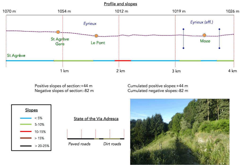
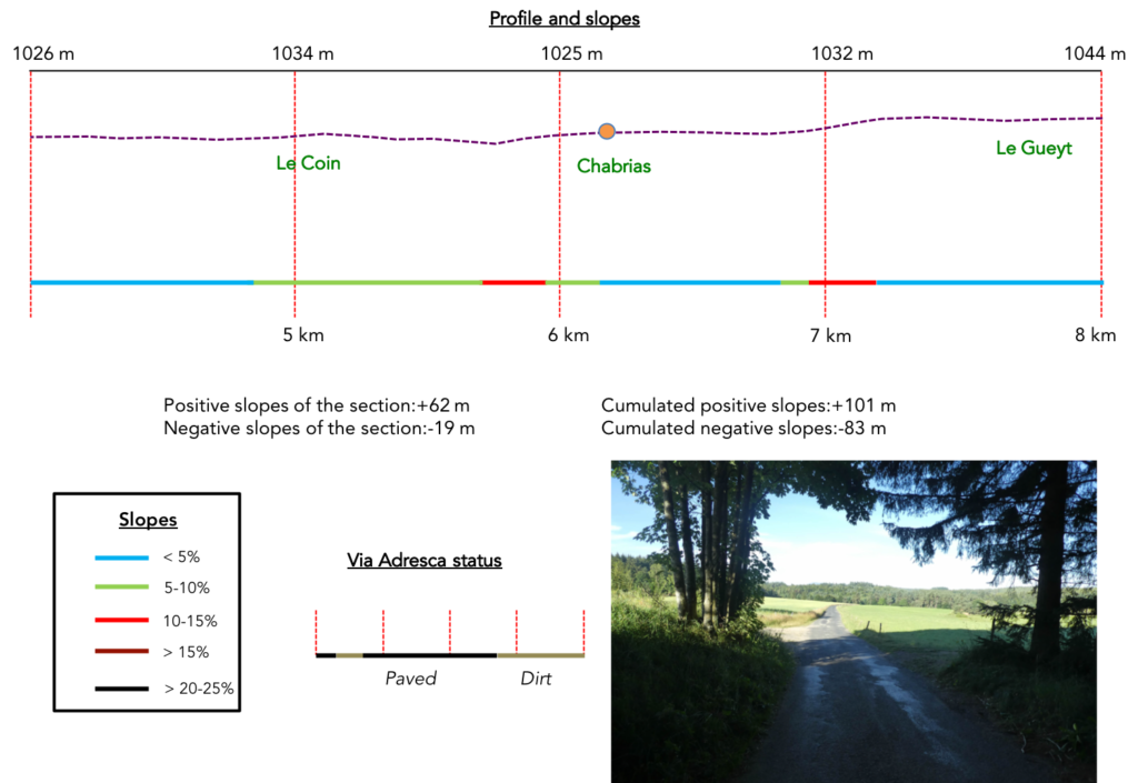
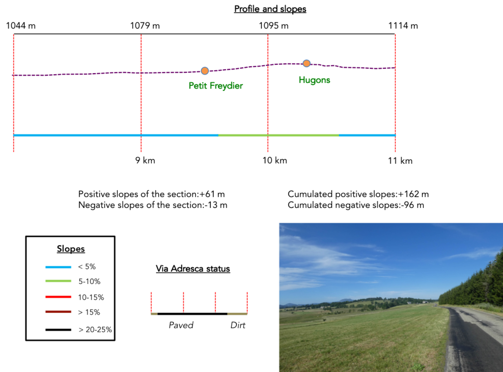
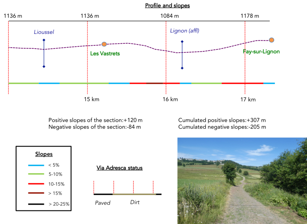
Difficulty level: The elevation changes are moderate (+307 meters / -205 meters) over the course of the stage. Only near Fay-sur-Lignon do the slopes become steeper, as the route descends into the valley of the Lignon River and climbs again to the village perched atop the hill.
State of the Via Adresca: The balance between paved roads and paths is fairly even:
- Paved roads: 8.1 km
- Dirt roads : 9.2 km
Sometimes, for reasons of logistics or housing possibilities, these stages mix routes operated on different days, having passed several times on these routes. From then on, the skies, the rain, or the seasons can vary. But, generally this is not the case, and in fact this does not change the description of the course.
It is very difficult to specify with certainty the incline of the slopes, whatever the system you use.
For those seeking « true elevations » and enthusiasts of genuine altimetric challenges, carefully review the information on mileage at the beginning of the guide.

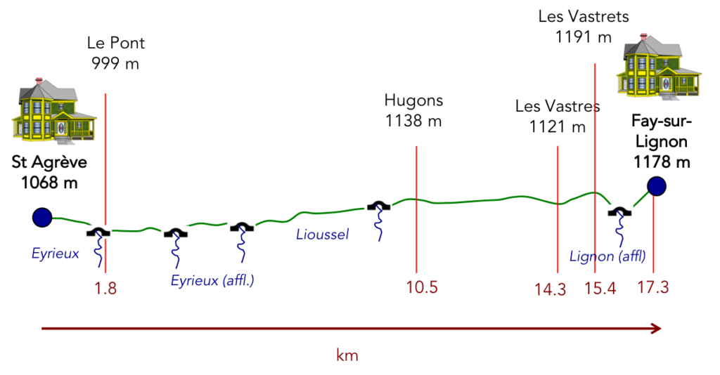
Section 1: Stroll on the St Agrève Plateau
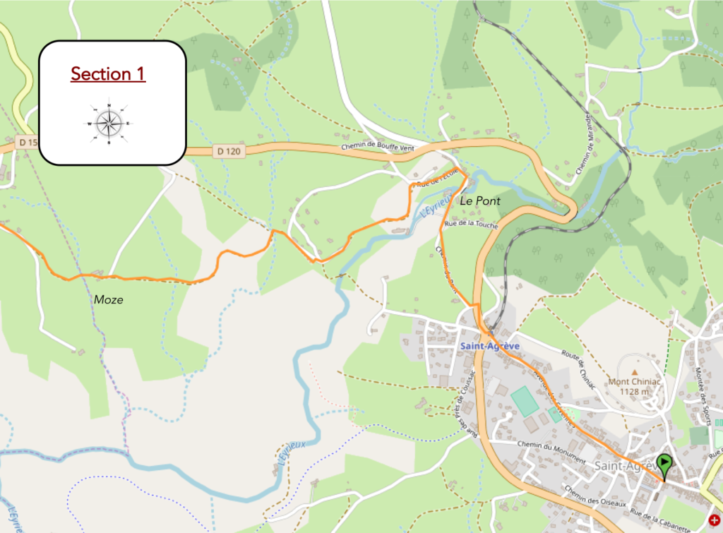
Overview of the route’s challenges: route without difficulty.
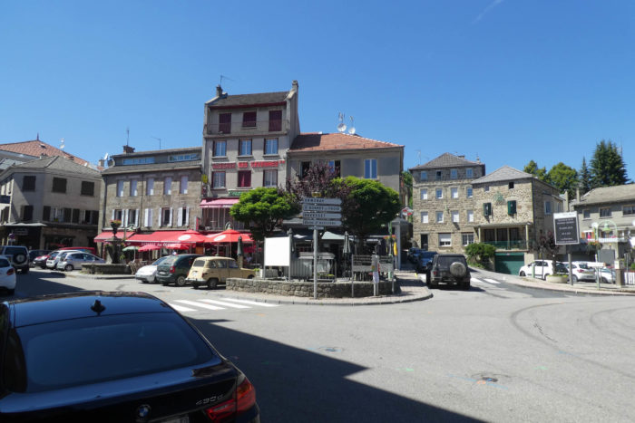
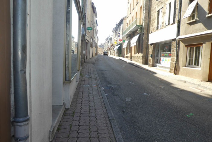
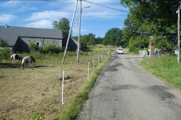
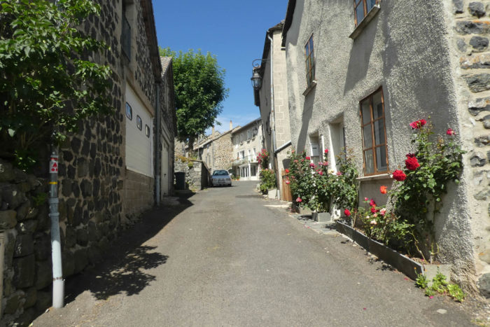
| From the heart of Saint-Agrève, the route takes flight, winding through the town in a maze of narrow paved roads. This crossing, which stretches for nearly a kilometer, leads inexorably to the station, a silent witness to a bygone era. |
 |
 |
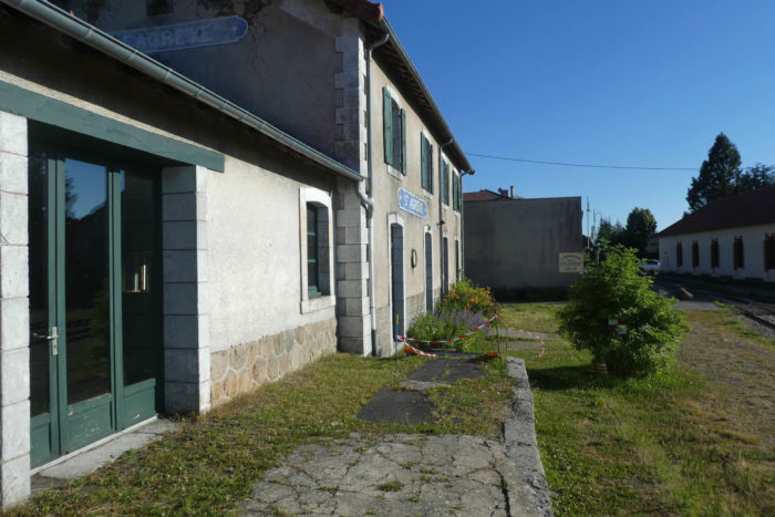
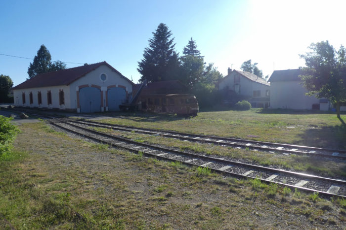
| The station, though still functional, exudes a quaint charm. It is nothing like modern constructions: its stones, weathered by the years, seem to tell a thousand tales. This is where the tourist route of the Velay Express begins, a picturesque itinerary linking the preserved landscapes of this region. Nearby, an old locomotive, frozen in time, rests by the warehouses, marked by years of wear. |
 |
 |
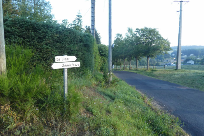
| From the start, the route merges with the renowned GR7, GR420, and GR430, setting off with determination toward Le Pont, a nearby village. |
 |
 |
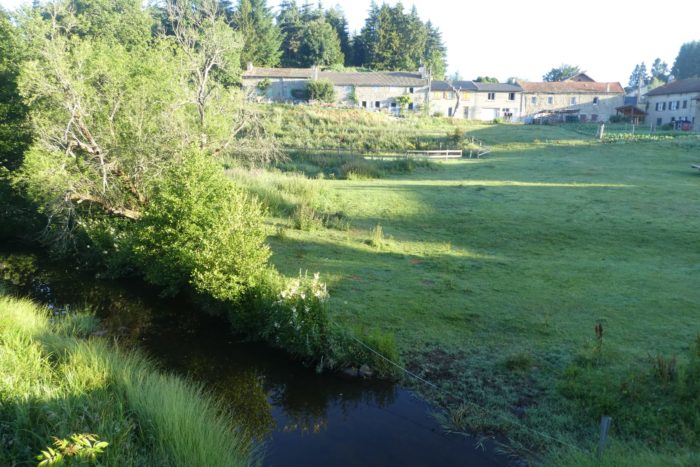
| Le Pont, humble, is marked by the crossing of the Eyrieux, a stream that here appears as a modest river. Yet, the Eyrieux is one of the most significant arteries of the Ardèche, winding through a deep and secret valley. This is the backdrop where the train once passed, now replaced by the Dolce Via, a path popular among hikers who, like you, come to seek the raw and tranquil beauty of nature. You brushed past the Eyrieux Valley near St Julien-Labrousse and Chalencon, two villages that jealously guard their secrets in the heart of the mountains. |
 |
 |
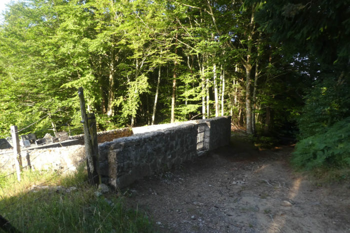
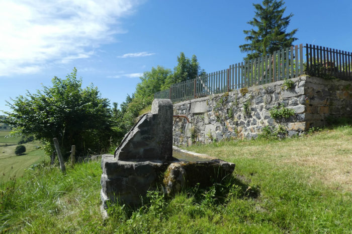
| The Via Adresca leaves the village of Le Pont and its quaint rubble stone houses. You follow the road that runs along the communal washhouse, this beautiful structure of solidly sealed stones, a witness to a past where water was at the center of daily life. |
 |
 |
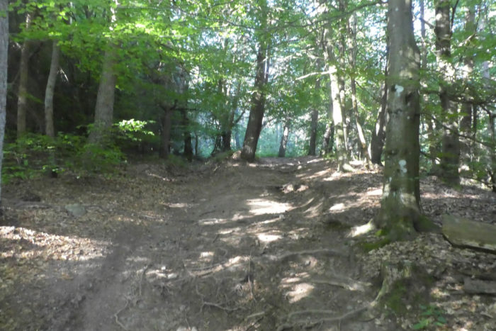
| There, a narrow trail climbs slowly, winding along a steep embankment overlooking the river. You enter the undergrowth, where the dense vegetation envelops you in its soothing shade. Gradually, the path widens, offering you a privileged view of a wild world, made of slender conifers, maples with veined leaves, ash trees with gnarled trunks, and century-old chestnut trees, silent yet majestic. |
 |
 |
| At this point, the Via Adresca hesitates between dirt, sand, and even asphalt at times, as if adapting to nature’s changing moods. The chirping of birds mingles with the gentle rustling of leaves, while the tall ash trees grow ever more imposing, extending their green arms to dominate the scene. |
 |
 |
| A wide dirt path crosses an undergrowth of brackish clay, where the footprints of hikers remain imprinted for a long time. The signs of the GR and the Via Adresca stripe the trunks, guiding each hiker like a living compass, ensuring no one gets lost in this natural labyrinth. |
 |
 |
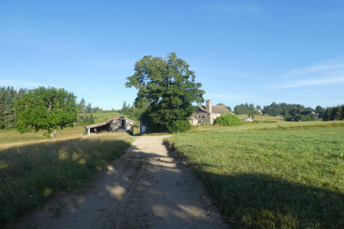
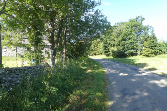
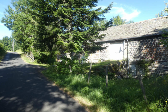
As you exit the forest, the path opens up to a splendid panorama. You find yourself facing an imposing farmhouse, built of granite stones, which seems to emerge from the earth itself. This region indeed rests on a granite base, a material that, over the centuries, has served as the foundation for local construction, anchoring humans in this both harsh and magnificent landscape.

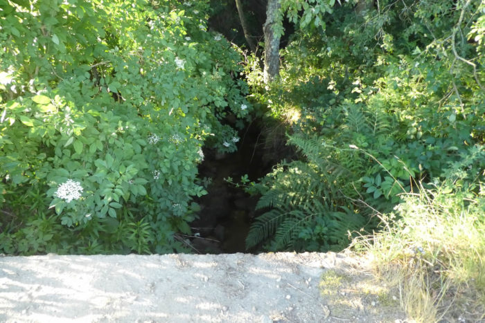
| A little farther on, the path gently slopes down to join one of the many tributaries of the Eyrieux, a river that discreetly winds between the valleys. The humidity becomes palpable, seeping into the air and soil. The ground, saturated with water, sometimes turns into a muddy mixture of clay, difficult to cross, bearing witness to the constant dampness of the place. |
 |
 |
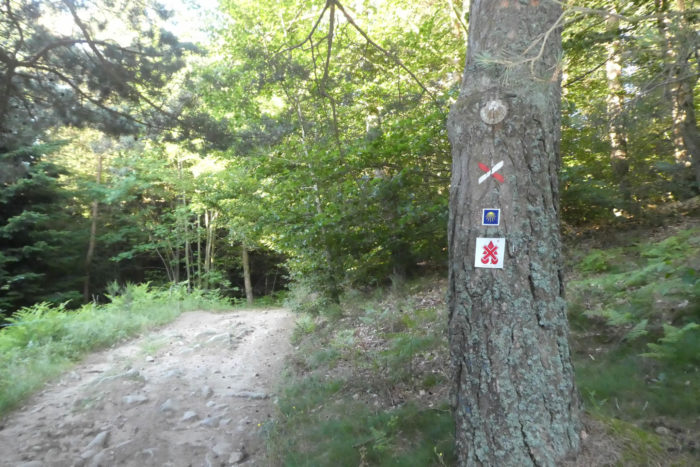
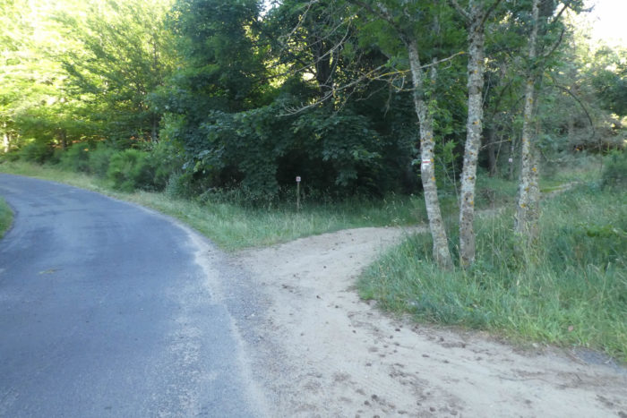
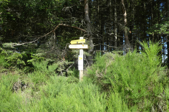
| At the entrance to an undergrowth, pay close attention to the signposts. Here, the Via Adresca, the Camino de Santiago path marked with its emblematic shells, separates from the GR trails, which traverse the landscape like a red and white line. This discreet yet strategic gesture reflects each path creator’s desire to preserve the authenticity of their route. Alas, it sometimes causes more confusion for the novice hiker. It is here that the Via Adresca takes its own direction, following the same route as the Petite Randonnée (PR) path, marked in yellow and white. Shortly after, all ways will converge again, like streams merging to form a single river. This little interplay is an invitation to sharpen your memory, to avoid getting lost in this maze of paths. |
 |
 |
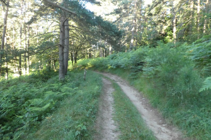
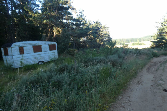
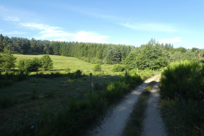
| A grayish and slippery dirt path plunges into the undergrowth, winding among ferns that thrive in the humid coolness of the area. Here, light struggles to pierce through the leafy canopy of pines, creating a soft and tranquil ambiance. The path eventually opens onto meadows, where grass stretches as far as the eye can see. The ferns, these exuberant plants, flourish without constraint in this damp region, spreading over hectares like a verdant carpet. The plateau, perched at over a thousand meters above sea level, hosts rarer vegetation. At this height, chestnut trees, majestic yet temperamental, struggle to thrive above 800 meters. But then, why do farmers keep these rusty caravan frames, these memories of past vacations, in the shade of the woods, within such a natural haven? |
 |
 |
| The path then drifts, slowly but inexorably, through a vast plain of meadows, like a tranquil river gliding over soft grass. It passes close to Moze, where a large farmhouse hides under the imposing foliage of a majestic ash tree. This tree, with its commanding stature, seems to watch over the home like an old sage. |
 |
 |
| A little farther, the path improves and gently stretches, weaving between the fields at the edge of the forest. Here, conifers multiply, their presence becoming denser and more imposing, drawing vertical lines that challenge the sky. For several days, you have crossed forests almost entirely made of chestnut trees, these trees with rough leaves and marked bark. Here, however, the ash trees take over, their majestic trunks rising almost to the Puy, both robust and graceful. The countryside, unfolding under your steps, is of undeniable beauty, a nature that feels timeless. |
 |
 |
Section 2: In the forests of the St Agrève plateau

Overview of the route’s challenges: route without difficulty.
| The path, initially immersed in soft grass, eventually transitions into a small paved road that skirts the edge of the woods, a subtle border between the wild and the civilized. . |
 |
 |
| The road leads to a crossroads, where, if you were tempted, you could head toward the Château de Flossac. Yet, the spirit of a traveler compels you to resist this route. In the distance, beyond the dark rows of spruces, the ridgeline of the Cévennes and the Puys emerges, dominated by the imposing Mont Mézenc. It is here that the Via Adresca once again merges with the GR trails, a confluence of paths like streams converging in a dale. |
 |
 |
| A wide path then stretches across meadows, shaded by robust ash trees, majestic pines, and maples, in a landscape that seems to unfold in all its splendor. Time slows here, carried gently by the serenity of the surroundings. . |
 |
 |
| This is a true stroll, a walk through untouched and generous nature that welcomes you effortlessly and without constraints. The soul drifts serenely, buoyed by the beauty of this world, untroubled by the slightest exertion. Further on, the path abruptly ends on asphalt, signaling a return to civilization. |
 |
 |
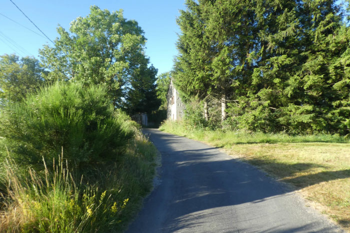
| The modest, yet determined, little road stretches across verdant pastures toward the hamlet of Le Coin. Here, Abondance cows, majestic creatures of Reblochon fame, graze peacefully at altitude, indifferent to the passage of time. |
 |
 |
| A little further, the calm and steady road joins a larger artery, the one connecting St Agrève to Puy-en-Velay. But rest assured, it is not a busy route. This part of Ardèche, wild and preserved, seems to escape the bustle of major roads. |
 |
 |
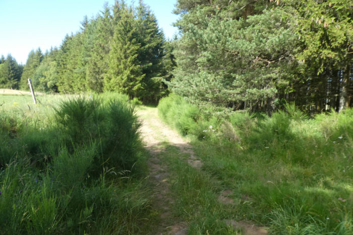
| True to its character, the Via Adresca does not follow the D15 road. Instead, it dives between woods and meadows, always accompanied by pines, spruces, ash trees, and maples. Ahead of you, forests stretch as far as the eye can see, scattered with conifers, mostly pines, whose slender silhouettes etch sharp lines against the sky. |
 |
 |
| The road then discreetly enters the vast forest of Maret, blending into its almost impenetrable density, as if becoming a part of this vegetal world. |
 |
 |
| A small path, escaping the main road, winds between the trees, delving deeper into the wild. But soon, it reunites with the main road again, as though the call of civilization was too strong to resist. |
 |
 |
| The road continues through the dense forest, eventually reaching a clearing, a haven of light in the heart of the shadowed trees. |
 |
 |
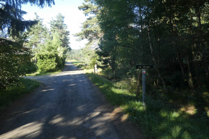
| At a modest crossroads, the Via Adresca takes the direction of Le Gueyt, an unassuming locality steeped in calm. |
 |
 |
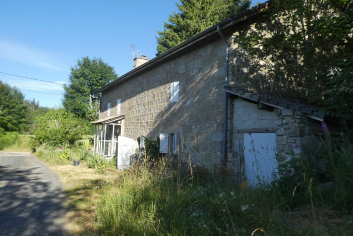
| Here, the region is marked by the absence of villages or hamlets. Only a solitary house stands, home to donkeys seeking refuge in the shade of protective ash trees, like quiet shadows in this peaceful landscape |
 |
 |
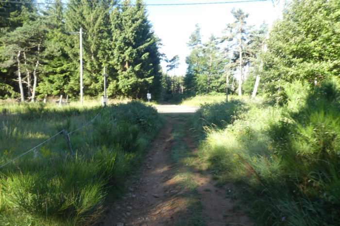
| A bit further on, after a seemingly abandoned farm, the road ends, and a path once again plunges into the woods, enveloped in almost palpable silence. |
 |
 |
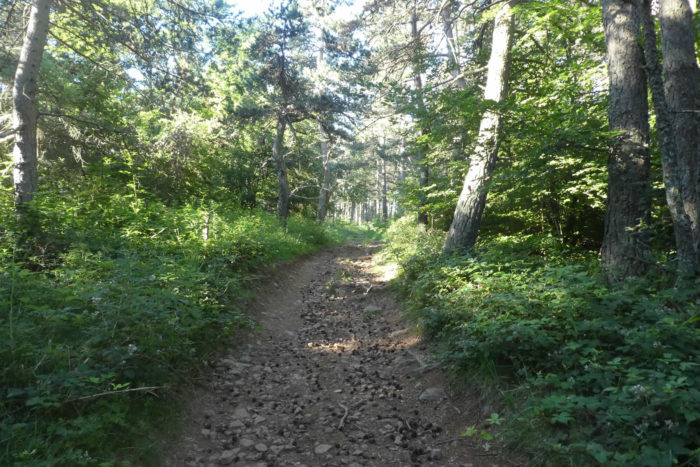
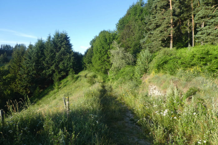
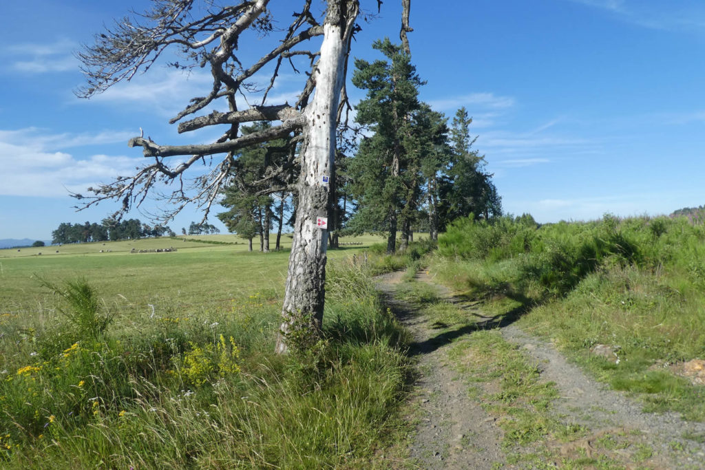
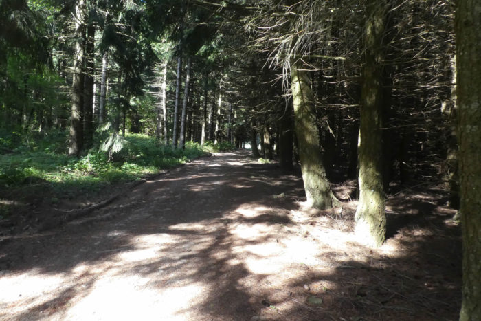
| From a distance, the forest might appear uniform, dominated by tightly packed spruces and pines. However, it holds an unexpected richness. The forest here is mixed, sheltering a variety of splendid deciduous trees that add diversity to this vegetal world. The ground, shifting between gray and ochre tones, is scattered with pinecones that roll underfoot, adding a fragrant and tactile layer to the experience. |
 |
 |
| Shortly after, the path briefly emerges from the forest, crossing a small road before pausing, as if catching its breath for the journey ahead. |
 |
 |
Just a stone’s throw away, the road reaches a crossroads where a cross stands as a subtle landmark. Here, you could choose to visit the village of St Romain, home to an astronomical observatory, a beacon of knowledge amidst nature.
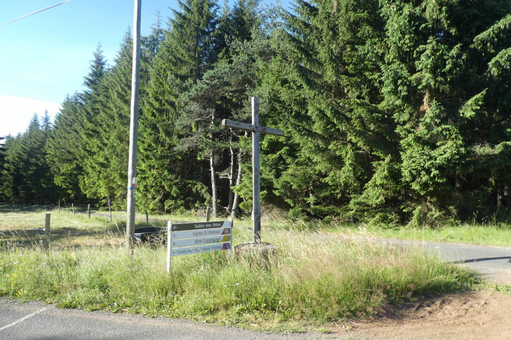
| Once again, the Via Adresca diverges from the GR trails, taking a barely visible path. The GR markers fade on the trees, leaving only the familiar scallop shell to guide you forward without deviation. You might wonder, in amusement, what peculiar ideas the trail designers had when making these seemingly illogical decisions.
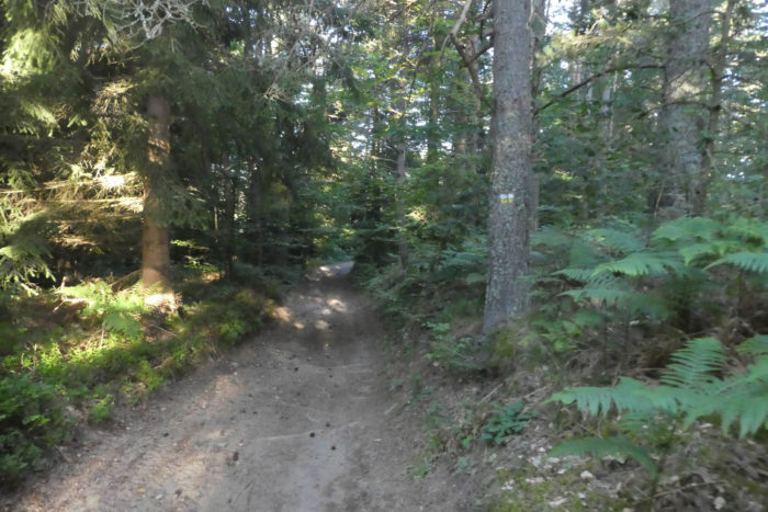
The path then traverses a forest of spruces and Douglas firs, giants aligned as if drawn with a ruler, forming an endless vegetative column. |
 |
 |
| Further ahead, it emerges onto ochre-colored earth, in a sunlit clearing where ash and maple trees sway gently in the wind. These trees, lovers of fresh air and open spaces, thrive fully in this peaceful haven. |
 |
 |
Let’s just say that on this high plateau, the natural scenery is simply magnificent, perhaps the most beautiful along the entire Via Adresca, or at the very least, the most peaceful. Not a single cultivated field, no often-sorry-looking cornfields, but also no waves of wheat swaying in the wind. Just meadows and forests.
Section 3: At the far end of Ardèche

Overview of the route’s challenges: route without difficulty.
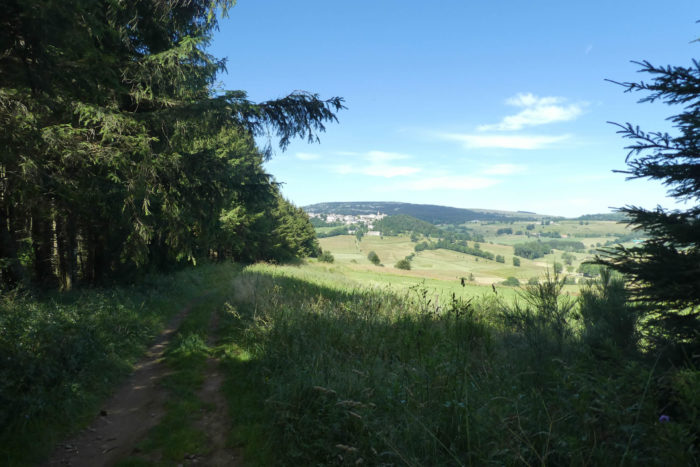
| A little further on, the path joins the small departmental road D151, which stretches out like a long ribbon of asphalt meandering through verdant meadows. The tall, dense grasses line the road on both sides, swaying gently in the light breeze. On the horizon, the mountain ridgeline remains steadfast, its majestic silhouette etched against the sky. The Gerbier de Jonc, once imposing, now seems to fade, gradually reducing to a distant and almost intangible form, while the bulkier and more commanding Mont Mézenc begins to dominate the scene, its prominent shape emerging more clearly from the landscape. Its summit rises like a sleeping giant, standing watch over the valley. |
 |
 |
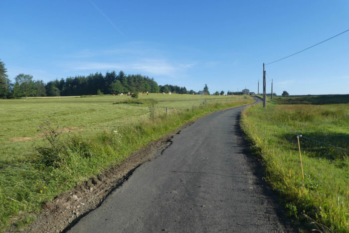
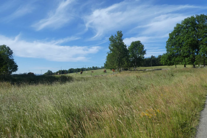
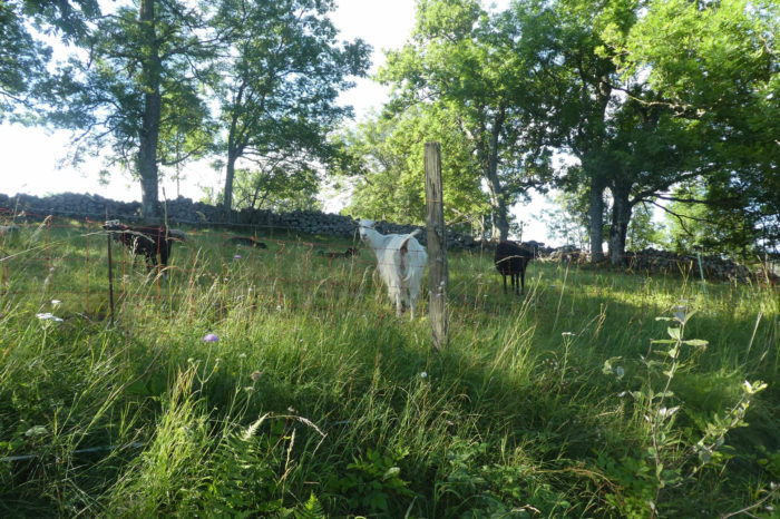
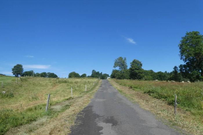
| The road seems endless, an open space unfurling amidst a panorama of rare beauty. It stretches over long distances through infinite meadows, where herds of livestock scatter here and there, wandering peacefully through the tall grass. The animals, almost invisible in this sea of green, seem to merge with the scenery, like shadows living in perfect harmony with the surrounding nature. Here and there, the first trees, maples, pines, and ash trees, appear, standing as wooden sentinels, immobile and solitary, observing the passage of time. These discreet giants silently guard the countryside, offering shade and coolness to anyone who approaches. Here, the livestock live in a world of freedom, where each cow, goat, or horse appears to master its domain, moving with the wind and the seasons. Livestock farming reigns in this land, where cultivated fields rarely thrive above 1,000 meters in altitude, except when bowing to the whims of the harsh climate. |
 |
 |
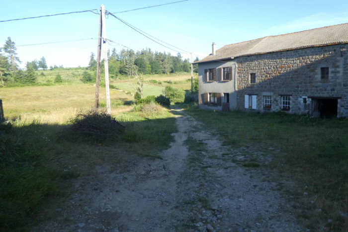
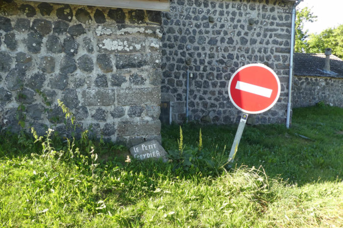
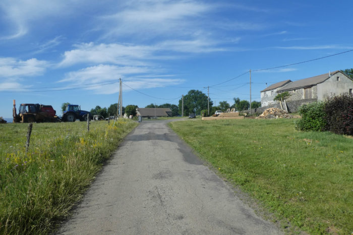
| The road approaches the hamlet of Le Petit Freydier, an almost secret little village, concealed under roofs of meticulously cut and joined stone. The farms, modest and discreet, hide among the trees, their stone walls crafted with an almost millennial care, silent witnesses to generations long past. In this region, the homes are never grand structures but rather simple, sturdy houses built to withstand the trials of time and climate. They seem to blend into the landscape, like natural elements, and their modest forms reflect an elegant, almost rustic simplicity. |
 |
 |
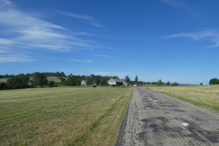
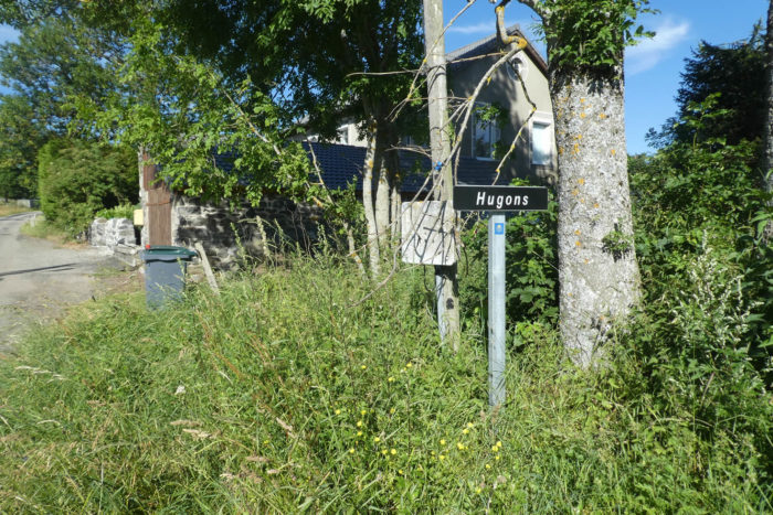
| At this point, the Via Adresca leaves the departmental road, a barely perceptible but deeply meaningful gesture. The path veers away from the asphalt to merge once again with the more natural trails, those of the long-distance hiking paths where traces of the past intertwine with the geography of the land. The GR trails and the Via Adresca merge, as if the paths had finally decided to ignore their separation. The trail now heads toward the village of Hugons, through a peaceful countryside where agriculture, occasionally interspersed with cereal crops, adds a touch of vibrant greenery to the landscape. The fields seem to come to life each season, draping the land in the gentle cycles of renewal. |
 |
 |
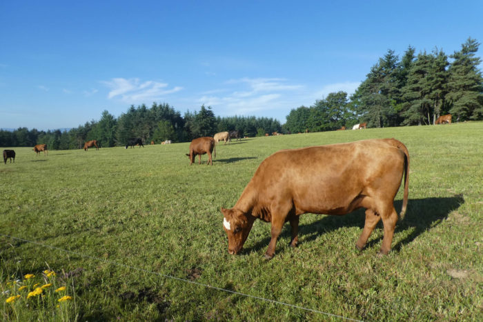
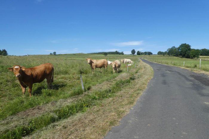
| The soil of this plateau, primarily granite, is a fundamental element of this region. Stone is everywhere, a faithful companion to both man and nature. The dry-stone walls that demarcate the pastures stand as guardians of this territory, marking the invisible borders of the land. The farms and houses are built from stone, solidly rooted in this hard and sometimes rugged earth. In some areas, basalt joins granite, adding a new texture to this mineral landscape. But what stands out most are the majestic Abondance cattle, those imposing cows grazing peacefully in the fields. They embody the tranquil strength of nature, bred in a harsh climate where the « burle, » a fierce icy wind, blows violently, especially in winter, hurling snow across the plateau’s slopes with incredible force. These cows are the living embodiment of resilience in this land, a symbol of life’s endurance against the fury of the elements. |
 |
 |
 |
 |
| The road then leaves a village, fragmented and scattered across the fields. This is not a place where life concentrates but rather a land where each house seems like a small cell, focused on agricultural activity, attuned to the seasons and the harvests. The men and women of this village are like the lands they cultivate, solidly rooted but also open to the whims of nature. |
 |
 |
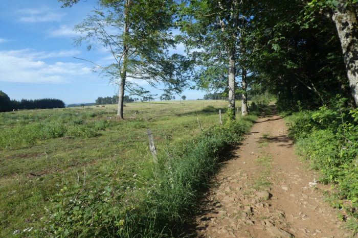
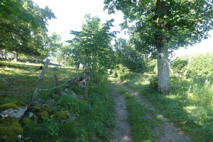
| A narrow path, bordered by mossy granite walls, then stretches under ash and maple trees, their branches intertwining above like a living canopy. The path winds, at times nearly invisible, like a well-kept secret in this landscape where livestock, peaceful and free, wander here and there. Cows, goats, and sometimes horses share this territory with quiet joy, embodying a perfect harmony between man, animal, and earth. Here, everything seems calm, almost frozen in time, a landscape where every element finds its place with tranquil certainty. |
 |
 |
Section 4: Welcome to Haute-Loire

Overview of the route’s challenges: route without difficulty.
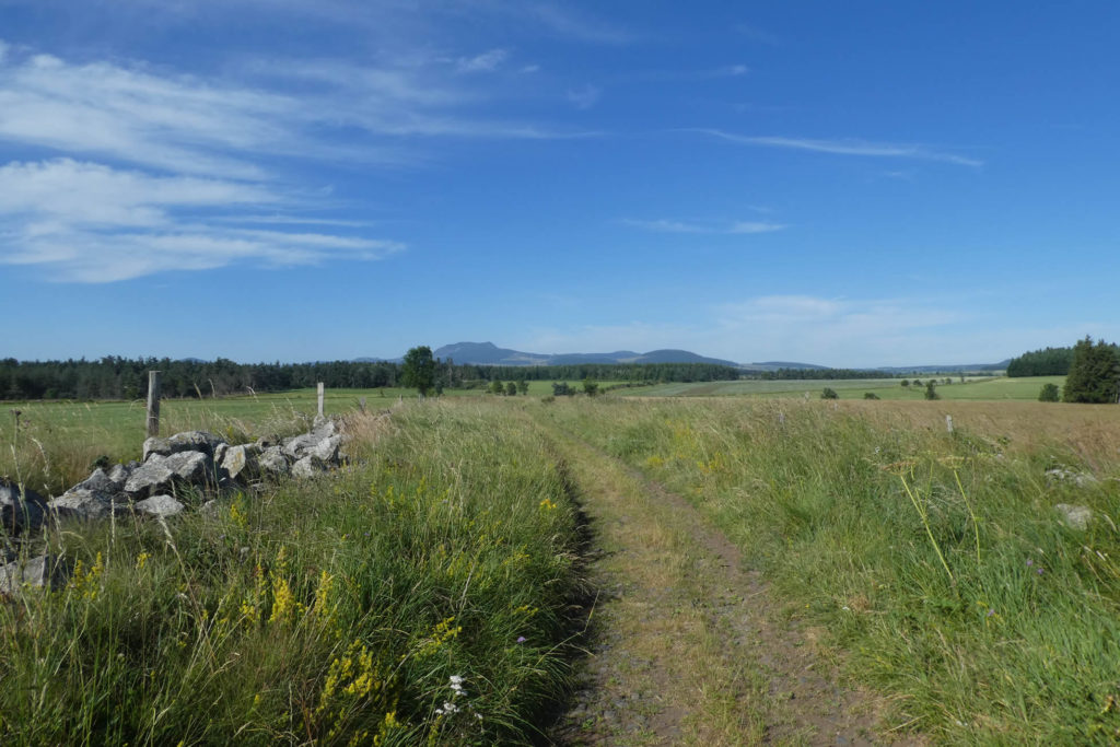
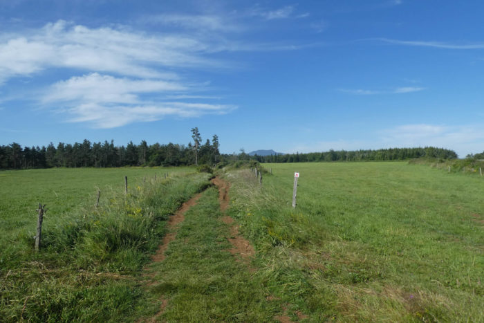
| The path crosses an immense, desolate plain, as vast as it is disconcerting. A nearly surreal landscape unfolds, with a raw simplicity matched only by the freedom it offers. The grass grows wild and unrestrained, standing tall in a green sea where a few old, scattered dry-stone walls are the only traces of ancient, forgotten labor. Here and there, granite boulders lie on the ground, like sculptures abandoned by nature itself without any apparent reason. Free-ranging cows are scattered across this infinite expanse, like pieces of a puzzle spread across the canvas. It’s a place where the soul seems to rise, floating in the vastness, lifted by the stark beauty of the plain. Here, you feel both small and serenely lost, at peace. It is in this boundless expanse that you quietly leave the Ardèche department and enter Haute-Loire, on the lands of Puy-en-Velay. |
 |
 |
The horizon seems to pull you further toward the ridge of the Cévennes, toward those mountains that, while close, seem almost out of reach, like slumbering giants. Ahead, Mont Mézenc stretches out before you, vast and imposing, its elongated silhouette standing against the horizon. This mountain is a must-visit for local tourism enthusiasts, as is its neighbor, the Gerbier de Jonc. The latter, despite its fame, does not seem to rival the grandeur of Mézenc, which, split in two by geography, rises with strength and determination. The southern summit, reaching 1,753 meters, is the highest point in the Ardèche department, while the northern summit, equally tall, becomes the highest point in Haute-Loire.
It is said that when the wind sweeps across this plain, it can carry meters of snow in an instant, covering the plateau with its icy mantle. The cautious traveler might think it best to traverse the area outside of this period, yet the place remains strikingly beautiful. It recalls the Aubrac region, with its granite-strewn landscapes where every stone seems to tell the story of a bygone era.
| At the far end of this endless plain, where you wish the path would never end, the earth takes on an ochre hue, and the path slowly dives into a sparse woodland. The Charolais cows, with their pale coats and gentle, large eyes, and the Blondes d’Aquitaine, robust and elegant, pause under the ash and spruce trees, savoring the calm of the area. The lightly wooded area allows glimpses of the vast plain, creating a sense of gentle isolation. The rustling of leaves in the wind is the only sound breaking the silence, like a whisper that nature shares with itself. |
 |
 |
 |
 |
| A little farther, the forest takes on a different character. Spruce and Douglas firs crowd closely together, forming an almost impenetrable forest. Their massive trunks, packed tightly in a vertical dance, seem to reach for the sky, while the light struggles to find its way through the dense canopy. The ground, covered in thick moss, seems to absorb all sound, creating an almost surreal ambiance where time feels suspended, awaiting some mysterious event. The atmosphere becomes nearly black, a tranquil darkness where the trees’ shadows blend into a vast unity. |
 |
 |
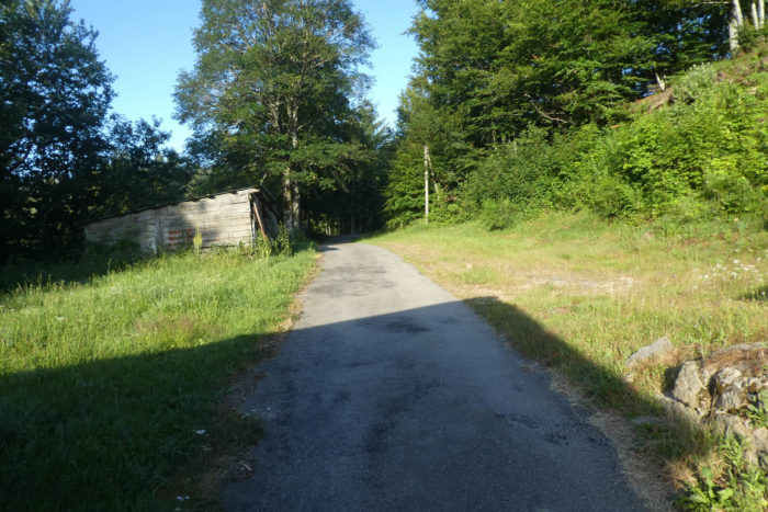
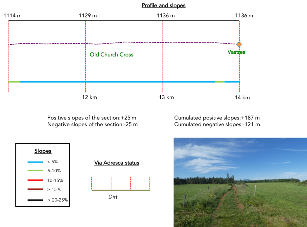
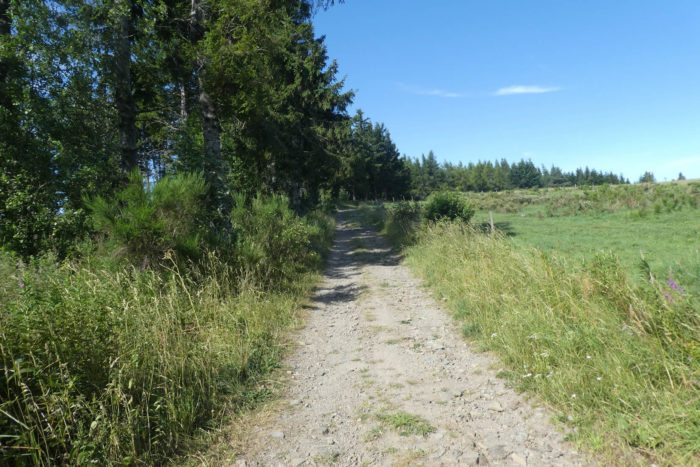
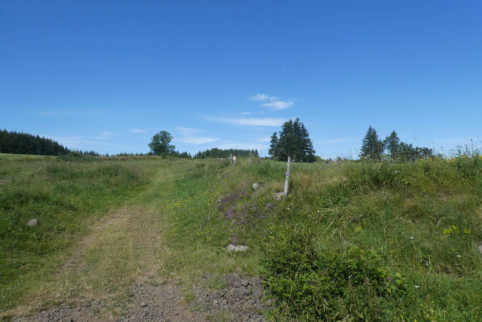
| Throughout this crossing of the plateau, the path remains wide, easily passable, and almost perfectly clear. It presents few obstacles, and the ground feels soft underfoot. When the path finally emerges from the woods, it passes by the Cross of the Old Church, a solitary granite monument lost here amidst unspoiled nature. This cross, majestic in its simplicity, marks the site of a former church, destroyed during the Hundred Years’ War in the 14th century. The stones of the church have been swallowed by time, but the cross remains, a witness to a bygone past, indifferent to the world’s changes. |
 |
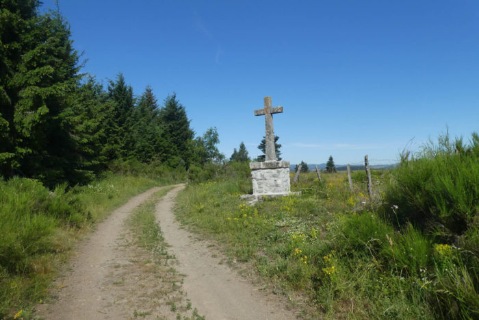 |
| From the granite cross, the path continues its course, crossing the plain and winding among meadows and broom hedgerows lining the way. This path, long yet imbued with an almost unshakable serenity, seems to stretch endlessly, and yet time here feels elastic. Hours blend into the landscape, like colors merging in an impressionist painting. This area once hosted a Roman road, and one can almost imagine Caesar’s legions, their chariots speeding across this plain, invincible and confident in their conquest. The geography of the area, perfectly suited, provided them an ideal passage, a path that neither weather nor war could hinder. |
 |
 |
| Farther along, the path crosses a solitary menhir, a mysterious remnant standing amidst the fields. This basalt block, set upon a granite base, rises as a silent witness to the ancient rituals and beliefs that once inhabited this land. Little is known of its symbolism, but one feels a strange sense of solitude, as if this monolith is still waiting for something, a memory, a return, or perhaps a forgotten recognition. The menhir seems to bide its time, lost in the vastness of the fields, waiting to be reclaimed by history. |
 |
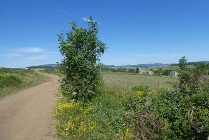 |
| The path now descends slightly, moving away from the vast plain toward civilization. It guides travelers to the village of Les Vastres, where Sainte-Anne Church, built in the 14th century with stones from the former destroyed church, stands majestically. Restored and altered over the centuries, its silhouette remains intact, a permanent reminder of the past. The region, marked by a strong Protestant heritage, is also divided by a complex religious history. The Protestants, in a quiet act of resistance against local history, have their own temple, located in a hamlet far from the village. |
 |
 |
Section 5: Toward Fay-sur-Lignon, atop the hill
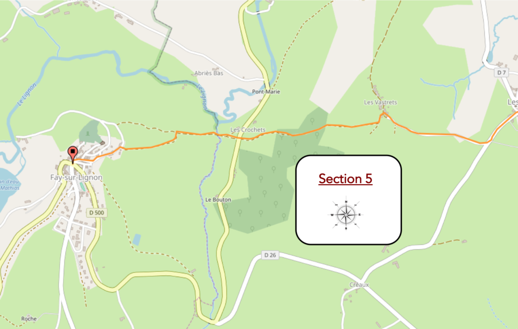
Overview of the route’s challenges: the only difficulty lies in a steep descent into the Lignon plain, followed by an endless climb to the town atop the hill.
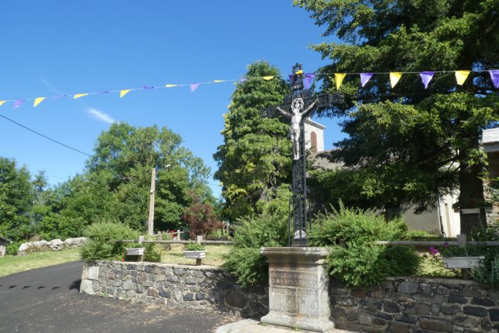
| At Les Vastres, a modest village of 200 inhabitants, vigilance is essential as many routes intertwine here. Near a massive iron cross bearing Christ, you will find your own route, marked by the pilgrim’s shell. You then embark on the Circuit du Marais, a route that draws you deeper into nature, along tracks trodden for centuries. |
 |
 |
| The route, like a silent serpent, soon heads toward the departmental road D7 as it leaves the village, following the GR7/420/430 route. It blends discreetly into the landscape as it moves toward Fay-sur-Lignon. Then, almost imperceptibly, the path veers away from the road, passing by a granite cross, a timeless witness to the past. |
 |
 |
| A small paved road slops up gently, almost effortlessly, toward Les Vastrets. The altitude nears 1,100 meters, and the world seems reduced to a vast expanse of meadows and free-grazing cattle. The fields stretch as far as the eye can see, an ocean of greenery where the shadows of animals merge into the light, like silhouettes lost in a living painting. |
 |
 |
| The paved road advances under a clear sky, winding its way among ash and maple trees lining the landscape. Les Vastrets slowly reveals itself, like a promise fulfilled at the end of this tranquil climb. Your direction remains unchanged: the Circuit du Marais continues to guide you peacefully. |
 |
 |
| Here, among stone and granite, tradition seems frozen in the material. The houses, carved from basalt and granite, bear witness to the resilience of the land and the people who tamed it. Yet, amidst this wild beauty, a temptation grips you: the urge to follow the path straight on and climb into the meadows. But no, as soon as you leave the hamlet, a detour is necessary. The path turns right, veering into the heathland, gently climbing along the ridge. A small shell, discreetly attached to a post, is your only guide. |
 |
 |
| The path then winds along the ridge, making it impossible to lose your way. A little farther on, a large ash tree signals that you are still following the GR route, a path that, like an imprint on the grass, invisibly but profoundly connects these places. |
 |
 |
| At the end of the ridge, the path enters a wooded area, where the Via Adresca merges with a PR (a short hiking circuit), carrying the walker onto the Chemin de la Douce. The path playfully weaves through the trees, heading toward an even gentler promise, a landscape less harsh but equally alive. |
 |
 |
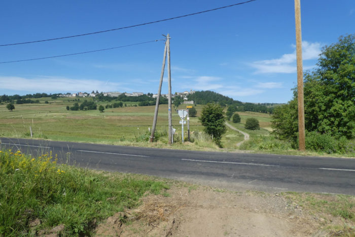
| When the forest finally clears, Fay-sur-Lignon rises before you, perched atop its hill. At first glance, you might imagine it’s a simple descent to reach the village. But don’t be fooled; the valley between the two hills is an invisible barrier, a hollow of earth you must cross before climbing to the suspended village. Haute-Loire, like Ardèche, is a land of dips and rises, where every valley calls for the ascent of a peak. |
 |
 |
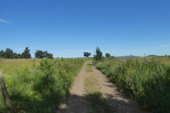
| The path plunges into the open meadows, like a stream of light slicing through the darkness. It heads toward the departmental road D500, which leads to Fay-sur-Lignon. The journey has been generous, but here the slope grows steeper, often exceeding 15%. The rugged ground seems to challenge your resolve to continue. |
 |
 |
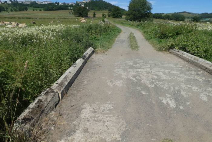
| After crossing the road, the path continues to descend, but this time more gradually, with a gentler slope. It guides you to a bridge, delicately spanning a tributary of the Lignon, like a small stone arc bridging the ages. |
 |
 |
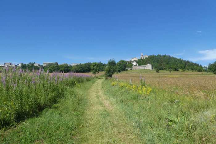
| Between the bridge and the village lies nearly 100 meters of elevation gain. The climb is demanding. You climb again, among ash trees, toward the first stone houses lining the base of the village. It’s not an easy ascent, but it’s rewarded by the sight of these sturdy buildings, where every stone seems to tell a story. |
 |
 |
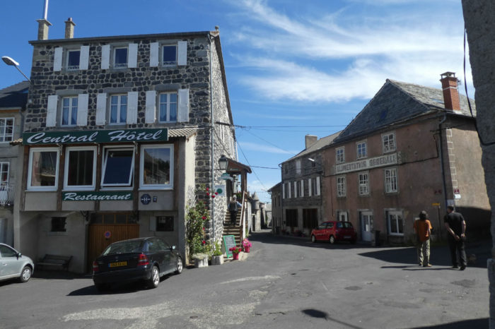
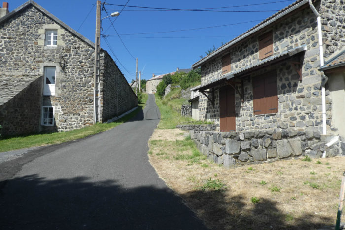
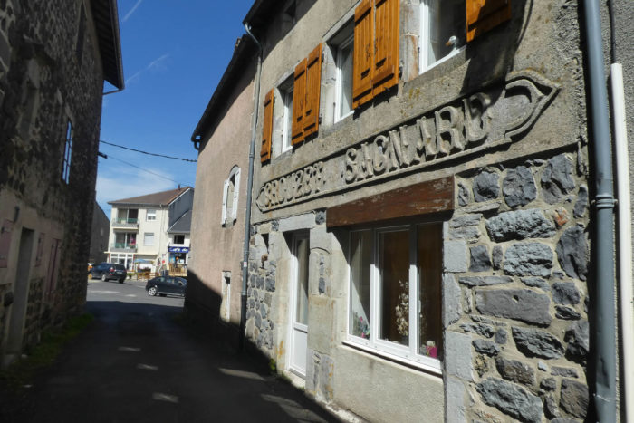
| As you approach the village, the dirt path gives way to asphalt. Grass is replaced by pavement, and the climb becomes steeper and more pronounced, winding past magnificent basalt and granite houses. No house seems out of place here; each appears to have been carved from the same stone, creating a perfect harmony of elegance and strength. |
 |
 |
| LThe road then leads you to the St Régis fountain, a local pilgrimage site where, in the 16th century, St Régis is said to have quenched his thirst while crossing this region deeply marked by the Reformation. Pilgrimage here is a living tradition, etched into the stone and the waters of this fountain. Then, you arrive at Saint-Nicolas Church, a 12th-century structure transformed over the centuries, yet still a precious testament to the past. Near the church stands a basalt peak, a geological marvel echoing the natural forces of the region (Image Wikipedia Commons, auteur: Arnaud-Victor Monteux). |
 |
 |
| In the 10th century, the Fay family built a fortress on this basalt rock, giving birth to the village of Fay-sur-Lignon. Today, this village of 375 inhabitants is a picturesque place with all the shops necessary for daily life, a village where time seems to have paused, yet life continues peacefully and serenely among the stones and mountains. |
 |
 |
Official accommodations on the Via Adresca
- La Rose de Vents, Les Vastres; 04 71 75 55 34/06 36 92 13 89; Guestroom, dinner, breakfast
- L’auberge gourmande, Les Vastres; 09 87 55 66 13; Hotel, dinner, breakfast
- Camping municipal (mai-sept), Fay-sur-Lignon; 06 50 98 21 7506 65 38 62 18; Camping
- La Traverse, Rue de la Tour, Fay-sur-Lignon; 06 41 20 73 99; Gîte, dinner, breakfast
- Gîte Les Chênes, 233 Route du Puy-en-Velay, Fay-sur-Lignon; 04 71 56 33 87/ 06 657 92 43 31; Gîte, dinner, breakfast
- La Drapière, 22 place du Foirail, Fay-sur-Lignon; 04 71 59 15 26/06 85 70 94 975 30 10 12/06 33 16 66 56; Hotel, dinner, breakfast
- Central Hôtel 1 Rue de la Tour, Fay-sur-Lignon; 04 71 59 50 76; Hotel, dinner, breakfast
Pilgrim hospitality/Accueils jacquaires (see introduction)
On the Via Adresca, accommodation options are almost always limited. This is not the touristy southern part of Ardèche. Lodging is scarce, even when it comes to AirBnB, and their addresses are not always available. The list only includes accommodations located directly on the route or within one kilometer of the route. The guide published by the Friends of Compostela provides a complete list of available accommodations, as well as bars, restaurants, and bakeries along the trail, including places several kilometers off the main route. There are no accommodation options before reaching Les Vastres, just before Fay-sur-Lignon, a small village that offers all essential services and a wider range of lodging options.
Feel free to add comments. This is often how you move up the Google hierarchy, and how more pilgrims will have access to the site.
|
 |
Next stage : Stage 17: From Fay-sur-Lignon to Bigorre |
|
 |
Back to menu |