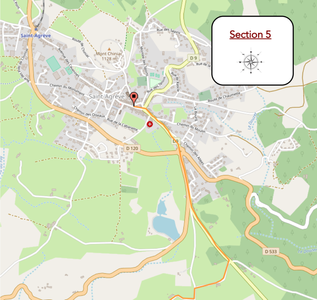
St Agrève, known as « The Balcony of the Cévennes »
DIDIER HEUMANN, ANDREAS PAPASAVVAS
We divided the course into several sections to make it easier to see. For each section, the maps show the course, the slopes found on the course, and the state of the route (paved or dirt roads). The courses were drawn on the « Wikilocs » platform. Today, it is no longer necessary to walk around with detailed maps in your pocket or bag. If you have a mobile phone or tablet, you can easily follow routes live.
justify; »>For this stage, here is the link:
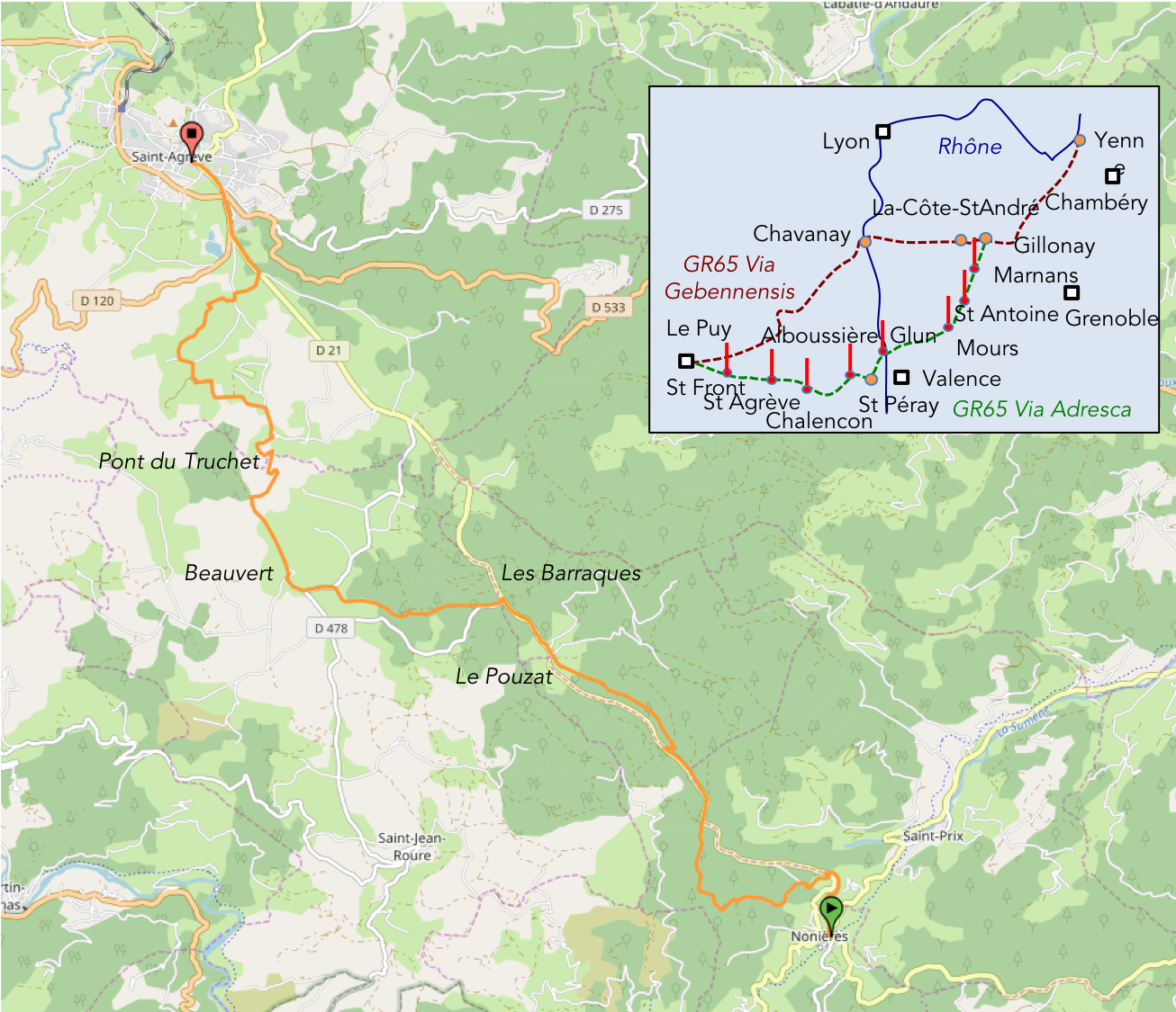
https://fr.wikiloc.com/itineraires-randonnee/des-nonieres-a-st-agreve-par-la-via-gebennensis-adresca-32985268
| Not every pilgrim feels comfortable using GPS devices or navigating on a phone, especially since many sections still lack reliable internet. To make your journey easier, a book dedicated to the Via Gebennensis through Haute-Loire is available on Amazon. More than just a practical guide, it leads you step by step, kilometre after kilometre, giving you everything you need for smooth planning with no unpleasant surprises. Beyond its useful tips, it also conveys the route’s enchanting atmosphere, capturing the landscape’s beauty, the majesty of the trees and the spiritual essence of the trek. Only the pictures are missing; everything else is there to transport you.
We’ve also published a second book that, with slightly fewer details but all the essential information, outlines two possible routes from Geneva to Le Puy-en-Velay. You can choose either the Via Gebennensis, which crosses Haute-Loire, or the Gillonnay variant (Via Adresca), which branches off at La Côte-Saint-André to follow a route through Ardèche. The choice of the route is yours. |
 |
 |
If you only want to consult lodging of the stage, go directly to the bottom of the page.
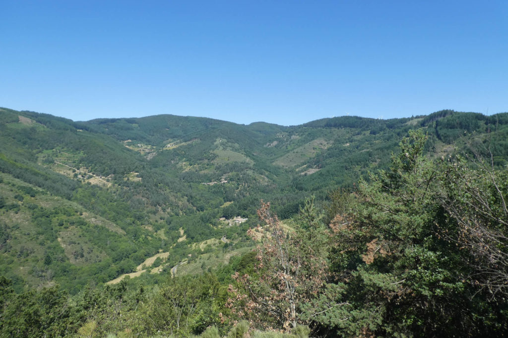
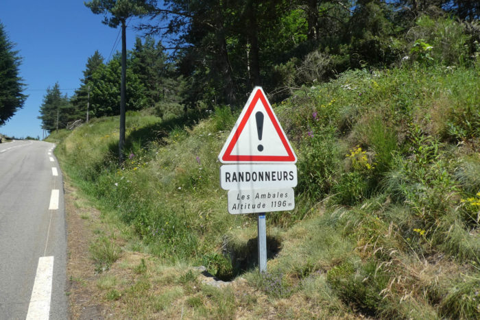
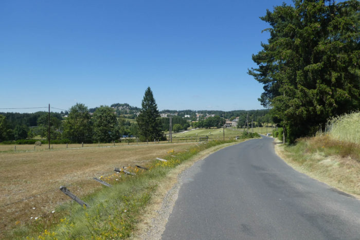
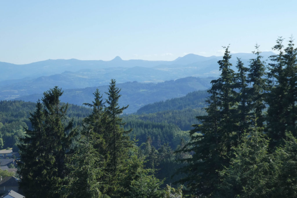
This stage is characterized by a long, steady ascent, mostly through forest, leading to the St Agrève plateau, which rises above 1,000 meters in altitude. This rural, mid-mountain plateau features rolling hills, where chestnut trees grow rarely. Instead, beech and spruce forests dominate the landscape, dotted with pastures where cows, horses, and sheep graze at the edges of clearings and meadows. Winters here can be harsh, especially when the frigid burle wind blows. St Agrève sits on a granite foundation shaped by millions of years of uplift and erosion. Part of the Massif Central, it shares its geological traits with the nearby Velay region. The terrain features granite interspersed with transformed rocks like gneiss and schist, while basalt from ancient volcanic activity punctuates the landscape. To the horizon, the Ardèche mountains, marked by extinct volcanoes and small lakes, serve as a natural border with the Haute-Loire department. These rounded volcanic structures, known as “sucs“, are iconic of the region. On clear days, you’ll spot the Gerbier de Jonc, the Loire River’s source, and the renowned Mont Mézenc. While not directly on the route, these landmarks attract many hikers and are also accessible by car. St Agrève is often referred to as the “balcony of the Cévennes” because of its sweeping views of the Ardèche mountains, which form the northern barrier of the Cévennes range. However, reaching this “balcony” is a demanding uphill journey, occasionally quite steep and taxing.
The Via Adresca and the GR420 trails diverge early in this stage. The GR420 takes a scenic but arduous detour to Le Cheylard and the Ardèche mountains before returning to St Agrève via the GR420A variant. While this offers stunning views, it is longer and more challenging. For this guide, we follow the Via Adresca, which, while shorter, is no less demanding.
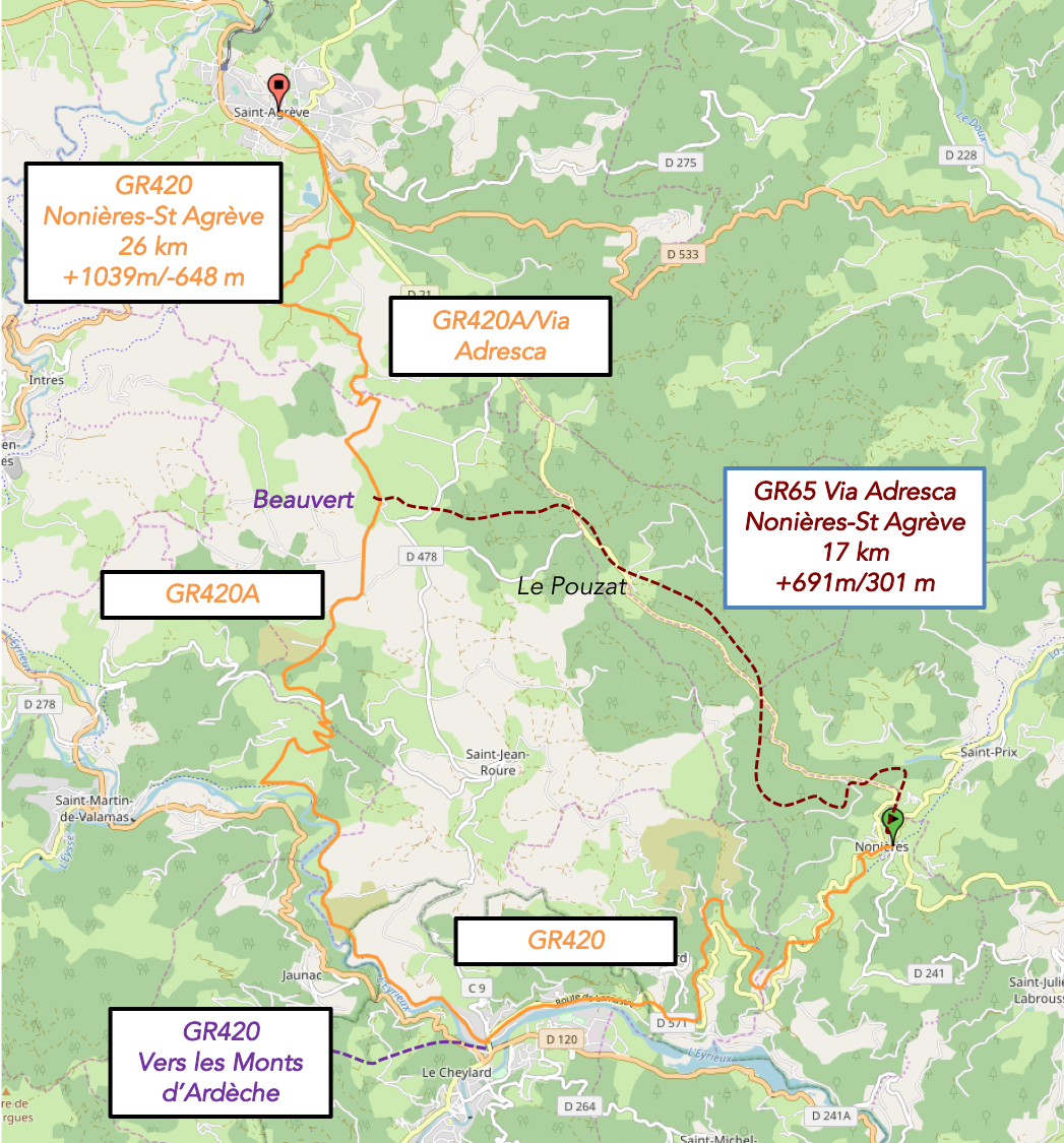
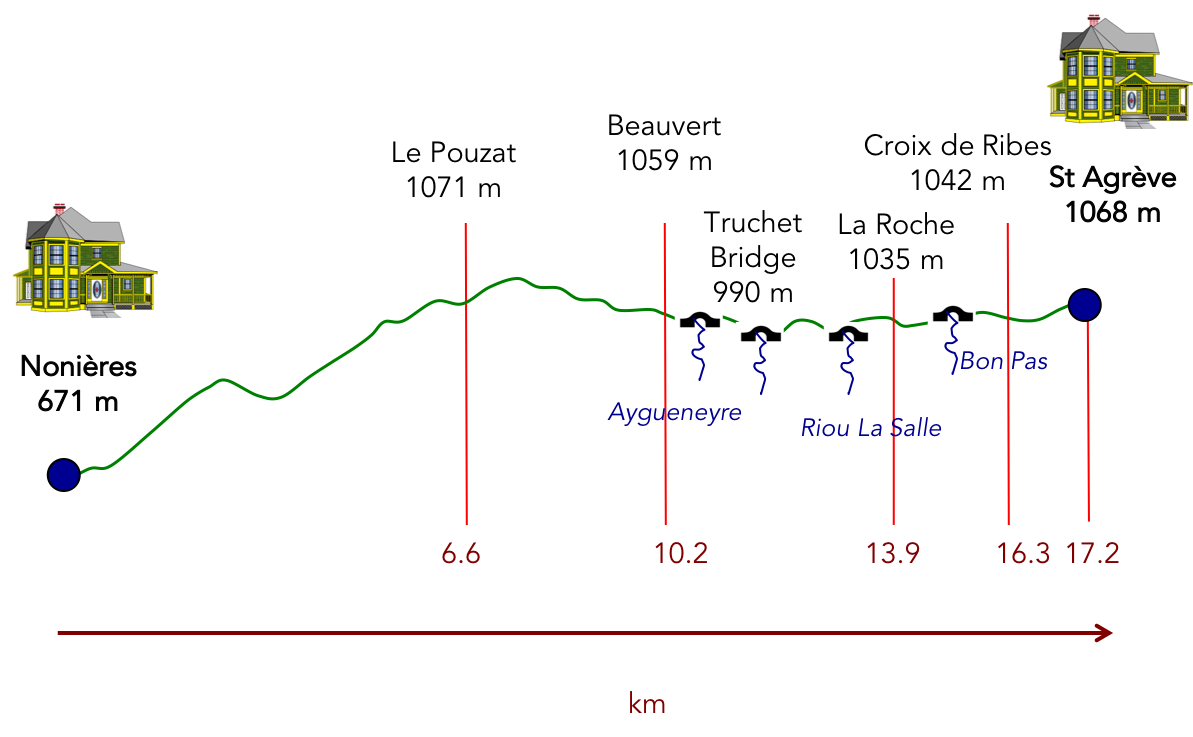
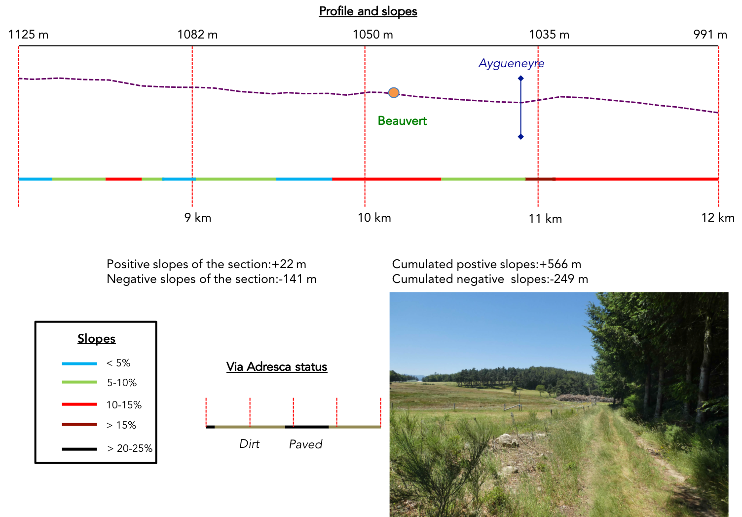
Difficulty level: The elevation gains (+677 m/-316 m) are significant for such a short stage. The climb above Les Nonières is steep and unrelenting until you reach the Saint-Lager Forest, where the trail briefly flattens. From there, rolling terrain (often exceeding 10-15% gradients) leads to a steady ascent toward Le Pouzat. Approaching St Agrève, the slopes become more moderate, though there are still occasional steep sections both uphill and downhill.
State of the Via Adresca: The route is split almost equally between paved roads and natural paths:
- Paved roads: 8.2 km
- Dirt roads : 9.0 km
Sometimes, for reasons of logistics or housing possibilities, these stages mix routes operated on different days, having passed several times on these routes. From then on, the skies, the rain, or the seasons can vary. But, generally this is not the case, and in fact this does not change the description of the course.
It is very difficult to specify with certainty the incline of the slopes, whatever the system you use.
For those seeking « true elevations » and enthusiasts of genuine altimetric challenges, carefully review the information on mileage at the beginning of the guide.

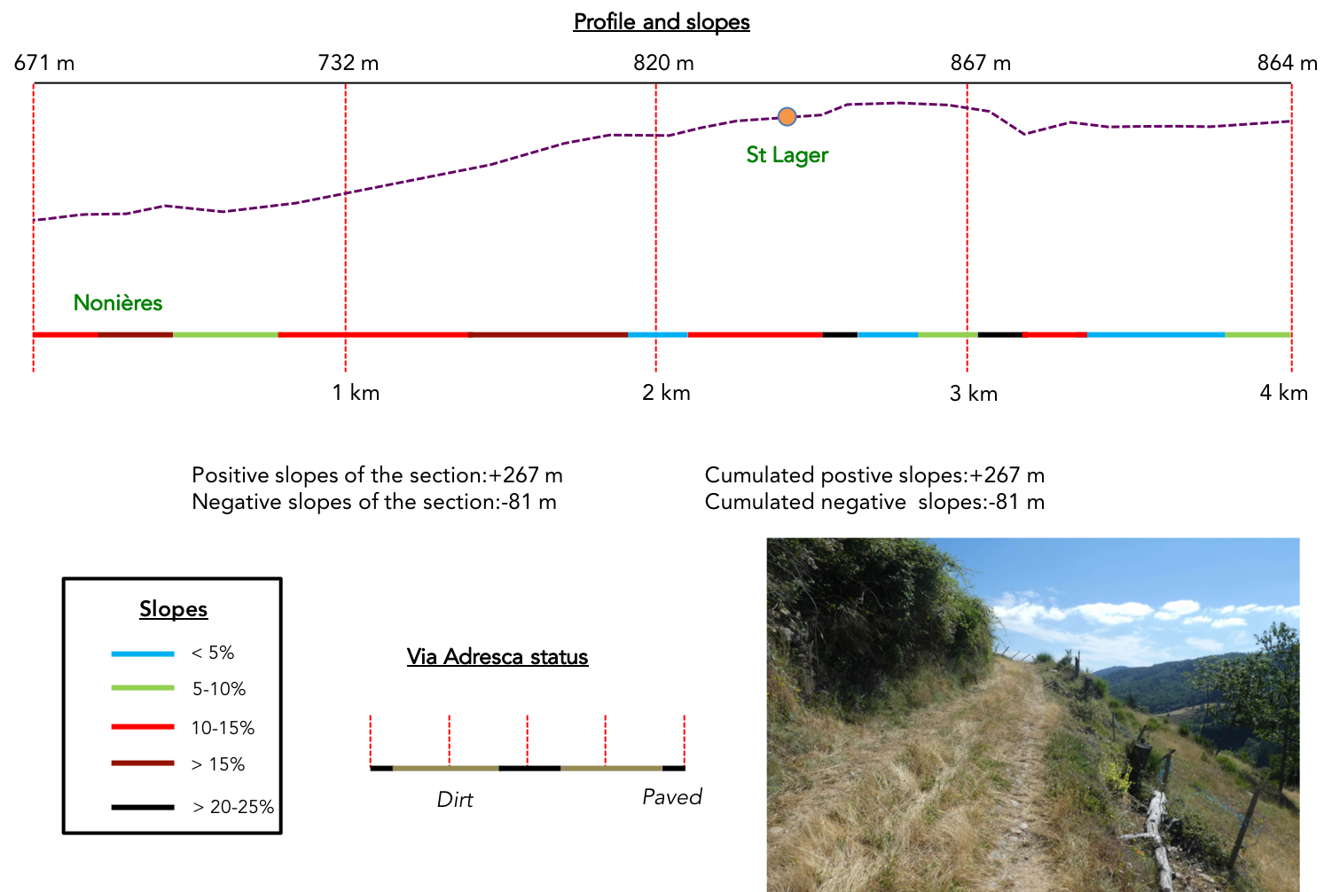
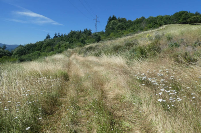
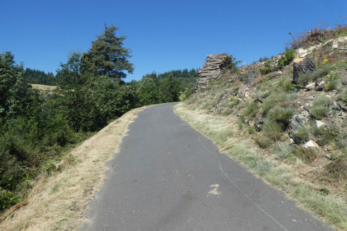
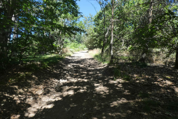
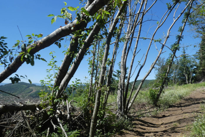
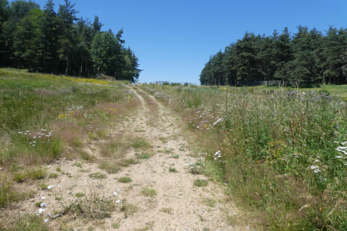
Section 1: Steep climb above Les Nonières
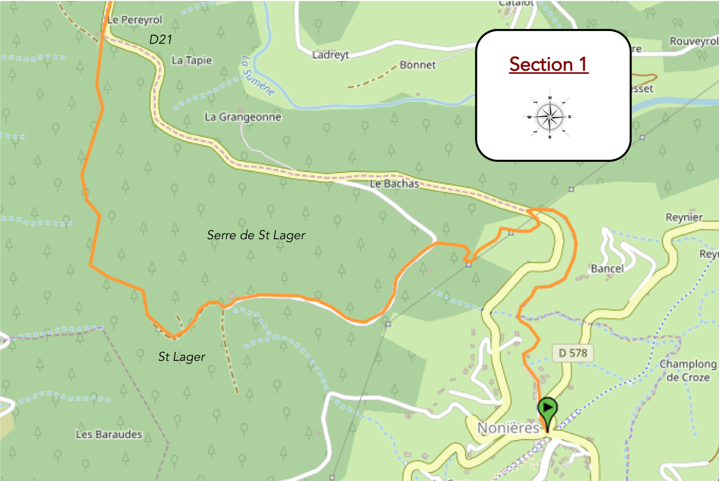
Overview of the route’s challenges: steep climb, often over 15%, up to the plateau of St. Lager; then a tiring route through the forest.
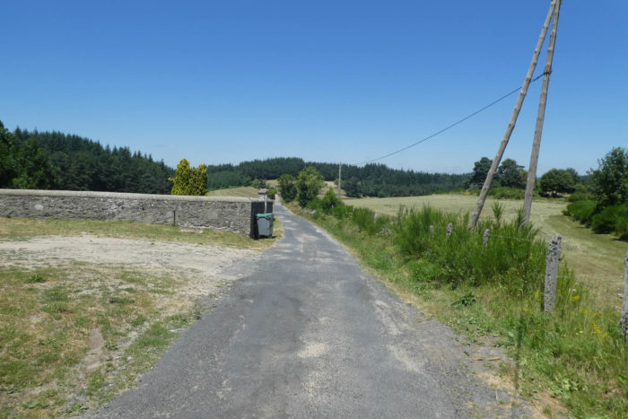
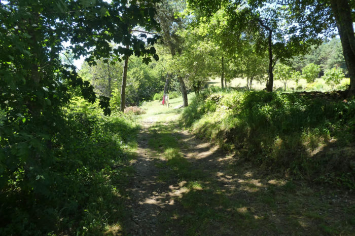
| Be attentive here, as the GR420 runs through the village. But this is not your paved road today. The Via Adresca, still marked with the pilgrim shell symbol, takes the lead and gradually climbs toward the summit of Les Nonières. A first path, discreet but persistent, winds its way through the tall grass, forming a sinuous line that climbs like the quiet curve of a forgotten river. This path, still marked by the passage of souls on a quest, is a relic of the past, where every step seems imbued with the history of the pilgrims who once dragged themselves on their pilgrimage to Santiago. Here, the ground seems to hold the memory of their steps, as if the earth itself absorbed the dust of centuries. |
 |
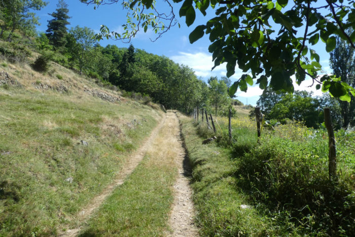 |
| The path, growing steeper, climbs fiercely above the village, winding through the fields like a snake dragging its tongue along the scorching earth. In places, the slope seems to graze the sky, defying the horizon, with an incline easily reaching 15%, a path like a trail ripped from the land, devoured by heat and hostility. The dust of the ground, trampled by thousands of steps, mixes with the dry air, and one can feel the roughness of the terrain beneath the soles, so dry is the earth, and the vegetation, rare, is reduced to thorny bushes. The effort to climb this ascent is highly exhausting. |
 |
 |
 |
 |
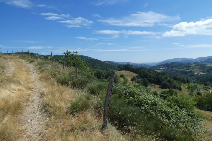
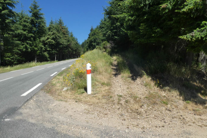
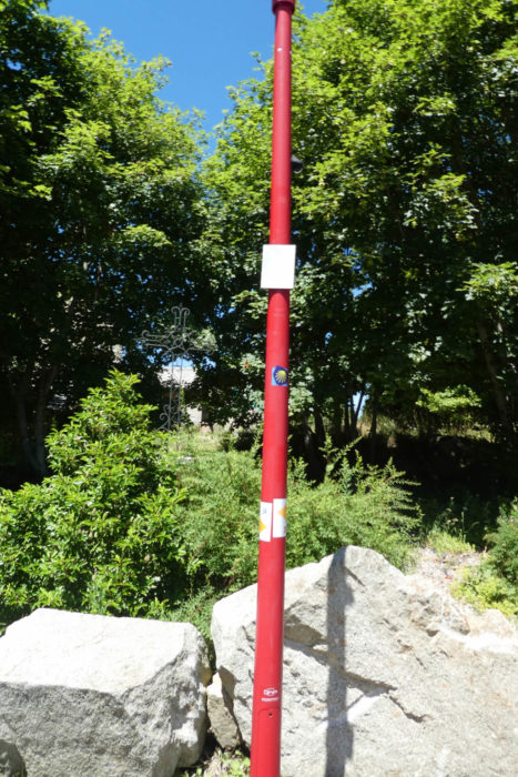
| But the climb is not over yet. After crossing the paved road D21, a trail sneaks into a new ascent, even more daunting, toward the meadows. The slope becomes even steeper, almost vertical, like a challenge to gravity. At this point, the difficulty also lies in the unpredictability of the terrain: the trail may disappear beneath the thick layer of hay covering the ground, leaving only a faint trace of passage. The vegetation seems to swallow the path whole, and it becomes necessary to aim for the pole, discreet but visible under the forest, like a lighthouse guiding the travelers’ steps. This landmark then becomes the promise of a path rediscovered, at the heart of a world that seems to want to erase all human trace. |
 |
 |
| Then, you must aim for the second pole, more distant, more discreet, but no less important. Below, the village slowly disappears from your field of view, slipping quietly behind the curve of the hills, like a memory trying to be grasped before it is swallowed by the mist. The gaze drifts into the vastness of the virgin lands stretching beneath the azure sky, and each step seems to push this place, laden with the history of everyday life, further away. |
 |
 |
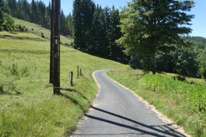
| Soon, the slope eases, like a breath, and the trail joins a small paved road that winds through the heart of the Serre de St Lager, on a suspended plateau, dominated by the clear sky. At 900 meters in altitude, you have climbed nearly 250 meters in elevation from Les Nonières. A long and steady ascent, where every drop of sweat, every short breath, is a tribute to the majesty of nature, which seems to unfold beneath your feet, wild and untamed. |
 |
 |
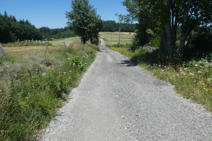
| The paved road then becomes a long murmur, a soft melody swaying between the rolling meadows and shady forests, gently winding toward the few isolated houses of St Lager. In places, the light breeze passing through the woods intoxicates the air with scents of resin and damp earth. The atmosphere, calm and almost suspended, seems to wrap us in a rare serenity, where the noise of the world disappears beneath the whispers of nature. |
 |
 |
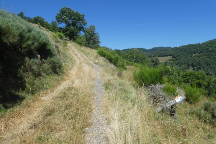
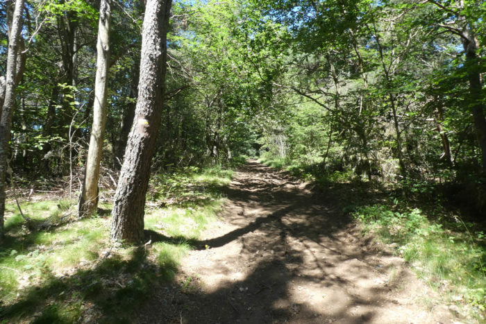
| A new path then takes over, descending unevenly, with a jarring rhythm, through the Serre de St Lager. The forest unfolds into a vast setting of pines, spruces, and hardwoods, oaks, hornbeam sprouts, and maples stand together in harmony. However, the chestnut trees seem to have melted under the summer heat, slowly disappearing like remnants of another age, swallowed by oblivion. The light filtering between the branches of the trees is soft, creating a mysterious ambiance where every movement seems to echo the history of this place. |
 |
 |
 |
 |
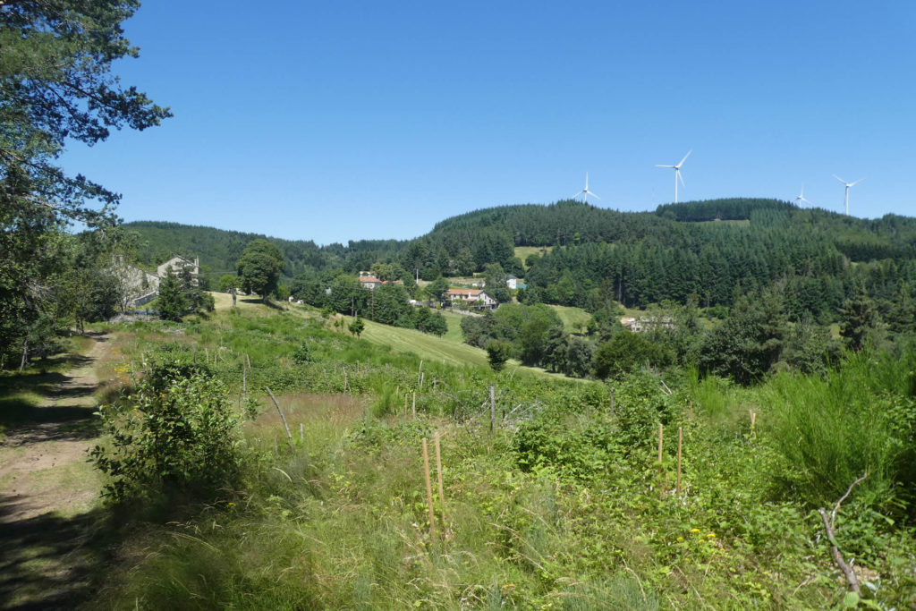
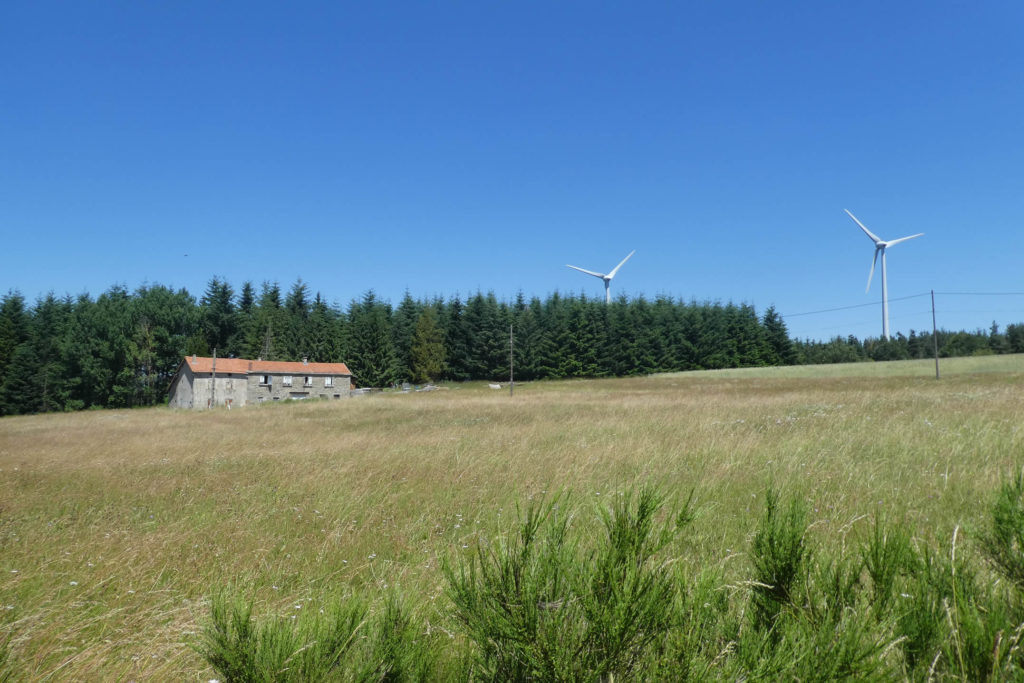
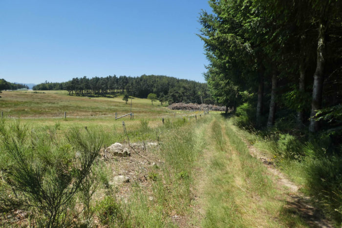
On the way, the eye inevitably falls on the other side of the valley. Over there, a succession of winding small roads stretches out, snaking between secret valleys, leading to dead ends where, sometimes, a few stray houses seem lost in the vastness of the forest. Higher up, near the wind turbines, these metal giants that stand proudly in the sky, you will soon catch sight of them, visible for two days, like silent witnesses of another time, suspended between the past and the future.
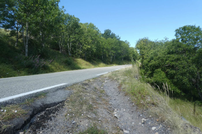
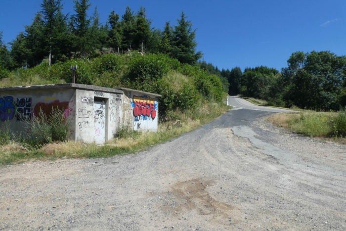
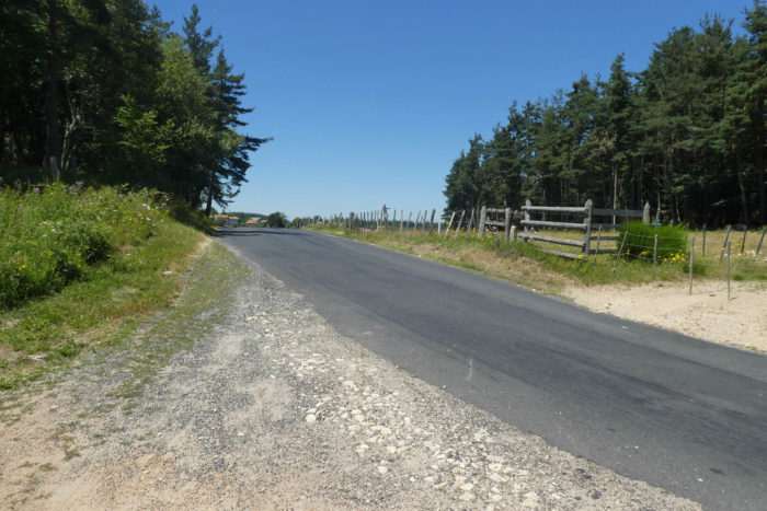
| The path continues a bit further, winding between deep forests and wide clearings, before joining the departmental road D21, the second main route of the day. This paved road, which connects Les Nonières to Saint-Agrève, slowly unveils itself like Ariadne’s thread, guiding you toward other horizons, other landscapes to discover. |
 |
 |
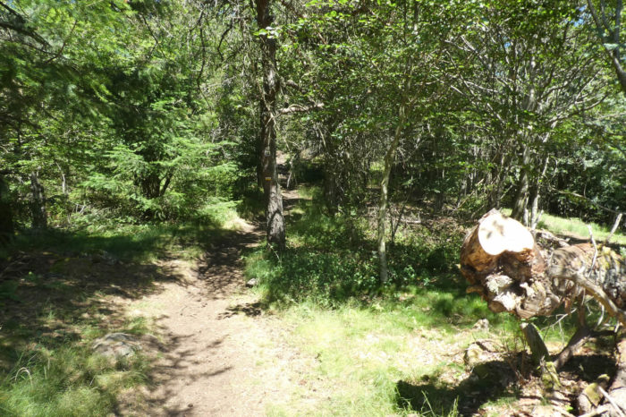
Section 2: Constant climb in the forest
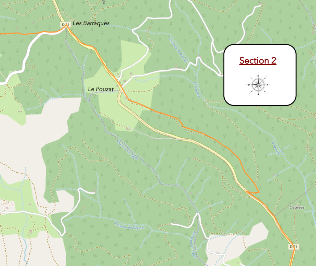
Overview of the route’s challenges: continuous ascent up to Pouzat, with some sections exceeding 15%; at Baraques, you will reach the highest point of the stage, at 1125 meters.
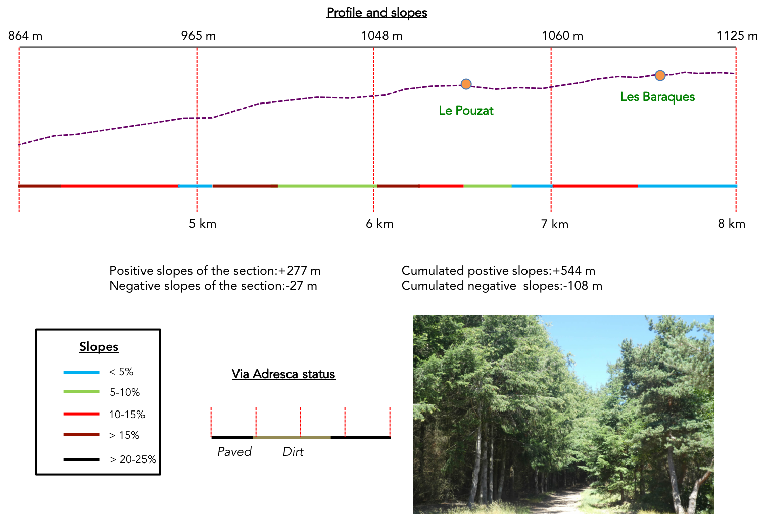
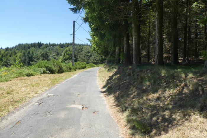
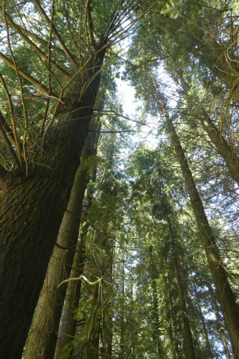
| The Via Adresca will climb relentlessly to Pouzat, winding endlessly through the forests. The slope, unrelenting, often ranges from 10% to 15%, without excess, but sometimes offering a brief respite in the form of fleeting flat sections. It is an almost austere route, where the road weaves between spruces, pines, and Douglas firs, giants pressed tightly together, upright and frozen like soldiers in a parade. The forest seems denser, the earth taking on a reddish color, like dry powder scattered underfoot. |
 |
 |
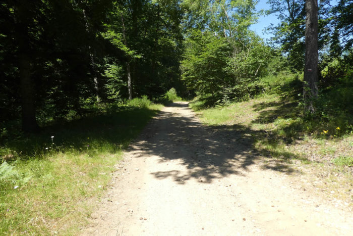
| A little higher up, the Via Adresca leaves the paved road for a path that dives into the Forêt de la Blache. At first, the atmosphere becomes heavier, the conifers are gaunt, lifeless, their tops reduced to a scant tuft of greenery, clinging to trunks thinned by the persistent shadow. The sun’s rays struggle to filter through the canopy, leaving this part of the forest in a twilight that weighs down the air. |
 |
 |
| But forests, like life, are ever-changing. You never know what might happen, and nature, in its infinite wisdom, transforms things without noticing. Higher up, on a trail that seems to stretch endlessly, the mood lightens. The forest regains its colors and vigor. The majestic conifers spread their branches in a silent, soothing dance. The air becomes cooler, more pleasant, and you are lulled by the tranquility of the place. |
 |
 |
| At times, the path narrows onto the dark, almost brown earth, where the vegetation seems more rudimentary, almost wild. The pines and spruces dominate the landscape, like the leaders of a silent army. The deciduous trees, meanwhile, are shy guests, relegated to the background in this symphony of wild green. |
 |
 |
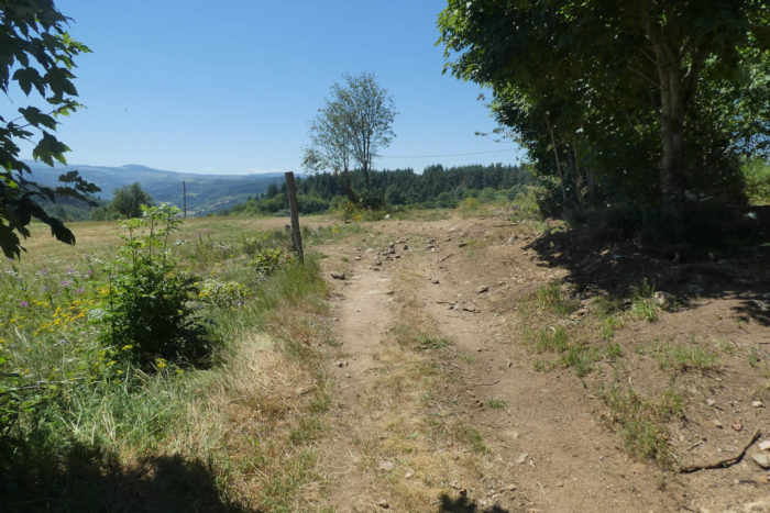
| At the turn of a flat section, the landscape suddenly opens up. The wooded hills stretch endlessly, swallowing the horizon beneath their green cloak. And then, like an apparition, the Gerbier de Jonc and Mézenc stand proudly on the horizon. These majestic volcanoes, witnesses of a bygone era, seem to intertwine the Velay of Haute-Loire and the Vivarais of Ardèche in a great geological breath. From this moment on, these mountains will never leave your sight, imposing their eternal silhouette. Closer to you, wild cherry trees, like lost travelers, timidly extend their branches amidst the hills. These wild cherries must have arrived here through the capricious winds, carriers of history and mystery. |
 |
 |
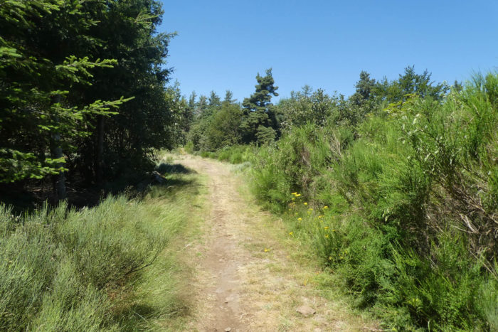
| The path, true to itself, continues its course along the ridge, like a peaceful spectator following each movement of the landscape. The walk remains pleasant, rocked by the conifers and gorse, although the ascent continues its slow climb. But here, the slope becomes gentler, less obvious, almost imperceptible. The body, less taxed, is carried by the serene atmosphere, and each step becomes a moment of respite. |
 |
 |
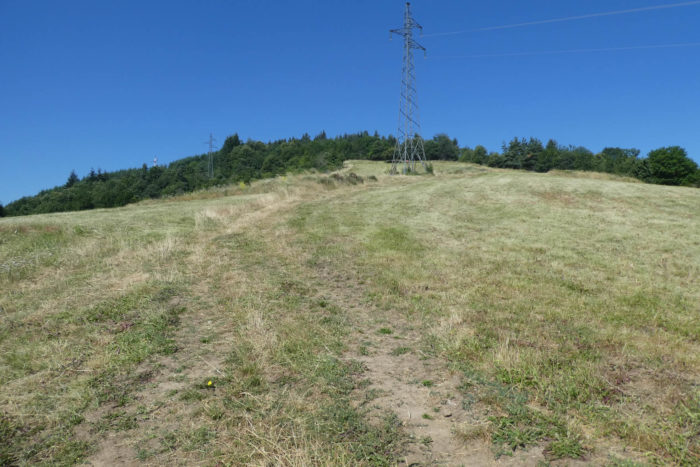
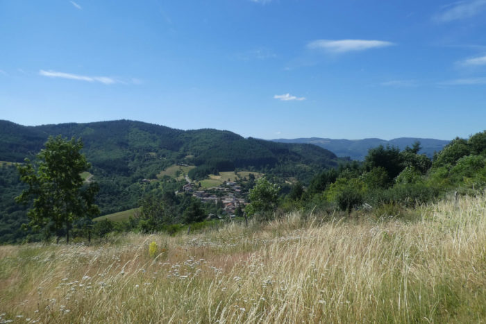
Finally, after this long ascent, Pouzat reveals itself, emerging beneath the wind turbines that, more than two days ago, already outlined themselves on the horizon. At first glance, the High Vivarais seems like a vast plateau, a calm sea of greenery and rocks. Yet, as you venture deeper into this land of valleys and ridges, it becomes clear that this plateau is merely an illusion. In reality, this land is cut through by small valleys, hollows where you constantly slope down only to climb again, an endless back-and-forth between sky and earth.
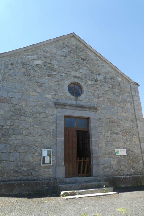
| The path stretches in front of a solitary chapel, perched on a small hill, in the shadow of a cemetery. The history of Ardèche whispers through these stones, imbued with the centuries-old quarrels between Catholics and Protestants. Here, each monument seems to tell its own legend, woven from stories and popular beliefs. These chapels are refuges where, it is said, miraculous springs spring forth, offering pilgrims the promise of miraculous healings, remedies for all the ills of the soul and body. |
 |
 |
| The Via Adresca then moves away from this place of worship and joins the D21, which crosses the village. Traffic here is almost negligible, like a whisper in the grand symphony of landscapes. It is neither the road leading to the volcanic regions of Ardèche, nor the one linking Valence to Le Puy-en-Velay, but simply an asphalt thread running peacefully between houses and fields, almost indifferent to the majesty of the lands it traverses. |
 |
 |
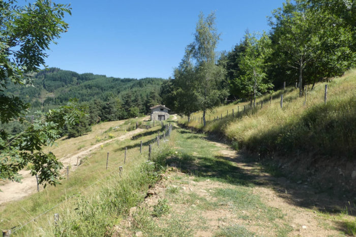
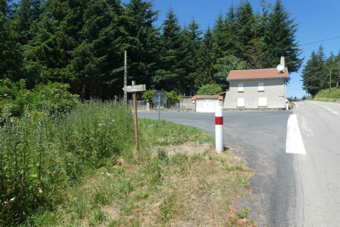
| The road begins to slope up slowly, climbing toward Baraques, the highest point of the stage, at over 1,100 meters in altitude. There, the Via Adresca abandons the D21 road, which still awaits at St Agrève, to turn onto the Chemin des Ambalès. A small road unfolds before you, like the peaceful breath of the landscape. |
 |
 |
| The route flattens, then starts a gentle descent, winding through a sea of spruces, white firs, and Douglas firs, giants of the heights, like the inhabitants of an altitude kingdom. The chestnut trees, however, disdain these lofty skies and do not venture beyond the gentle slopes. A few hundred meters further, a path takes over, heading toward Les Boudouilles, where you might almost hear, with a fine ear, the echoes of history resonating between the stones. |
 |
 |
Behind the gorse, the meadows stretch endlessly, punctuated here and there by the wind turbines that slowly turn in the wind. These metal giants, borne by the air, have they disfigured the landscape? Some, perhaps, might think so. But in certain places, these colossi seem to have perfectly integrated into the natural harmony, like true giant birds gliding in the sky, their blades tracing arcs in the immensity. In these landscapes, their presence seems almost elegant, a silent and majestic dance, to the rhythm of the air and time.
Section 3: Passing through the protestant villages of Ardèche

Overview of the route’s challenges: an easy route, mostly descending gently.
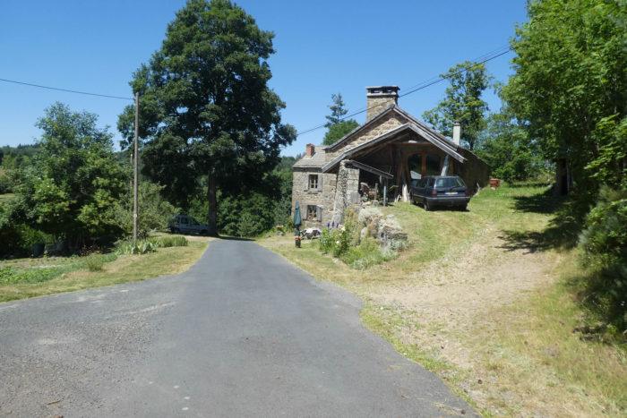
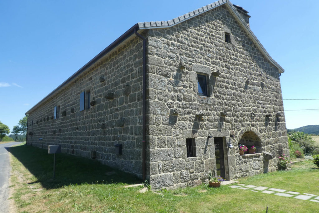
| The path, bordered by silence, soon widens before a sturdy stone house, majestic in its austerity. These houses, so characteristic of the Ardèche landscapes, are guardians of an ancient heritage. The thick walls, adorned with a patina only centuries of passage can provide, carry within them the memory of generations, of modest and laborious lives. They stand resilient, stoic, silent witnesses to the winds of history that have brushed against them. Yet, the path, indifferent to this frozen eternity, plunges again into the soothing shadows of the forest. |
 |
 |
| Here, the forest reveals itself in all its contained splendor, beautiful without pretension, welcoming in its calm. The trail, barely marked, seems to float over a soft ground, made of gray or ochre sand, gentle beneath the feet. The spruces, like taciturn guardians, stand tall with their slender columns, forming a natural, solemn architecture. At times, a clearing opens, a shaft of light piercing the canopy, revealing a sliver of sky. These suspended moments are like a sigh, a beneficial pause in the shaded intimacy of the forest. |
 |
 |
| Further along, the Douglas firs take over, their immense trunks rising to the heights, witnesses of careful plantations, likely undertaken in the post-war years. These trees, with their lofty stature, mix with large beeches, their leaves rustling gently in the wind. Together, they form an honor guard, a vegetal procession where one walks feeling infinitely small, almost unreal. Here, you find yourself at the crossroads of the living and the eternal, an insignificant dwarf at the heart of a cathedral of greenery. |
 |
 |
| Then, like a painting changed by a brushstroke, the path opens onto a bright clearing, almost surreal. Tall grasses ripple in a gentle wind, evoking a peaceful sea. On the horizon, the Gerbier de Jonc and Mont Mézenc draw familiar silhouettes. These dormant volcanoes, unchanging, dominate the scene, their contours barely altered by the passage of time or distance. Their constancy is a balm, an anchor for the soul in this shifting landscapet. |
 |
 |
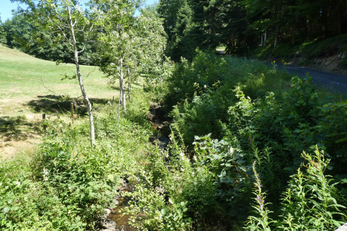
| After this reverie, the path continues its ascent, skirting a place called Le Riou Frey. Here, a stream, the Aygueneyre, flows with an almost absolute discretion, hidden beneath ferns and moss-covered stones. Its murmur is barely audible, like a whisper in the depths of the woods. The path, unperturbed, rises again, climbing toward a hillock, as if searching for a privileged vantage point over these silent, unfolding landscapes. |
 |
 |
| At the summit, a small road appears, drawing a peaceful and determined line toward Beauvert. This name, which resonates like a promise, evokes a village with simple and harmonious contours. |
 |
 |
| Entering Saint-Jean-Roure, or Beauvert, the traveler is struck by the raw elegance of the place. The stone houses seem to have been designed to defy time. Each wall, each façade, is a poem of sobriety. The village is a tribute to simplicity, a haven where the soul can find respite. |
 |
 |
| But at the heart of the hamlet, it is not a church that rises, but a temple, sober and upright, like a silent manifesto. It tells, in its own way, the Protestant history of Ardèche, marked by persecution and revival. These temples, young in their architecture, contrast with the venerable Catholic churches. Here, in this first village where Protestantism clearly asserts itself, the temple serves both as a place of worship and as a monument to a living memory. Today, however, how many still gather around this faith? While only 5% of Catholics still practice, the temple seems to speak more to the past than to the future. |
 |
 |
| From Beauvert, the Via Adresca intertwines with the GR420A. From now on, the red and white markers also guide the way. A dilapidated road leaves the village, passes by the cemetery, often distant from temples in the Protestant tradition, and stretches into the countryside, soon swallowed by the forest. |
 |
 |
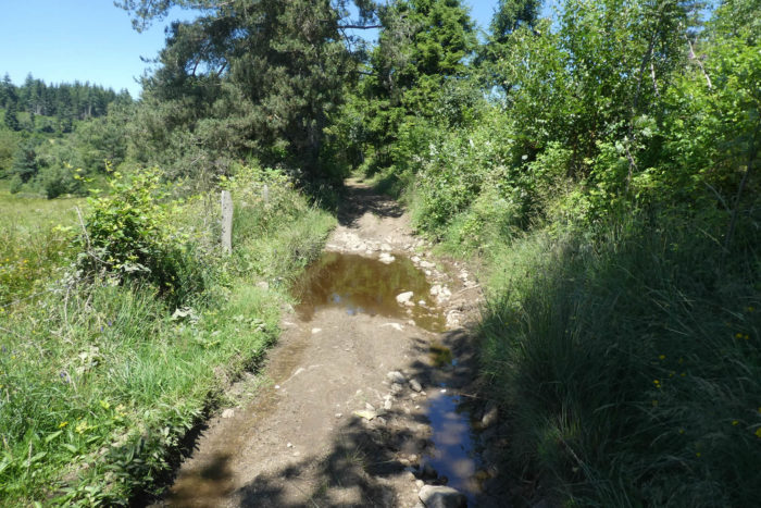
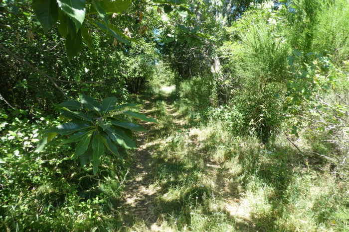
| At the edge of the woods, the route becomes a simple dirt track again. Here, the chestnut trees reappear, as if to remind us of their role as sentinels of the Ardèche hills, witnesses of centuries and seasons. |
 |
 |
Section 4: Ups and downs between meadows and woodlands
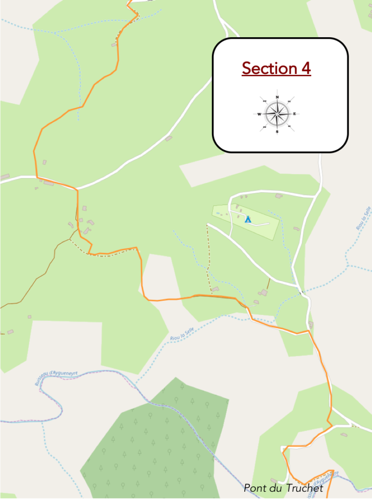
Overview of the route’s challenges: a rough route with some marked inclines.
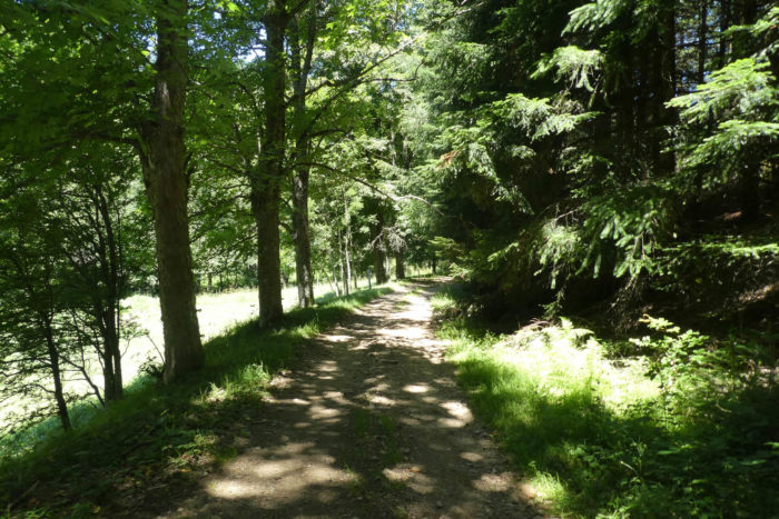
| The path begins its descent, widening gently as if to better blend with the majesty of the deciduous trees that surround it. Under this natural dome, the chestnut trees assert their presence, true sentinels of the landscape. Their massive, gnarled trunks carry the memory of human hands that grafted and bent them to their needs, while respecting their wild strength. Each tree is a story, a fragment of a bygone agricultural past. Beside them, the conifers, relegated to a timid discretion, seem to bow in recognition of their natural superiority. The air here is soft, imbued with a vegetal freshness, and the light, filtered through the dense foliage, scatters in fragile bursts, creating a moving and intimate painting. |
 |
 |
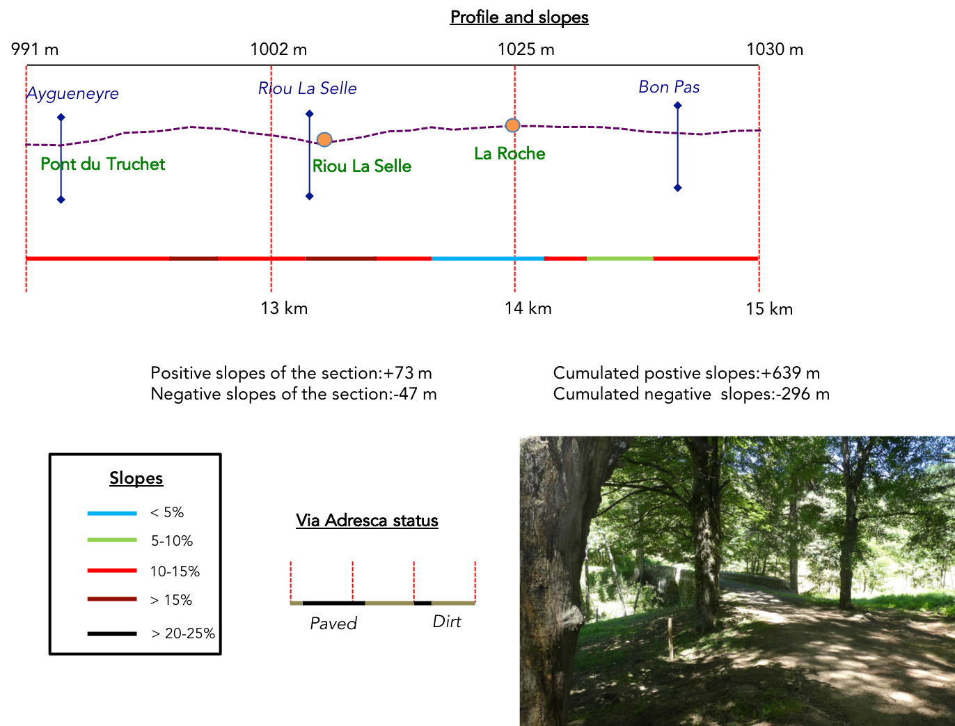
| Under chestnuts and ash trees, the path crosses a small stone bridge, the Truchet Bridge, a discreet marvel suspended above the barely audible murmur of the Aygueneyre stream. The water, so delicate it sometimes seems absent, lazily winds between the pebbles. This is a place that invites stopping, a careful observation of what, at first glance, seems insignificant: the gentleness of a trickle of water, the ancient robustness of the stones that overhang it, the simplicity of the human structure that merges with nature. These bridges, humble and solid, are the silent poems of the countryside, fragile passages between yesterday and today. |
 |
 |
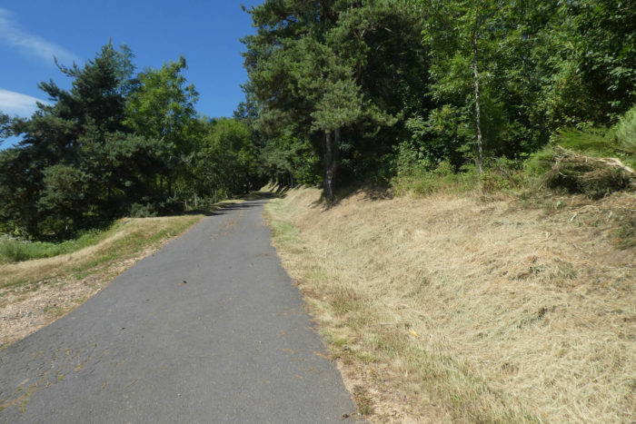
| Beyond the bridge, the path resumes its course, winding to bypass the dale. Its texture gradually changes, briefly giving way to a paved road, an almost incongruous reminder of modernity in this timeless setting. Yet, even this surface seems to blend into the landscape, like a discreet vein in the great body of nature. |
 |
 |
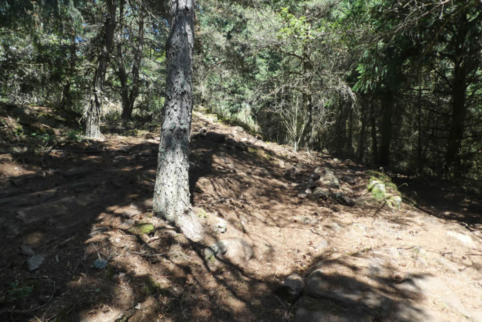
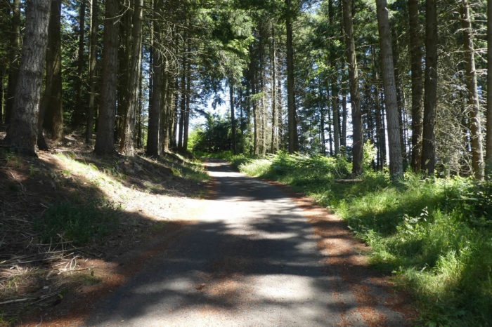
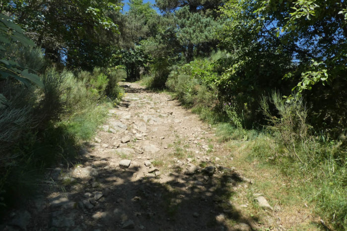
| Each forest in Ardèche is a unique universe, a variation on the same theme, but never redundant. Here, the pines and spruces regain their dominance. Their trunks, straight and stern, reach for the sky, as if defying gravity. The ground, rough and stony, crunches beneath the feet, adding an austere music to the scene. Soon after, you leave the tarmac and follow a brief upward path, lined with scattered stones, before rejoining the road a little higher, as if the path plays at disappearing and reappearing, surprising the traveler. |
 |
 |
| Shortly after, you leave the paved road to follow a path that climbs briefly, lined with scattered stones, before rejoining the road a little higher up—as if the path were playing at disappearing and reappearing, surprising the traveler along the way. |
 |
 |
| Further on, the road plunges into a secret, almost forgotten valley. The Riou La Selle stream sleeps there, lost in the wild grasses. It seems like an impressionist painting, where green dominates, and the water is but a fleeting sparkle, a discreet note in a vegetal symphony. Here, time seems suspended, held by the shade of trees and the softness of the air. |
 |
 |
| From this slumbering stream, a path resumes its course, gently climbing the side of a hill. It oscillates between bare earth and soft grass, tracing a simple but perfect line, like a purified calligraphy on the canvas of the landscape. The slope is gentle, almost friendly, inviting a slow, contemplative walk. |
 |
 |
| At over 1,000 meters of altitude, the air carries a particular clarity, a freshness almost vibrant. The conifers, masters of these heights, rise like the columns of a temple dedicated to nature. Their stillness imposes silent respect, as if the wind itself hesitates to disturb their serenity. |
 |
 |
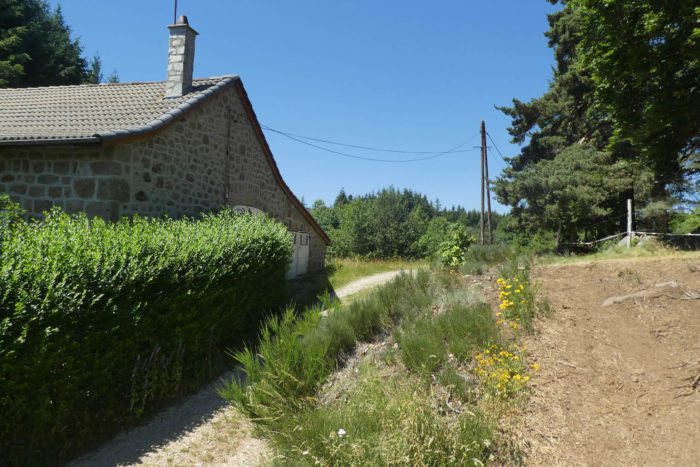
| Descending the hill, the path again gives way to an asphalted road, which winds with respectful discretion toward the hamlet of La Roche. Here, the houses, rare and scattered, stand like stone sculptures, witnesses of a time when building was an act of love for endurance. |
 |
 |
At the edge of this road, a house made of cut granite catches the eye. It is a « tenar » house, a masterpiece of rural ingenuity. Its massive and impressive walls tell of the patient effort to build for eternity. Between its double walls, filled with stones and rubble, the « tenars », these immense granite blocks, bind the whole structure with quiet power. This architecture, as pragmatic as it is poetic, transcends function to become a monument, an ode to hard work and respect for the materiale.
| The Via Adresca then slips into a woodland, regaining the protective intimacy of the pines and spruces. The ground, sometimes muddy, retains puddles in places, like little mirrors reflecting the treetops. In the shade, imposing and peaceful Aubrac cows rest. Their presence adds a domestic softness to this wild tableau, a reminder that humans and nature have coexisted here for centuries. |
 |
 |
| From time to time, the path unveils new marvels: stone houses, nestled in a nature that seems to guard them jealously. The region’s granite foundation, sometimes visible, sometimes only hinted at, imposes its raw strength. Granite, gneiss, schists, these stones tell the geology of an ancient world. This land is an open book, where each rock, each tree, each house is a page of history, a fragment of eternity offered to those who take the time to look. |
 |
 |
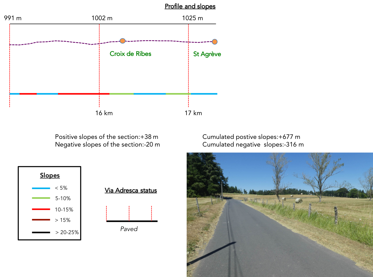
Section 5: In St Agrève, on the plateau
Overview of the route’s challenges: a route without difficulty.
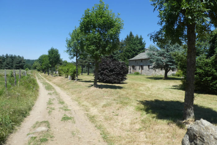
| The path heads then to Rilhac, where, under the benevolent shade of trees, a charming hotel hides. The building, discreet yet elegant, blends into the setting where nature seems to watch over it. It is the last refuge before the path finally gives way to ribbons of asphalt. Here, the wild trails come to an end, like a final sigh before the approach of the city. |
 |
 |
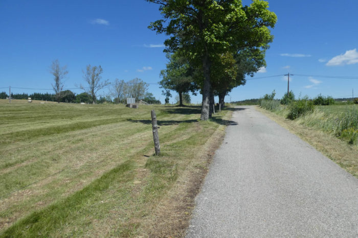
| The road slopes up, but without haste. It stretches lazily through the meadows, where the grass sways gently under the light breeze. Everything feels calm, almost drowsy, as if this part of the countryside still holds onto some of the innocence of the vanished path. |
 |
 |
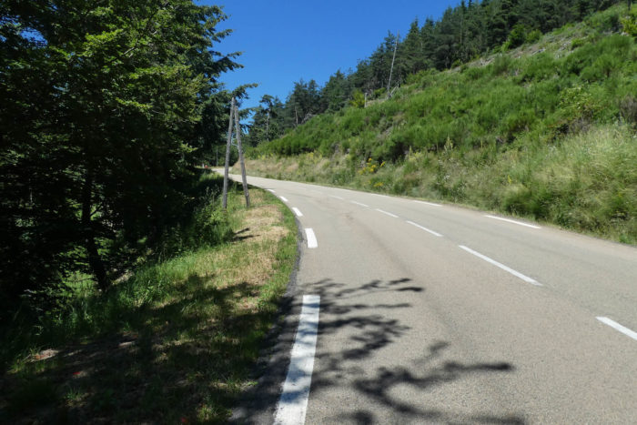
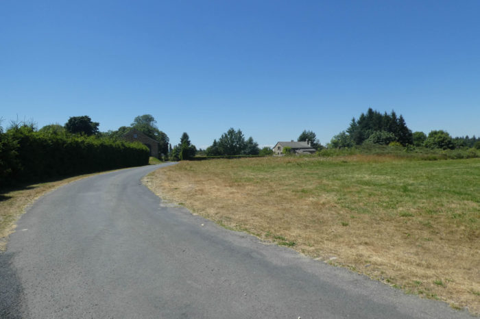
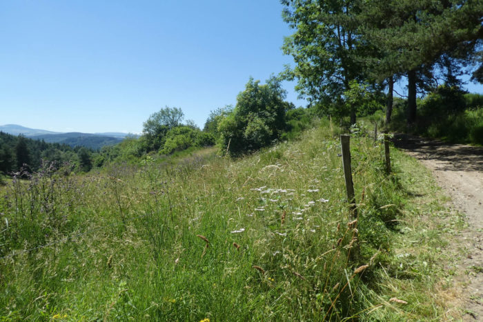
Further ahead, the road reaches an intersection, an ordinary junction but charged with discreet symbolism: that of transition. Here, just a few steps from St Agrève, the horizon narrows, and the meadows gradually give way to a more structured, more human presence. The D21 regional road makes its appearance, signaling the proximity of a village.

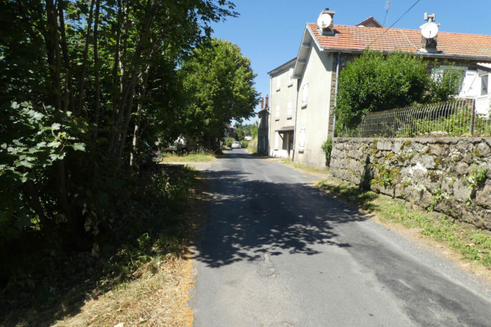
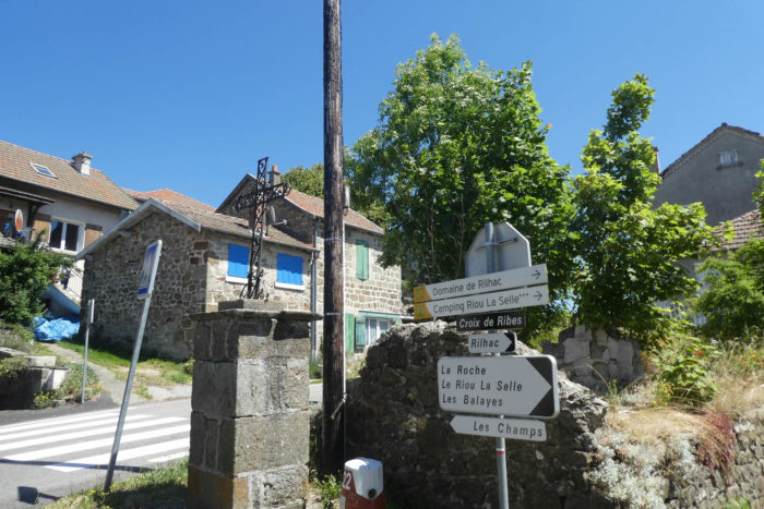
| The D21 road soon runs soon through La Croix de Ribes, a sort of antechamber to the city. The cut-stone houses lining the road form a visual transition between the countryside and urbanity. These well-aligned homes possess a warm austerity, as if they wanted to reconcile the harshness of stone with the comfort of human habitation. |
 |
 |
| Just a few more meters, and here is another intersection, this time with the D533 regional road. This name evokes recent memories: this same road that, a few days ago, climbed beyond St Peray, the road from Valence to Puy-en-Velay. This crossing marks the official entrance into St Agrève, the town that proudly dominates the plateau. |
 |
 |
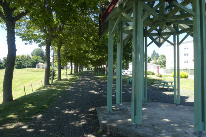
| At the entrance to the town, a small park offers a breathing space, a green threshold before the urban heart. Then the road slides gently toward the hospital, an imposing building that reflects St Agrève’s importance as a regional center. |
 |
 |
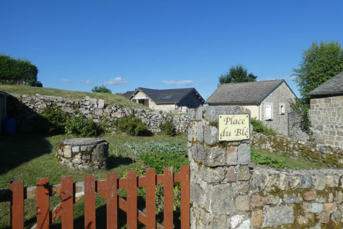
| St Agrève, with its 2,500 inhabitants, is a town that, due to its strategic position on the Vivarais plateau, has played a central role through the centuries. Its origins date back to the time of the Gauls, perched on Mount Chiniac. Under Roman rule, the town took root, before the 7th century gave it its definitive name, courtesy of Bishop Agrève, a missionary figure who shaped the religious history of the plateau. The Wars of Religion in the 16th century plunged the Vivarais into chaos, and Saint-Agrève, caught in the bloody conflicts between Protestants and Catholics, was largely destroyed by Catholic forces. But the town survived, gradually redeveloping on the slopes of Mount Chiniac to become what it is today.
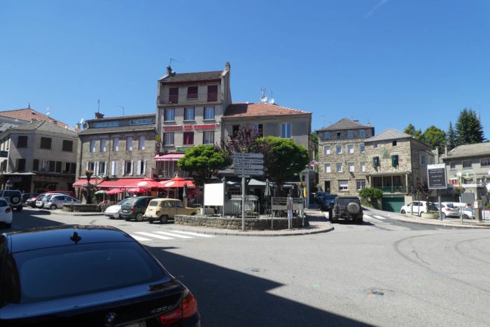
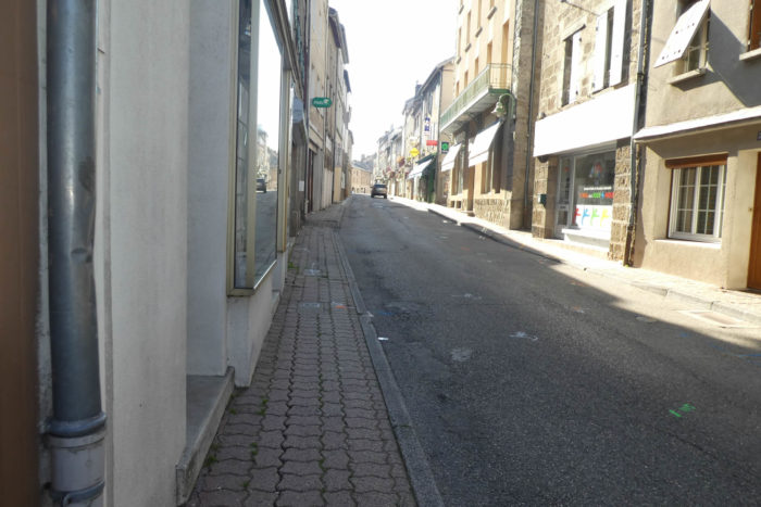
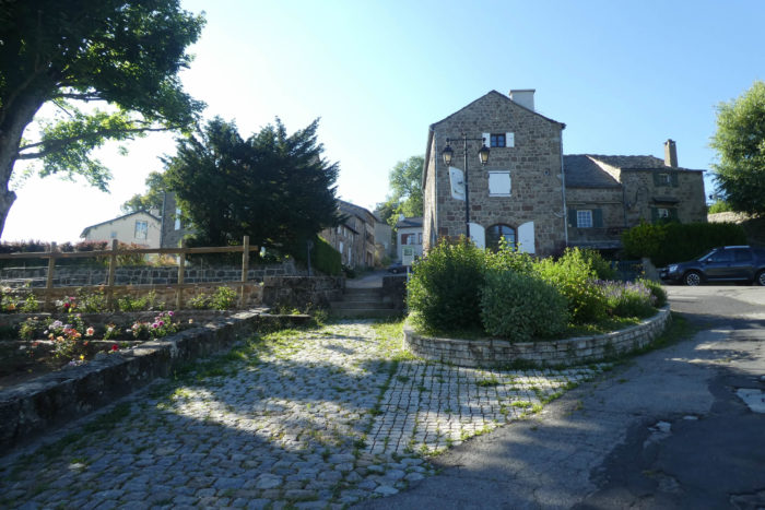
The social life, vibrant despite the town’s modesty, is centered around the main crossroads and the street that runs through the town. Here, the heart of St Agrève beats, a place where ancient stories and the discreet modernity of a small town that refuses to be forgotten meet.
|
 |
 |
| Today, St Agrève is a theater of peaceful coexistence between Catholics and Protestants, an equilibrium symbolized by the presence of two religious buildings. The Catholic church, dating from the late 19th century, features classical architecture, reflecting the rebuilding efforts after the tumult of earlier centuries. In contrast, the Protestant temple, built in the early 19th century, reflects the austerity typical of Reformation places of worship. True to Calvin’s precepts, the building eschews any superfluous ornamentation, abandoning the flourishes deemed decadent, a silent echo of a time of religious tension when every stone carried a message. |
 |
 |
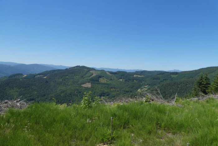
| To understand the history of St Agrève, you must climb Mount Chiniac, the birthplace of the town. Once, a 11th-century castle dominated this strategic peak. Today, only ruins remain: a crumbling wall connecting the remnants of two towers. Yet this place is still grand, offering a breathtaking panorama. From the top of this promontory, the view embraces a vast territory: the undulations of the plateau, the folds of the valleys, the mountains of Velay and Vivarais. On clear days, the Cévennes mountains appear on the horizon, like a mirage. A simple map details the volcanic ridges that mark the crest, illustrating this well-earned title of the “balcony of the Cévennes.” While the Cévennes mostly stretch further south, here the High Cévennes seem within reach, marking the northern boundary of this untamed massif. |
 |
 |
Facing this natural tableau, the Gerbier de Jonc stands as a familiar silhouette. This iconic volcano, which the path has been greeting for hours, is much more than just a mountain: it is here that the Loire River originates, winding its way across France. A protected site, it is the second most visited tourist location in Ardèche, after the majestic Ardèche Gorges. Alongside it, Mount Mézenc and a myriad of small volcanoes in the Puys chain rise, each telling a unique geological story. At this precise point also passes the watershed line, separating the basins of the Mediterranean and the Atlantic, like an invisible thread dictating the course of rivers.
| Beneath the remnants of Mount Chiniac, the Ville Haute gently descends toward the modern center. While the medieval ramparts have disappeared, the cut-stone houses, so typical of the region, impart a robust and authentic charm to this part of the town. History is still palpable in these streets where past and present coexist seamlessly. |
 |
 |
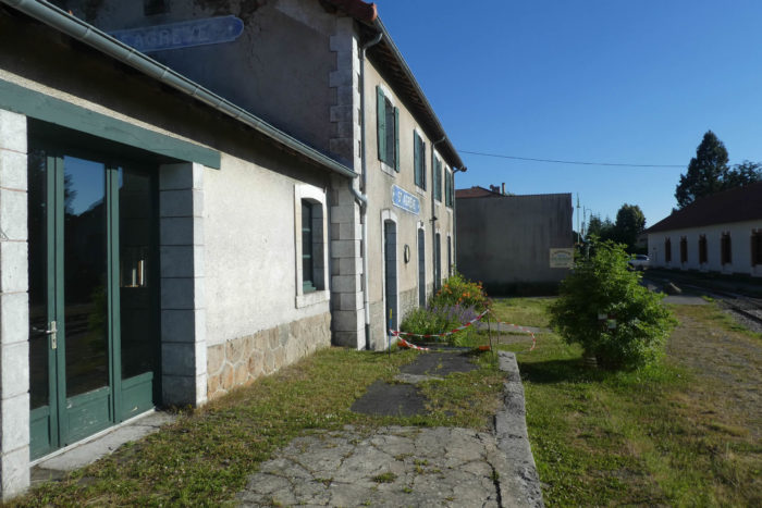
| St Agrève also bears a unique cultural imprint: that of Louis Jouvet. This immense actor and director, born in 1887 in Crozon, spent part of his childhood here. It is a chapter marked by personal tragedy: his father, an engineer responsible for local railway works, lost his life in a serious accident. This event, which took place in this otherwise peaceful setting, created an indelible connection between the theater man and this land of Vivarais.
The railway network that Jouvet’s father worked on still exists, supported by the passion of volunteers. The Velay Express line, a relic from a bygone era, connects St Agrève to Haute-Loire. Though its trains run only on rare occasions, mainly on Sundays, each departure is an invitation to travel back in time, aboard carriages where the past seems to still linger. |
 |
 |
Official accommodations on the Via Adresca
- Domaine de Rilhac***, Croix de Ribes; 04 75 30 20 20; Hotel, dinner, breakfast
- Le Bois Sauvage***, Route de Valence, Croix de Ribes; 04 69 23 81 17; Hotel, dinner, breakfast
- La Cabanette, 300 Rue de la Cabanette, St Agrève; 06 65 38 62 18; Guestroom, dinner, breakfast
- Mme Beghin. 46 Rue du Dr Toruasse, St Agrève; 06 51 92 03 43; Guestroom, dinner, breakfast
- Hôtel Le 1050, la Gare, St Agrève; 04 75 30 10 12/06 33 16 66 56; Hotel, dinner, breakfast
- Hôtel Fraysse, 10 Place Verdun, St Agrève; 04 75 30 13 31; Hotel, dinner, breakfast
- Auberge des Cévennes, 10 Place de la République, St Agrève; 04 75 30 10 22; Hotel, dinner, breakfast
Pilgrim hospitality/Accueils jacquaires (see introduction)
Along the Via Adresca, accommodation options are almost always limited. You’re not walking through the touristy South of Ardèche. Lodging is scarce, even on Airbnb, where addresses are often unavailable. This list includes only accommodations located directly on the route or within 1 km of the route. The guide published by the Friends of Compostela, however, lists all available lodging addresses, as well as bars, restaurants, and bakeries along the route, even those several kilometers away. There is nothing available until you reach La Croix de Ribes, just before St Agrève. The latter is the largest town in the area, offering all essential services and a wider range of accommodation options.
Feel free to add comments. This is often how you move up the Google hierarchy, and how more pilgrims will have access to the site.
|
 |
Next stage : Stage 16: From St Agrève to Fay-sur-Lignon |
|
 |
Back to menu |