From one valley to another in the Haut Vivarais
DIDIER HEUMANN, ANDREAS PAPASAVVAS
We divided the course into several sections to make it easier to see. For each section, the maps show the course, the slopes found on the course, and the state of the route (paved or dirt roads). The courses were drawn on the « Wikilocs » platform. Today, it is no longer necessary to walk around with detailed maps in your pocket or bag. If you have a mobile phone or tablet, you can easily follow routes live.
justify; »>For this stage, here is the link:
https://fr.wikiloc.com/itineraires-randonnee/de-chalencon-aux-nonieres-sur-la-via-gebennensis-adresca-32958489
| Not every pilgrim feels comfortable using GPS devices or navigating on a phone, especially since many sections still lack reliable internet. To make your journey easier, a book dedicated to the Via Gebennensis through Haute-Loire is available on Amazon. More than just a practical guide, it leads you step by step, kilometre after kilometre, giving you everything you need for smooth planning with no unpleasant surprises. Beyond its useful tips, it also conveys the route’s enchanting atmosphere, capturing the landscape’s beauty, the majesty of the trees and the spiritual essence of the trek. Only the pictures are missing; everything else is there to transport you.
We’ve also published a second book that, with slightly fewer details but all the essential information, outlines two possible routes from Geneva to Le Puy-en-Velay. You can choose either the Via Gebennensis, which crosses Haute-Loire, or the Gillonnay variant (Via Adresca), which branches off at La Côte-Saint-André to follow a route through Ardèche. The choice of the route is yours. |
 |
 |
If you only want to consult lodging of the stage, go directly to the bottom of the page.
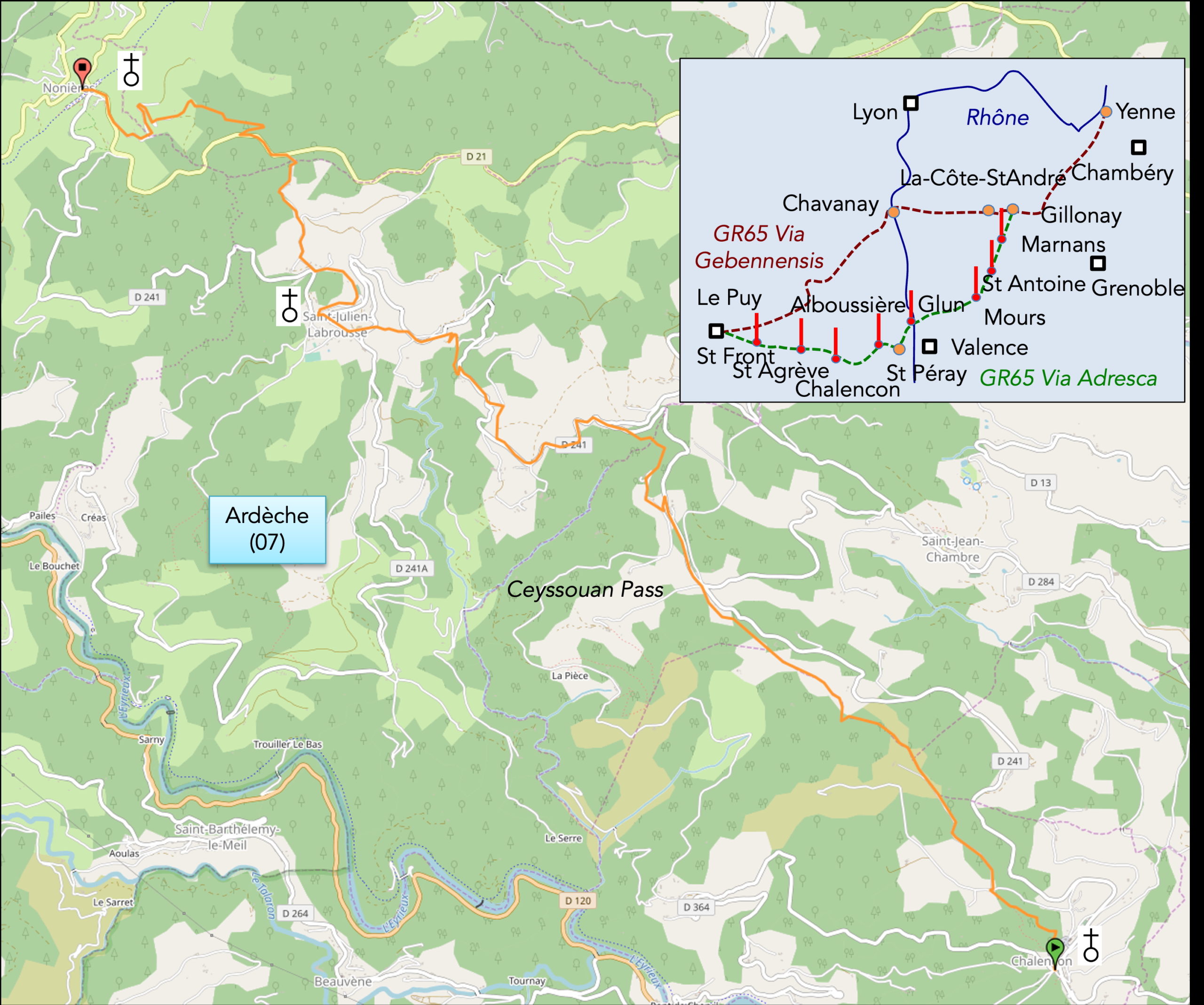
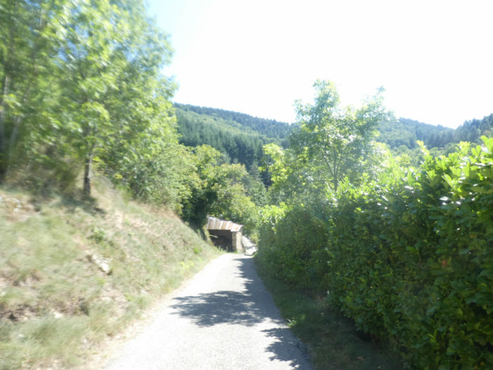
Long ago, a small train used to run through the Haut Vivarais and Haute-Loire, connecting the Rhône Valley to Le Puy-en-Velay. In the late 19th century, on challenging terrain, a narrow-gauge steam railway was constructed with tunnels and viaducts to open up the region. This little train became popular with passengers and also for transporting wood, chestnuts, and textiles, one of the region’s specialties. However, with the rise of road transport, small railways fell out of favor. In 1968, a ministerial decision ended the train’s operations, and by the 1970s, the tracks were removed. Today, all that remains is the “Dolce Via, the Voie Douce,” a trail popular with hikers and cyclists that winds through the region, passing through places like Les Nonières. However, the Camino de Santiago does not follow this gentle roure. Instead, it takes the steeper Via Adresca, which often rivals the even steeper GR420 trail, also connecting Chalencon to Les Nonières. While the GR420 is longer and more demanding, it’s an option for those who enjoy a challenge. For this guide, we’ll stick with the Camino route, the Via Adresca.
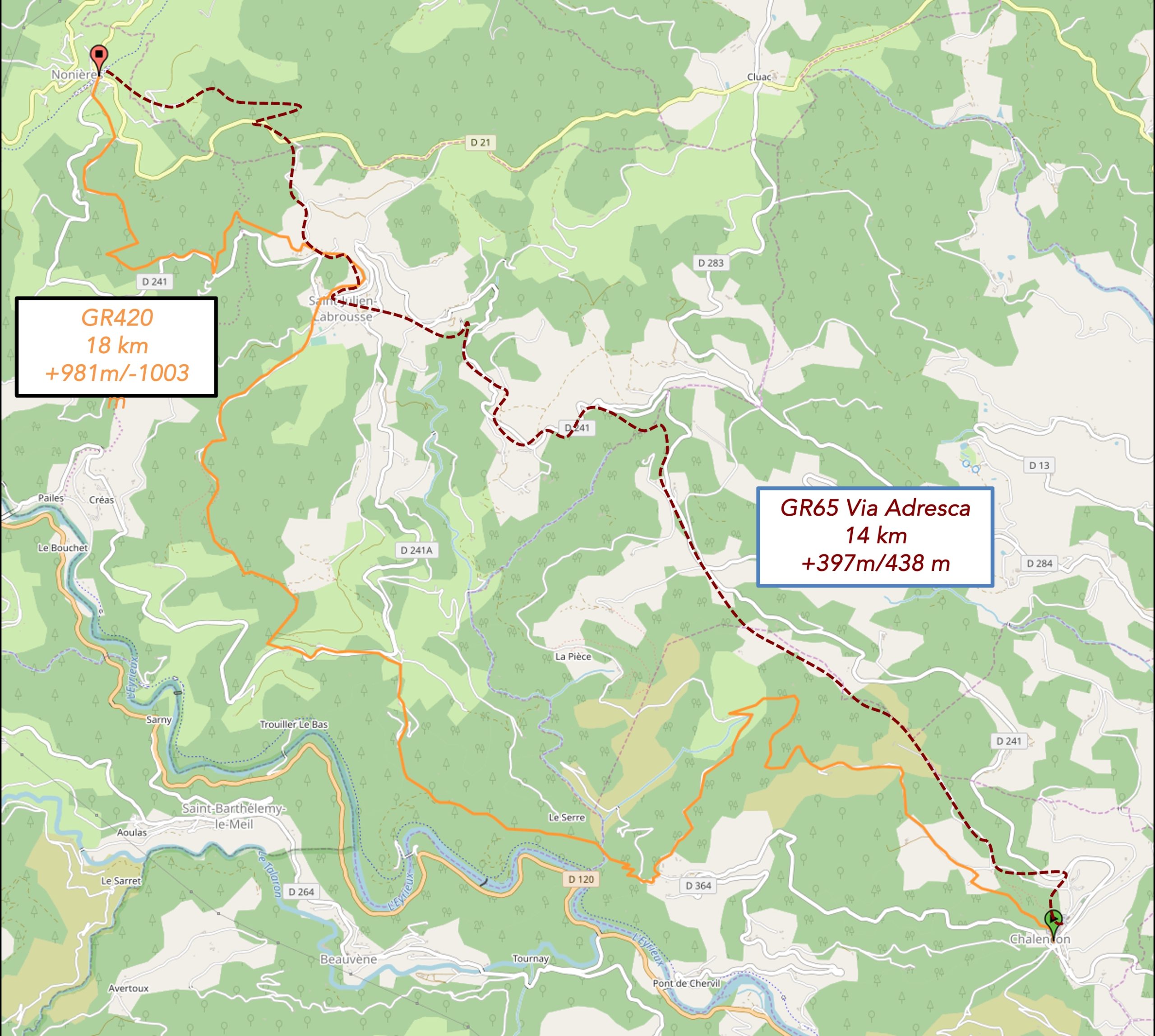
It’s possible to reach St Agrève in a single day, but this involves over 1,000 meters of climbing. To make the journey more manageable, many opt to stop at Les Nonières midway.
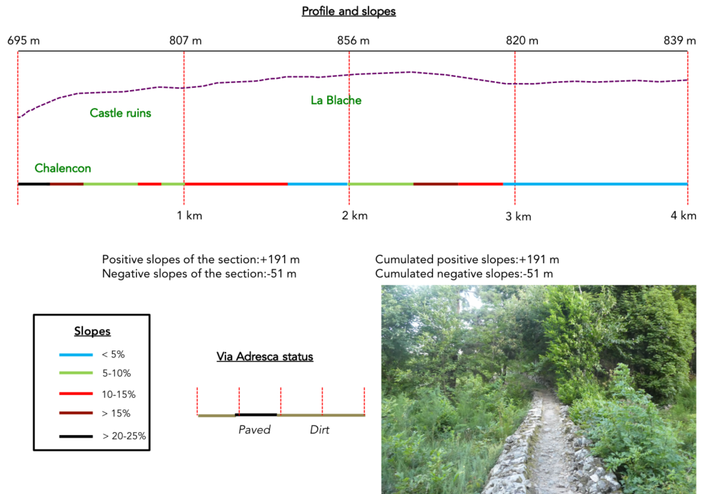
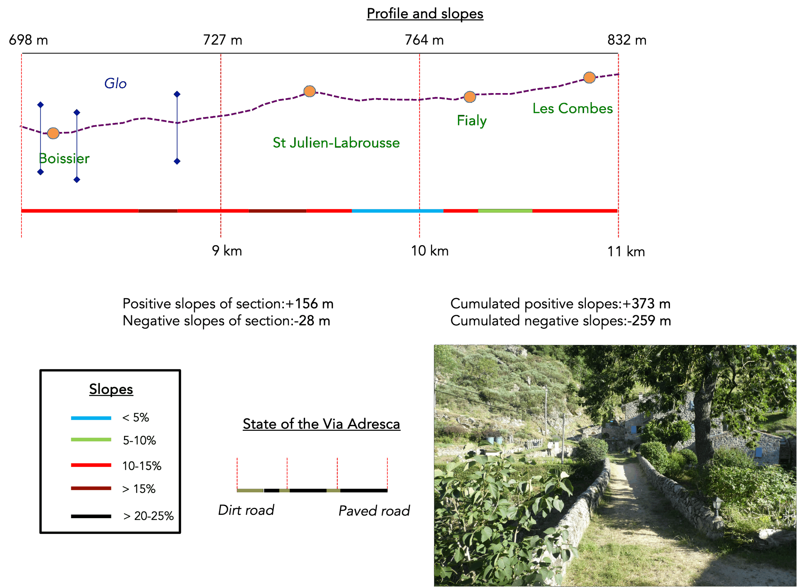
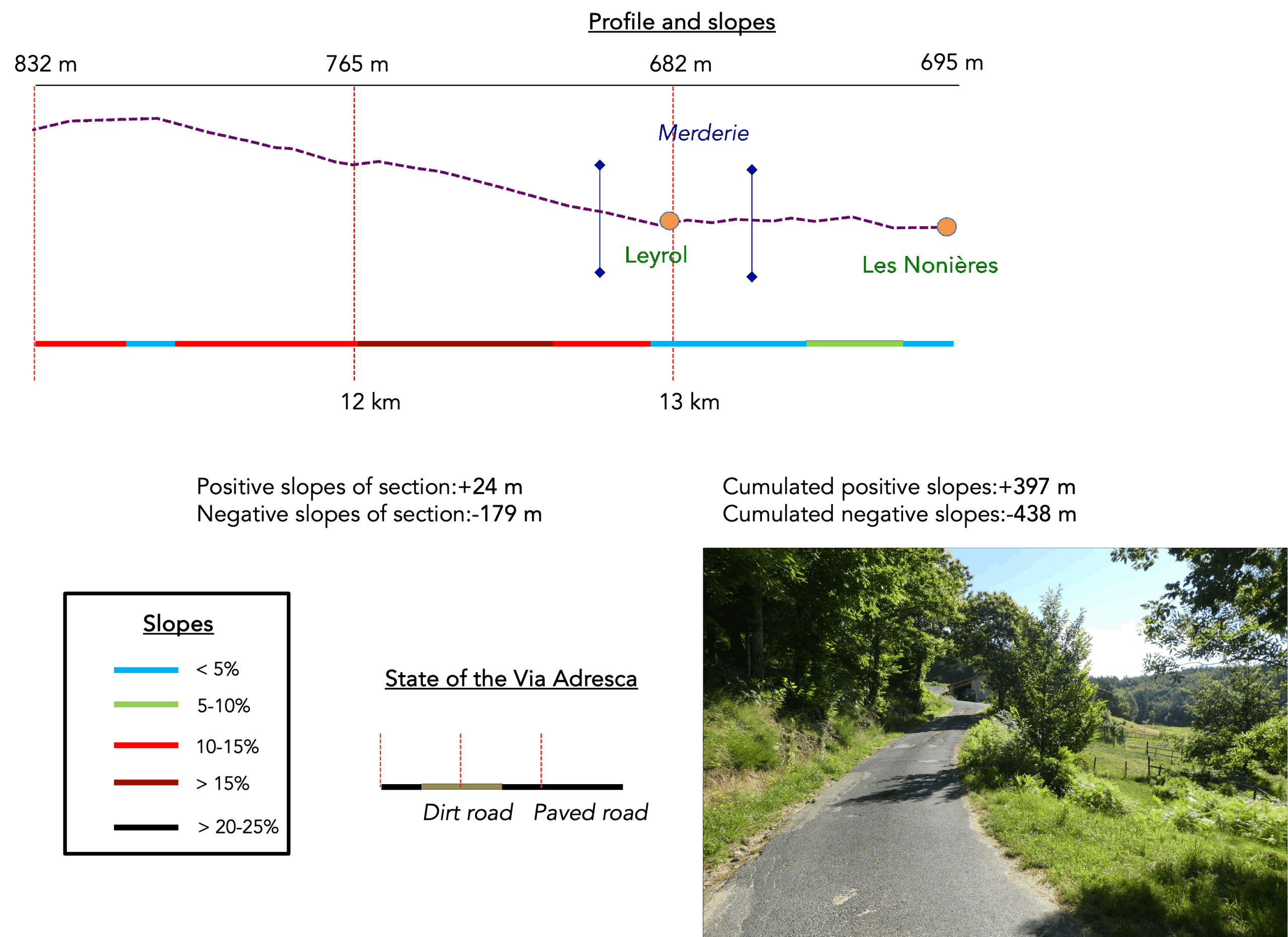
Difficulty level: The reduced route to Les Nonières involves a total elevation gain (+397 meters/-438 meters), making it quite reasonable. The route climbs steeply from Chalencon to the Roman oppidum before leveling off towards the Ceyssouan Pass. From the pass, there’s an easy descent into a valley below St Julien-Labrousse, followed by a steady climb to the forested heights above Les Nonières. The descent to Les Nonières is uncomplicated.
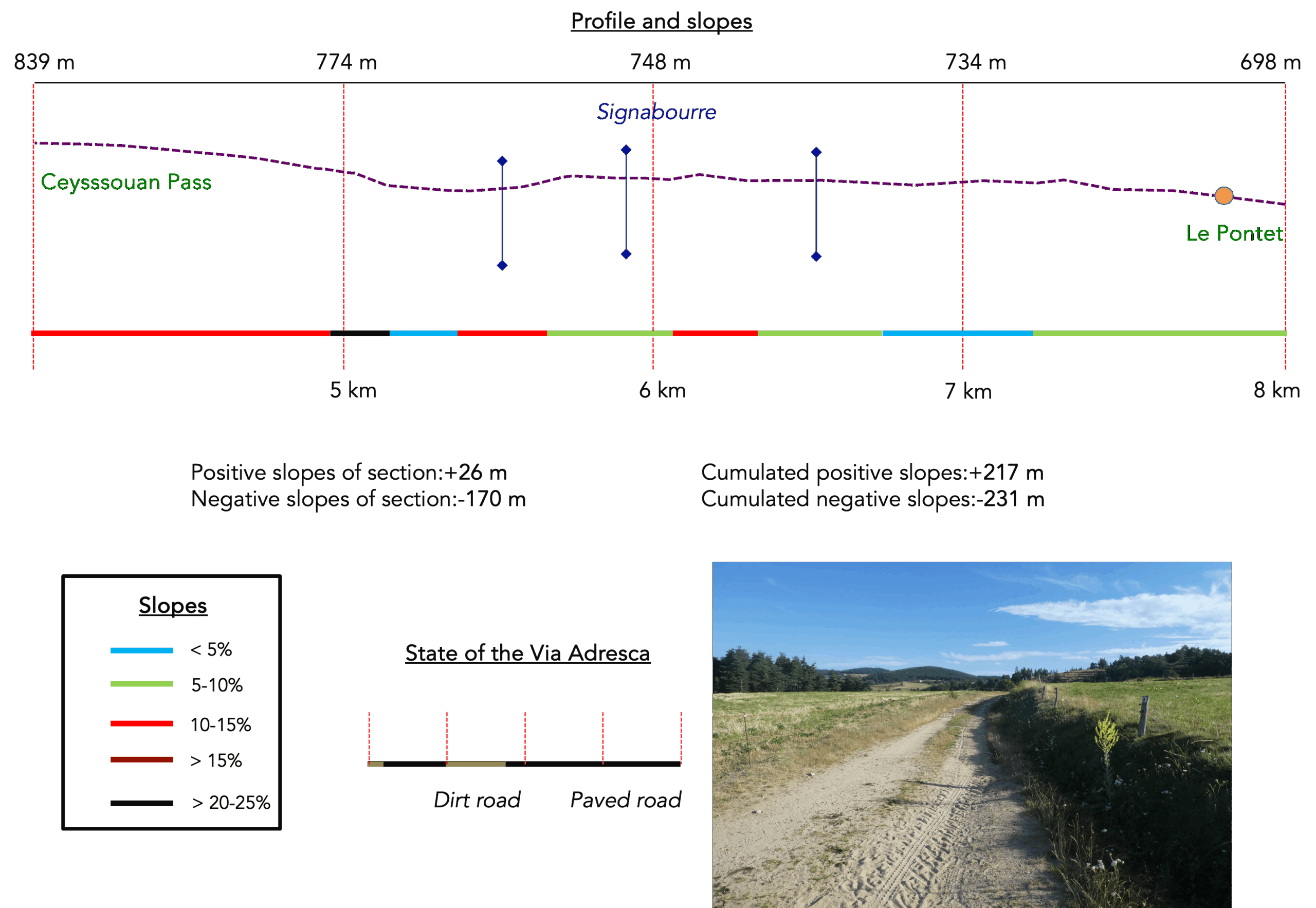
State of the Via Adresca: This stage includes a mix of paved roads and natural paths:
- Paved roads: 7.9 km
- Dirt roads : 6.0 km
Sometimes, for reasons of logistics or housing possibilities, these stages mix routes operated on different days, having passed several times on these routes. From then on, the skies, the rain, or the seasons can vary. But, generally this is not the case, and in fact this does not change the description of the course.
It is very difficult to specify with certainty the incline of the slopes, whatever the system you use.
For those seeking « true elevations » and enthusiasts of genuine altimetric challenges, carefully review the information on mileage at the beginning of the guide.

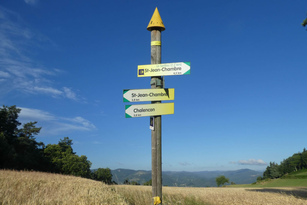
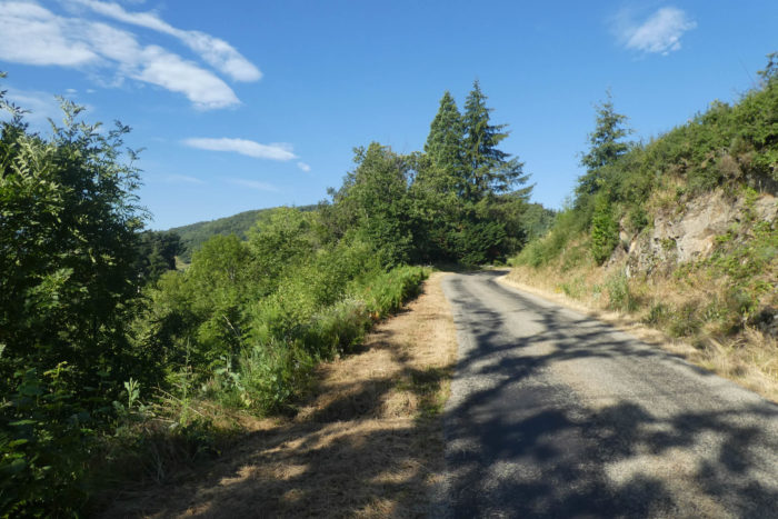
Section 1: Above Chalencon towards Ceyssouan Pass
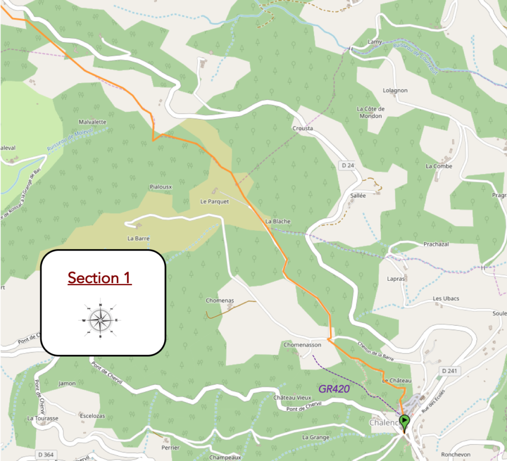
General overview of the difficulties of the route: severe climb on the heights of Chalencon, then route almost constantly uphill towards the pass, but requiring little sweat.
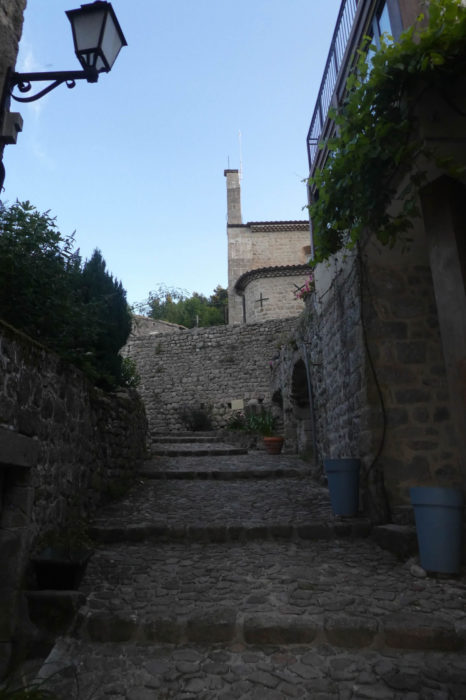
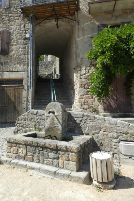
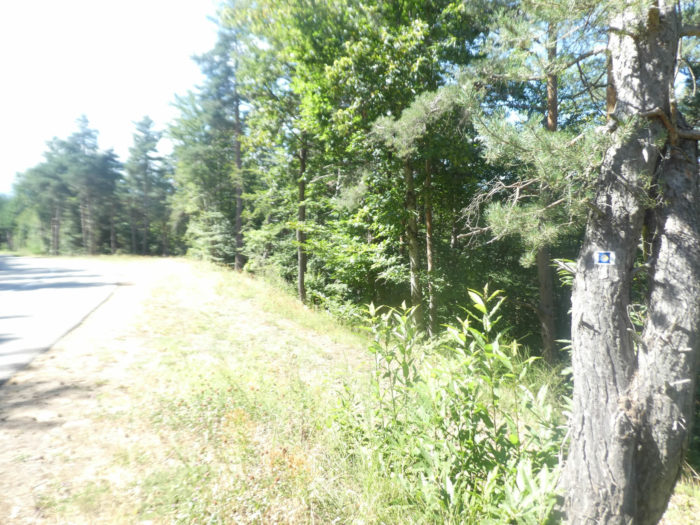
| Today, you will leave from Place du Valla, by the stairs which, like outstretched fingers, lead to the church and the Tourist Office. This place, at the crossroads of paths, demands increased vigilance. Until now, the GR420 and the Camino de Santiago followed the same paved road, but here, the divergence is clear. The GR, true to its trajectory, veers left of the building, while the Via Adresca escapes to the right. It is essential not to get lost at this subtle fork. |
 |
 |
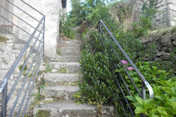
| The beginning is nothing like a summer stroll, far from it. The effort is felt from the very first steps. The stairs, always ascending, wind above the church, like suspended arteries between sky and earth. They will then lead you to a place where history becomes even older, a place where the stones, mute and proud, whisper the secrets of their past. It was not just a simple passageway but a Celtic oppidum, a relic of a bygone era, which later, under Roman occupation, became a strategic site. |
 |
 |
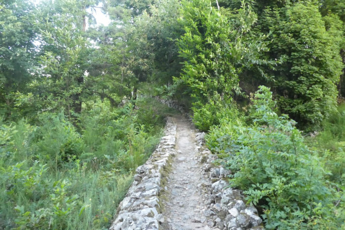
| The path weaves its way with an almost sensual slowness through the ruins of the oppidum. Here, the stones, witnesses of a bygone time, seem to hesitate between what they were and what they have become. The fortifications that once protected the site have been engulfed by the weight of the ages. This jumble of stones, now solitary and blunted, evokes a bittersweet melancholy. It is neither an imposing ruin nor a majestic site, but rather a space where nature, both generous and invasive, has reclaimed dominance. Yet, despite the oblivion and the omnipresent vegetation, you can still discern the outlines of what was once a city. This story began between the 9th and 6th centuries BC, a story of Celts settled here. Moreover, the very name of the commune echoes this era: “Kal,” a pre-Celtic root meaning a pile of stones, and “anco,” a suffix designating a mound. This name, like a relic frozen in time, reminds you of the importance of this place. During the conquest of Gaul in 52 BC, Caesar’s legions immediately spotted the summit of Chalencon, a strategic observation post overlooking the Haut-Vivarais. There, the generals of the Empire built a fort, then a village. A garrison settled there for several centuries, leaving behind the imprint of an oppidum and perhaps even a Roman road, of which only the memory of the stones remains. |
 |
 |
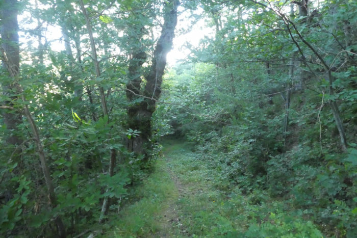
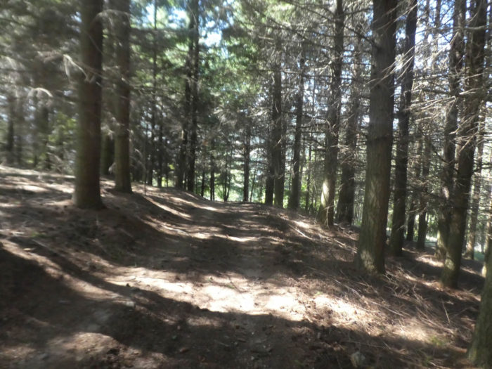
| At the top of the oppidum, a trail continues, slipping like a serpent among moss-covered walls, in lush vegetation where pines, hornbeam shoots, and chestnut trees intertwine their shadows. This landscape, still today, seems suspended in time, as if, in a final tribute to ancient grandeur, the Roman path retained some of its former splendor. It is uncertain whether this is exactly the original route, but it retains the discreet majesty of ancient routes that only the footsteps of travelers still manage to revive. |
 |
 |
| On this path, it is not uncommon to come across centuries-old chestnut trees, their gnarled trunks and thick branches bearing the scars of time. But the oaks, too, are likely just as old, proud witnesses to an immutable past. The path then winds between these giants, progressing with a calm slowness through the woods, until it meets a paved road that climbs, like a promise of adventure, into the forest. |
 |
 |
| The direction points toward La Blache, a name that echoes history. The blaches, these lands often reclaimed from oak forests, testify to the constant evolution of nature under the influence of man. But here, the forest is a living patchwork, a harmonious assembly of various deciduous trees, interspersed with pines and spruces, as if each tree, with its roots knotted in the earth, were competing for a little light and space. |
 |
 |
| The paved road ends at La Blache, and from there, scattered hamlets appear like small, isolated pearls, spread across the countryside or along the forest edges. These houses, often closed and solitary, preserve a sort of primitive tranquility, far from the noise of the world. |
 |
 |
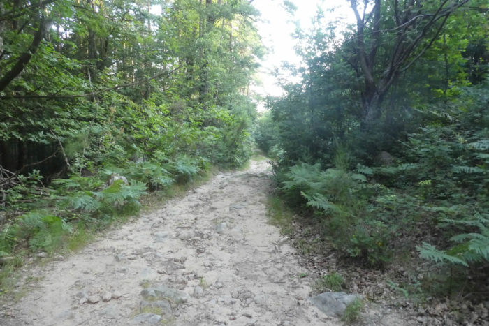
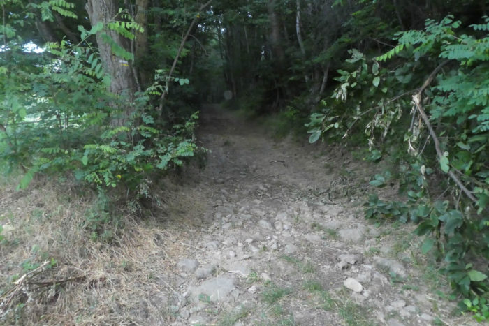
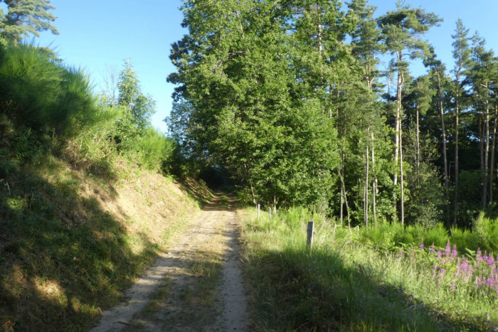
| A dirt path, slightly rocky, slips into the forest, climbing gently up to the location known as Les Parquets. The ground, a mixture of clay and stones, bears the imprint of centuries. |
 |
 |
| The path seems to hesitate between the density of the undergrowth and the openness of the meadows in the clearings. The landscape, with its somewhat dull hues, oscillates between hard earth and wild grasses, in an atmosphere where nature seems to hold its breath. This is not a place of celebration but rather a quiet pause, a suspended breath. |
 |
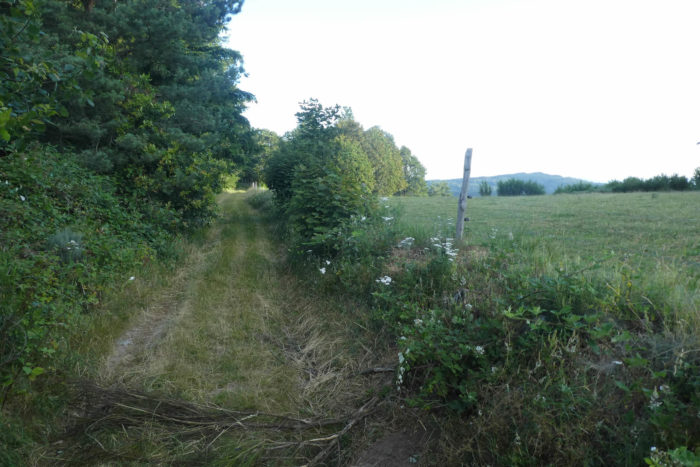 |
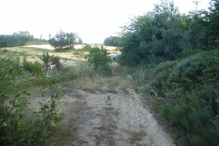
Higher up, the Via Adresca reaches the place called Pracoulet, nestled in the heart of a clearing, like a well-kept secret, where the forest finally gives way to a little air and light.

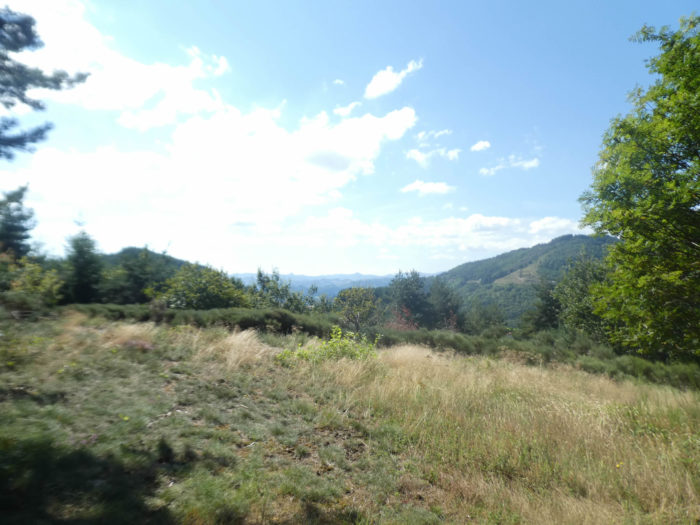
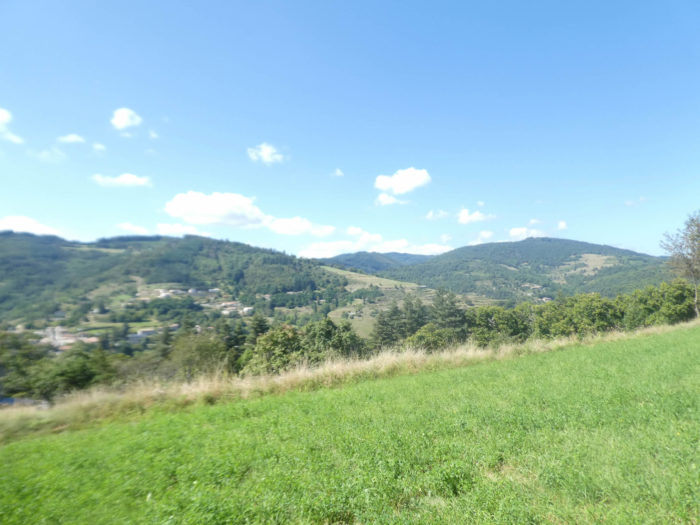
| The path continues its ascent, slowly slipping through meadows and undergrowth. If you lift your eyes toward the horizon, there is nothing but forests, immense and imposing, that tumble down the hills as if they were trying to touch the heavens. Here and there, a few houses or villages barely emerge, isolated in this green vastness. This part of Ardèche, deserted by visitors, is of a wild and intimate beauty, very different from the south, where the crowds flock. Ahead of you, in the distance, a massive hill looms: this is where the route will lead tomorrow, towards St Agrève. Doesn’t the mountain seem austere, almost menacing? |
 |
 |
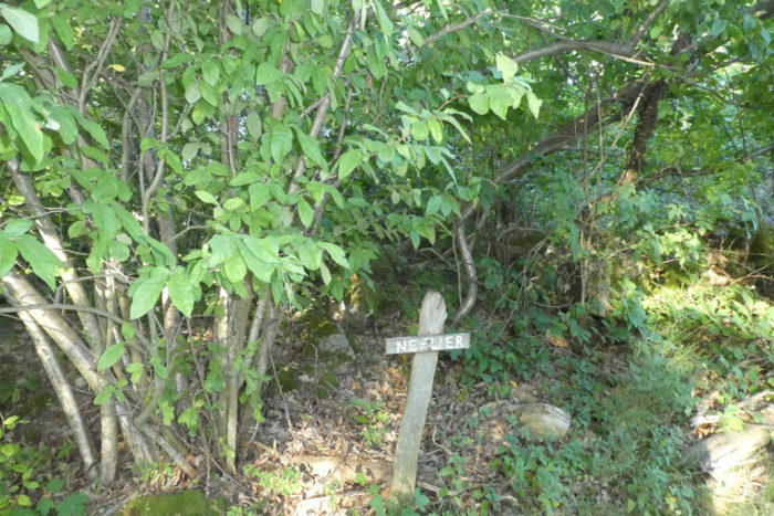
| Here, you can afford to dawdle, to wander. The eye catches sight of a shrub whose name escapes the mind, much like a faint perfume that one struggles to identify. Have you ever tasted medlars, those fruits that seem suspended between sweetness and acidity, like a promise of summer? |
 |
 |
| The path continues to unfold, meandering through a tranquil landscape of golden wheat fields, bright yellow broom, and forests of pines and spruces, like a canvas painted with soft, soothing colors. |
 |
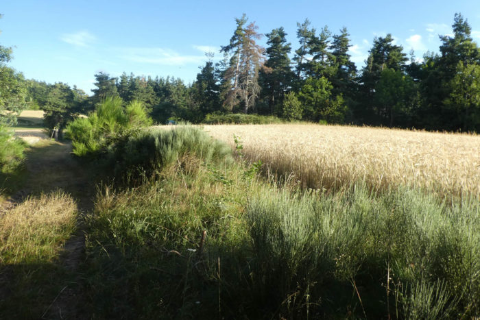 |
The path then leads to the place called Le Fraysse, a small plateau where wheat, ripening slowly under the sun, sways gently in the breeze.
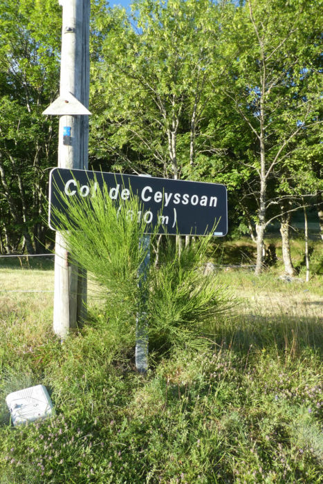
| A lovely beaten-earth path, ocher like the color of warm sand, stretches ahead, winding between undergrowth and meadows. At the very end, the small departmental road finally reveals itself, heading straight toward the Ceyssouan Pass, a paved road that connects this world of nature to that of humans. |
 |
 |
Section 2: Over hill and dale through the chestnut trees
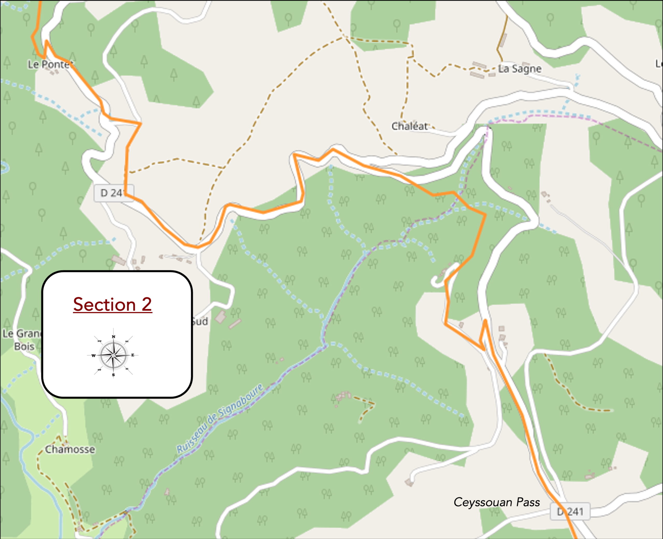
Overview of route’s challenges: mostly downhill, without significant challenges.
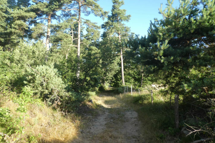
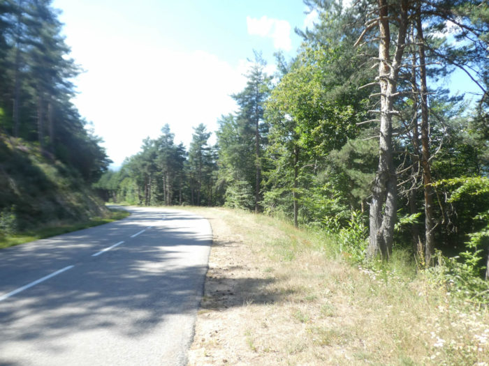
| The path quickly leads you to the Ceyssouan Pass, where chestnut and ash trees blend in a silent dance. The landscape, at this altitude of over 800 meters, feels delicate, almost serene. Higher up, the hills seem to bow under the weight of spruces, and the dense, mysterious forest seems to guard its secrets jealously. |
 |
 |
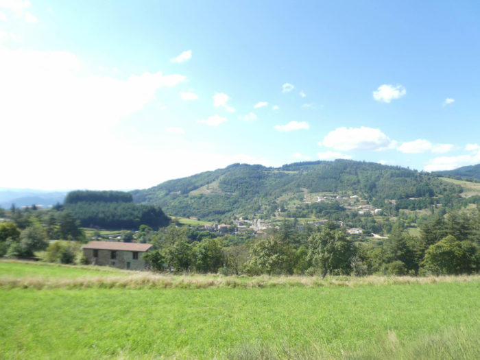
| The Via Adresca then heads toward St Julien-Labrousse, following the peaceful axis of the D241 departmental road, which connects Chalencon to Les Nonières. Ahead, the village appears under the wooded hills, while in the distance, the imposing and discreet heights beckon you to continue. Tomorrow, they will be waiting for you, ready to guide you toward St Agrève, where paths cross and diverge. |
 |
 |
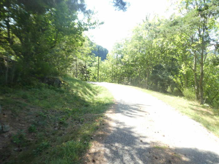
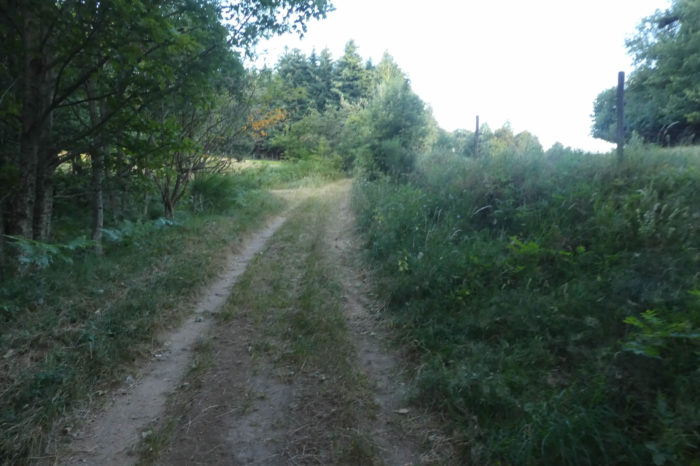
| The small road plunges into a forest rich in diversity, where spruces and chestnuts reign supreme. But soon, the route becomes less hospitable. A rough forest trail, steep and uneven, veers off under the road, drawing you into a maze of loose soil and exposed roots. |
 |
 |
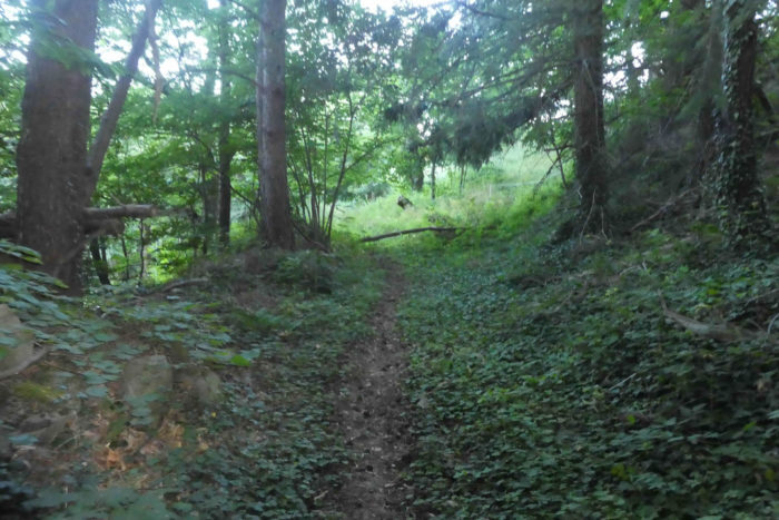
| The trail then descends into a kind of small jungle, dense and slightly wild, where centuries-old chestnut trees stand as witnesses to the passage of time. The atmosphere here is humid, and the air is laden with woody aromas, steeped in humus and vegetation. |
 |
 |
| Gradually, the path widens again, with the chestnuts giving way to a more varied vegetation as it winds toward the meanders of the Signabourre stream. The ground, often slippery, is a mix of clay and mud. A true challenge, even in good weather, where every step must be measured to avoid slipping. |
 |
 |
| This route through the lush vegetation is merely a necessary detour to avoid the departmental road. In case of rain, it is advised to stick to the road, as the trail, often overrun by invasive vegetation, becomes a veritable labyrinth. The stream, winding through tall grass and bushes, creates an air of whimsical chaos, but the humidity and slippery terrain make progress laborious. |
 |
 |
| After a long interplay with the stream as it twists and stretches through the tall grasses, a trail slowly climbs back up a hill, reconnecting with the departmental road. Here, the vegetation becomes more subdued, with bushes, deciduous trees, and pines interlacing. A welcome pause before resuming the journey. |
 |
 |
| The Via Adresca returns to the D241 road and reaches a small crossroads where the road crosses the Signabourre stream before disappearing again into the pines. The air here is drier, calmer, as if the forest were allowing you to breathe a little more freely. |
 |
 |
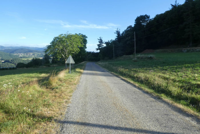
| The road leaves the forest to reveal itself more fully, passing near the place called Le Pontet. In this isolated corner, vehicles are rare, and the world seems suspended, as if outside of time. The village of St Julien-Labrousse is only two kilometers away now, but it still feels distant, far off at the edge of this peaceful land. |
 |
 |
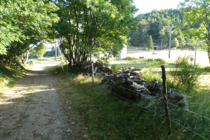
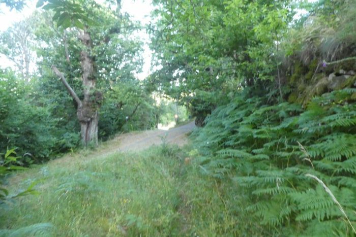
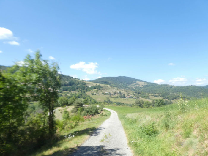
| Finally, the Via Adresca leaves the departmental road to follow a wide sandy path, stretching flat across the meadows. The air is light, and the ground is soft underfoot. Then, soon, you find a small paved road again, leading you back toward the heart of the world, while still maintaining a certain tranquility. |
 |
 |
Section 3: From the charming site of Boissier, passing through St Julien-Labrousse

Overview of route’s challenges: a few brief slopes to tackle.
| The Via Adresca continues its way along the small paved road, winding among the pines, before crossing the Glo stream. On the other side of the valley, the village of St Julien-Labrousse slowly reveals itself, emerging from the forest like a well-kept secret, nestled between the hills. |
 |
 |
| The road then descends, and to the left, a wide dirt path opens before you. It gently sinks into the dale, gradually descending toward the stream winding below, its shimmering surface catching your eye. |
 |
 |
| Lower down, the path becomes more intimate, running through tall grass before slipping under the arch of a stone bridge. This bridge, simple yet beautiful, seems to wink at you, like a kind-hearted archway, a bridge between two worlds, a memory from another time. |
 |
 |
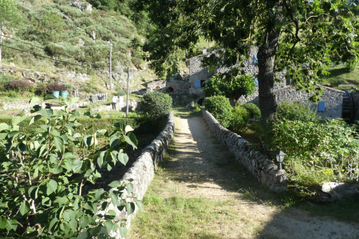
| At the bottom of the descent, deep in the dale, the path leads you to Boissier. The place seems adorned with an ancient, almost magical charm. Light filters through the trees, caressing another stone bridge, designed in a style reminiscent of Roman bridges, made of raw stone, solid yet elegant. The blue of the stream, softly babbling at your ears, enhances the scene, while a house built from massive rubble stones, beautiful in its simplicity, stands majestically near the water. It is as beautiful as a living painting, a scene suspended in time. |
 |
 |

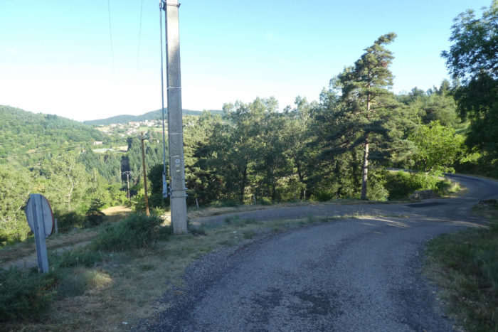
| The path then climbs steeply but briefly, under the shade of tall trees that, like benevolent giants, seem to whisper ancient secrets. It sneaks onto a small paved road, a ribbon of asphalt discreetly winding above the site, almost as if it wanted to follow the curves of the land without leaving an indelible mark. |
 |
 |
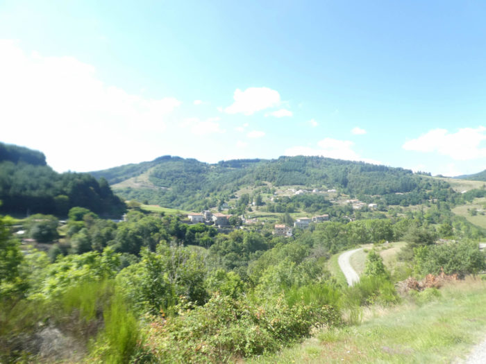
| The Via Adresca follows this peaceful paved road, and a little further, it heads toward the D421 departmental paved road, whose route blends harmoniously into the lush, vibrant nature surrounding it. At this precise moment, you find yourself directly across from St Julien-Labrousse, a village hidden in a small hollow, ready to reveal its mysteries to anyone venturing past its borders. |
 |
 |
| True to its way, the Via Adresca leaves the paved road and sinks into a small dale, like a discreet stream slipping under the canopy. Moss, like a soft and humid skin, covers the ground, while wild grasses rise in an exuberant dance. Here, one of the arms of the Glo, secret and hidden among the dense vegetation, seems to offer a haven of freshness and tranquility. |
 |
 |
| At the stream, the path resumes its climb, pulling away from the valley’s gentle quietness to venture into an almost wild steppe. The mountains, majestic and unyielding, watch over you as you ascend, guided by a rough trail, until you reach a small, almost forgotten paved road, winding under the village. |
 |
 |
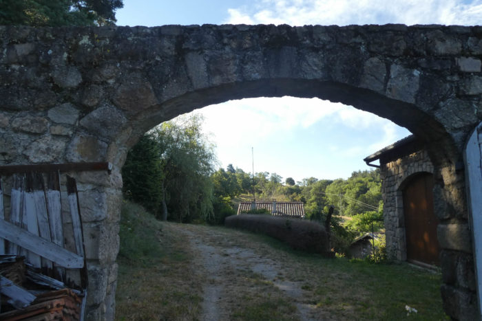
| It’s likely that this valley, before serving as a passage, once hosted a mill. The name of a street, at the base of the village, seems to stand as a persistent witness, a memory of a time when the water from this stream was harnessed to power machinery. Could the village hall, dressed in ocher and red, conceal an even older secret? Perhaps an old factory. The 350 inhabitants of this small corner of the world likely know. But to reach the heart of the village, you’ll still need to climb a slope of over 15%, one last effort before discovering the quiet charm of this place out of time.
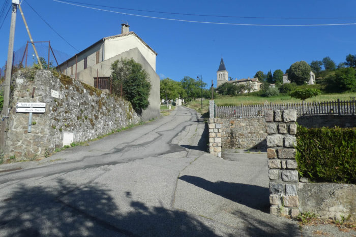
If you wish to understand what St Julien-Labrousse once was, you’ll need to travel back in time to the 12th century, when this isolated village proudly overlooked the Eyrieux Valley. Once a dependency of the Chalencon barony, it still retains traces of its centuries-old past, starting with its church, rebuilt in the 17th century. Here, the Catholic Church of the region found new life by dedicating its bell to St Régis, a devotion deeply ingrained in the village. |
 |
 |
 |
 |
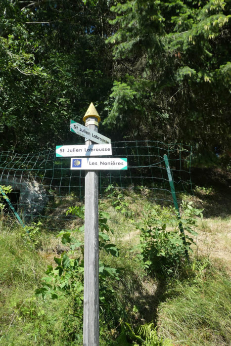
| The Via Adresca also intersects with the GR420, which, for a few hundred meters, follows the same route to Fialy. The paved road runs by the large communal washhouse, still functional, a faithful witness of bygone eras, while a small paved path winds above the village toward the cemetery, a place filled with serenity. |
 |
 |
| But there, at the cemetery, the paved road fades away, giving way to grass, which slowly reclaims the territory. |
 |
 |
| Here, you must be extra attentive. Don’t be mistaken: the no-entry sign doesn’t apply only to vehicles. No, it also applies to you. The path is unmarked and follows, almost invisibly, the edge of the cemetery, losing itself in the tall grass that seems to swallow all traces of human presence. A challenge to intuition and observation, but also an invitation to adventure. |
 |
 |
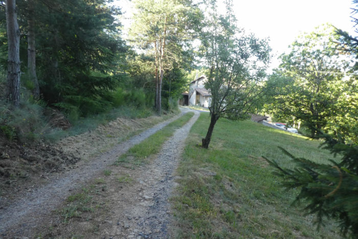
| A trail then enters a secret undergrowth, a place where chestnut trees seem to have been planted by an invisible hand, pressed tightly together like sardines in a tin, their dense foliage forming an impenetrable, almost mystical canopy. The atmosphere here is heavy with silence, each tree appearing to whisper forgotten stories. Then, without warning, the trail emerges from this green cocoon and joins the paved road near the newer houses of Fialy, like a passage between two worlds—the natural and the constructed. |
 |
 |
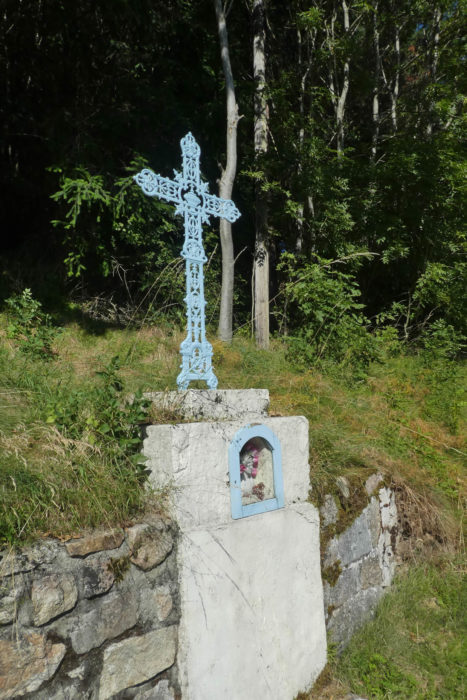
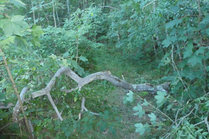
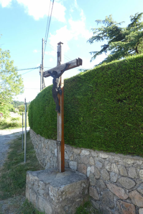
| Not far away, a humble and silent cross marks a fork. The GR420, apparently satisfied with its route, turns left, continuing in another direction, leaving the Via Adresca to pursue its solitary climb. |
 |
 |
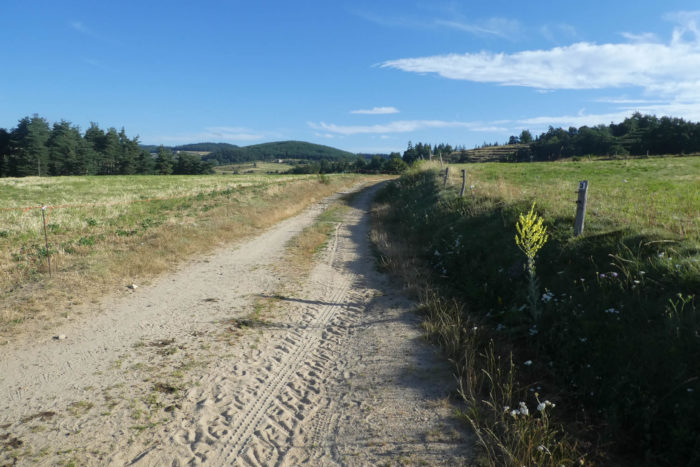
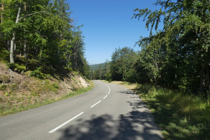
| As for the Via Adresca, it slopes up straight ahead, challenging the mountain toward Les Combes. The ribbon of asphalt unrolling before you is no easy walk. Here, Ardèche becomes wild, rugged, a true playground for those who love challenges. The terrain is steep, and the paved road, climbing with relentless consistency, reminds you at every step that you are in a region where the spirit of nature reigns supreme. |
 |
 |
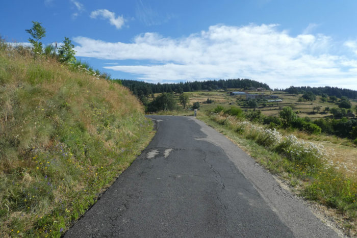
The climb continues through a verdant, almost bucolic meadow before entering a forest of spruces. The hilltop, where the paved road eventually leads, feels elusive, far, yet close, like a promise. The incline doesn’t relent, varying between 7% and 15%, a constant challenge for walkers and travelers. Yet paradoxically, the summit rarely feels unattainable, as nature, despite its rigor, makes the climb almost familiar, like a silent companion.
|
 |
 |
Section 4: Overlooking Les Nonières

Overview of route’s challenges: a descent of nearly 200 meters in elevation towards Les Nonières, with some very steep slopes at times.
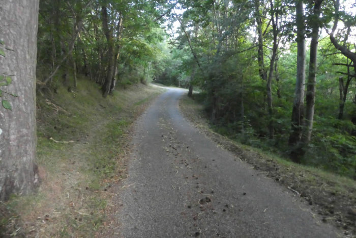
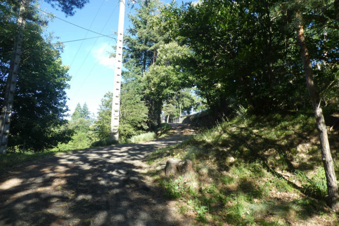
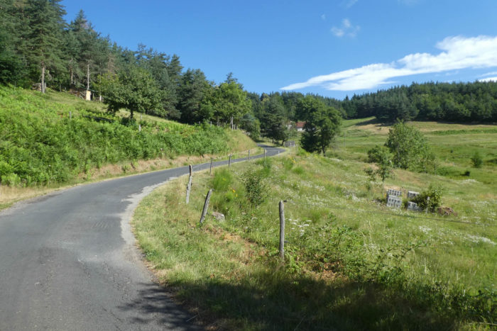
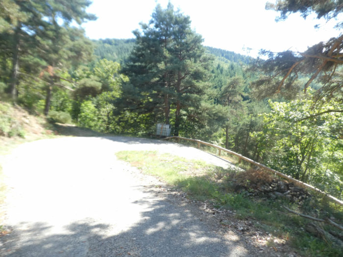
| A little above Les Combes, the Via Adresca connects to the D21 departmental road, winding through the spruce trees of Serre des Portes, a vast forest that overlooks Les Nonières. The paved road, enveloped by the dense shadows of conifers, seems to vanish into the solemn silence of these towering green giants, their needles quivering under the gentle breeze. It’s another world, a universe where human presence feels almost out of place. |
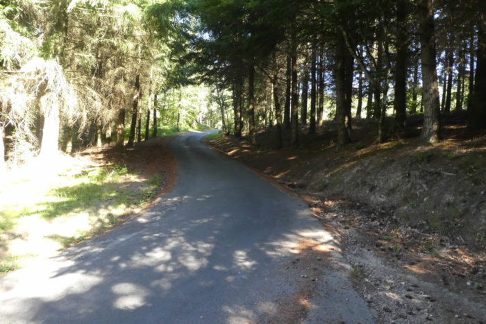 |
 |
| The descent begins, as the paved road gradually blends into the landscape, heading towards Les Nonières. The terrain becomes steeper, and as you sink deeper into this nearly impenetrable nature, the fresh, woody scent of the trees fills the air, infusing every movement and breath. |
 |
 |
| Be cautious as you descend, for just before reaching Les Nonières, a path discreetly slips into the forest, leading toward the hamlet of Leyrol. If you follow the correct walking path and stay on the left side of the paved road to see oncoming vehicles better, you might miss the bifurcation. A simple marking on a tree, almost invisible, indicates the way, but like all subtle signs, it only reveals itself if you know to look for it. Missing it matters little, as you can also continue along the main route to the village. In any case, vehicles rarely use this stretch, so you won’t be disturbed.
If you notice it, you’ll find this hidden path to the right, almost concealed, marked by a sign as subtle as a whispered promise. |
 |
 |
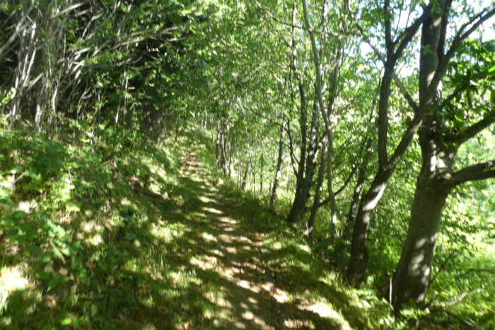
| Once you’re on it, you’ll discover a wide path plunging into a forest of breathtaking beauty. Here, nature feels larger than humanity, and the presence of Santiago shells reminds you that this land is traversed by many other secret, inviting trails. |
 |
 |
| The slope then grows steeper, sometimes exceeding 15%, but the forest’s splendor makes up for the effort. Chestnut trees, beeches, maples, and oaks mingle in a silent dance, their foliage blending into bursts of greens, golds, and rusts. The ground is a sea of needles and pinecones, scattered over time and seasons like memories fallen from the heavens. |
 |
 |
| Further down, the forest darkens, almost taking on a nocturnal hue, as the path widens amidst towering Douglas firs. These majestic trees, with their red, ridged trunks, stand like silent sentinels. Their bark, rougher than that of spruces, reveals the richness of this ancient forest. The Douglas firs also bear cones, though smaller than those of the spruces. Their massive silhouette dominates the space, contrasting with the slenderness of the white firs, which bear no cones. |
 |
 |
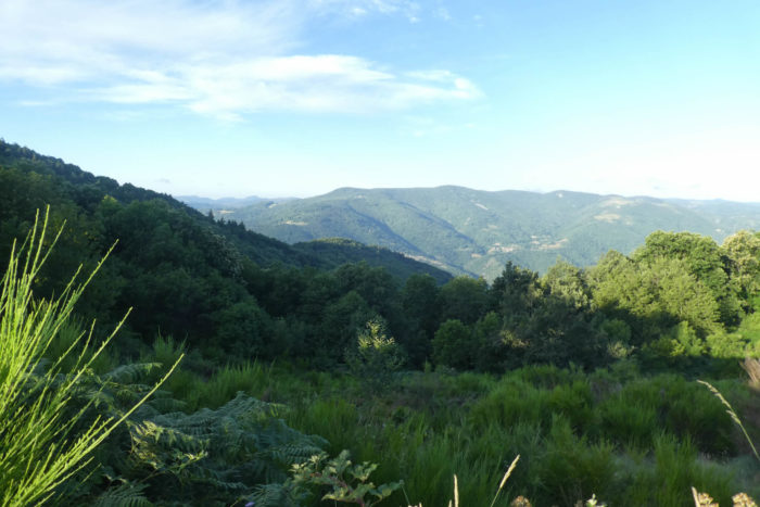
| Even further below, the path leaves the protective shade of the trees and opens onto steppes of clearings, vast, open spaces where nature seems to breathe more freely. The landscape spreads out before you, offering a breathtaking view of a vast amphitheater of forests unfolding on the horizon, an interwoven tapestry of greens, browns, shadows, and lights, a living canvas shifting before your eyes. |
 |
 |
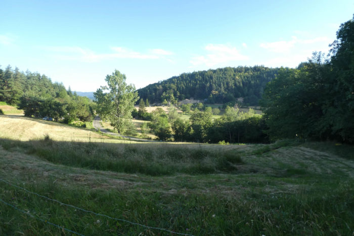
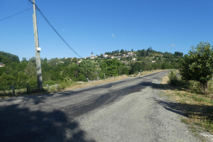
| Emerging from the woods, you’ll have a good idea of what awaits you the next day. At the bottom of the valley, the village of Les Nonières awaits, nestled at the heart of the hollow like a well-kept secret. St Agrève lies beyond the hill. To reach it, you’ll need to tackle the formidable hill overlooking Les Nonières, an ascent reminiscent of the perseverance of travelers of old. Up above, you can already spot the wind turbines swaying in the breeze, their blades slowly turning like modern sentinels watching over this land. A promise of challenges yet to come, but also, of course, a bit of pleasure. |
 |
 |
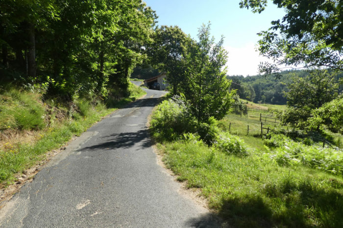
| The path then begins descending through meadows, crossing open spaces where the view unfolds magnificently. It leads to a small paved road, meandering gently along the woods, shaded by tall trees. |
 |
 |
| Though the slope is less steep, it remains steady on this paved road that winds through wide bends, alternating between lush meadows and dense woodlands. At every turn, the scenery changes, and nature offers a new tableau, sometimes peaceful, sometimes wilder. |
 |
 |
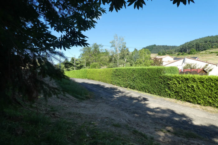
| As the road nears the village, the pace of the walk slows, becoming more predictable. Below, you can spot the departmental road also descending towards the village. You’ll remember that this same road is what you would have followed if you’d missed the forest bifurcation earlier. Both ways merge towards the same destination. |
 |
 |
| Finally, the road reaches the base of the descent, where the stone houses of Leyrol stand in solitude on the edge of the woods. They seem to merge with the landscape, solid and ancient, silent witnesses to centuries gone by. |
 |
 |
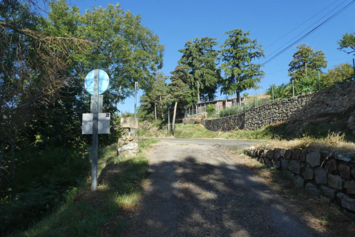
| Soon after, the small country road merges with the departmental road, bringing you to the outskirts of the village. |
 |
 |
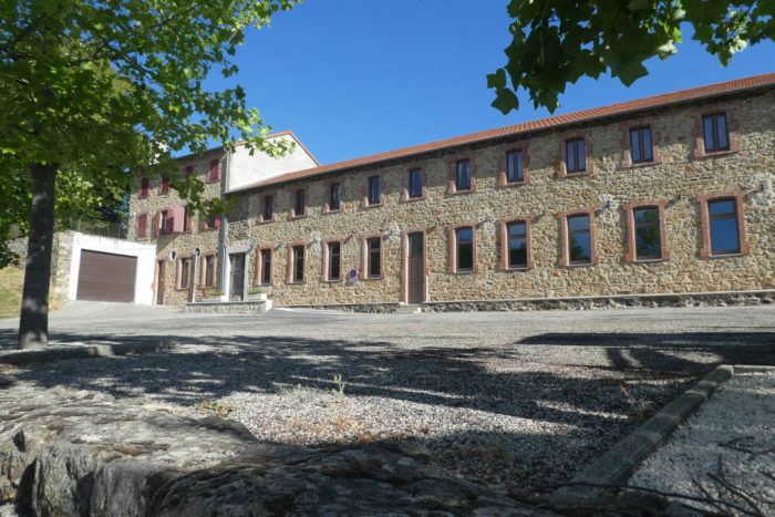
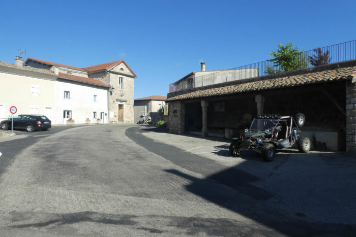
| The village then reveals itself in its simplicity, a small hamlet of 200 souls, both peaceful and welcoming. There are options to eat and even to stay overnight, though accommodations are limited, with just one lodging available. Some pilgrims choose to continue their journey to St Agrève, about fifteen kilometers further, seeking more amenities. It’s worth noting that along this alternative route of the Camino de Santiago, accommodations are rare, as are travelers daring enough to venture here, unlike the Via Podiensis. However, you’ll encounter hikers from the GR420, who also make a stop here, adding a bit more life to this isolated village. |
 |
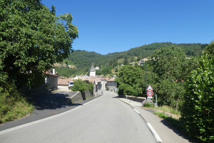 |
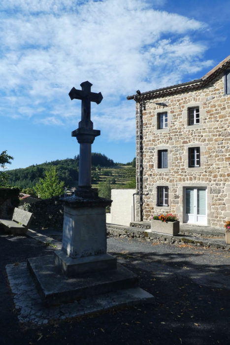
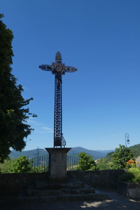
| Here, in this village, Protestants destroyed the old church, a 19th-century building. Yet the new church that stands in its place is a somber and contemplative site, where every corner invites prayer. An imposing iron cross rises toward the sky, nearly touching the clear blue, a symbol of faith that transcends the ages. |
 |
 |
Official accommodations on the Via Adresca
- Auberge L’École, St Julien Labrousse; 04 75 29 17 32/06 77 38 47 47 75 61 72 13/06 11 95 35 76; Guestroom, dinner, breakfast
- L’Art des Chemins, Les Nonières; 04 75 30 34 07; Guestroom, dinner, breakfast
- Dépannage, Les Nonières; 06 62 25 51 32; Gîte, dinner, breakfast
Pilgrim hospitality/Accueils jacquaires (see introduction)
Along the Via Adresca, accommodation options are almost always limited. You’re not walking through the touristy South of Ardèche. Lodging is scarce, even on Airbnb, where listings are often unavailable. This list includes only accommodations located directly on the route or within 1 km of the route. The guide published by the Friends of Compostela, however, lists all available lodging options, as well as bars, restaurants, and bakeries along the route, even those several kilometers away. You can find both food and lodging in these two villages. However, accommodations here are minimal, and you’ll often need to continue all the way to St Agrève to find something, and that’s quite far. Make sure to book ahead at all costs.
Feel free to add comments. This is often how you move up the Google hierarchy, and how more pilgrims will have access to the site.
|
 |
Next stage : Stage 15: From Les Nonières to St Agrève |
|
 |
Back to menu |