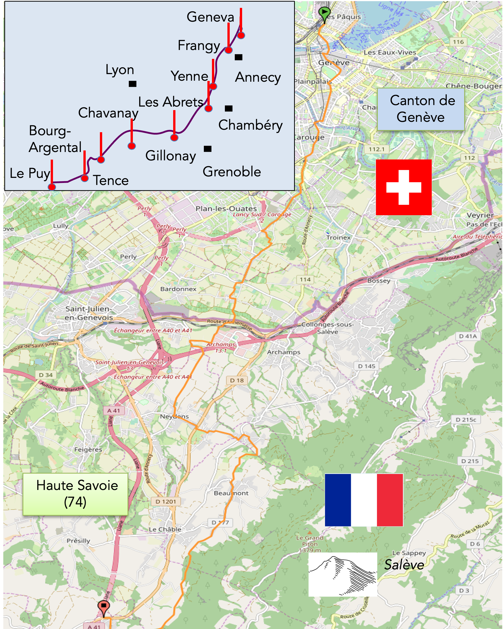
From Lake Geneva to the foothills of the Salève Mountain
DIDIER HEUMANN, ANDREAS PAPASAVVAS
We divided the course into several sections to make it easier to see. For each section, the maps show the course, the slopes found on the course, and the state of the route (paved or dirt roads). The courses were drawn on the « Wikilocs » platform. Today, it is no longer necessary to walk around with detailed maps in your pocket or bag. If you have a mobile phone or tablet, you can easily follow routes live.
For this stage, here is the link:
https://fr.wikiloc.com/itineraires-randonnee/de-geneve-gare-au-col-du-mont-sion-par-la-via-gebennensis-33318901
| Not every pilgrim feels comfortable using GPS devices or navigating on a phone, especially since many sections still lack reliable internet. To make your journey easier, a book dedicated to the Via Gebennensis through Haute-Loire is available on Amazon. More than just a practical guide, it leads you step by step, kilometre after kilometre, giving you everything you need for smooth planning with no unpleasant surprises. Beyond its useful tips, it also conveys the route’s enchanting atmosphere, capturing the landscape’s beauty, the majesty of the trees and the spiritual essence of the trek. Only the pictures are missing; everything else is there to transport you.
We’ve also published a second book that, with slightly fewer details but all the essential information, outlines two possible routes from Geneva to Le Puy-en-Velay. You can choose either the Via Gebennensis, which crosses Haute-Loire, or the Gillonnay variant (Via Adresca), which branches off at La Côte-Saint-André to follow a route through Ardèche. The choice of the route is yours. |
 |
 |
If you only want to consult lodging of the stage, go directly to the bottom of the page.
Geneva, this cosmopolitan metropolis nestled by Lake Geneva, becomes an essential crossroads for countless pilgrims from Germany, Austria, and Eastern Europe. It is also the starting point for many Swiss pilgrims heading towards distant Galicia. The main route, taken by the vast majority of pilgrims, is the Via Gebennensis, connecting Geneva to Le Puy-en-Velay. Unlike the Camino de Santiago in France, where traversing major cities is rare, Switzerland’s small size often necessitates passing through urban centers. Geneva, nestled between Lake Geneva and the Salève mountains, is no exception.
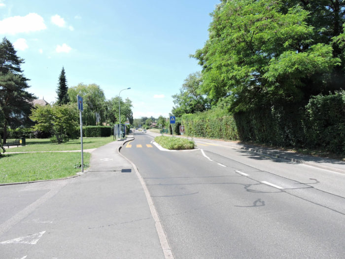
To leave Geneva, one must traverse the entire city, notably Carouge, a picturesque town that adds to the charm of this crossing. While Geneva is renowned for its banks, it also hides a small but beautiful old town. Once outside the city limits, the French-Swiss border is a short distance away. The route then transforms into a bucolic hike under the foothills of the Salève Mountain, offering a striking contrast with the urban hustle. You will be struck by the quick transition from city to countryside, despite the development of satellite villages around Geneva. In July 2016, the milestone of 100,000 foreign nationals holding a cross-border permit was reached for the first time in the canton of Geneva, according to the Cantonal Statistical Office. Most of these cross-border workers live in Haute-Savoie (74%), with the others in neighboring departments. In the villages you will pass through, the majority of residents, whether French or Swiss living in Haute-Savoie, work in Geneva.
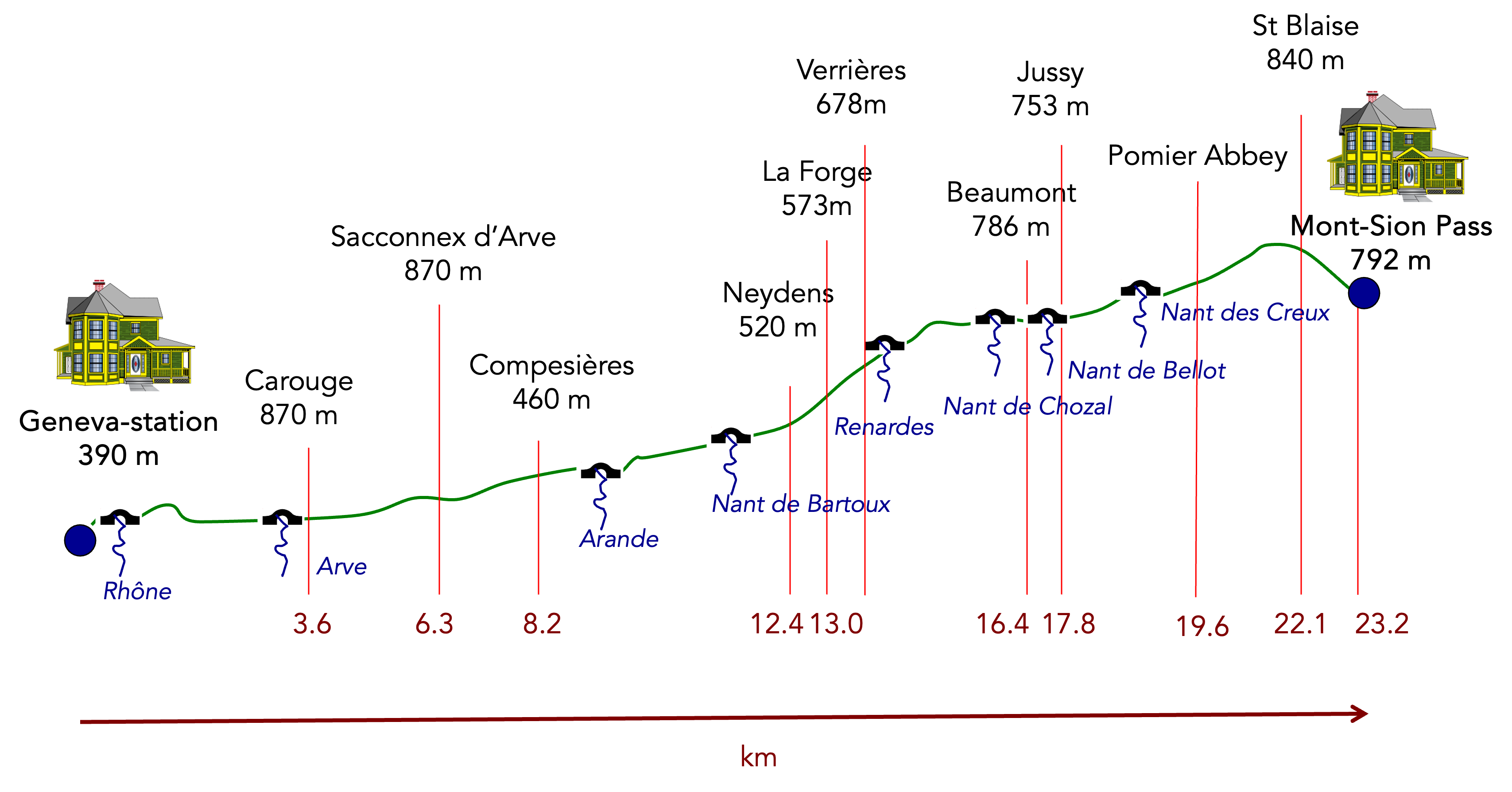
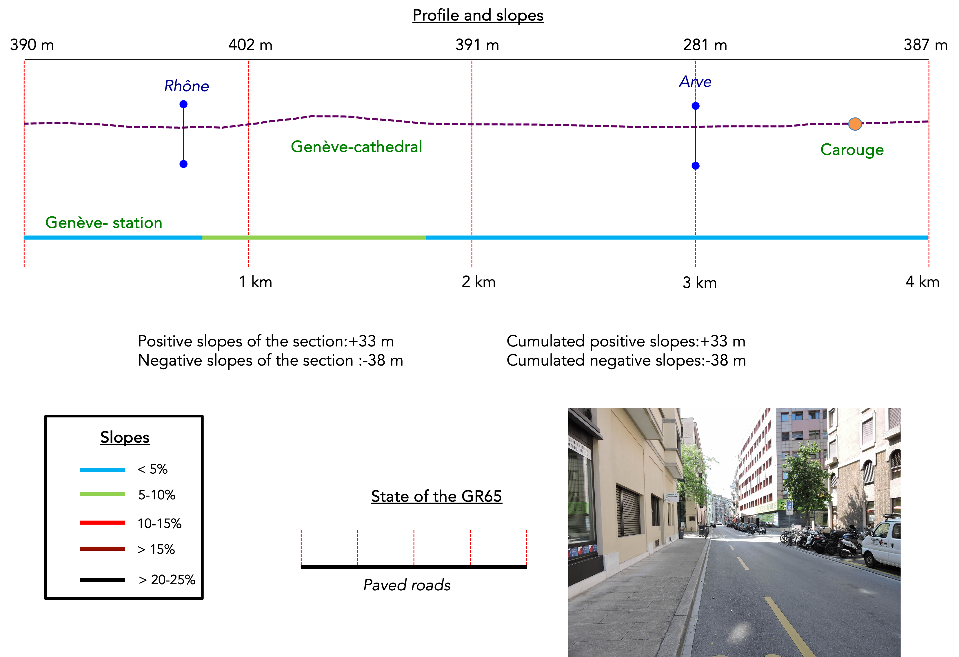
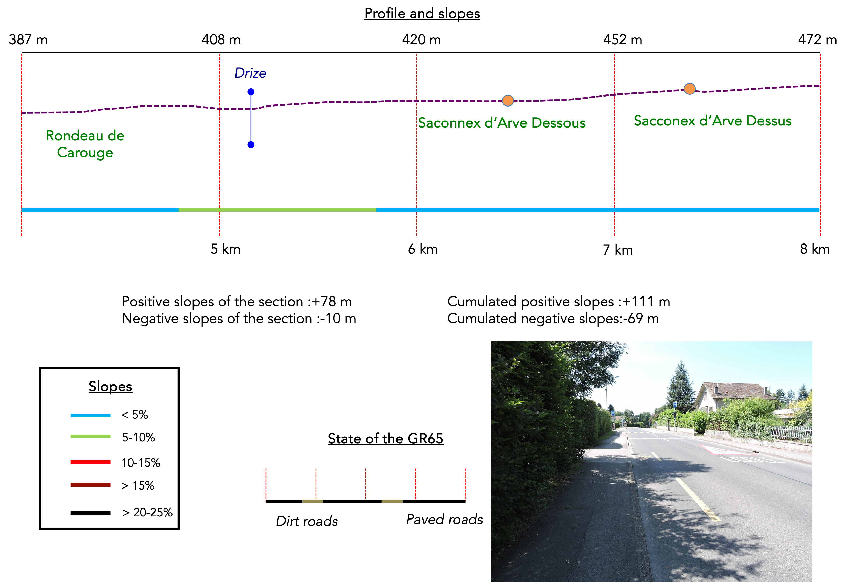
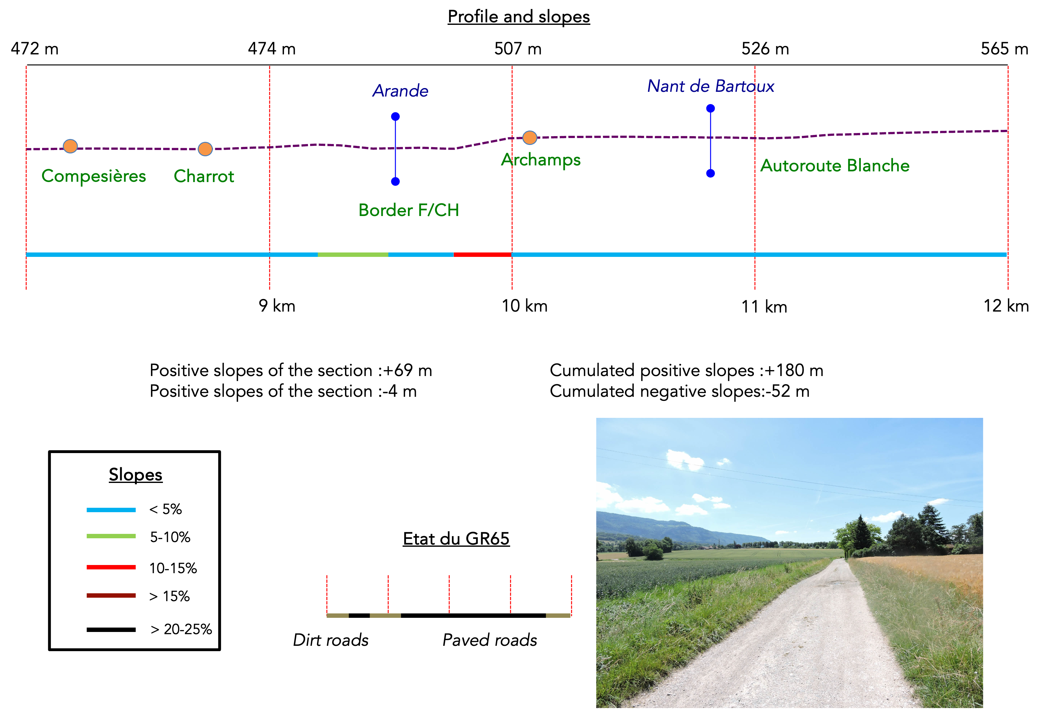
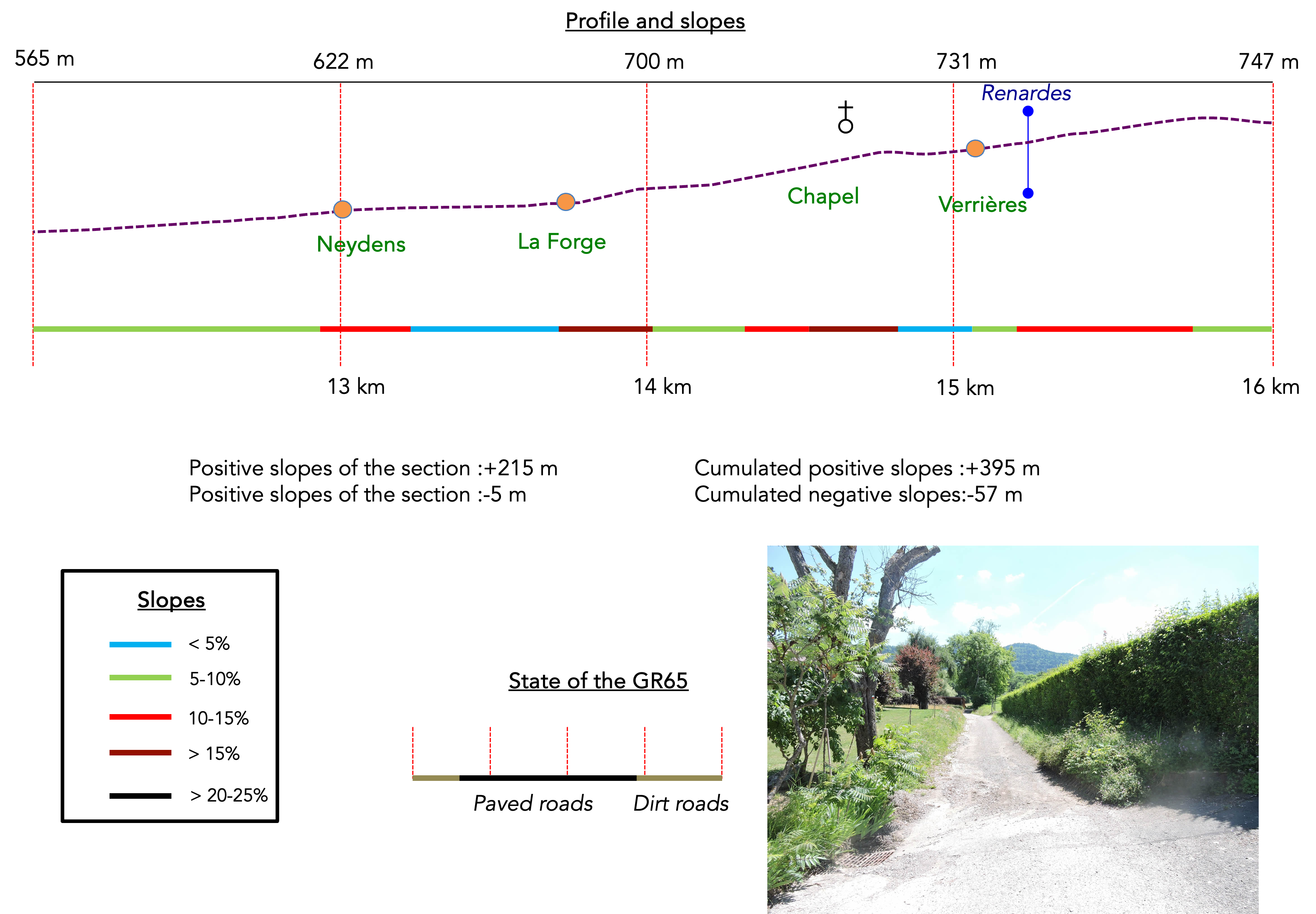
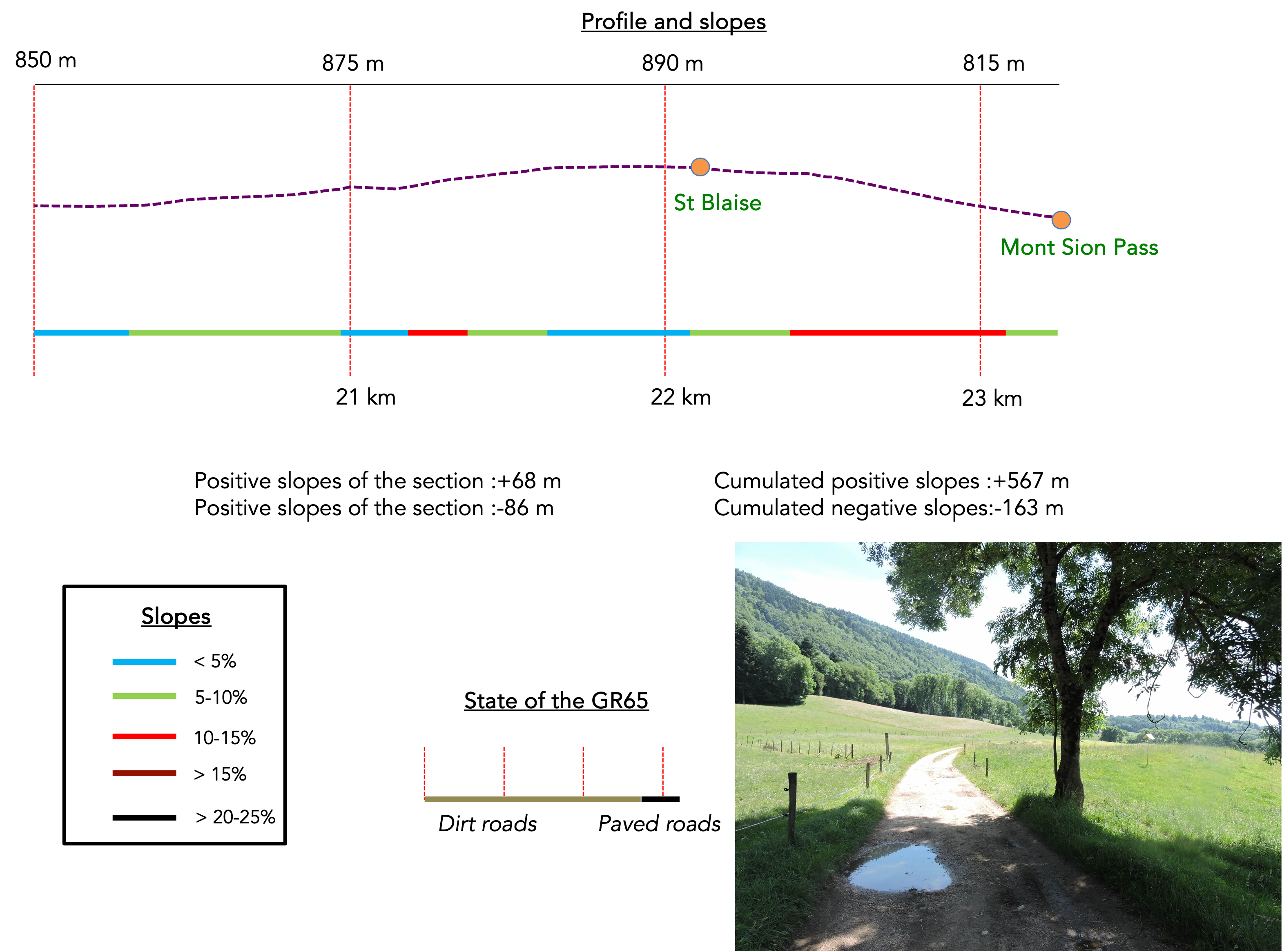
Difficulty level: The elevation changes on this stage (+567 meters / -163 meters) are not extremely high, considering that a low-altitude pass is reached. Until the French-Swiss border, after Compesières, the path is relatively flat or gently ascending. But once the border is crossed, the route climbs almost continuously up to the Mont Sion pass. The slopes, though never too steep, not exceeding a 15% gradient, still offer some challenging ramps to overcome, especially around Verrières.
State of the GR65: During this stage, a significant portion of the route takes place on paved roads. This is unavoidable, as you are walking for a long time in or near a major city:
- Paved roads: 15.3 km
- Dirt roads : 7.9 km
Sometimes, for reasons of logistics or housing possibilities, these stages mix routes operated on different days, having passed several times on these routes. From then on, the skies, the rain, or the seasons can vary. But, generally this is not the case, and in fact this does not change the description of the course.
It is very difficult to specify with certainty the incline of the slopes, whatever the system you use.
For those seeking « true elevations » and enthusiasts of genuine altimetric challenges, carefully review the information on mileage at the beginning of the guide.

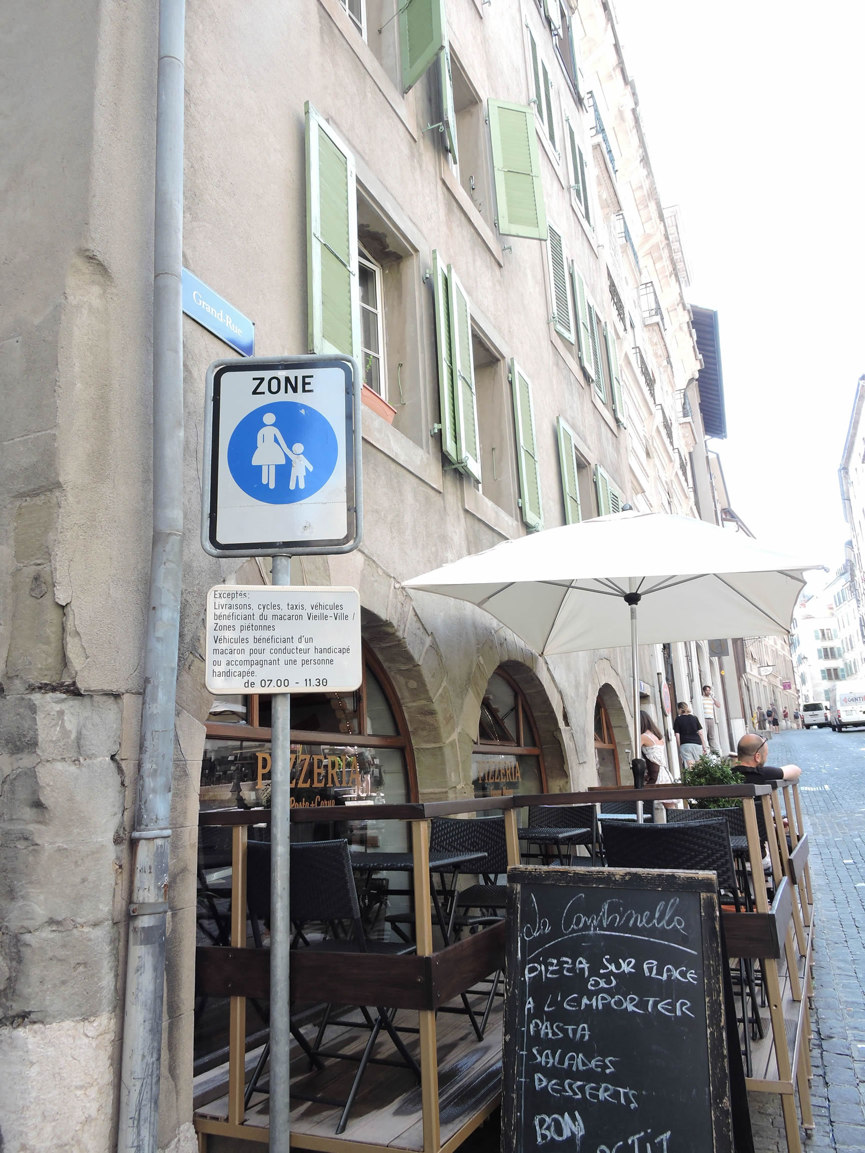
Section 1: The crossing of Geneva and Carouge
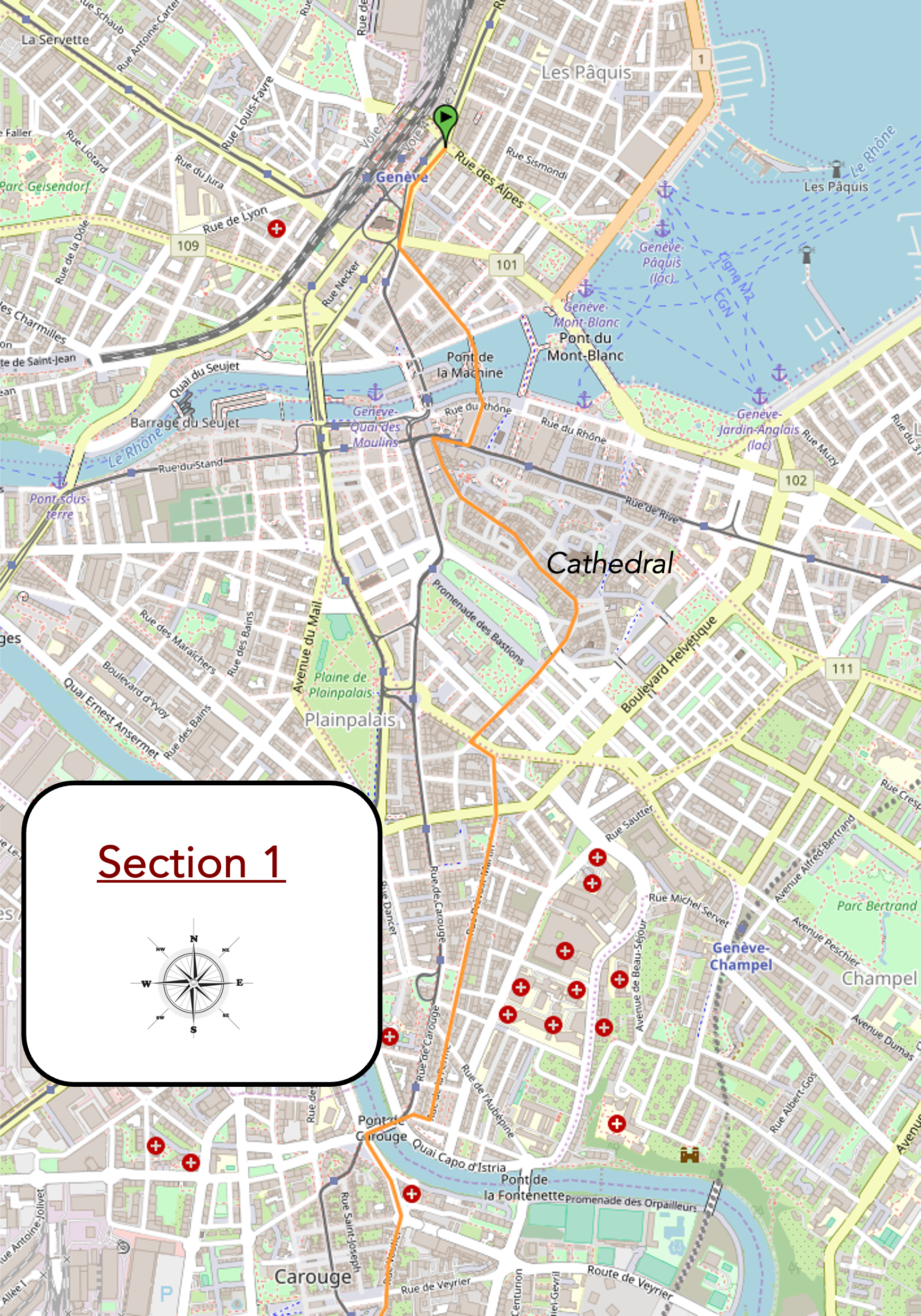
Overview of the route’s challenges: flat, in the city.
|
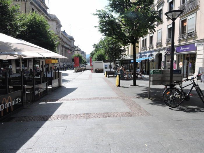
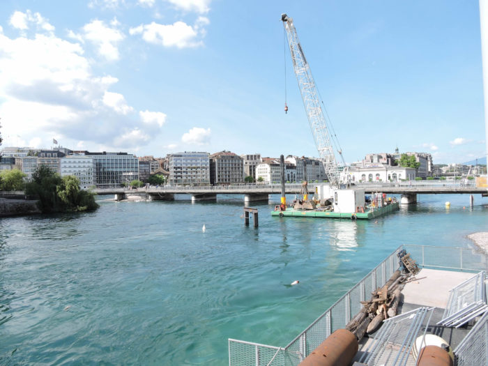
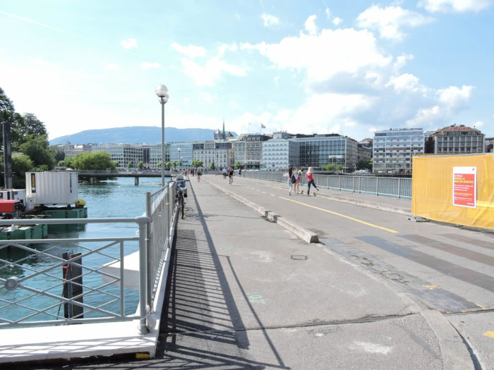
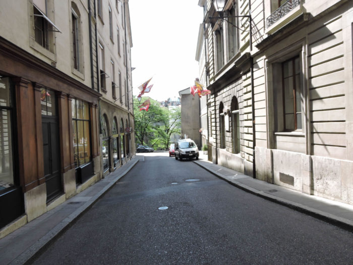
Starting from the large Place de Cornavin, near the station, the true cosmopolitan crossroads of Geneva, it is recommended to begin the descent from the station down Rue du Mont-Blanc towards Lake Geneva until reaching the Pont du Mont-Blanc and the Quai des Bergues. This majestic bridge, spanning the harbor, harmoniously connects the two shores of the city. Throughout the day, it becomes the city’s backbone, sometimes bustling with the incessant flow of vehicles, sometimes bathed in the changing light of the lake.
|
 |
 |
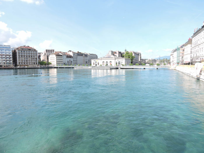
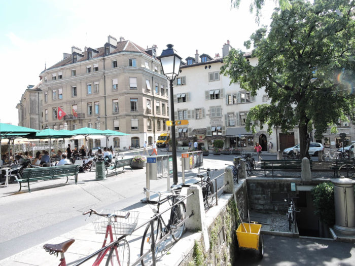
| To cross the Rhône, a quieter alternative is available along the Quai des Bergues, where the Ponts des Bergues and de la Machine stand as historical guardians. Geneva dreams today of an ideal harbor, redeveloped to return its quays to strollers, but financial challenges remain a constant obstacle to these grand ambitions. |
 |
 |
| To the right of the Pont de la Machine, extends the peaceful Quai de l’Île, where another historical bridge crosses the Rhône. This strategic location, witness to the first human civilizations, was initially a natural sandbank dividing the river. Cited by Julius Caesar, this area was marked by the tumult of history. Destroyed and rebuilt many times, this bridge embodies resilience and permanence through the ages. |
 |
 |
| Crossing the Pont des Bergues, you enter the left bank, where the shopping streets, known as the Rues Basses, welcome you in a chic and lively atmosphere. Let yourself be guided towards the Old Town and its majestic St. Peter’s Cathedral, timeless symbols of Geneva’s history and spirituality. |
 |
 |
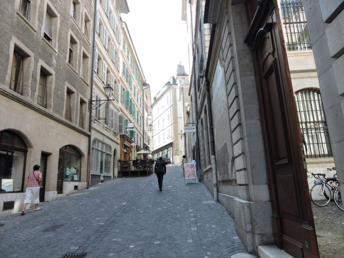
| In the shadow of this ancient edifice, you dive into the Old Town, a true preserved gem of Geneva. Nestled on a modest hill, this historic district houses not only the cathedral but also the town hall and a labyrinth of cobbled streets. Every step resonates with the echo of the great thinkers and reformers who have marked this city over the centuries, a palpable testament to its deep identity and preserved serenity. Strolling through these picturesque settings is navigating between past and present, capturing the very essence of a city where natural beauty harmoniously blends with historical imprints. |
 |
 |
The route winds in front of the Old Arsenal, in the shadow of the majestic Town Hall. Under the centuries-old arcades, at the foot of frescoes depicting Geneva from Julius Caesar to the Reformation, rest five ancestral cannons, silent guardians of the ancient ramparts. Today, this historic site houses the precious archives of the state, a silent witness to bygone eras.

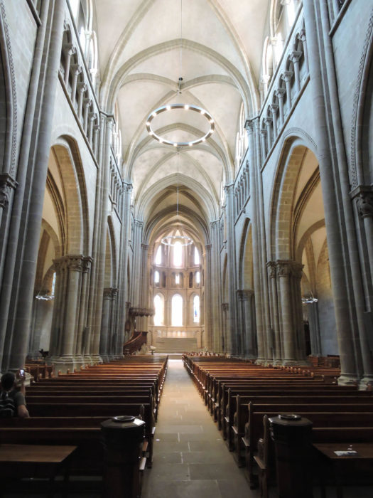
| Beyond, overlooking the city, the church has stood proudly since the 4th century, dedicated to S. Peter. The current cathedral, built between the 12th and 13th centuries, is a masterpiece of Romanesque and Gothic architecture. Ravaged by wars and fires over the centuries, it has resisted and transformed, witnessing the historical upheavals that have marked Geneva. After the abolition of the mass in August 1535, it became a Protestant temple, still retaining the name of St Peter’s Temple today, a symbol of resilience and spiritual continuity. After the separation of Church and State in 1907, it was ceded to the Protestant Church of Geneva while continuing to host major civil ceremonies, including the swearing-in of the republican government. Under the venerable foundations of the cathedral lies the well-kept secret of the paleo-Christian church, a precious vestige of ancient faith, witnessing spiritual continuity through the ages. |
 |
 |
 |
 |
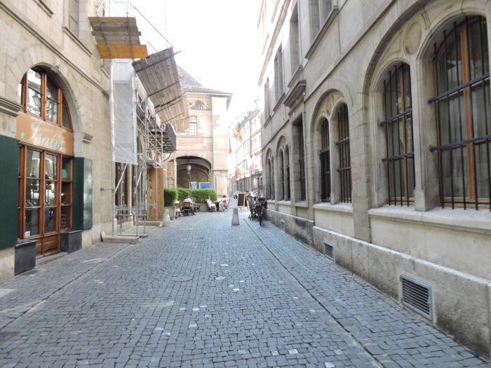
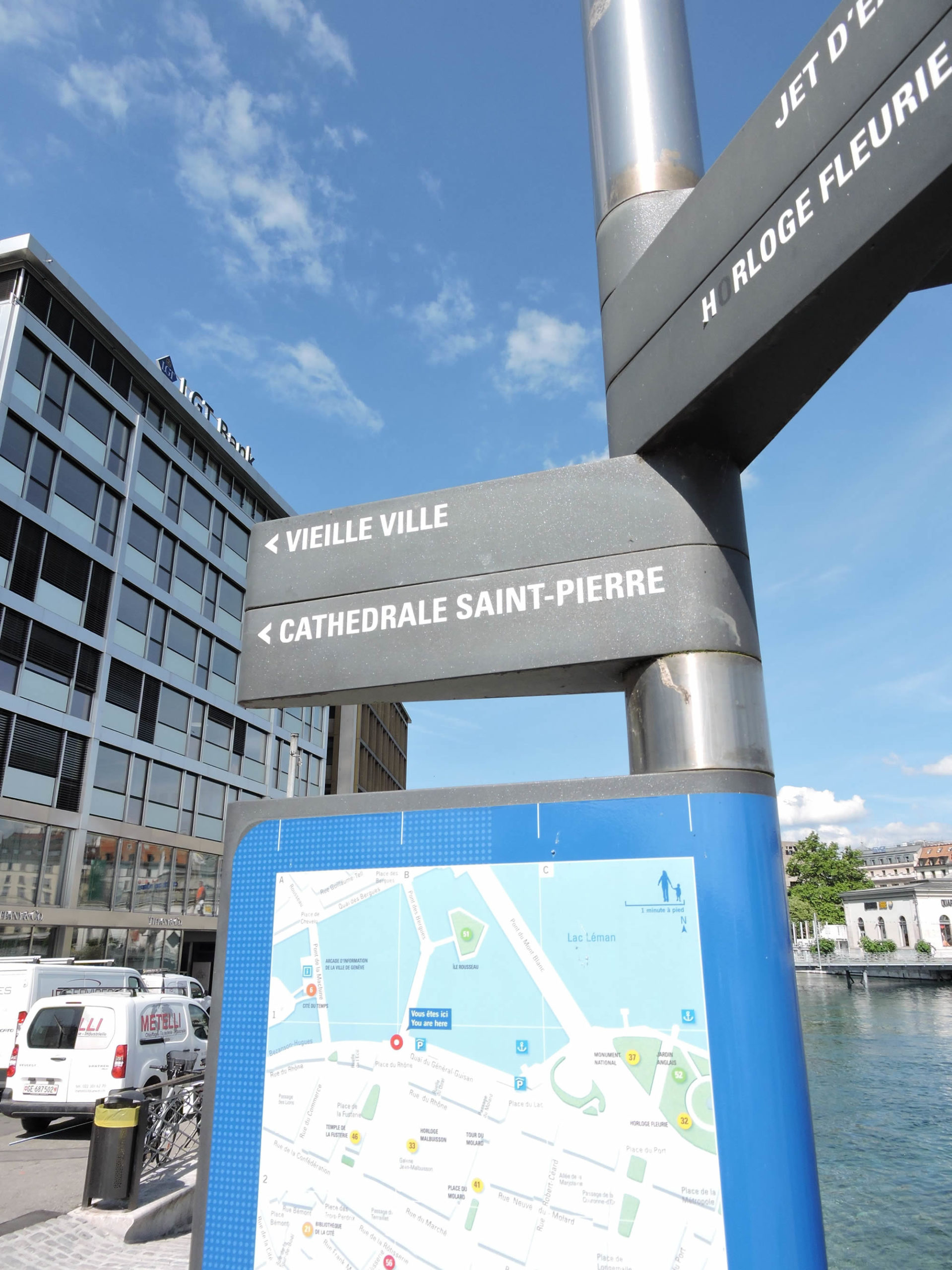
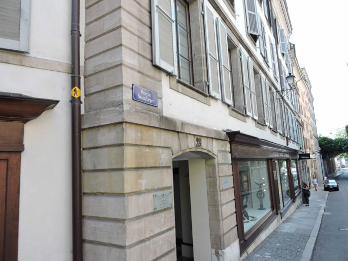
| From this spiritual stronghold, the route advances towards the Place du Bourg-de-Four, at the edge of the Old Town, where the vibrant heart of the medieval market once beat. Here, the benevolent trace of the Via Jacobi 4 is revealed, marked by the deep blue that guides it to the confines of Switzerland, where it becomes the GR65. These signs, modest blue sentinels, are your assured guides through the urban meanders, preserving the timeless magic of this pilgrimage route. |
 |
 |
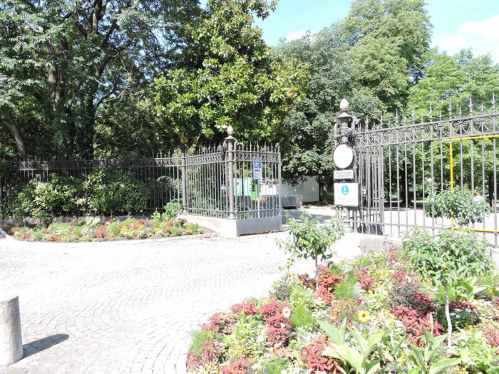
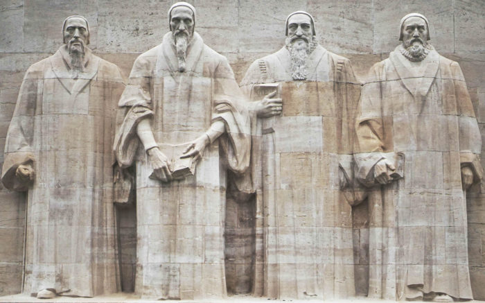
| The Via Jacobi then follows Rue de Saint-Léger and gracefully skirts the Bastions Park, a true green jewel in the heart of the city. Entering this haven of peace, one discovers with wonder the majestic Wall of the Reformers, an imposing monument that eloquently recounts the history of the Reformation in Geneva and its influence worldwide. Inaugurated in 1909 to celebrate the 400th anniversary of John Calvin, this impressive wall features the emblematic figures of Guillaume Farel, John Calvin, Theodore Beza, and John Knox, dressed in the noble Geneva robe, like apostles of Protestantism radiating wisdom and determination. |
 |
 |
 |
 |
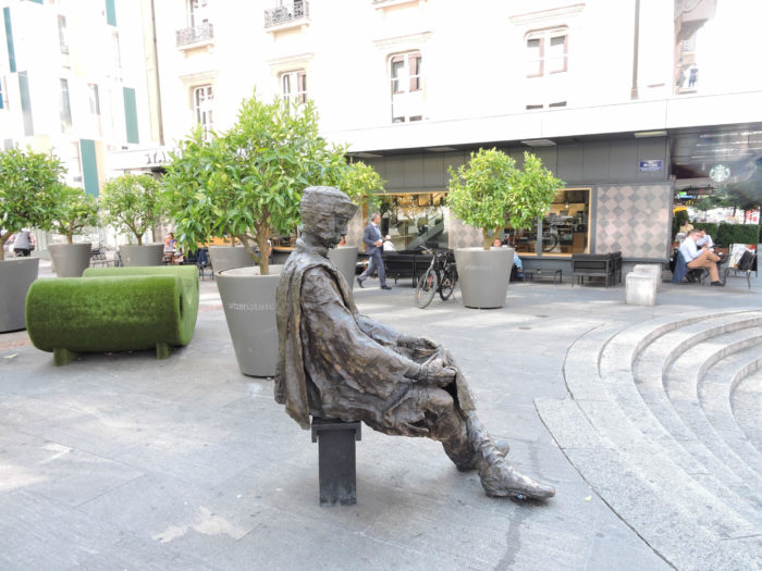
| Rue Saint-Léger, after revealing its secrets, opens onto the Boulevard des Philosophes. This place, imbued with an intellectual atmosphere, reminds us that Jean-Jacques Rousseau, the illustrious philosopher and writer, was born here, in the Old Town, in a Calvinist family of French origin. His childhood was lulled by the ticking of clocks in his father’s workshop, a watchmaker. Before leaving these lands, Rousseau was undoubtedly influenced by the progressive ideas of Geneva, a hotbed of dissenting thought in the 18th century, which inspired his monumental work, « The Social Contract ». |
 |
 |
| Here, in the heart of Geneva, it is easy to get lost in the maze of historic streets. The boulevard must be crossed with caution, and one must follow the Via Jacobi signs by veering slightly left to reach Rue Prévost-Martin, a peaceful and straight artery. |
 |
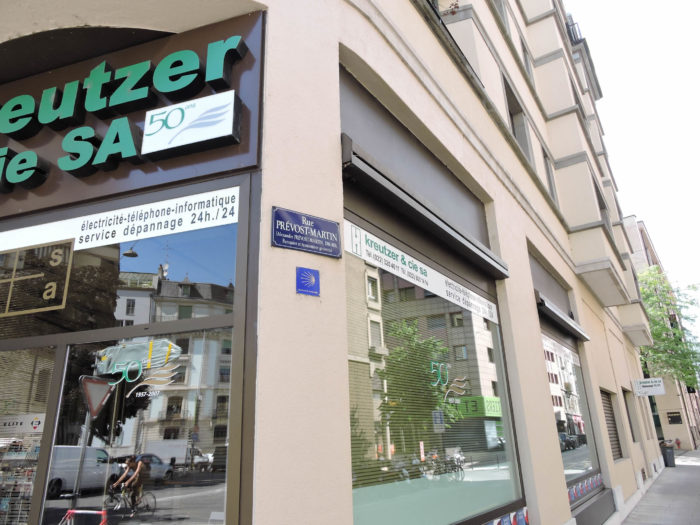 |
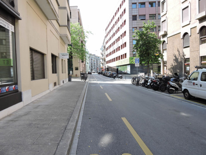
Rue Prévost-Martin, serene and lightly trafficked, intersects the Boulevard du Pont d’Arve. Walking along these streets, one feels the tranquility and harmony emanating from Geneva’s urban landscapes, a subtle blend of tradition and modernity, where every corner tells a story, every building whispers ancient legends.
| These large boulevards, imposing and silent, reveal little of their secrets to those who are unaware of the country’s history. But it doesn’t matter, as they serve as a bridge between vibrant Geneva and charming Carouge. |
 |
 |
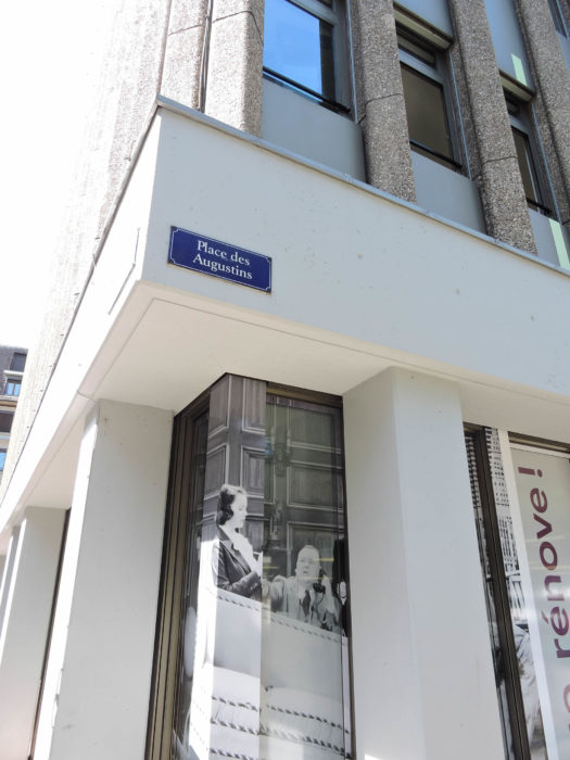
| The Via Jacobi follows Rue Prévost-Martin to Place des Augustins, where it then engages on Rue de la Ferme, a picturesque road lined with buildings with old façades. |
 |
 |
| At the end of Rue de la Ferme, it turns right for a few moments onto Rue de la Colline, a street with a name evoking hilly landscapes, although there is no trace of a hill here. |
 |
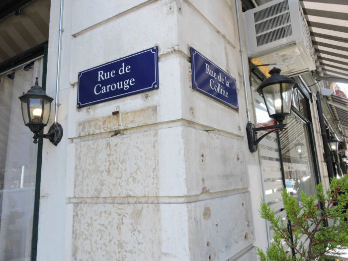 |
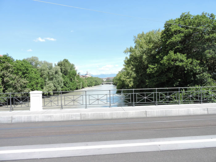
| The tumultuous and muddy Arve is just a stone’s throw away. Descending majestically from the Mont Blanc massif in France, it flows into the deep blue Rhône at the city’s exit, heading west. Crossing the bridge, you find yourself in the commune of Carouge, a picturesque enclave of 22,000 inhabitants. Carouge is particularly known for its Vieux Carouge, an enchanting district with lively squares, welcoming terraces, and picturesque houses that you will enjoy crossing. |
 |
 |
 |
 |
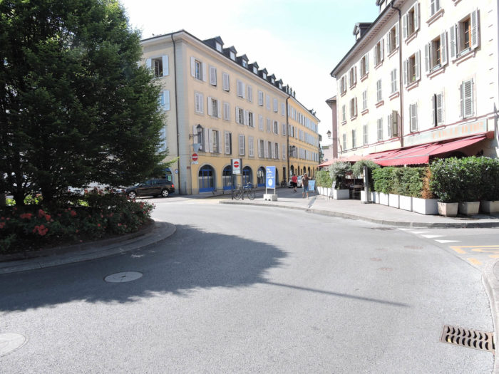
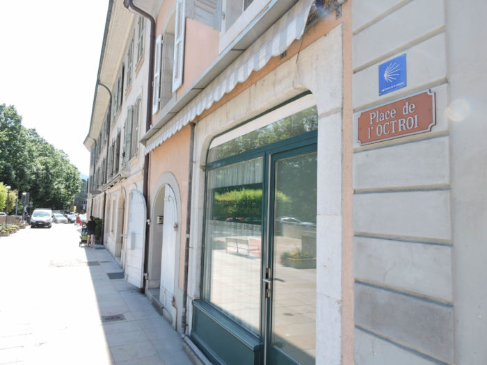
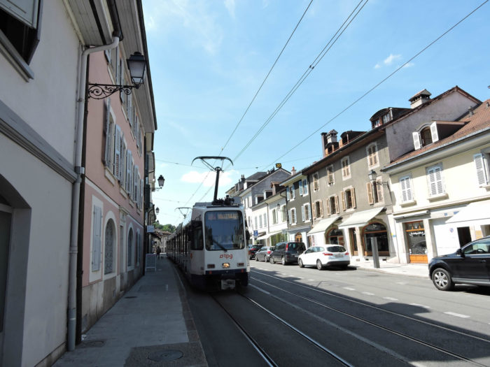
| On the other side of the Arve stands the beautiful Place de l’Octroi, the arrival point of the famous tram line 18, which winds through the old quarters of Carouge, adding a touch of nostalgia to this historic town.
The rivalry between Geneva and Carouge is rooted in history. In the 18th century, Carouge was entirely rebuilt to rival Geneva, under the direction of Italian architects who designed a city with grid lines, imbued with Mediterranean charm. The inhabitants of Carouge, proud of their city, will not fail to extol its virtues, asserting with a touch of chauvinism the quality of life and the charm of strolling through its streets. |
 |
 |
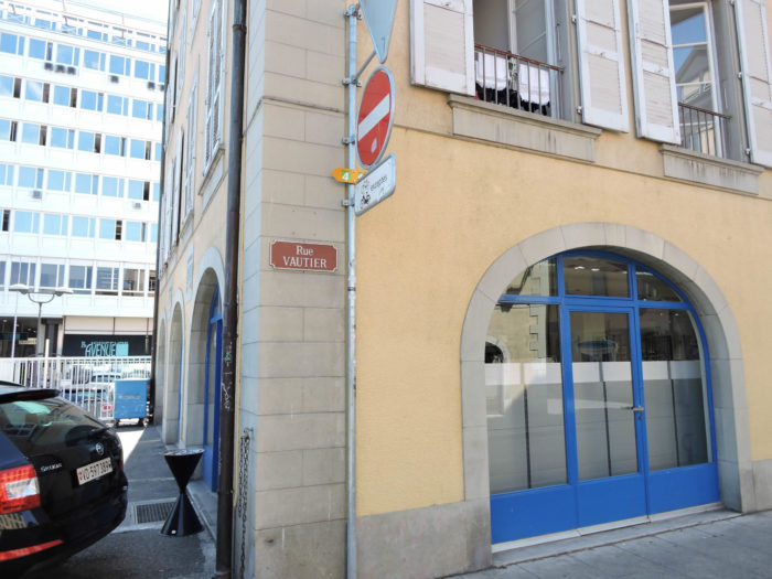
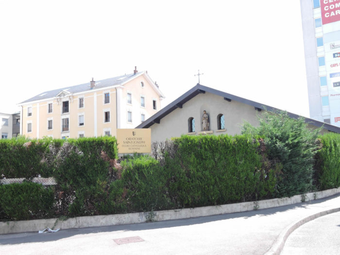
| The Via Jacobi does not immediately follow the tramway. It makes a graceful detour around the square, skirting the Catholic Oratory of St. Joseph before slipping into Rue Vautier. This street, resembling Ariadne’s thread, guides the traveler through the urban landscape’s meanders. Architectural diversity and bucolic tranquility marry here in serene harmony. |
 |
 |
| Rue Vautier borders the Place du Marché. Carouge, a town with many faces, has no single center but several hearts beating in different points. From this place and up Rue Ancienne, one truly perceives the pulse of this old district, where history and modernity meet in an incessant ballet. |
 |
 |
| At the end of Rue Vautier, the route extends towards Rue Ancienne. This passage is an invitation to go back in time, each cobblestone telling a story, each façade whispering secrets of yesteryear. |
 |
 |
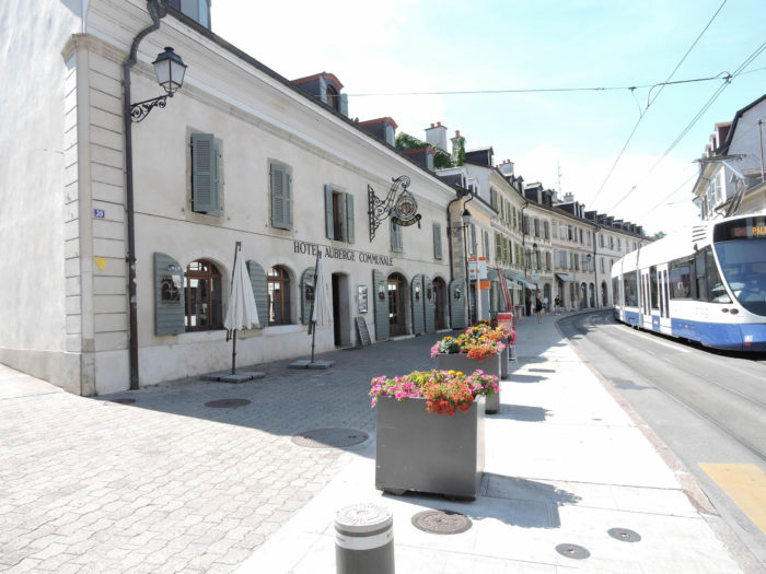
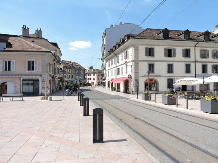
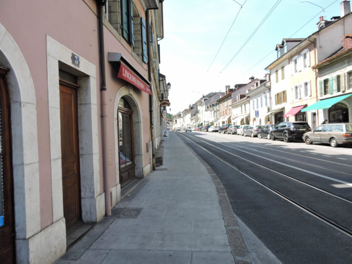
| It is undoubtedly the most beautiful street in the region, where the tram seems to float among the beautiful homes, quaint shops, lively cafés, and welcoming restaurants. The charm of this human-scale street lies in the warm and friendly atmosphere that reigns there. It is easy to understand the love and enthusiasm that the people of Carouge have for their city, so enchanting are the places. |
 |
 |
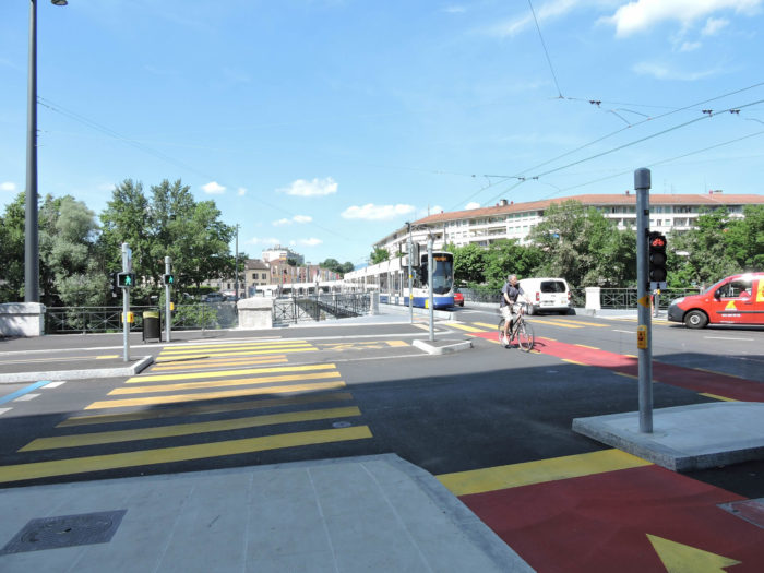
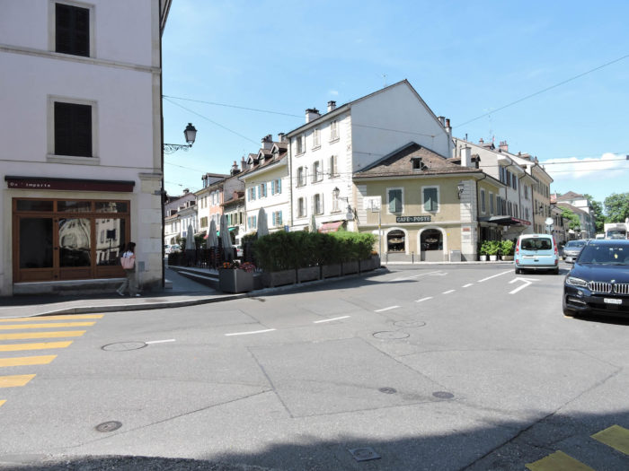
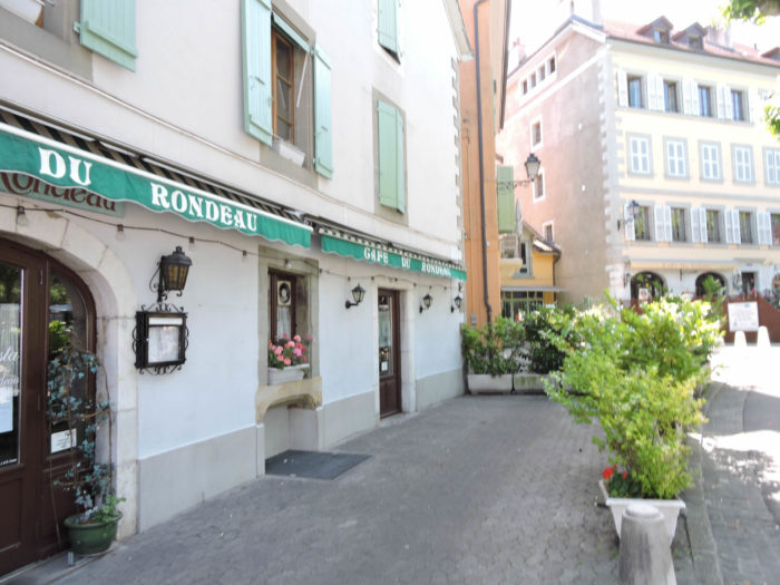
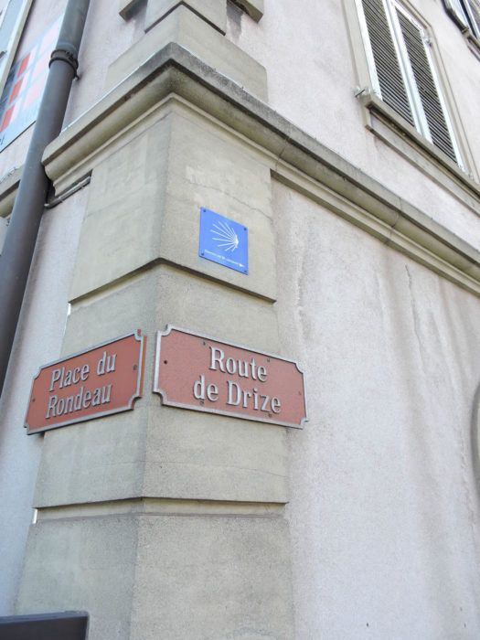
| At the end of Rue Ancienne, one reaches Place du Rondeau. It is here that the Via Jacobi definitively leaves the comfort of the city to embrace the tranquility of the suburbs. It took nearly four kilometers to cross the city from the lake. By strolling, one can easily spend nearly two hours, savoring every moment of this walk. With the tram, the journey would have been faster, but one would have missed the poetry of the detours. |
 |
 |
Section 2: In the Geneva countryside, or at least shat remains of it

Overview of the route’s challenges: The route is without difficulty.
|
In the serene and verdant setting of Geneva, where modernity and nature coexist in surprising harmony, the Via Jacobi meanders peacefully, leaving behind the urban bustle to soon lose itself in more bucolic surroundings. At Place du Rondeau, the Via Jacobi turns onto the Route de Drize, passing by the majestic park of the Battelle Research Institute. Once a place of genetic exploration, this area has now transformed, focusing on innovation in information technology and management. Geneva, far from being a conventional industrial city, asserts itself as a dynamic hub dedicated to both national and international services.
|
 |
 |
| The road winds through a discreet suburb, a rare haven of tranquility in Geneva, where every parcel of space is precious and meticulously preserved. |
 |
 |
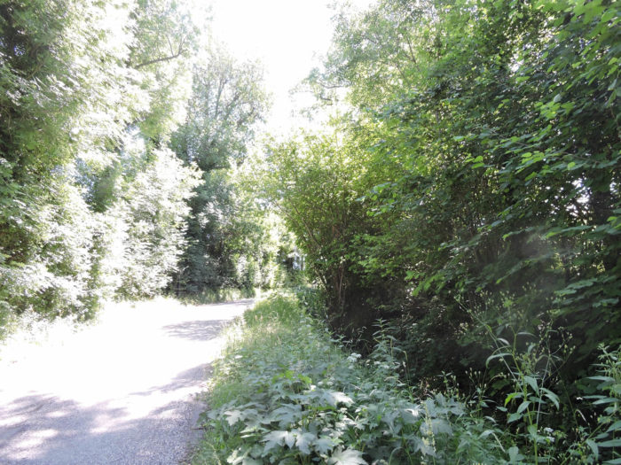
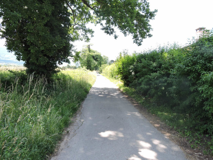
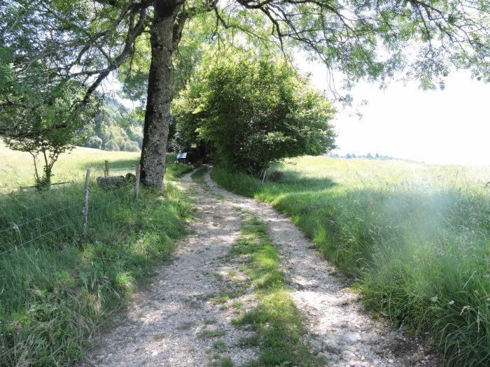
| Soon after, the Via Jacobi veers away from the noisy arteries to venture into enchanting underwood, where charming homes nestle like well-kept bird nests. |
 |
 |
| Here, the pilgrim rediscovers the joy of life, delighted to feel the beaten earth beneath their feet, the soothing murmur of trees, and the gentle prickling of small stones on the path, awakening their wandering soul. It’s their favorite universe, in a way. |
 |
 |
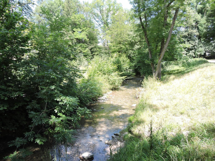
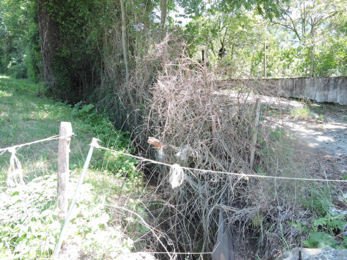
| The path, bordered by thick, discreet hedges, barely protecting the hidden opulent homes, crosses the broad Drize stream, amidst vegetation that seems to hold its breath. |
 |
 |
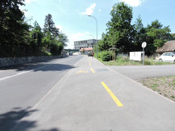
| But the pastoral scene lasts only a moment, as reality quickly takes over. The path climbs from the riverbanks through the undergrowth, soon returning to the asphalt of the road. The Via Jacobi then heads towards Saconnex d’Arve, leaving behind the fleeting rural idyll to gently climb the heights. |
 |
 |
| The road gradually slopes up through a scattered suburb, where immaculate housing estates stretch elegantly towards Saconnex d’Arve Dessous. |
 |
 |
| Here, farmers still resist the total sale of their lands, but inexorable urbanization looms, justified by the needs of a densely populated and cosmopolitan Geneva. With its 500,000 inhabitants on a restricted territory, Geneva stands out as Switzerland’s most international canton, housing a community where foreigners represent a significant part, far from the urban tumult of major European metropolises. |
 |
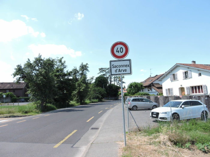 |
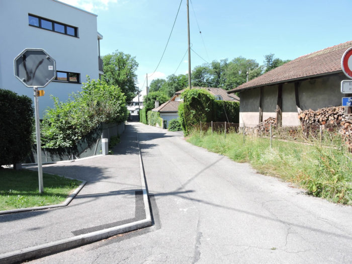
| In Saconnex d’Arve Dessous, the village exudes tranquility and cleanliness, reflecting a well-being where money, sometimes discreet luxury, cultivates a cozy and serene atmosphere, far from the hustle and bustle of the big city. |
 |
 |
| In the majestic shadow of great oaks, the Via Jacobi gracefully escapes the village, a promising path towards the Étang de Paradis (Paradise Pond). Quite a program, isn’t it? It’s like an invitation to a poetic adventure, where every step reveals a new tableau of nature, a bridge between the earthly and celestial worlds. |
 |
 |
You will never know if paradise or simply the pond exists here. At least, the Via Jacobi does not go there, and the enigmatic atmosphere dissipates as the Via Jacobi emerges from the woods and meets the asphalt again, a reminder of pragmatic reality.
| Exiting the woods, the road winds gracefully through the fields, like an emerald and yellow ribbon on the canvas of the still-preserved Geneva countryside. But yes, there is still a bit of countryside in the canton of Geneva, like an ode to serenity and simple life. |
 |
 |
| The road now leads to Saconnex d’Arve Dessus. These small villages of the Geneva countryside all seem very new, as if they were built in recent years. Which is not the case, of course! |
 |
 |
Section 3: From Switzerland to France in the countryside

Overview of the route’s challenges: The route is without difficulty.
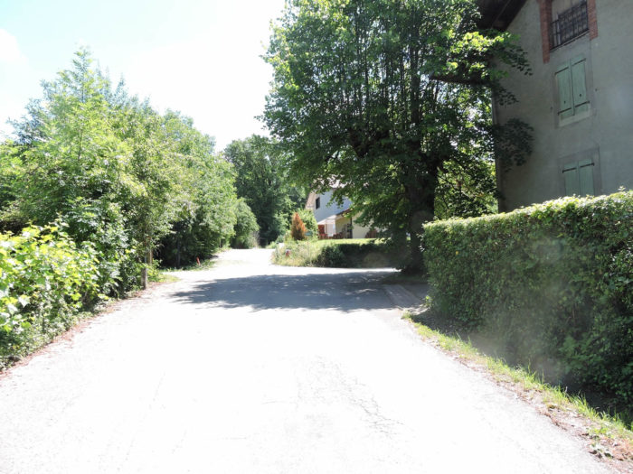
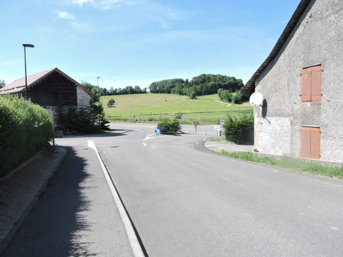
| Upon leaving the village of Saconnex, your gaze is immediately captured by the charming vision of Compesières, proudly nestled atop rolling hills of golden wheat. This place, imbued with timeless serenity, seems to tell an ancient story with every breeze caressing the stalks. Compesières is not a newcomer; its venerable existence is inscribed in time with palpable dignity. |
 |
 |
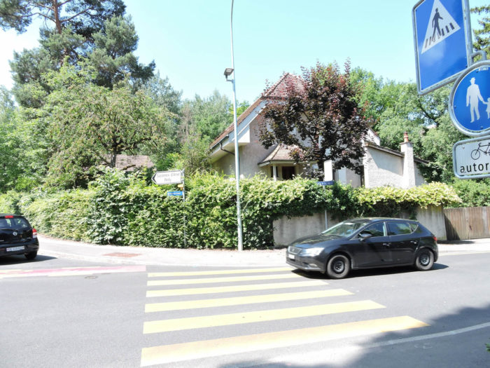
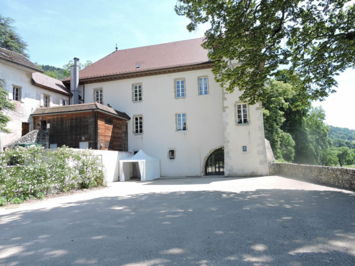
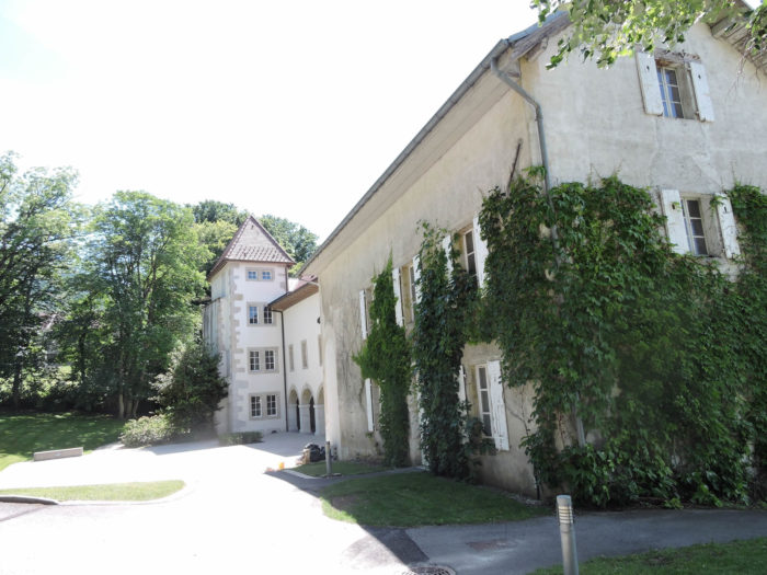
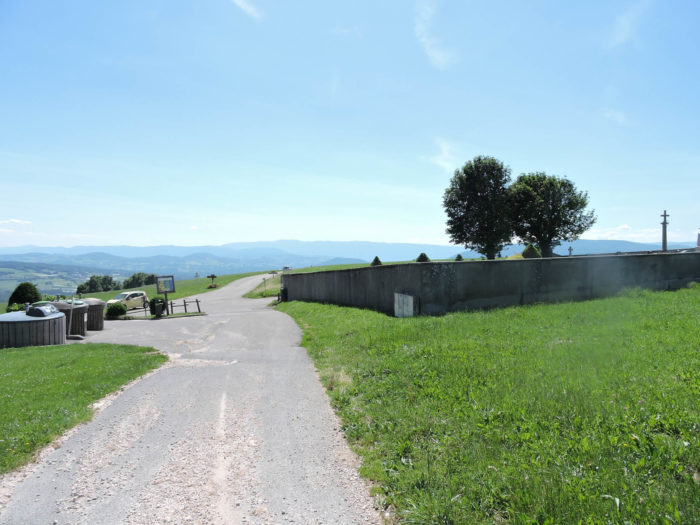
| Compesières is located just a short distance from the Franco-Swiss border. Although its population is reduced to about twenty souls, this site enjoys particular renown among Genevans. Today, it serves as the administrative, religious, and educational heart of the commune of Bardonnex. Classified as of national importance, this place still resonates with echoes of its glorious past. Archaeological excavations have uncovered the remains of a Roman settlement, suggesting that a prosperous village once thrived here. In the feudal era, the Hospitallers of Saint John of Jerusalem established a commandery here, fortifying the domain with ramparts and towers in the 17th century. This commandery later came under the authority of the Order of Malta until 1793, before becoming a saltpeter factory. Since 1822, the hamlet has reorganized around its church, the commandery, a farm, several outbuildings, and a surprisingly large cemetery, bearing witness to lives marked by history. |
 |
 |
| The Via Jacobi, named in homage to its journey through Switzerland, first stretches on a ribbon of asphalt before gently fading into beaten earth, guiding steps towards the village of Charrot. This picturesque hamlet, shared between farmers, horticulturists, and Geneva commuters, marks the definitive transition out of Greater Geneva. The hills and fields become more authentic, as if nature is slowly reclaiming its rights. |
 |
 |
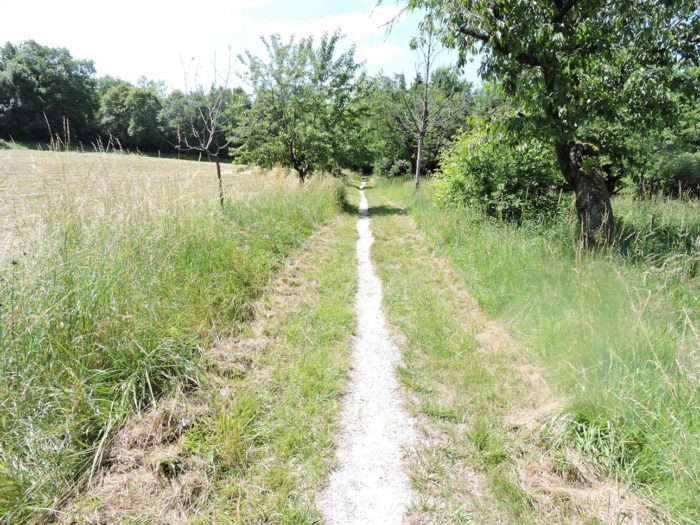
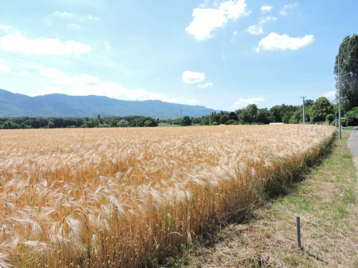
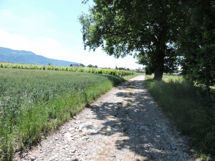
| The Via Jacobi leaves Charrot heading towards Lathoy, first crossing an asphalt road before transforming into a dirt path. Here stretches a vast plain dotted with fields, vineyards, and vegetable gardens. The sporadic presence of carefully preserved hedges brings the landscape to life, contrasting with the modern trend of erasing all vegetation on the pilgrimage paths. These hedges offer a visual respite and shelter precious biodiversity, reminding you that even in intensive agriculture, it is possible to preserve islands of wild nature. |
 |
 |
 |
 |
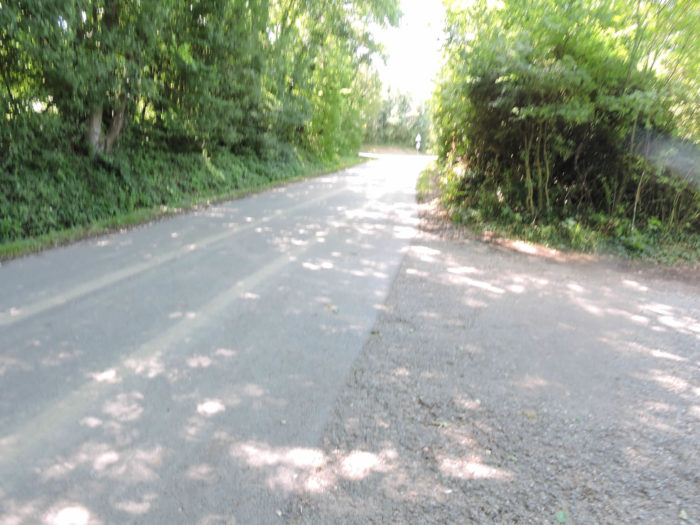
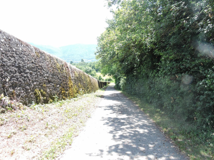
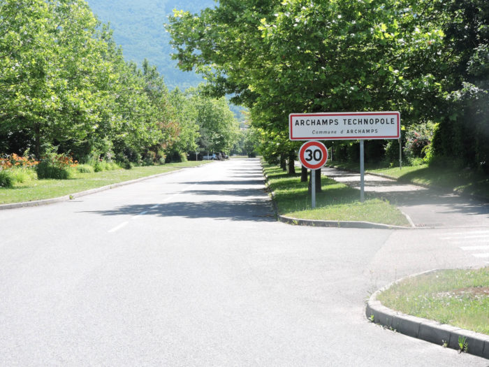
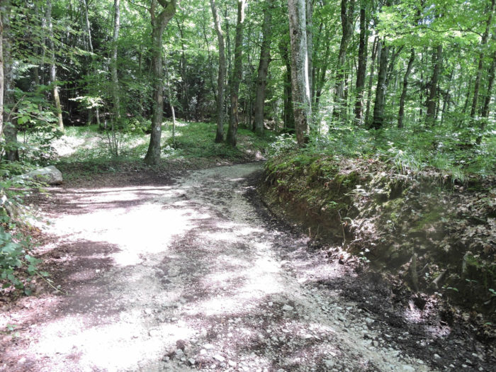
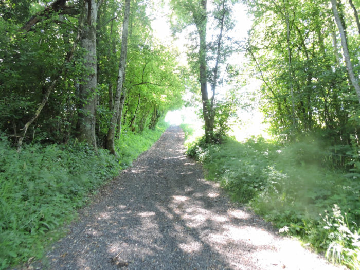
| The gravel path heads almost nonchalantly towards a discreet woodland, where the light filtered through the foliage creates a soft atmosphere. There, before you, stand the modern and audacious buildings of the Archamps Technopole, like glass and steel sentinels amidst the greenery. As you follow the path, you pass an imposing wall, reminiscent of fortifications of yesteryear. This remnant whispers tales of a bygone era when the now peaceful border was a crucial defense line. It’s easy to forget that these solid stones were erected at a time when Switzerland might still have feared France’s military ambitions, although these fears have calmed over the past two centuries. Napoleon, lastly, caused them real trouble. |
 |
 |
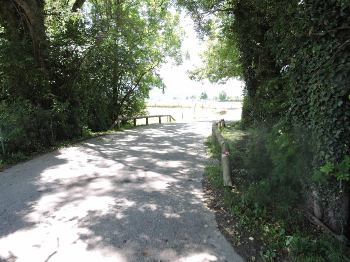
| Penetrating deeper into the woodland, the dirt path crosses the Arcande stream, a discreet watercourse almost lost in the dense hedges and wild grasses. This stream, meandering with poetic tranquility, evokes the untouched beauty of nature. |
 |
 |
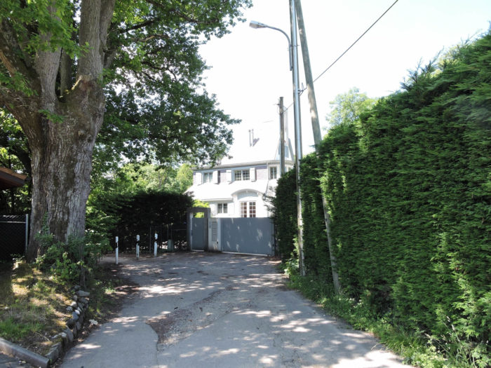
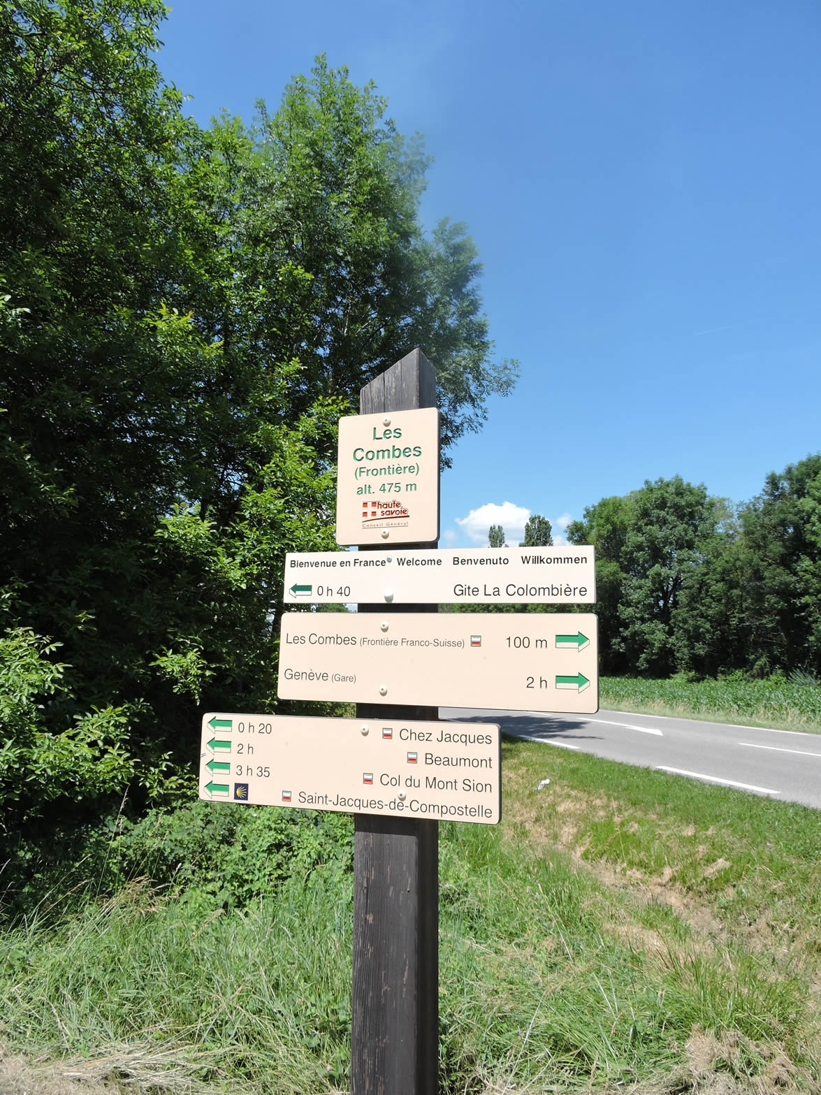
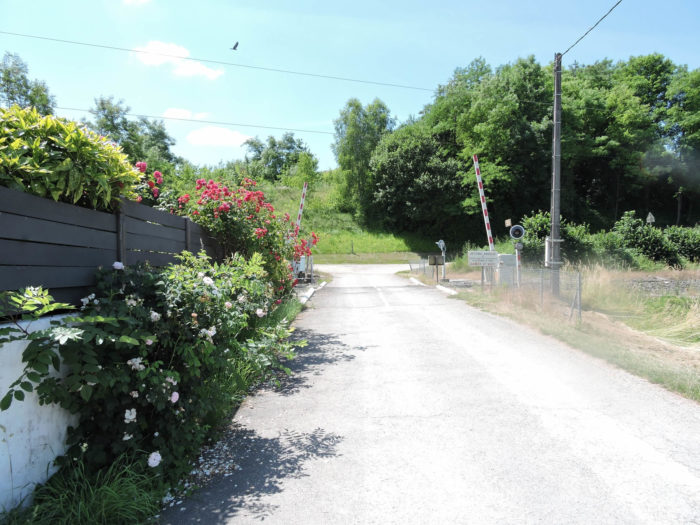
The Via Jacobi reaches its end at Les Combes, just steps from the Technopole and the border. Here, tranquility reigns supreme, and customs formalities seem to belong to another world. The border, just a stone’s throw away, is an invisible line that no one notices, reinforcing the feeling of unity and freedom.
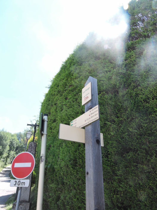
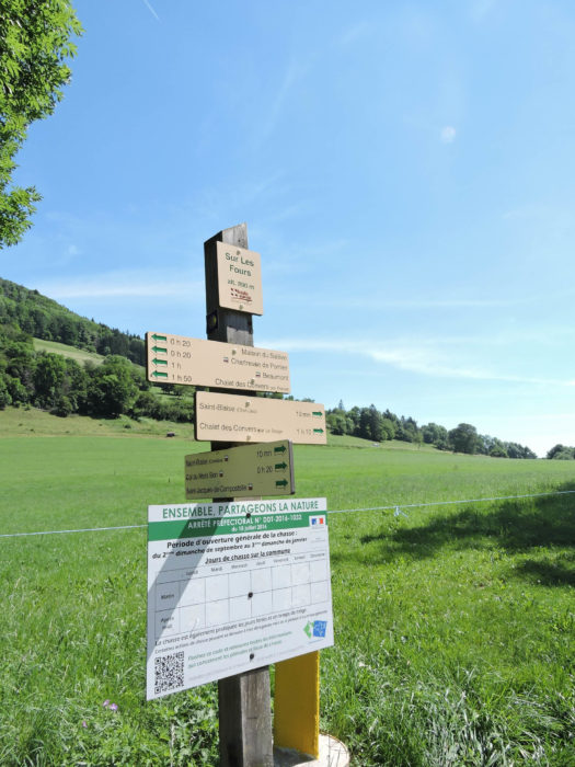
You are now walking in Haute-Savoie, on the famous GR65, the Way of St. James from Le Puy-en-Velay. A transition is required: after following the bright yellow signs, like chanterelles emerging from moss in the Swiss forest, you must now get used to more discreet and varied signage. Here, the signs mix the GR65 markers (red and white), the scallop shells, symbols of Compostela, and various local signs. Each sign tells a story, providing precise details about walking times, adding a touch of authenticity and complexity to your journey. But don’t worry, this abundance of detail won’t last through all the subsequent stages. Prepare yourself: the Mont Sion Pass, more than three hours’ walk away, awaits with the promise of new discoveries on the Via Gebennensis.
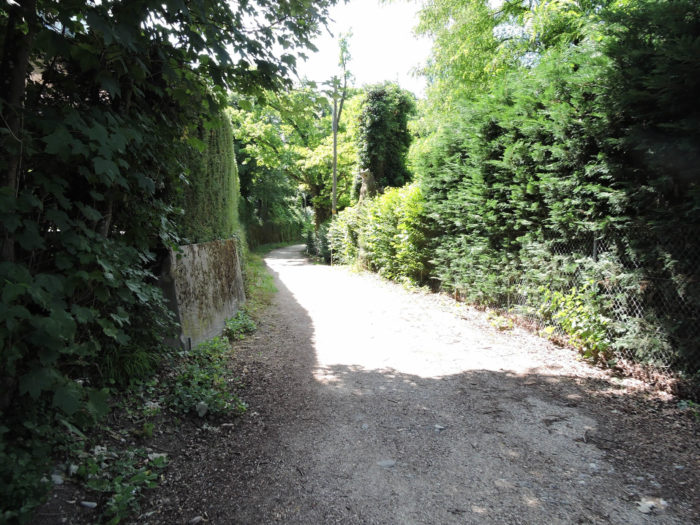
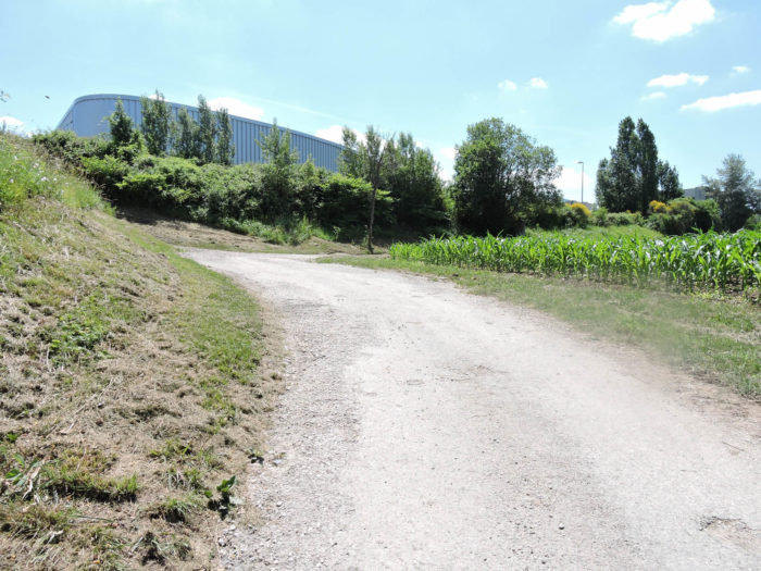
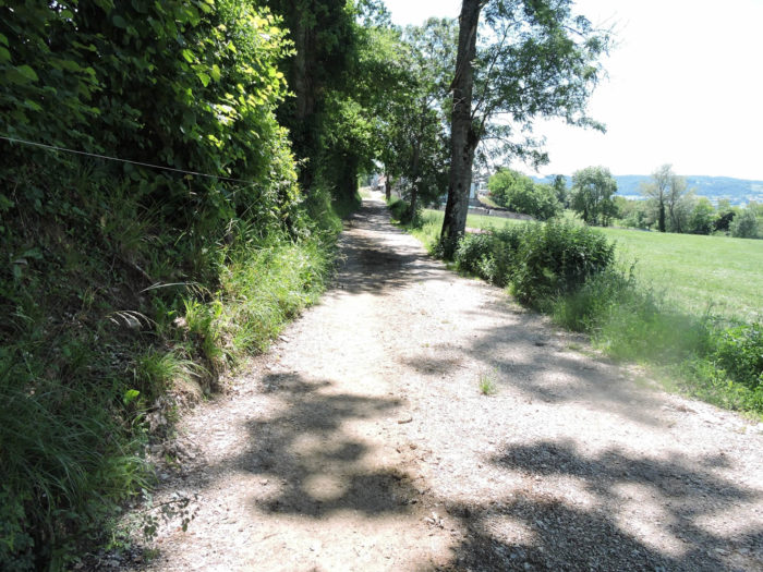
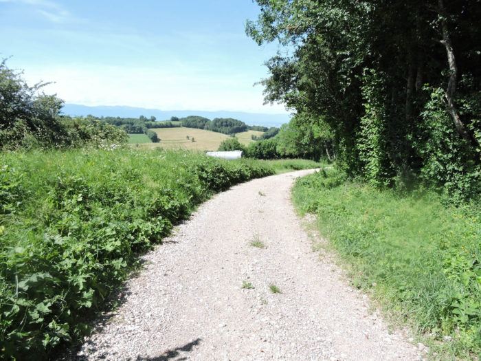
| From Les Combes, a wide path slopes up gently but resolutely, first paved and then turning to dirt. It crosses a small railway line, like a bridge between two worlds, before stretching across a countryside where nature unfolds in all its magnificence. The meadows extend as far as the eye can see, dotted here and there with fields of corn and wheat, where a few solitary oaks stand guard, impassive and majestic. |
 |
 |
 |
 |
| At the heart of this haven of peace stands the Archamps Technopole, founded in 1989 and described as the « first Euro-Swiss technopole. » Housing around 230 units dedicated to life sciences, electronics, micro-technologies, and knowledge transfer activities, this place is an enclave of modernity within nature. French, European, and Swiss scientists cross paths here, exchanging ideas and innovations in an inspiring setting, closely linked to the surrounding universities. The buildings, with their modern and sleek architecture, harmoniously contrast with the surrounding bucolic landscapes, symbolizing the successful marriage between nature and technology. |
 |
 |
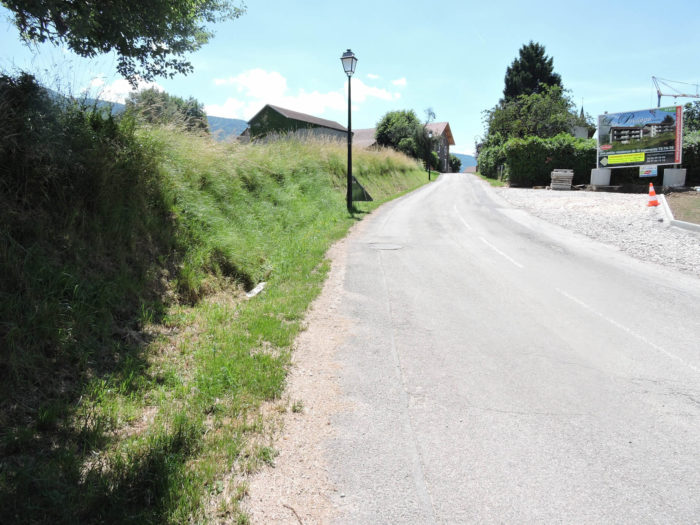
| A small paved road, like a discreet vein, escapes from the technopole to join the hamlet of Lathoy. This village, with its stone houses and flower-filled gardens, exudes tranquility and a discreet charm under the large trees. |
 |
 |
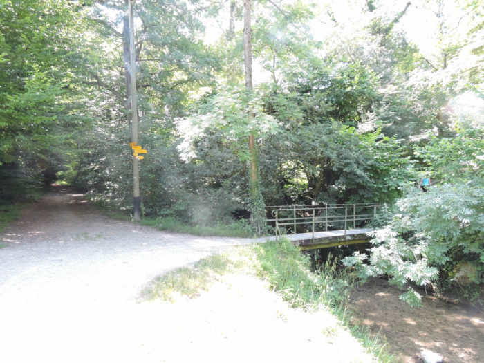
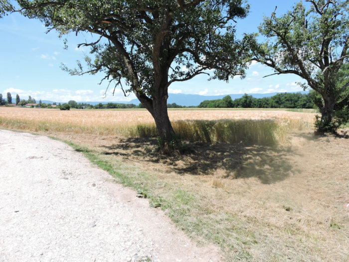
| The GR65, now identifiable by its red and white markers, continues its journey on a dirt road. It crosses the Nant de Barthoux, a clear stream whose waters glide over the stones with a soothing murmur. But this gentle murmur is quickly overwhelmed by the distant roar of the nearby highway, like a noisy artery at the heart of this rural tranquility. On the horizon, under the stern gaze of the Salève mountain, the plain stretches out, dominated by this imposing rocky sentinel that seems to watch over the countryside. |
 |
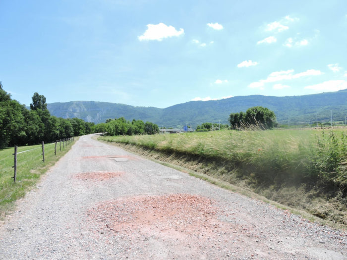 |
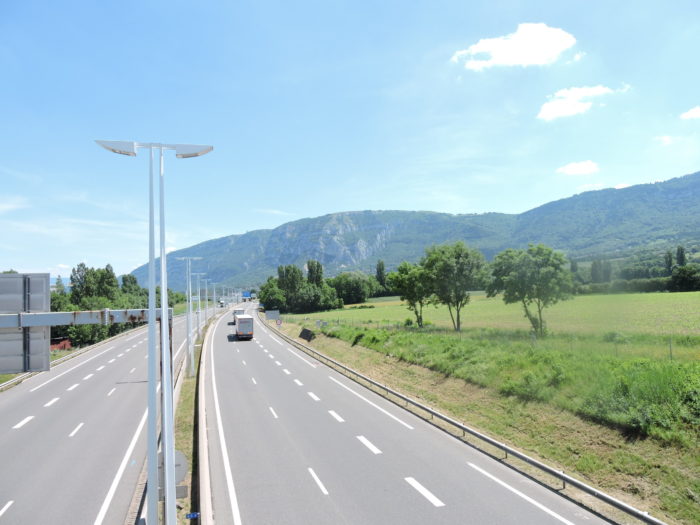
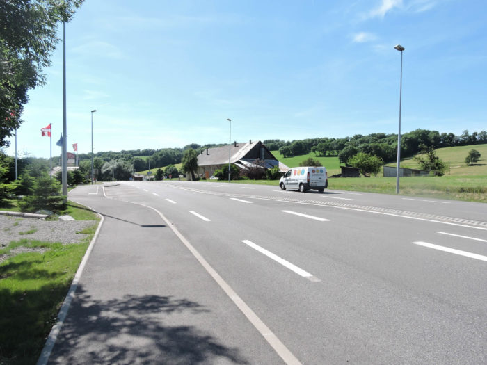
| The GR65 then crosses the A40 highway, nicknamed the « White Highway. » This fast route, connecting Mâcon to Chamonix and continuing towards Italy via the Mont Blanc tunnel, is an important transit axis, crossing the Franco-Swiss border at St Julien-de-Genevois. Here, the modernity of the infrastructure meets the tranquility of rural landscapes, creating a striking contrast between urban life and pastoral serenity. |
 |
 |
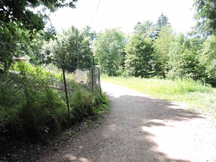
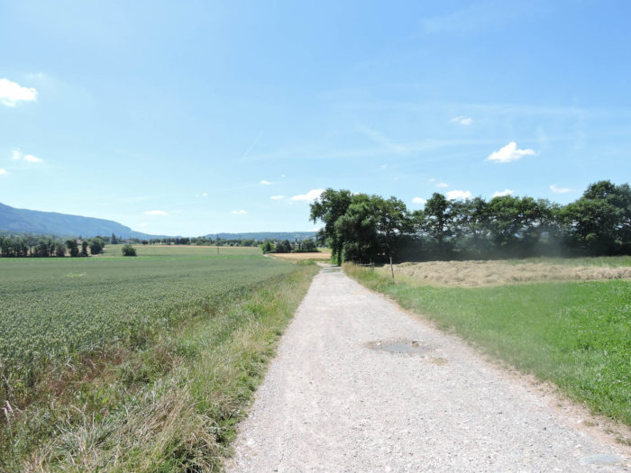
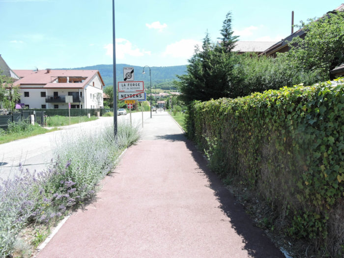
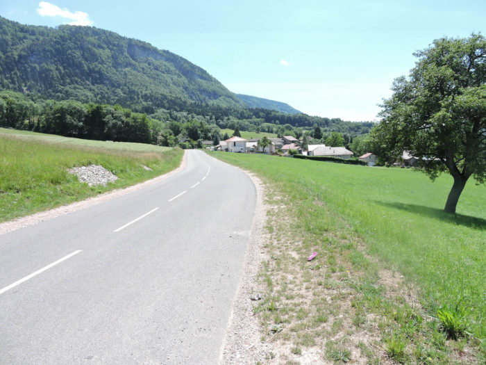
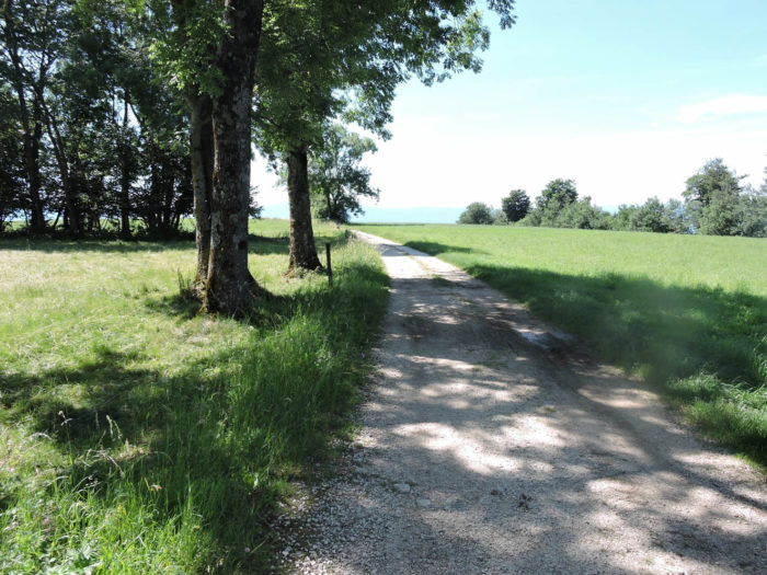
| Beyond the highway, a wide dirt road winds through a vast plain towards Neydens. Here, the land stretches as far as the eye can see, each hectare vibrating under the sun. The crops extend endlessly, a sea of green and gold, where a few groves offer islands of greenery, barely breaking the continuity of the landscape. |
 |
 |
Section 4: Climbing under the Salève Mountain

Overview of the route’s challenges: some steeper slopes between La Forge and Verrières.
|
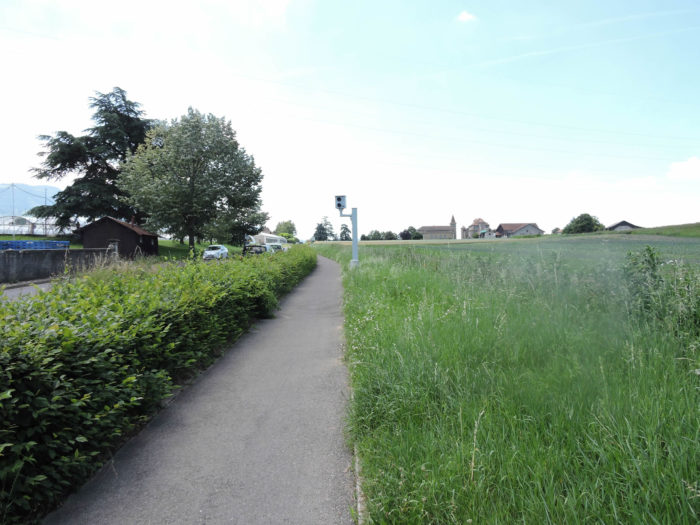
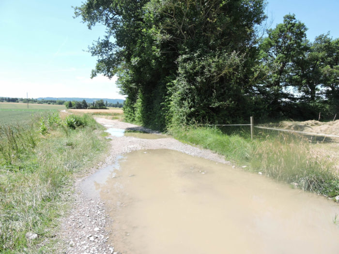
Ahead of you rises soon the steeple of the village of Neydens. In this region, when the sky fills with clouds, the paths turn into real muddy streams, making each step perilous. In the spring, after heavy rains, the tenacious mud swallows the shoes of hikers.
|
 |
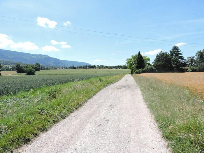 |
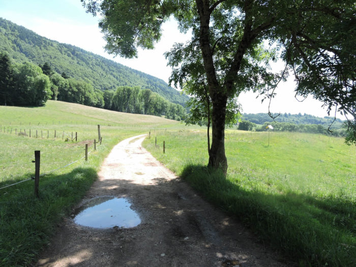
| Until now, the route from Geneva had been almost entirely flat. But the Col du Mont Sion rises in altitude, making an ascent inevitable. The climb is quite long up to the village. As you approach this picturesque village, the dirt road, increasingly strewn with stones, begins its ascent, mostly through cultivated fields. However, the slope remains gentle, and the eye is irresistibly drawn to the Salève, the majestic mountain watching over Geneva. |
 |
 |
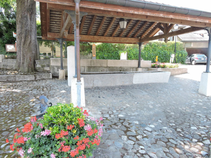
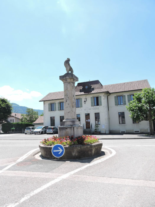
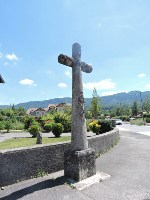
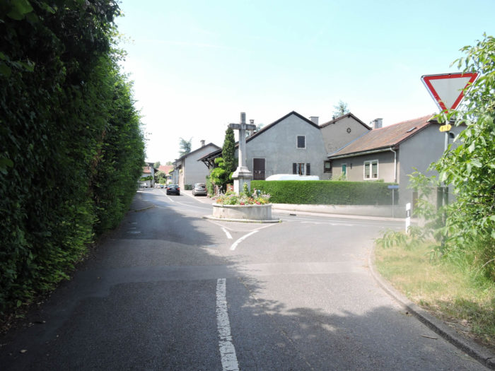
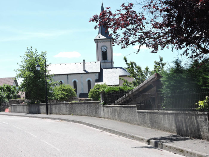
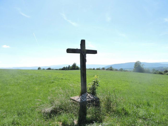
| Climbing higher, the path crosses Neydens. The many hamlets scattered across the foothills of the Salève are hard to distinguish. In the heart of the village, the Croix de Verrières, a splendid stone cross, stands proudly. The well-kept and charming houses of Neydens give it a decidedly residential air. Only the church and St. Laurent school, as well as the old school, show the patina of time. Most of the inhabitants surely work in Geneva, just a stone’s throw away. |
 |
 |
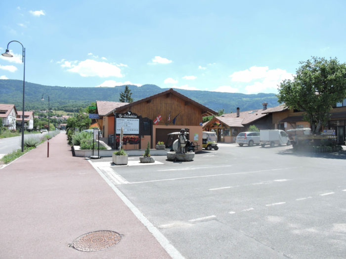
| The GR65 then follows the sidewalk to climb to La Forge, passing by the Colombière campsite-hostel, a popular resting place for hikers. |
 |
 |
| La Forge is a few steps away, and the GR65 joins a busier road passing under the Salève. All these roads, far from being major arteries, see moderate traffic, offering walkers a welcome tranquility. |
 |
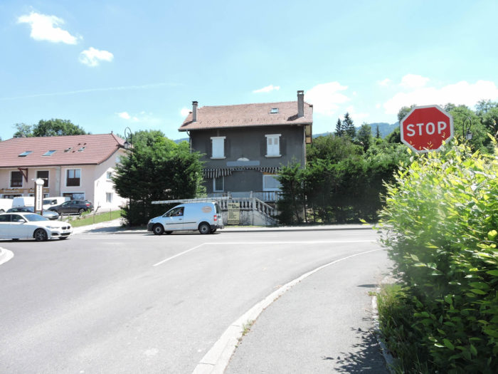 |
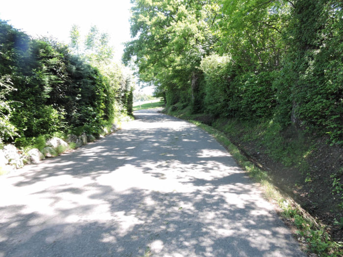
| From here, the slope becomes noticeable, up to 15%, to reach Verrières, then Beaumont. A winding little road climbs the hill, lined with upscale residences, elegantly hidden in shaded parks. The well-kept hedges and wrought iron gates testify to the privilege of those who have chosen to settle in this gentle countryside. Statistics do not say how many of these residents work in Geneva, but the majority, undoubtedly. |
 |
 |
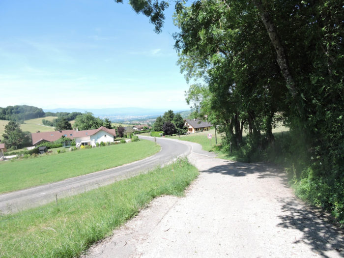
| Then, the villas become rarer, giving way to more untouched landscapes. Chains are even recommended in winter, and it is easy to understand why when the road, bordered by snow-covered embankments, climbs further towards Verrières. The surrounding meadows, dotted with majestic oaks and sturdy beeches, offer a palette of greens and browns that seems to stretch infinitely. On the horizon, the Salève mountain rises, imposing, almost giving the impression that it could be touched with a fingertip. |
 |
 |
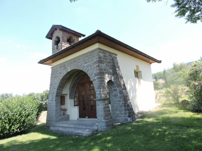
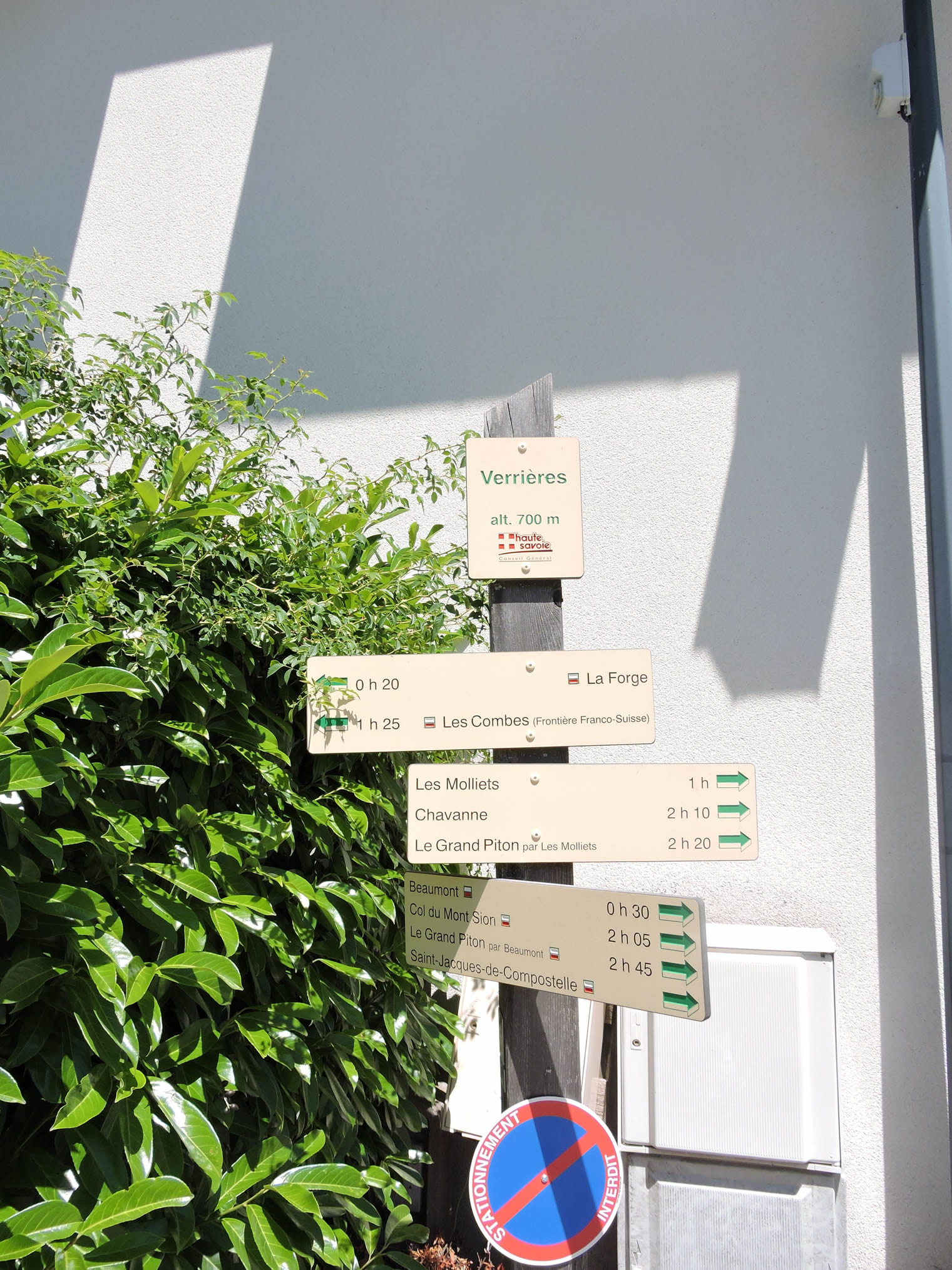
At the entrance of Verrières, perched on a hill, stands a gem of a small chapel. Quite recent and very simple, it stands out for its simplicity and discreet elegance. Its white walls contrast with the blue sky and the surrounding trees, creating an image of serene purity.
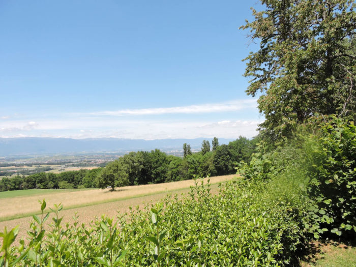
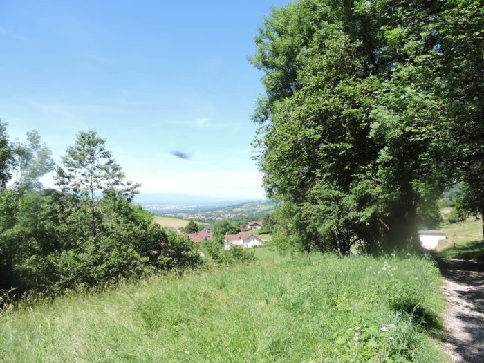
| From the promontory, the view extends over Neydens and La Forge below, and further towards Geneva, though here the lake is barely discernible behind the rolling hills. The golden wheat fields and green pastures create a vibrant patchwork under the sun. |
 |
 |
| Then, the slope becomes less severe, and the road gently winds through the very extended village of Verrières. While the lower part of the village is just a collection of new villa subdivisions, the village center itself shows a certain unity, an architectural harmony that recalls ancient times. There are still a few farmers in Verrières, their rustic farms adding a touch of authenticity to this pastoral setting. |
 |
 |
In Verrières, you find yourself at 700 meters altitude, about two hours’ walk from the Mont Sion Pass. The ascent, about 300 meters from the lake, has been demanding, but only 175 meters remain to the top of the stage. For pilgrims starting the Way in Geneva, it’s a tough challenge. But for others, it’s a simple pleasure walk, a refreshing stroll through inspiring landscapes.
| The GR65 leaves Verrières on the road towards Beaumont, but quickly abandons the road for a dirt path that delves into the countryside, winding its way through the undergrowth. The stony ground snakes through meadows, under abundant chubby oaks and slender ash trees, standing like wands on a reasonable slope. |
 |
 |
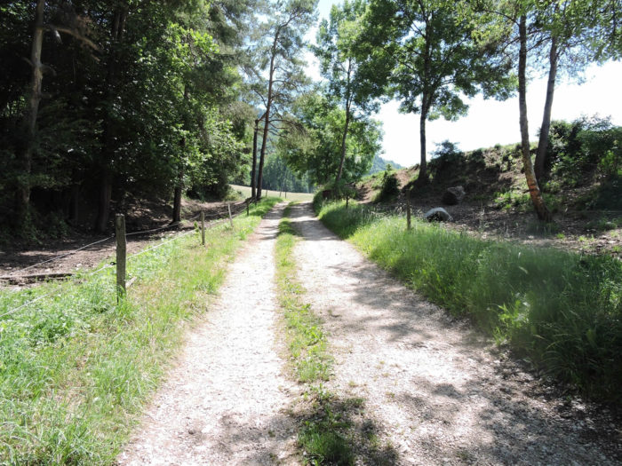
| n this region, in dry weather, it’s a real pleasure to walk these trails. But in rainy weather, the journey can become more difficult. Small streams, invisible under normal conditions, rush down the mountains and turn into real torrents, creating mud pits where cattle have marked their passage. You must then spot the largest stones to avoid getting bogged down, each step becoming an adventure, a cautious dance on capricious ground. |
 |
 |
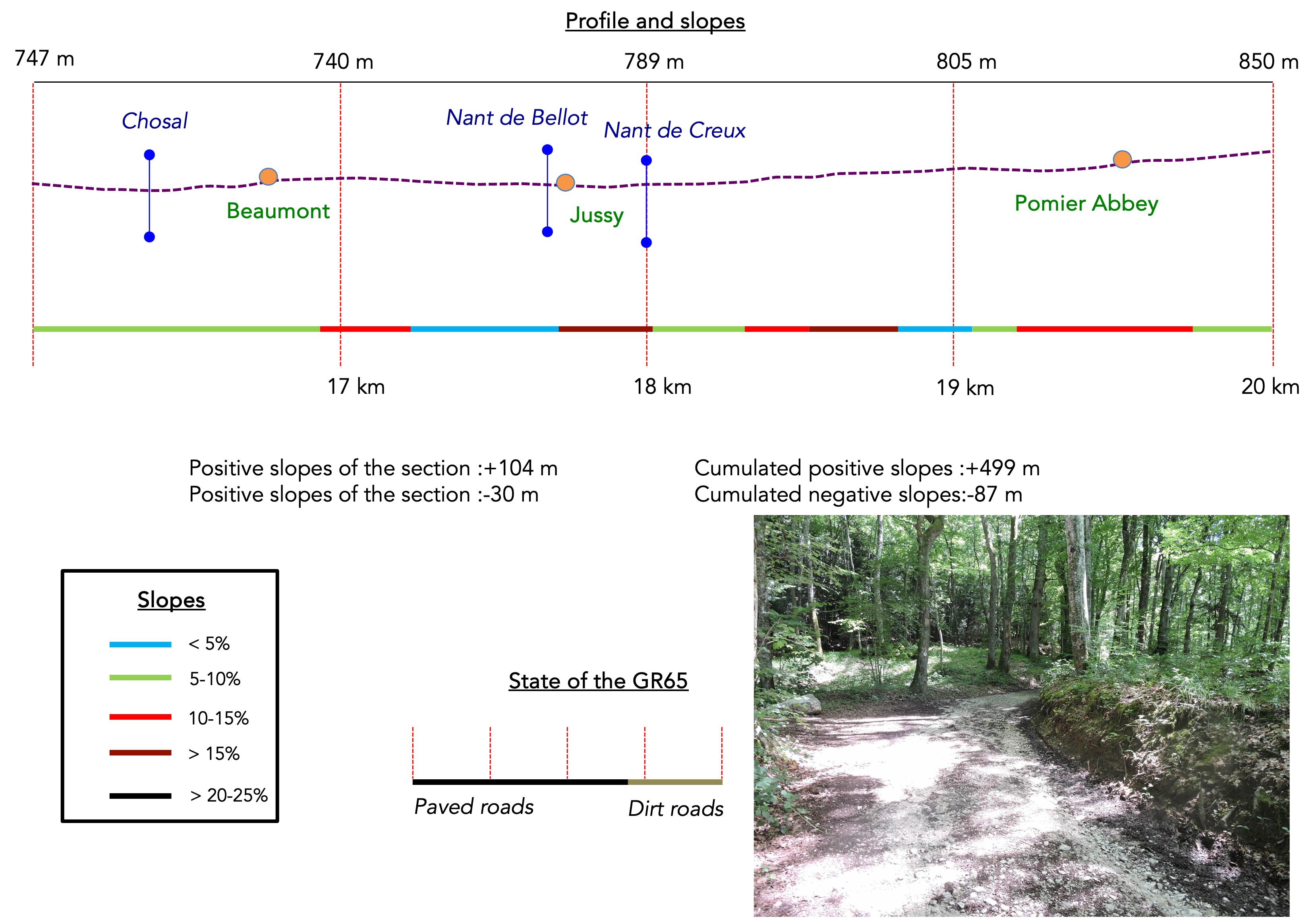
Section 5: On the route, there is the beautiful ancient Abbey of Pomier
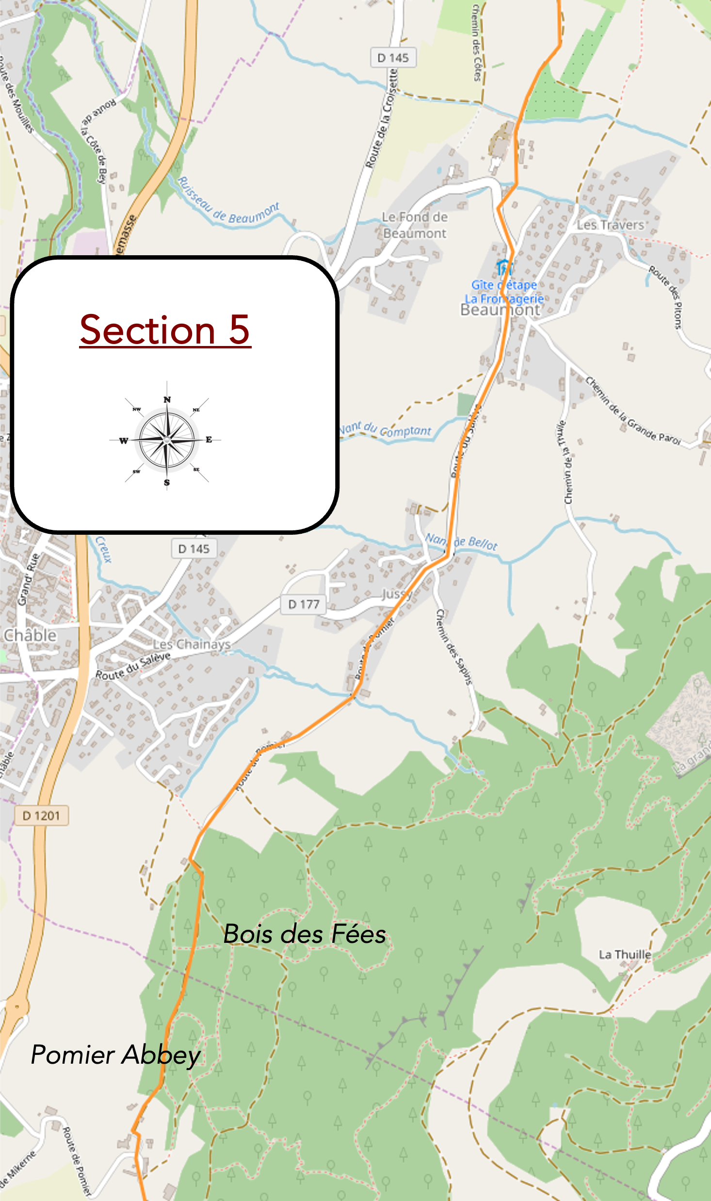
Overview of the route’s challenges: some challenging slopes between 10% and 15%, but far from insurmountable.
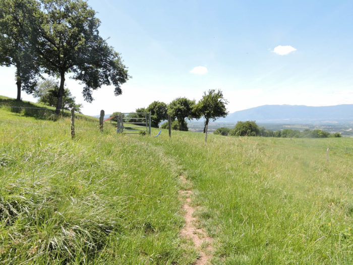
| Upon exiting the forest, the GR65 follows the ridge through meadows, with solitary oaks standing guard. The view extends to the distant Jura, and closer, to the Mont Sion Pass. The panorama is clear, each hill and valley unveiling itself like a new scene in a simple painting. |
 |
 |
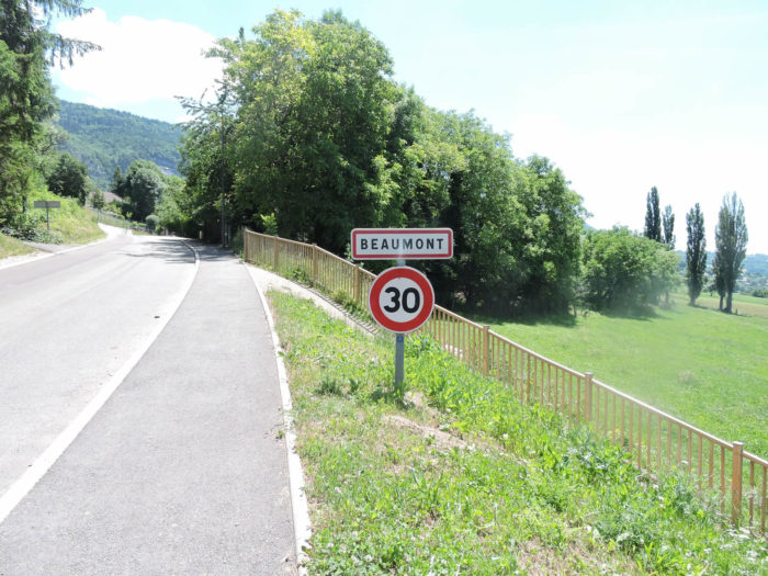
The path then gently descends towards Beaumont, a village nestled in the countryside on the slopes of the Salève mountain. The red-tiled roofs of the houses contrast with the green meadows, and a gentle tranquility pervades the place.

| The path heads towards the village, crossing the Nant de Chozal stream, discreet and hidden in the underbrush. In the event of rain, it’s a different story. The stream overflows, and passing here becomes almost a challenge, with sticky mud churned up by the cows’ hooves, transforming the path into a real quagmire. |
 |
 |
| The dirt path skirts a large farm, which is not a model of elegance with its decrepit walls and tired roof, but it exudes a certain rustic charm. The path passes near the small Nant de Beaumont stream, a trickle of water glistening through tall grass and bushes, and joins the village on the tarmac. |
 |
 |
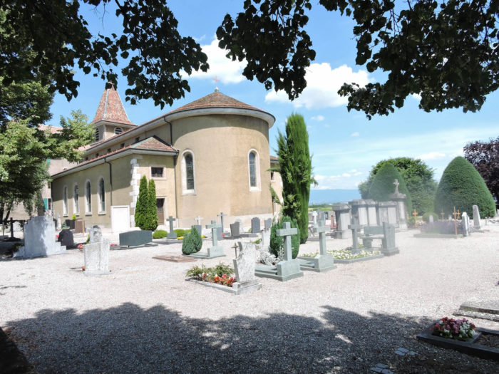
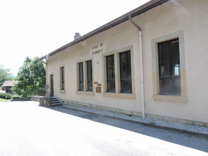
| Beaumont (2,600 inhabitants) is a village of two faces, each telling a different story of this picturesque corner of the French countryside. The upper part, which you traverse, is old Beaumont with its church, guardian of memories of yesteryear. Nestled below, at Le Châble, is the borough where activities and businesses concentrate, forming the vibrant heart of this community. Here, in the upper village, time seems to have stopped, preserving the authenticity of a rural way of life. |
 |
 |
|
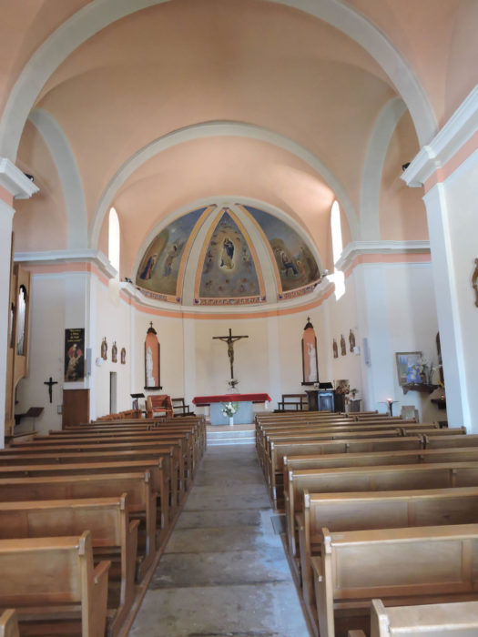
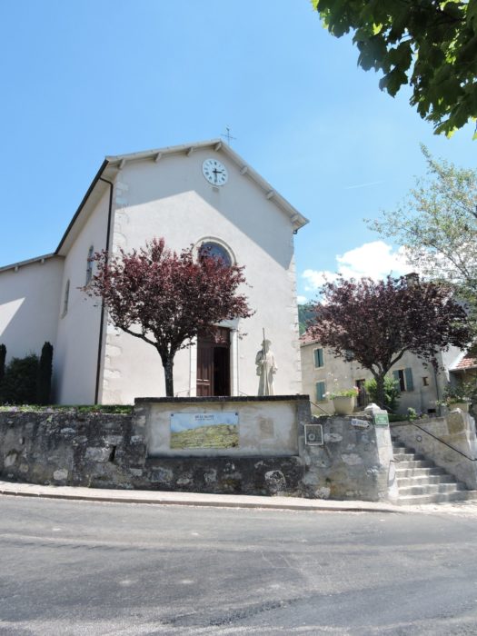
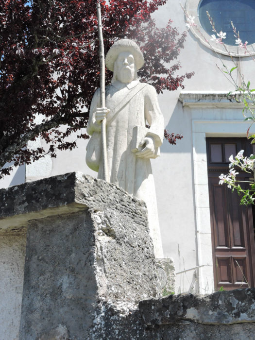
In front of the St Étienne Church of Beaumont, a magnificent stone Saint James statue watches over, imposing and majestic. This Romanesque church, though very old, has been renovated with simplicity, revealing a pure and welcoming interior. At this point of the journey, you are an hour and a half’s walk from the end of the stage, offering a spiritual and historical pause in this meaningful place.
|
 |
 |
| The road stretches flat upon leaving the village, skirting the old school whose activity seems a puzzle of the past. A discreet stream murmurs at your feet, adding a touch of serenity to this walk. |
 |
 |
| In no time, the road leads you to Jussy, another gem of the commune of Beaumont, crossing the Nant de Bellot. Here, the streams joyfully rush down the slopes of the Salève, bringing a refreshing coolness. |
 |
 |
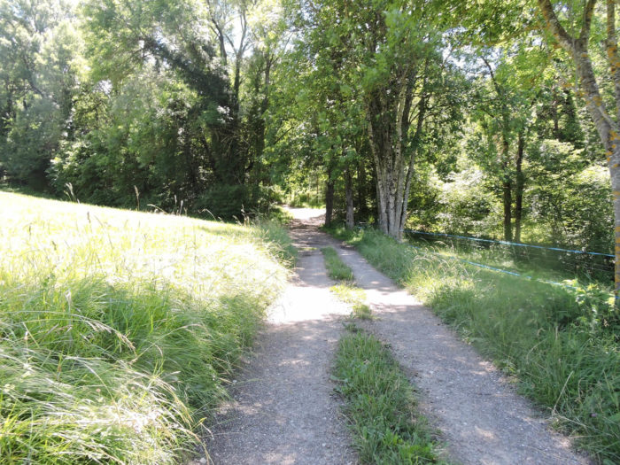
| The village preserves its old-time charm. From the hamlet, the road climbs steadily, sometimes steeply, between discreet groves and vast meadows. Nature here is generous, offering a spectacle of greenery and tranquility. |
 |
 |
 |
 |
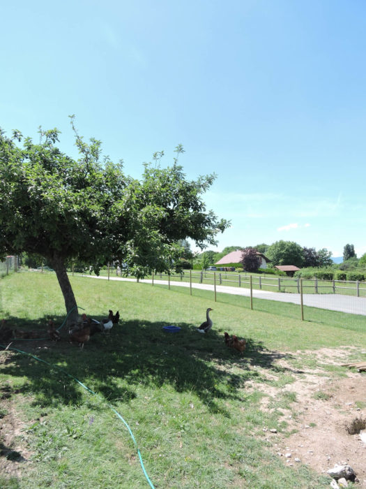
| Under the wooded cliffs of the Salève, a herd of Montbéliarde cows graze quietly. These cows, perhaps destined for Reblochon cheese production, evoke a rich cheesemaking tradition. Long ago, to avoid taxes imposed by their owners, peasants practiced incomplete milking, then, after the controller’s departure, carried out a second milking. Reblochon gets its name from the patois « Reblocher » meaning « to pinch the cow’s udders a second time. » Thônes, in Savoy, in the Val d’Arly, is the birthplace of Reblochon, but the AOP zone also extends to Haute-Savoie. The production of this raw, unpasteurized milk cheese is subject to strict regulations concerning livestock feed and authorized breeds: Abondance, Montbéliarde, and Tarine. The Tarine, with its light brown coat, and the Abondance, with a darker brown coat and white speckled head, are frequently encountered. However, the Abondance remains the favorite for Reblochon, emblematic of ancestral know-how. |
 |
 |
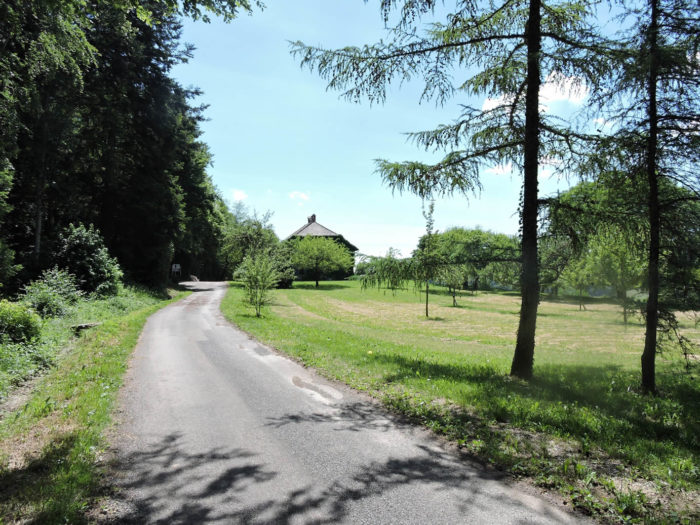
| The road winds through bucolic landscapes, ending in a cul-de-sac on a small plateau at the foot of the majestic Chartreuse de Pomier. This place, nestled in preserved nature, seems to be a timeless haven of peace, where every corner breathes history and serenity. Walkers venture here, attracted by the promise of a moment suspended in time, far from the hustle and bustle of the modern world. |
 |
 |
| The Pomier estate is a treasure of diversity and natural beauty. Vast deciduous forests, dominated by majestic beeches and dotted with ancient oaks, unfold a rich and varied vegetal canopy. These venerable trees, silent witnesses of centuries past, give the place an atmosphere of mystery and grandeur. The rarity of conifers at this altitude adds a unique touch to this enchanting landscape, where chestnut trees are rare but precious, emerging here and there like forgotten jewels. |
 |
 |
The gently inclined path invites strolling and discovery. In spring, one can imagine morels timidly emerging under dead leaves, while in autumn, it’s boletes that reveal themselves, promising forest feasts. Each step on this path is a promise of discovery, an invitation to scrutinize the undergrowth in search of these hidden treasures.
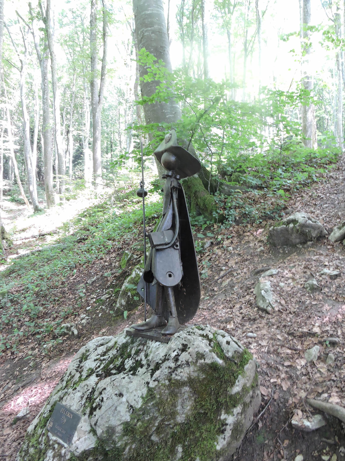
A pilgrim, perhaps, once got lost here, seeking refuge or comfort. The history of this place is steeped in such legends, stories of travelers and mystics in search of peace.
| The GR65, upon exiting the woods, reveals the dependencies of the Chartreuse, robust buildings coated in light lime, evoking the simplicity and solidity of old constructions. This site, imbued with tranquility, invites relaxation and contemplation. |
 |
 |
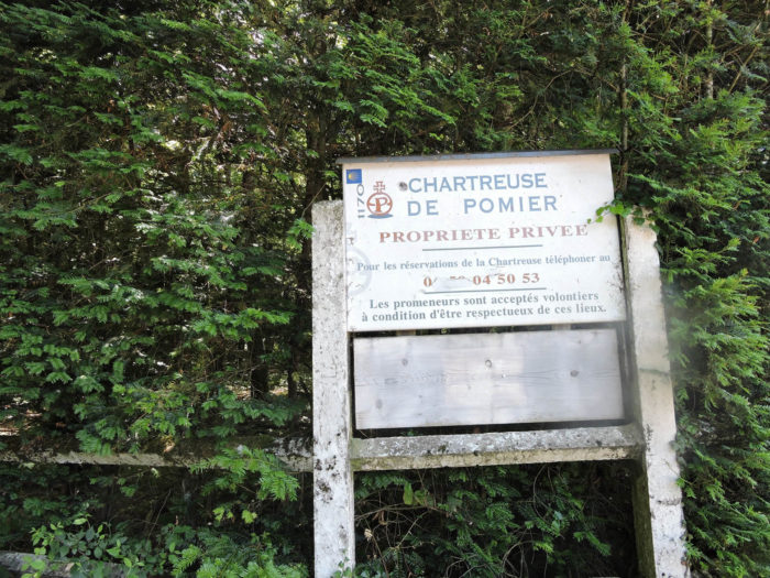
| Dating back to the 12th century, the Chartreuse Notre-Dame de Pomier is a precious witness of medieval history. Once a place of prayer and meditation for Carthusian monks, with its church, chapels, and cloister, it suffered the ravages of the Revolution in 1793. Pillaged and partially destroyed, it was abandoned for more than a century. In 1894, a visionary baron bought the estate, preserving the remaining ruins and reviving the place by transforming it into a hotel-restaurant. Today, it’s a private property hosting seminars and weddings, a place where history and modernity harmoniously meet. Access is via the road ascending the Col du Mont Sion from Geneva, a road rich in history. |
 |
 |
From the heights of the Chartreuse, the view extends over Geneva and the Rhône plain, offering a breathtaking panoramic view. This grand spectacle invites contemplation and daydreaming, each detail of the landscape revealing itself with dazzling clarity.

| The path then continues its ascent, leaving the Chartreuse to discover other sturdy buildings, undoubtedly former renovated agricultural structures, witnesses to the laborious life that once animated these places. |
 |
 |
Section 6: Under the Salève Mountain to the pass

Overview of the route’s challenges: some challenging slopes between 10% and 15%, but far from insurmountable.
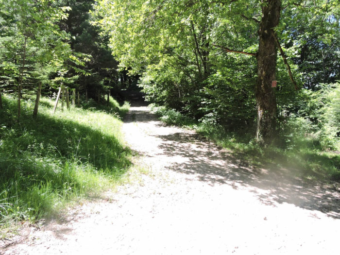
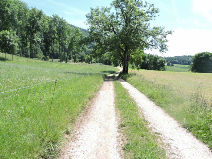
| A little more effort before reaching the heights of the pass. From the start, the climb is gentle, winding through deserted pastures where you can almost feel the mountain’s fresh air filling your lungs. Here and there, a majestic ash tree spreads its branches, offering shaded refuge to those venturing on this trail. But who truly benefits from this comforting shade? Many pilgrims traverse these paths in spring, and at this time of year, it is more likely to encounter muddy and steep trails than a clear sky. |
 |
 |
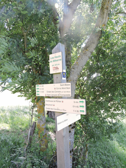
The dirt path, sprinkled with pebbles, quickly leads us to the place known as « Les Hauts de Mikerne. » Here, a sign directs towards the Maison du Salève, a vibrant cultural center offering workshops, activities, gourmet breaks, and hikes to explore the region’s treasures. However, the GR65, true to its idea, does not engage in it.
| The slope, although constant, remains gentle. It stretches peacefully along hedges or through deciduous forests. In these forests near Switzerland, majestic and imposing beeches dominate the landscape, creating a sublime spectacle of greenery. However, oaks and chestnut trees, determined to make their place, also stand tall, each seeking to reign over this kingdom of nature. |
 |
 |
| The climb ends as the forest path majestically opens onto a vast plateau, perched at nearly 875 meters altitude, known evocatively as Sur Les Fours. |
 |
 |
| Here, the land unfolds into a beaten path that stretches as far as the eye can see through the meadows, leading to the peaceful cemetery of St Blaise. It’s a blessed space, where nature flourishes unhindered, only punctuated by the majesty of ancient trees that watch like sentinels. |
 |
 |
| A large cross rises on the hill, marking this place imbued with serenity. The GR65, though a few steps away, does not cross directly through St Blaise. In clear weather, by walking to the edge of the plateau, a grand panorama opens up: the outlines of Geneva emerge on the horizon, while Lake Geneva glistens with a thousand lights, a mirage of a sublime and distant world. |
 |
 |
| St Blaise is higher than the Mont Sion Pass, which is situated about 100 meters below. The descent on a wide dirt road is short but sometimes demanding. |
 |
 |
| The path joins the road that climbs to St Blaise at the entrance to Mont Sion. |
 |
 |
| The road joins the major departmental D1201, the road connecting Geneva to Annecy. In the past, before the total junction of the highways from Geneva to Annecy, this route was congested up to Cruseilles, below, where the highway ended. Today, traffic here has diminished since the highway now passes under the mountain in a tunnel. However, traffic remains significant. Highways are very expensive in France. |
 |
 |
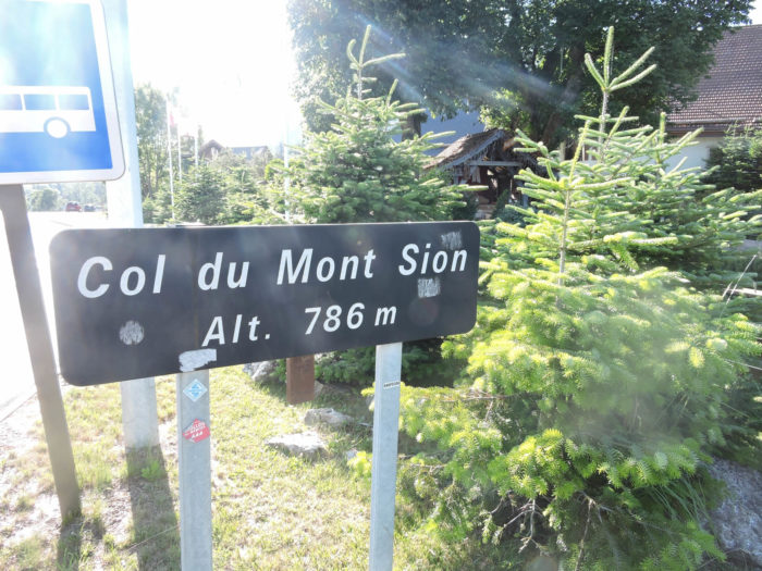
| Mont-Sion is part of the commune of St Blaise. Here, houses have sprung up like mushrooms in recent years. The location is just a stone’s throw from Geneva by road. But there is no village and only one lodging option. It is also here that Santa Claus reigns in his village during winter. |
 |
 |
Official accommodations on the Via Gebennensis
- Domaine de la Colombière, Neydens; 04 50 35 13 14; Gîte, breakfast
- Hôtel Rey, Mont Sion; 04 50 44 13 29; Hotel, dinner, breakfast
Pilgrim hospitality/Accueils jacquaires (see introduction)
- Compesières (1)
- Neydens (1)
- Jussy (1)
If we take stock of the accommodations, finding a place to stay can be tricky, but most pilgrims stop at Mont Sion, where there is space at the hotel. There are many options off the route. The guide of the Friends of Compostela keeps a register of all these addresses, as well as bars, restaurants, and bakeries along the route.
Feel free to add comments. This is often how you move up the Google hierarchy, and how more pilgrims will have access to the site.
|
 |
Next stage: Stage 2: from Mont-Sion Pass to Frangy |
|
 |
Back to menu |