On the route to what many pilgrims consider the “real” start of the Way of St James
DIDIER HEUMANN, ANDREAS PAPASAVVAS
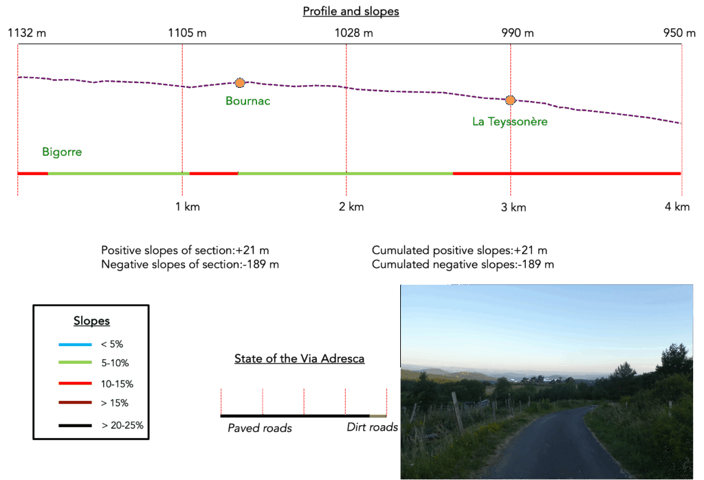
We divided the course into several sections to make it easier to see. For each section, the maps show the course, the slopes found on the course, and the state of the route (paved or dirt roads). The courses were drawn on the « Wikilocs » platform. Today, it is no longer necessary to walk around with detailed maps in your pocket or bag. If you have a mobile phone or tablet, you can easily follow routes live.
For this stage, here is the link:
https://fr.wikiloc.com/itineraires-randonnee/de-bigorre-a-aiguilhe-puy-en-velay-par-la-via-gebennensis-adresca-33259430
| Not every pilgrim feels comfortable using GPS devices or navigating on a phone, especially since many sections still lack reliable internet. To make your journey easier, a book dedicated to the Via Gebennensis through Haute-Loire is available on Amazon. More than just a practical guide, it leads you step by step, kilometre after kilometre, giving you everything you need for smooth planning with no unpleasant surprises. Beyond its useful tips, it also conveys the route’s enchanting atmosphere, capturing the landscape’s beauty, the majesty of the trees and the spiritual essence of the trek. Only the pictures are missing; everything else is there to transport you.
We’ve also published a second book that, with slightly fewer details but all the essential information, outlines two possible routes from Geneva to Le Puy-en-Velay. You can choose either the Via Gebennensis, which crosses Haute-Loire, or the Gillonnay variant (Via Adresca), which branches off at La Côte-Saint-André to follow a route through Ardèche. The choice of the route is yours. |
 |
 |
If you only want to consult lodging of the stage, go directly to the bottom of the page.
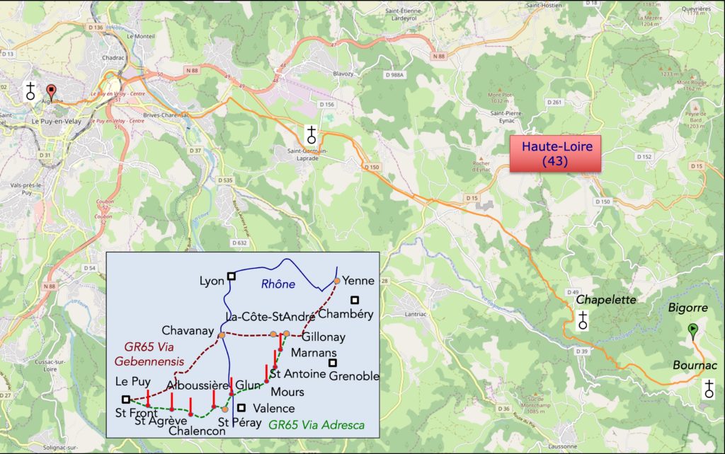
When you are a beginner on the Way of St James arriving in Le Puy-en-Velay feels a bit like arriving in Mecca for a Muslim. Guidebooks or now the Internet often make a big deal of this city. And then there is the departure ritual at the cathedral. Yet pilgrims in the Middle Ages did not arrive here by train. They probably passed through but not all of them. There were many other routes before reaching this place. Today you gradually move from the Ardèche and Haute-Loire mountains into the area of the Monts du Devès. The Loire River is the central axis of this entire layout.
Caerte.
Today the route is a long descent into Le Puy-en-Velay by way of a deep gorge. The route does not run like the nearby Via Gebennensis near the small volcanic “sucs” of the Velay. It contents itself with smaller rounded “guards” that still have the shape of little volcanoes. When the Via Adresca arrives in the plain it joins the Via Gebennensis near St Germain-Laprade. In this way all pilgrims from Eastern Europe including Germans Austrians and Swiss and sometimes a few French will come together to reach the city and pay homage on the rock of Saint Michel Aiguilhe or on Mont Anis near Notre-Dame du Puy.
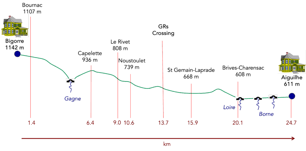
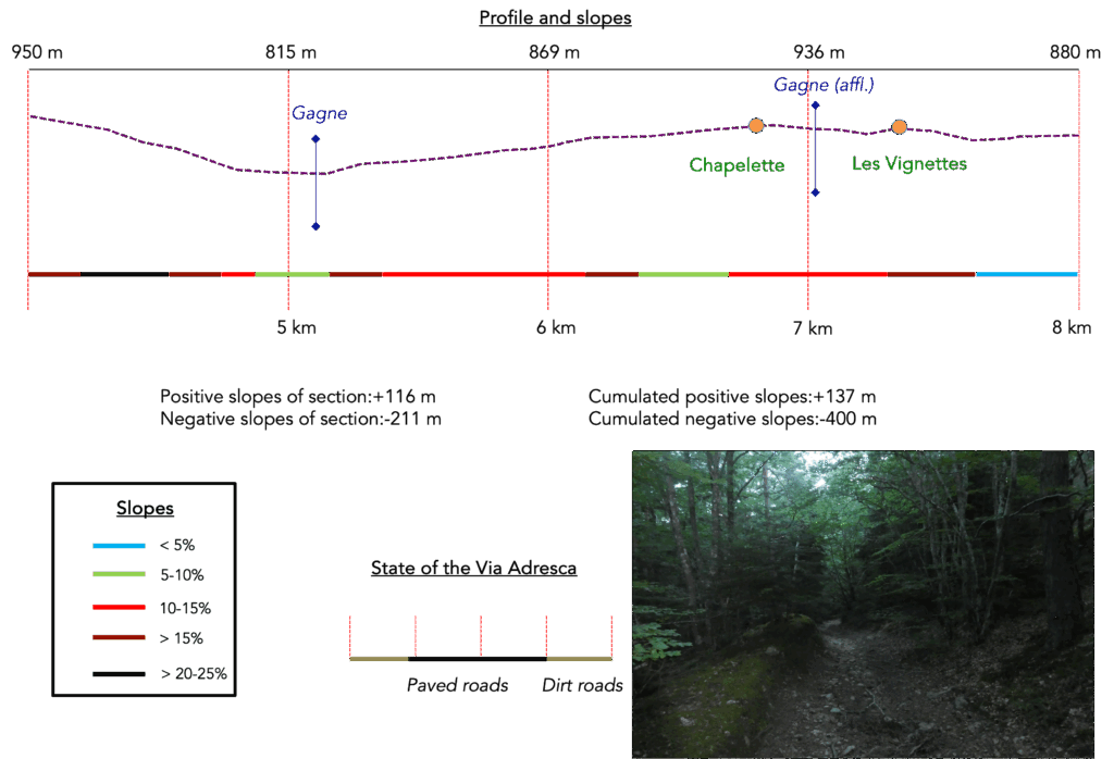
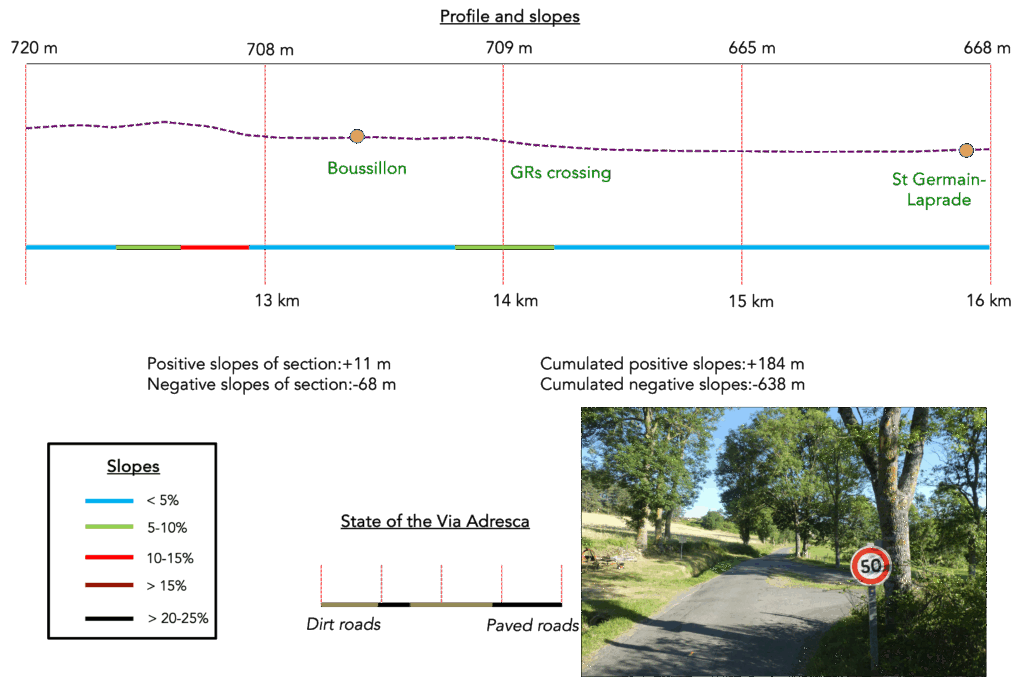
Difficulty level: The elevation changes (+234 meters / -758 meters) are mainly descents. The difficulty of the day is the gorge of the Gagne. The descent is “terrible” with steep and often very stony slopes. From the river you have to climb up the other side of the valley. But it is asphalt and the slope is a little less severe. From there there are no major problems. It is a long descent toward the plain with a few rolling hills just for fun before strolling along the Loire and the Borne rivers until reaching the city.
State of the Via Adresca: Today’s routes favor paths even though we counted the entire route near the rivers at the end as paths. However, there are also stretches of asphalt but these are not roads:
- Paved roads: 9.3 km
- Dirt roads : 15.4 km
Sometimes, for reasons of logistics or housing possibilities, these stages mix routes operated on different days, having passed several times on these routes. From then on, the skies, the rain, or the seasons can vary. But, generally this is not the case, and in fact this does not change the description of the course.
It is very difficult to specify with certainty the incline of the slopes, whatever the system you use.
For those seeking « true elevations » and enthusiasts of genuine altimetric challenges, carefully review the information on mileage at the beginning of the guide.

Section 1: On the way to Le Puy-en-Velay
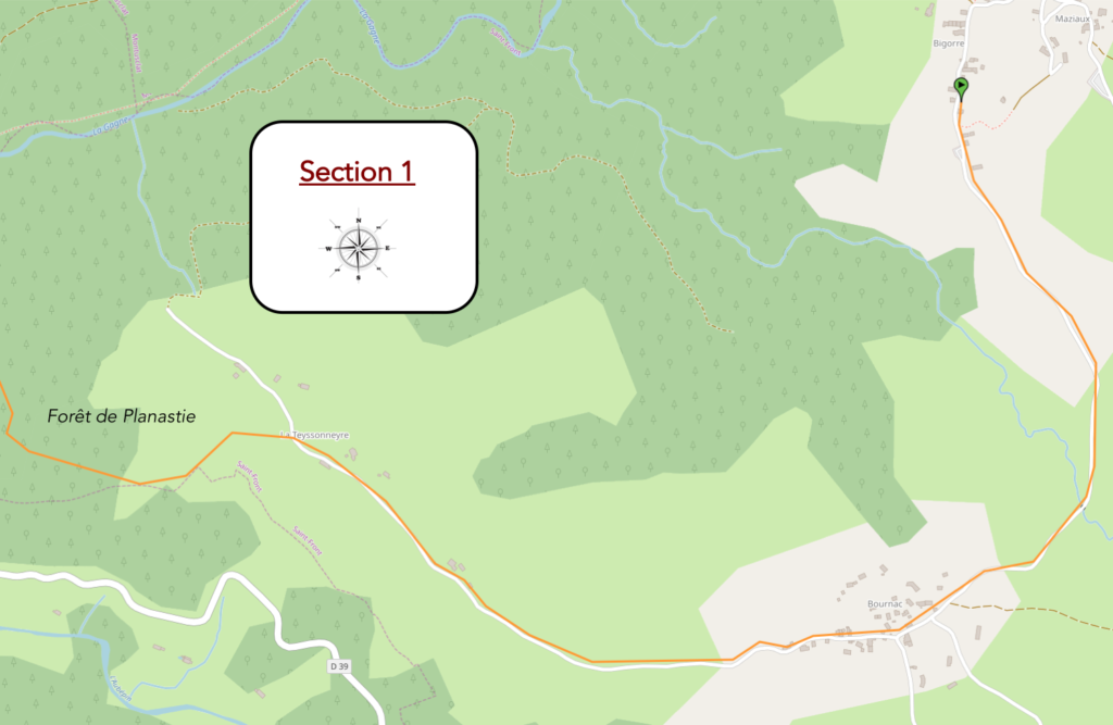
Overview of the route’s challenges: descent with increasingly steep slopes.
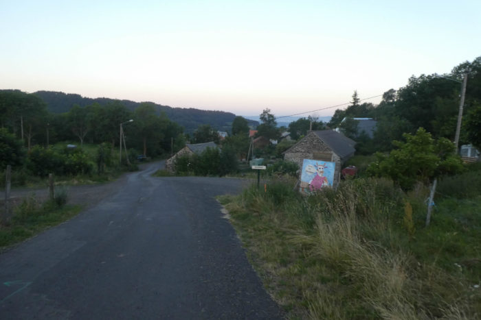
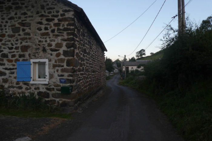
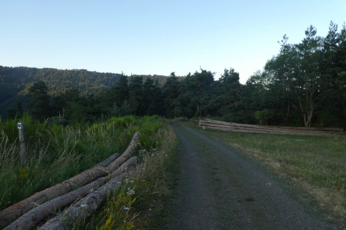
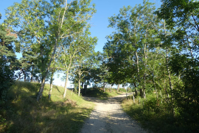
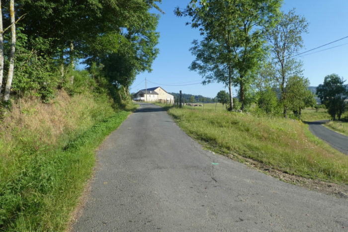
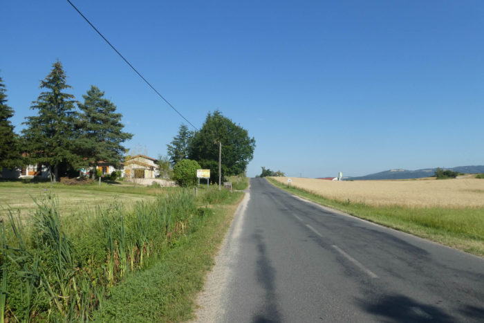
If you spent the night in the Bigorre area, your route will lead you back to Bournac, where the Via Adresca winds along.

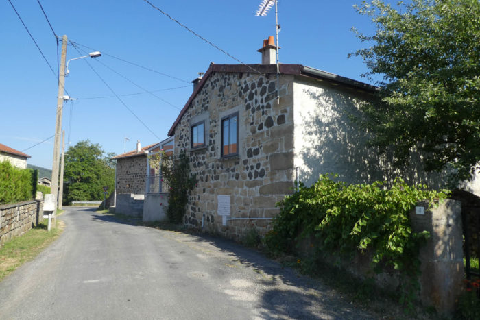
| Here you are in the heart of the village, bathed in a soft morning light. The air is calm, almost suspended, as if time itself had paused for a moment. . |
 |
 |
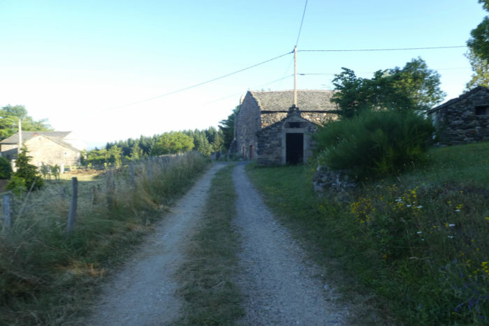
| The road, peaceful and modest, runs alongside a solitary chapel before crossing a hamlet dotted with noble houses built from volcanic stone. These homes, in the dark tones of carefully joined black basalt, are a testament to an architecture deeply rooted in this volcanic land. |
 |
 |
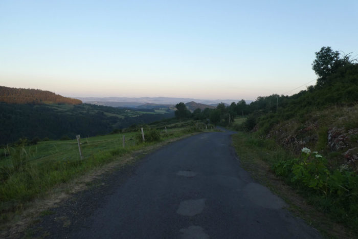
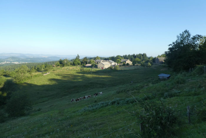
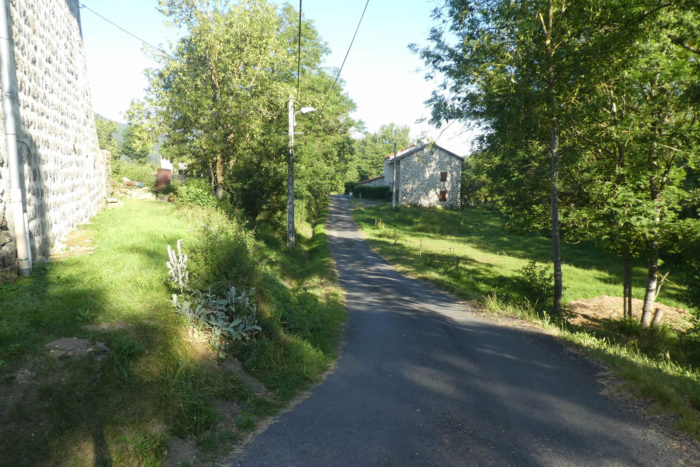
| Then, the descent begins, gentle but continuous, following the contours of a hill. For nearly two kilometers, the road unfolds toward La Teyssonière, a hollow wrapped in shadow in the early morning. There, the darkness slowly gives way to a grand scene: towering forests rise like a wall against the horizon. A wide opening in the landscape reveals the valley of Le Puy below, its small volcanoes piercing through the Velay, and in the distance, the majestic ridge of the Monts du Devès, where the Way of St James continues beyond Le Puy-en-Velay. |
 |
 |
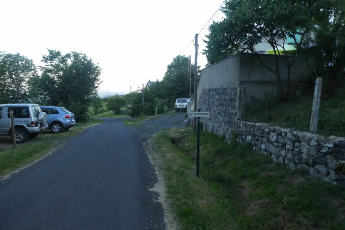
| Continuing on, the road reaches the hamlet of La Teyssonière. Gradually, the familiar volcanoes of the region, called “guads” here, become more clearly defined. These modest landforms, covered in fertile soil, offer rounded summits where groves and wild moorland alternate. However, the entrance to Le Puy via the Via Adresca lacks some of the dramatic flair found along the Via Gebennensis. There, the route weaves among the “sucs,” those rounded volcanoes that punctuate the Velay, Haute-Loire, and Ardèche, evoking small mountains rather than simple hills. |
 |
 |
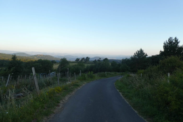
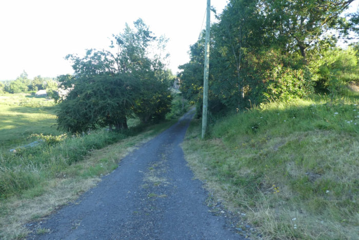
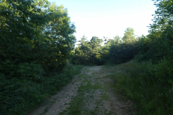
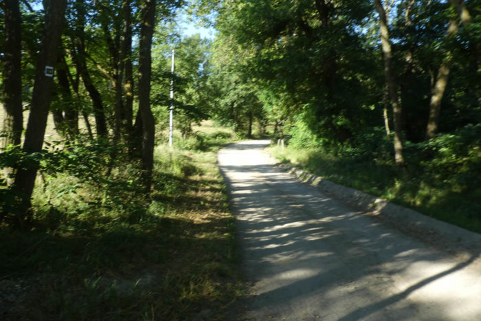
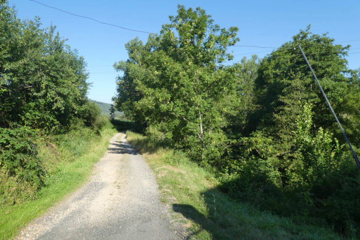
| From the hamlet, the descent continues, wrapped in a setting of ash trees. The road eventually meets a wide forest path that dives into the mysterious Planastie Forest. Here, a new feeling takes hold: adventure is near. |
 |
 |
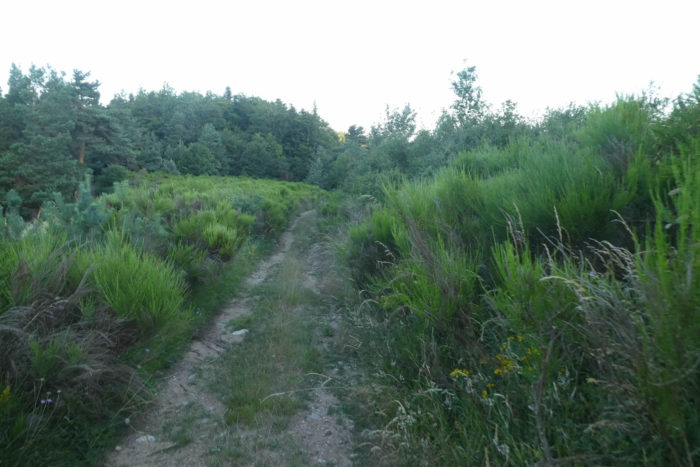
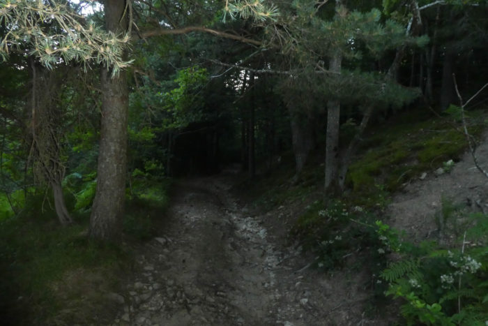
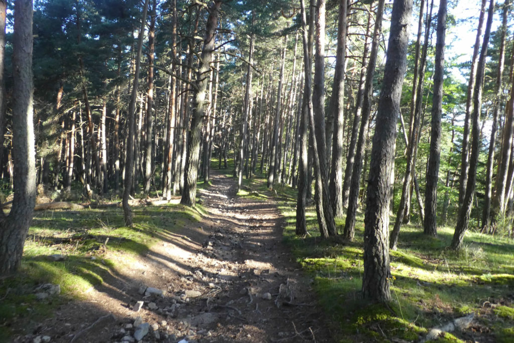
| It is at the entrance to this forest that your journey takes a deeper, almost initiatory turn. The paths of the Way of St James are never impassable, but some leave a lasting mark on those who walk them. This one will no doubt stand out as a memorable trial, perhaps even one of the most demanding of your route. |
 |
 |
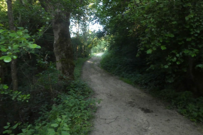
| At first, the trail seems almost welcoming. A gentle slope of about 15 % stretches beneath your feet, surrounded by golden broom, lush ferns, and wild grasses that dance under spruces and ash trees. But the atmosphere quickly changes. The trail becomes rougher, plunging into a chaos of tall grass where the forest below seems ready to swallow you whole. |
 |
 |
Section 2: One of the most beautiful gorges of the Way of St James

Overview of the route’s challenges: it speaks for itself.
| The trail plunges sharply into an impressive drop of nearly 200 meters, a relentless one-kilometer descent where the slopes reach up to 30 percent. Here, the forest tightens around you, dense and impenetrable, like an eternal night where even the sun’s rays struggle to find their way through. |
 |
 |
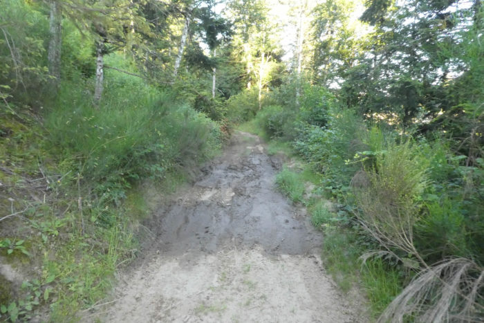
On this slope, the ground is strewn with huge stones and sharp rocks, set in black earth from which cold and persistent water seeps and slides between the blocks. On rainy days, this trail becomes a true challenge, a muddy swamp that spares neither the hiker nor their shoes. The dim light is such that one wonders how the trees, in such darkness, still manage to absorb any light at all.
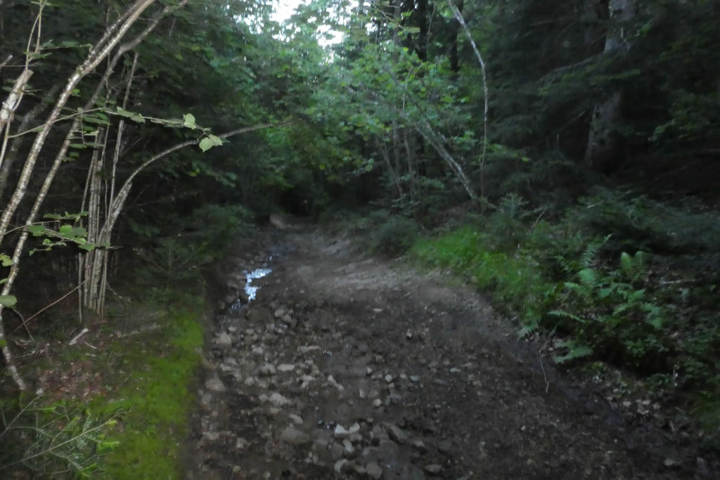
| Everywhere, the trail is marked by deep ruts carved by the unrelenting runoff water. There is no sign of tractors here, far too large for this place. Only deer, wild boar, and sometimes, in the imagination of walkers, wolves or even bears, dare venture into this untamed nature. The stones, angular and sharp, rise from the ground as if to defy each step. Nothing like the smooth pebbles of the Isère. |
 |
 |
| As the slope finally eases to around 15 %, a new obstacle appears: mud. Thick, sticky, it clings to your soles with the tenacity of an old enemy. But around a bend, the appearance of a scallop shell, symbol of the Way of St James, brings comfort to the spirit. You are still on the right path. |
 |
 |
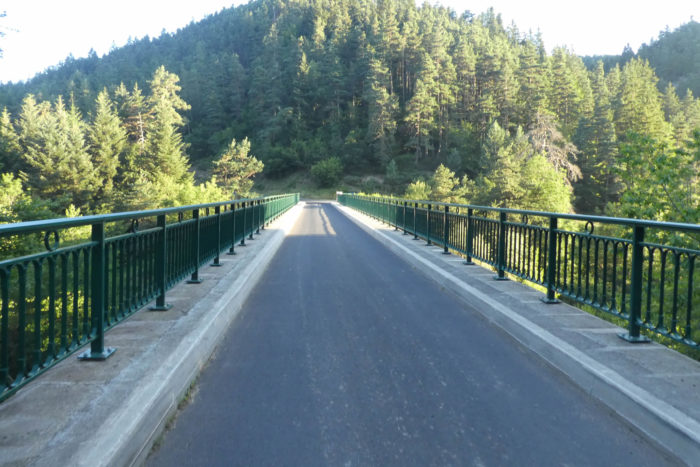
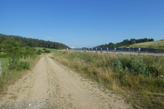
When the descent finally ends after traversing this wild and hostile landscape, a stone bridge rises before you, spanning a narrow gorge. The place, almost gloomy, evokes an old highwayman’s hideout, but for the modern pilgrim, it marks a moment of relief: a threshold crossed.

| In these remote valleys, isolation is not complete. Not far from here, the D49 departmental road winds along. The bridge, sturdily built, crosses the Gagne River, a quiet stream slipping through the undergrowth and eventually joining the Loire. |
 |
 |
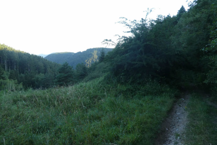
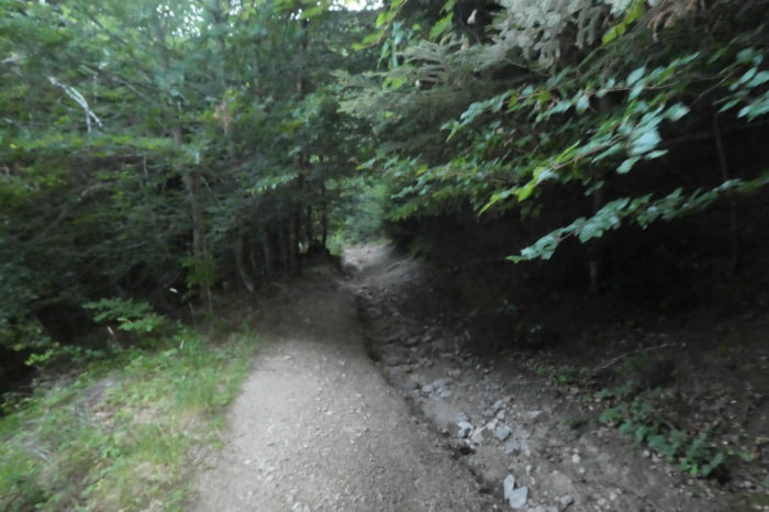
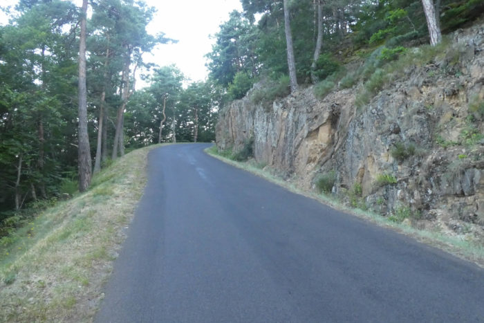
| True to its demanding nature, the road climbs once again up the opposite slope. This is the Way of St James: every descent foretells a climb. Over nearly two kilometers, it ascends through the Côtes of the Gagne Forest, lined with a profusion of pines interspersed with some broadleaved trees. The slopes range from 10 to 15%, and the landscape becomes more monotonous, far from the chaotic lushness of the earlier brushwood. |
 |
 |
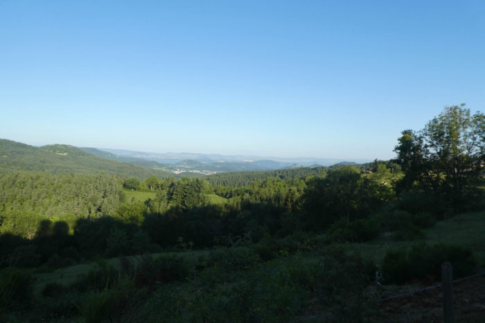
| But after a final turn, the light spreads out once more, piercing the darkness. At the top, a view opens onto a distant horizon: the region of Le Puy-en-Velay appears amid a vast sea of forest, for here, the center of France resembles a gigantic woodland. Further on, the hamlet of La Chapelette finally comes into view. Its stone houses, perched on a small plateau overlooking the valley, offer deliverance, a haven for the weary traveler. |
 |
 |
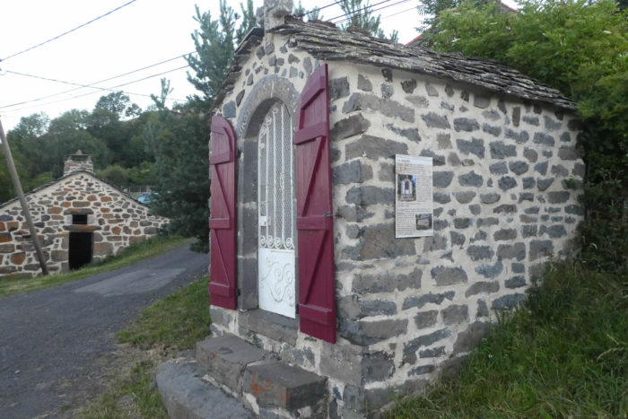
| The Via Adresca then leaves the paved road to venture onto a dirt path. It winds down to the hamlet, where you will find a small chapel built of black basalt, discreet but precious, like a gemstone nestled in the harsh landscape. |
 |
 |

| Beneath a beautiful stone house nestled in an undergrowth hollow, the path gently descends. The bushes, mingled with ash and oak trees, rise like old friends reappearing at each turn. One realizes then that the austere high plateaus have been left behind, where oaks seemed shy, almost absent. Here, their familiar silhouettes reemerge with grace, breathing life back into the forest. |
 |
 |
| A little further on, the path crosses a modest tributary of the Gagne, a murmuring thread of water running between the stones. In this undergrowth setting, a strange scene plays out: a silent struggle for existence. Ash trees, the kings of the region, dominate with magnificence, but for how much longer? Their days seem numbered, as a slow-consuming fungus threatens to end their reign. Perhaps the cold from the river halts its spread, or perhaps it is a mystery that even science struggles to explain. The laws of nature remain unpredictable: altitude, soil, climate, all seem to play a role in this great theatre where even chestnut and maple trees try to hold their ground against the imposing supremacy of the ash. |
 |
 |
| Descending a little further, the path becomes heavier, swallowed by zones where water seeps from the earth. Mud reigns supreme here, hindering each step as if to challenge those who dare to pass. |
 |
 |
| Just beyond, the stones return, and the path, rougher but more stable, leaves the dense forest cover. It opens onto the hamlet of Les Vignettes, a modest but charming place where a few quiet houses seem suspended in time. |
 |
 |
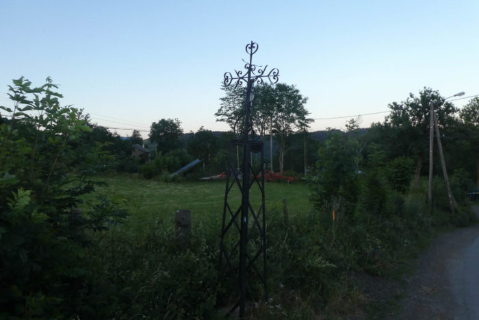
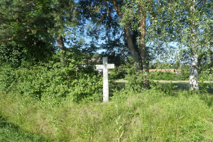
| A short asphalt section crosses this hamlet, winding through the ash trees. This tiny oasis, bathed in filtered light, contrasts with the oppressive shadows of the forest. But just beyond this place, a large iron cross appears on the horizon. Set upon a granite base, it bears a sculpted Christ, frozen in a posture full of solemnity, as if to bless or greet the travelers. This cross becomes the threshold of another world, heralding a radical change in landscape. The invitation is clear: you are entering the realm of the pines. |
 |
 |

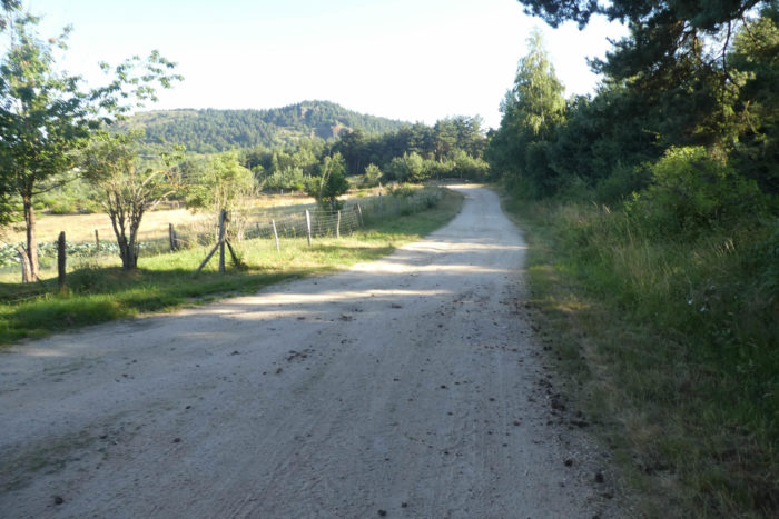
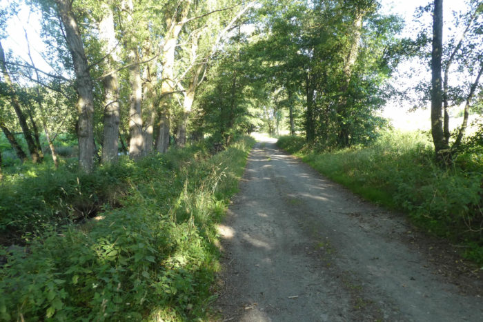
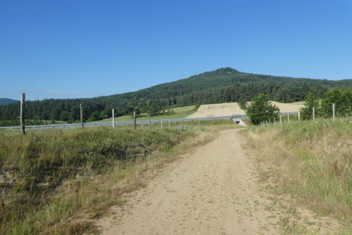
| As the path continues, a vast pine forest stretches out as far as the eye can see. At first, the trees seem scattered, each standing in solitary elegance, as if preparing for a secret gathering. The air is filled with their resinous scent, and the light, filtered through their tall branches, dances softly across the ground, offering an atmosphere that is both peaceful and enchanting. The descent promises to be long, but each step is a rediscovery, an immersion into a grand and calming natural world. |
 |
 |
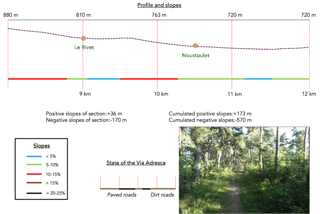
Section 3: Through an incredible pine forest before reaching the plain
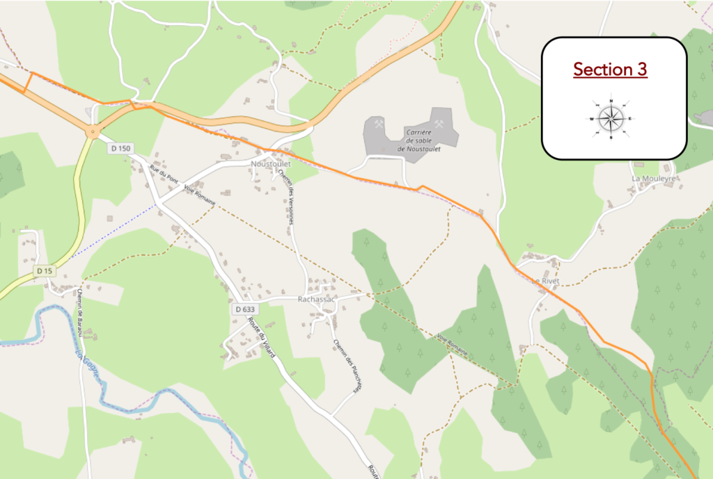
Overview of the route’s challenges: in constant descent, but an easy route.
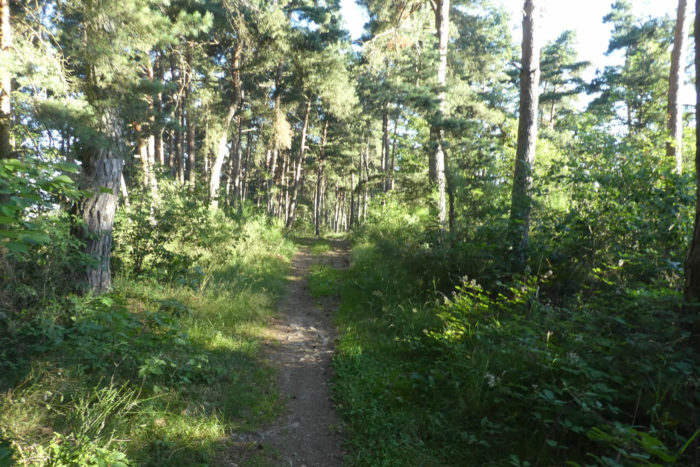
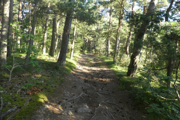
Lower down, the scene opens like a living painting. The pines, tightly packed together, raise their sturdy trunks and tapered crowns like an army of frozen soldiers defying the brilliant blue sky. This silent and almost solemn tableau stirs deep admiration, a simple joy that only nature can offer.
Beneath their imposing branches, serenity settles in. Pinecones are scattered across the brown ground, where roots snake lightly, drawing almost calligraphic shapes. The gentle and steady slope seems designed to please all the senses: the eye that contemplates, the gaze that wanders, and the soul that marvels.

| As you leave the majestic forest, a wide dirt path leads down toward a sprawling countryside, dotted with small discreet groves. These fragments of greenery give the landscape an intimate and welcoming charm. |
 |
 |
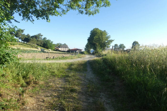
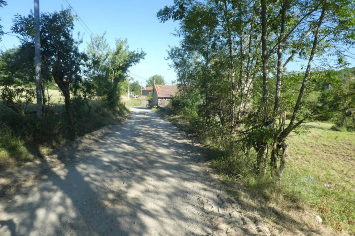
| The path reaches the hamlet of Le Rivet, a cluster of large farms nestled at the edge of the woods. Here, the houses of Ardèche and Haute-Loire stand out with their imposing character, built of massive stone that speaks of history. These homes from another time offer a pleasant contrast to the often-bland uniformity of other French regions. |
 |
 |
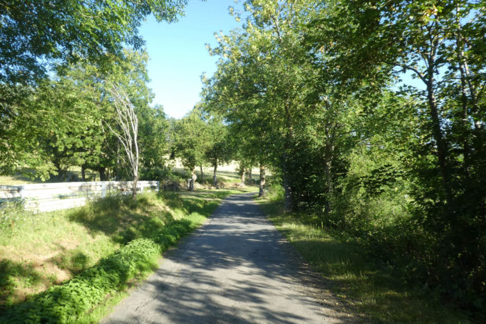
| Here, a road gently descends under the kind shade of large oak and ash trees. Although it is a road, the landscape retains a softness and poetry that enchants. The diffused shade invites daydreaming, and each step becomes an ode to calm. |
 |
 |
| At the place called La Portale, the Via Adresca leaves the road and takes another road, more intimate, that winds gently. Later, it leaves the pavement again to rejoin a wide dirt path. Here, the ground becomes almost sandy, a sign of the proximity of a quarry. |
 |
 |
| Ahead of you, the volcanic « guards » dominate the horizon. These soft, wooded mounds, covered with dense forests all the way to their summits, shape a landscape that is both soothing and powerful, an echo of the region’s tumultuous past. |
 |
 |
| The sandy track, after a few twists between meadows and groves, descends at a gentle slope. |
 |
 |
| Between oaks and ash trees, the sandy road reaches the first houses of the village of Noustoulet. |
 |
 |
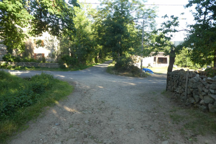
| Noustoulet is another gem of the region, a village shaped by volcanism, where the stones seem to tell stories from millennia past. The houses gleam with the sparkle of volcanic rock, shifting between warm hues and the dark depth of basalt. This village, steeped in a timeless atmosphere, feels like it belongs to another era. The Via Adresca crosses a departmental road, the D150, before venturing once again into the village’s narrow streets. |
 |
 |
| A small road quickly passes through the heart of the hamlet, skirting homes of unrivaled charm. These houses, with their narrow windows, seem to guard their secrets jealously, as if shielding their inhabitants from curious eyes. Their timeless architecture recalls past ages, yet they still stand, dignified and elegant. |
 |
 |
| Shortly after, the dirt path takes over again. The path winds once more between ash and oak trees, running along the Noustoulet stream, almost hidden beneath a thick cover of foliage. One can sense its quiet murmur, a faithful companion. |
 |
 |
| But soon, as the woods give way, the landscape changes abruptly. The horizon fills with large departmental roads, a ballet of roads crisscrossing the outskirts of Le Puy-en-Velay. |
 |
 |
| But soon, as the woods give way, the landscape changes abruptly. The horizon fills with large departmental roads, a ballet of roads crisscrossing the outskirts of Le Puy-en-Velay. The contrast is striking, almost brutal, but the Via Adresca, cunning as ever, manages to weave its way through this tangle of roads. It eventually reconnects with a dirt path, winding between fields of grain and meadows, heading toward a new “guard”, those soft, forested volcanoes watching over the plain. |
 |
 |
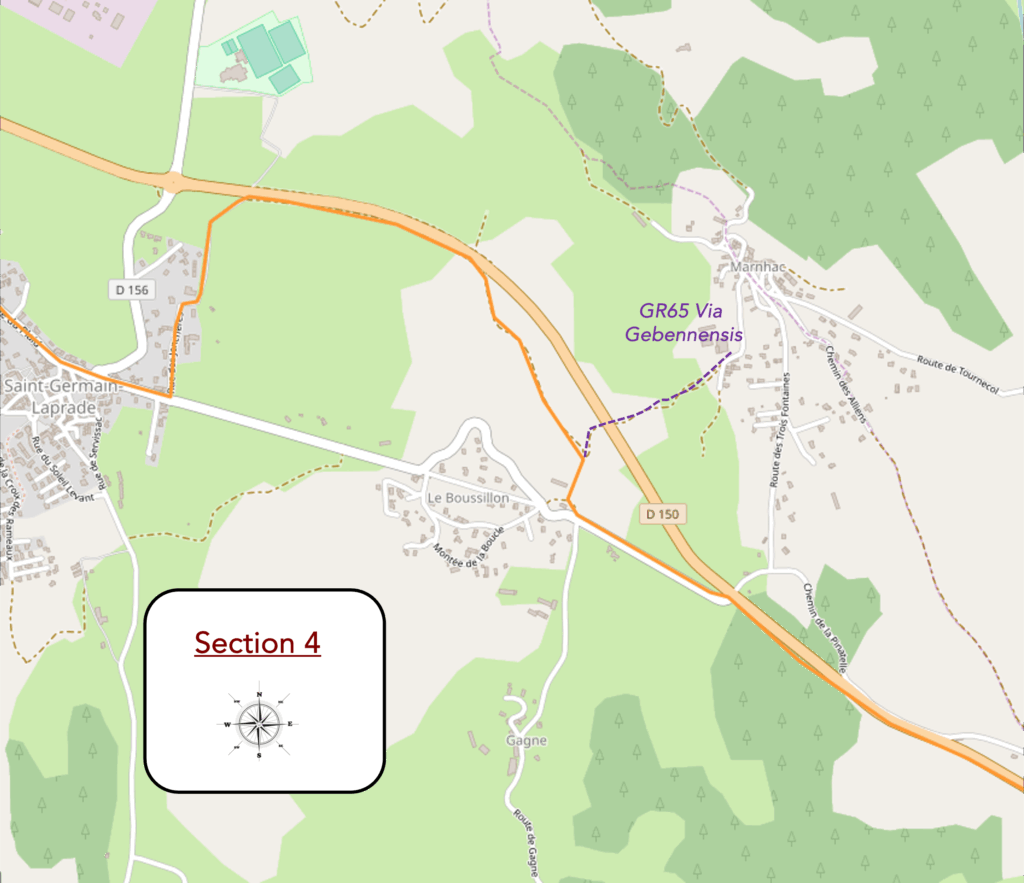
Section 4: Along the main roads of the Velay
Overview of the route’s challenges: a route without difficulty.
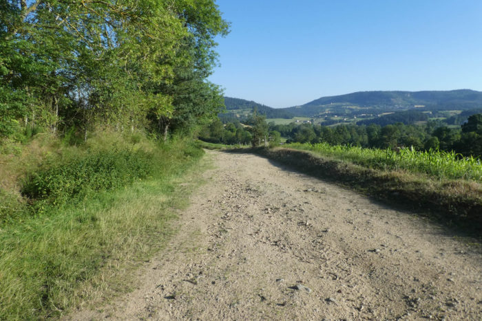
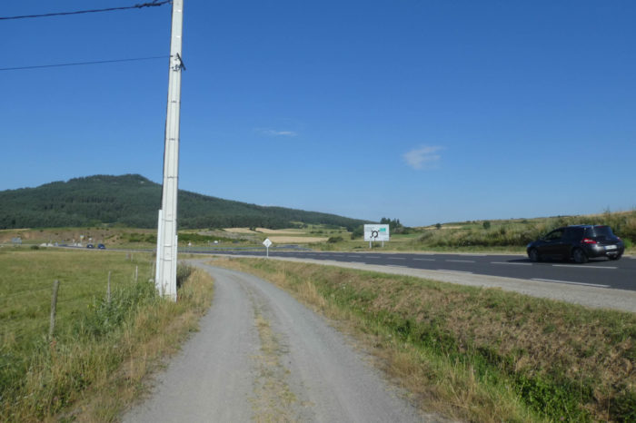
| The dirt path gradually approaches the departmental road D150, which it will follow for quite a while. This is not the most exhilarating part of the route. The atmosphere is monotonous, and the walk seems to stretch on endlessly. Fortunately, traffic here is rather light, since this road is not one of the region’s major arteries. It is not yet the main road descending from St Etienne toward Le Puy-en-Velay, which will appear further ahead. |
 |
 |
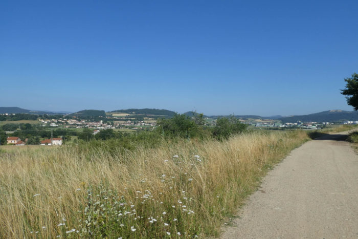
| There are moments on the Way of St James when boredom sets in, when the landscape no longer captivates, and each step feels like a repeat of the one before. These passages are rare, but this is one of them. Crossing road junctions or walking alongside departmental roads is an inevitable part of approaching major cities. After all, the route has to pass somewhere, doesn’t it? Soon, on the horizon, the industrial complex of St Germain-Laprade takes shape, imposing and without charm, a harsh contrast to the surrounding nature. Further beyond, the Devès hills offer a more familiar and comforting silhouette. |
 |
 |
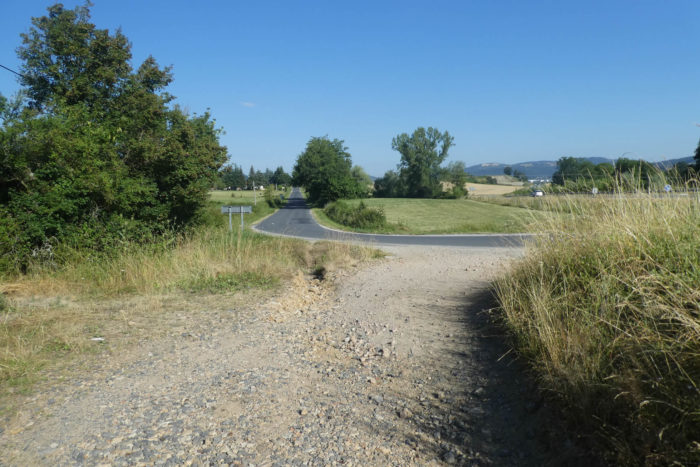
| Farther still, the Via Adresca leaves the departmental road and follows a paved road, straight and isolated, that heads deep into the countryside. Here, the landscape becomes peaceful again, though the setting remains simple and bare. |
 |
 |
| The road then approaches the village of Roussillon but only brushes past it. |
 |
 |
| Then, after a straight stretch that seems never-ending, the route turns right onto a wide path where gravel crunches beneath your feet. You are noticeably approaching Saint-Germain-Laprade and its industrial zone. |
 |
 |
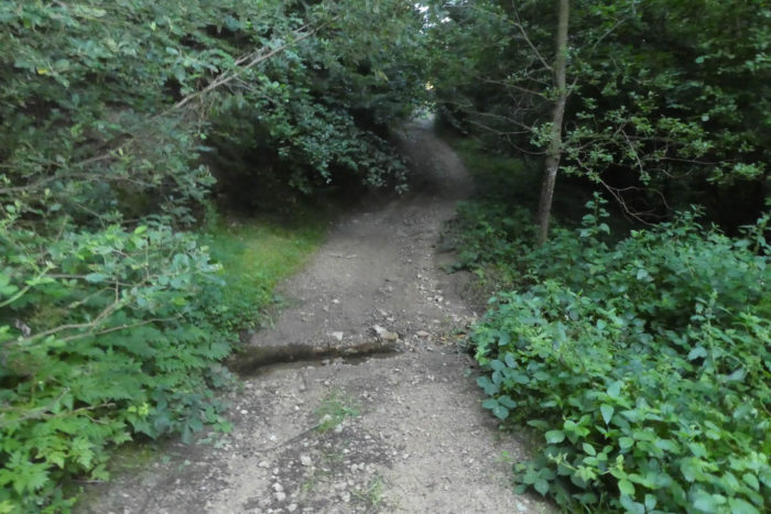
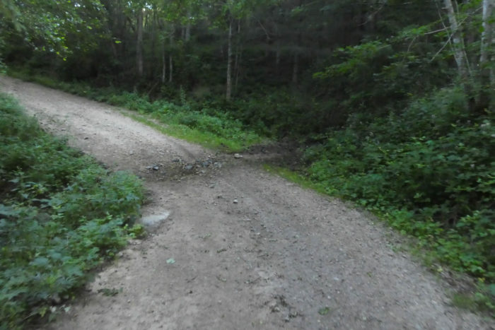
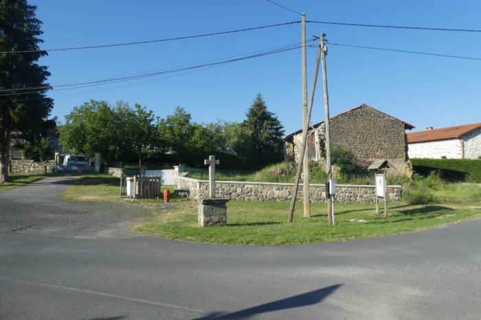
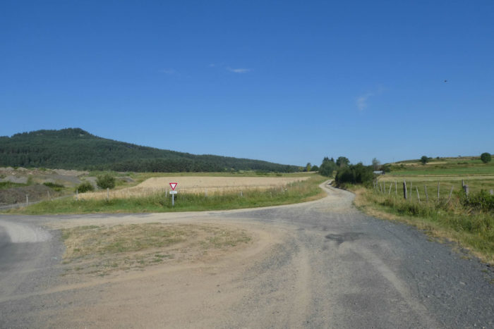
AAt the end of the path, a modest yet symbolic post stands to mark an important crossroads. Several well-known paths converge here: the GR430, known as the Way of St Régis, and the GR65, the Via Gebennensis, coming from Marnhac. The Via Adresca joins the latter at this precise point, marking the end of its distinct itinerary. The circle is complete.
For the continuation of the route to Le Puy-en-Velay (accommodation, city visit), refer to the parallel website covering the Via Gebennensis (Stage 14: Queyrières–Le Puy).

Feel free to add comments. This is often how you move up the Google hierarchy, and how more pilgrims will have access to the site.
|
|
 |
Back to menu |


