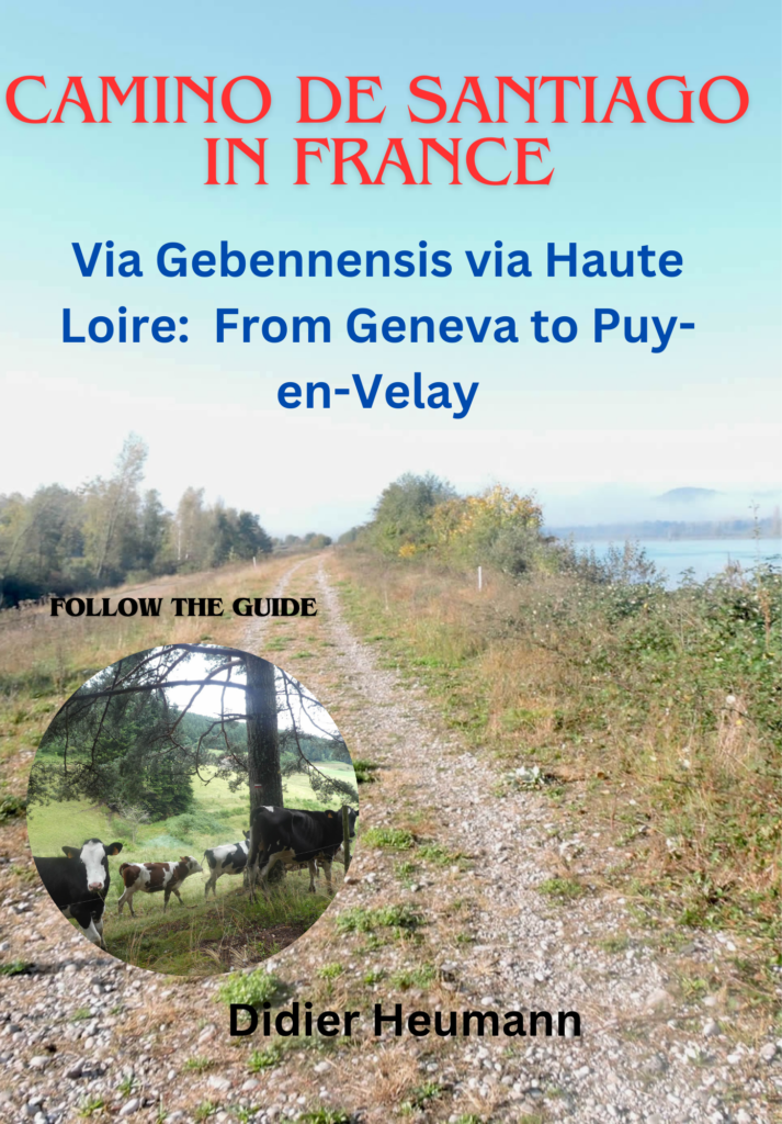
Among the Carthusians before greeting the Symphonie Fantastique
DIDIER HEUMANN, ANDREAS PAPASAVVAS

We divided the course into several sections to make it easier to see. For each section, the maps show the course, the slopes found on the course, and the state of the route (paved or dirt roads). The courses were drawn on the « Wikilocs » platform. Today, it is no longer necessary to walk around with detailed maps in your pocket or bag. If you have a mobile phone or tablet, you can easily follow routes live.
For this stage, here is the link:
https://fr.wikiloc.com/itineraires-randonnee/de-le-pin-lac-paladru-a-la-cote-st-andre-par-la-via-gebennensis-34136413
| Not every pilgrim feels comfortable using GPS devices or navigating on a phone, especially since many sections still lack reliable internet. To make your journey easier, a book dedicated to the Via Gebennensis through Haute-Loire is available on Amazon. More than just a practical guide, it leads you step by step, kilometre after kilometre, giving you everything you need for smooth planning with no unpleasant surprises. Beyond its useful tips, it also conveys the route’s enchanting atmosphere, capturing the landscape’s beauty, the majesty of the trees and the spiritual essence of the trek. Only the pictures are missing; everything else is there to transport you.
We’ve also published a second book that, with slightly fewer details but all the essential information, outlines two possible routes from Geneva to Le Puy-en-Velay. You can choose either the Via Gebennensis, which crosses Haute-Loire, or the Gillonnay variant (Via Adresca), which branches off at La Côte-Saint-André to follow a route through Ardèche. The choice of the route is yours. |
 |
 |
If you only want to consult lodging of the stage, go directly to the bottom of the page.
Today, starting from the shimmering shores of Lake Paladru, your journey will lead you through a series of gentle hills, eventually opening up to the vast plains of Bièvre-Valloire. You will traverse the Bas-Dauphiné, a big region spanning across the Isère. This imposing area, which covers a significant portion of the department, consists mainly of low to mid-altitude hills, interspersed with valleys and elongated plains, including those of the Rhône, Bièvre, Valloire, and Bourbre. On this leg of your journey, you will wind through the heart of the Terres Froides to reach the broad valley of Bièvre-Valloire. Should you opt to follow the Via Adresca further, a detour through Gillonay, you will discover the other side of the hills, those of Chambaran. The notable difference between these hills lies in the soil composition: Quaternary era pebbles are less present in the Terres Froides, making your walk gentler on your joints and shoes.

Upon entering the vast plain of Bièvre-Valloire, you will be immersed in a landscape sculpted by the geological upheavals of the glacial era. The glaciers of the Rhône and Isère waged an incessant battle here, carrying enormous amounts of alluvium and pebbles, creating paths that sometimes transform into veritable scree fields. You will also quickly leave this plain to tread the moraines, offering breathtaking views of the valleys below. However, do not be deceived by the term « walk »: this long trek along the foothills of the plain can be demanding. It may not be the most beautiful stage of the Camino de Santiago, but each pilgrim can find their own poetry and wonder here.
.

Difficulty level: The day’s elevation changes (+482 meters/-596 meters) are moderate for a stage of nearly 28 km. A few passages, however, require particular attention, notably the climb towards Les Allex after a night at Lake Paladru, then towards the Sylve bénite, and especially the tough climb to the Crêt Farm after Quétan. The descent on the pebbles of the Bièvre towards the Grand Lemps is one of the most challenging sections of the Camino de Santiago, particularly in rainy weather. Once in Bièvre, the difficulties lessen, except for a few short climbs.
State of the GR65: On this stage, roads predominate significantly over path sections:
- Paved roads: 17.0 km
- Dirt roads : 10.7 km
Sometimes, for reasons of logistics or housing possibilities, these stages mix routes operated on different days, having passed several times on these routes. From then on, the skies, the rain, or the seasons can vary. But, generally this is not the case, and in fact this does not change the description of the course.
It is very difficult to specify with certainty the incline of the slopes, whatever the system you use.
For those seeking « true elevations » and enthusiasts of genuine altimetric challenges, carefully review the information on mileage at the beginning of the guide.

Section 1: To reach Le Pin and beyond

Overview of the route’s challenges: The route is generally easy, except for the climb to Allex to join the GR65, and then the climb to Sylve Bénite, which is quite steep. The slopes often exceed 15%, but they are not long.

|
If you stayed in one of the few accommodations available in Le Pin, you are already on the GR65. However, if you spent the night in Ars, a stage now preferred by many pilgrims due to the limited lodging options in Le Pin, you will need to follow the GR65 from Lake Paladru by first taking the lake road…
|
 |
 |
|
…then beginning the steep ascent of Montée de la Madonne. As you climb this demanding road, the landscape transforms. You have descended much lower than the GR65, and it is crucial to rejoin it. An alternative is to follow the lake road to Le Pin, but this route is significantly longer. Pilgrims do not pass that way.
|
 |
 |
After about a kilometer, the road meets the GR65 at the village of Allex, a little gem of tranquility. Here, time stands still in the early morning, at the hour of the rare passing pilgrims.

| The road passes through this peaceful village, dotted with modest welcoming houses, lined along the road and green meadows. From the village, the descent to Le Pin takes you into the heart of a countryside that, although charming, may not evoke an admiring sigh from most walkers. The Dauphiné area, despite its discreet beauty and authentic landscapes, does not seek to dazzle, but rather to offer a serene and genuine setting, far from postcard clichés. |
 |
 |
| Yet, it is this very simplicity that makes it so charming. As you descend to Le Pin, the fields stretch as far as the eye can see, punctuated by hedges and a few solitary trees. Here, the pace of life seems slowed, dictated by the natural cycles of the seasons rather than modern hustle and bustle. At the end of this descent, you will arrive at the foot of the village of Le Pin. |
 |
 |
| Here, fishing is a reserved privilege, in two small marshy ponds, nestled in a preserved and wild nature. The Marais stream flows through this enchanting place, connecting one pond to another. The reflections of the weeping willows in the murky water create an atmosphere of mystery and absolute calm. The local fishermen, tranquil silhouettes by the water, seem themselves to belong to this immutable landscape. |
 |
 |
| Soon after, the road leads you to the heart of the village, a tableau of rural tranquility. |
 |
 |
| Le Pin is a typical village of the Dauphiné, with simple and unpretentious houses, built not from noble stones but from humbler materials. Since 2016, this village has lost its administrative identity, integrating into the commune of Les Villages du Lac Paladru. Yet, it retains its soul, its unique character. Here, one can still find sustenance at an inn where local flavors are celebrated, though the restaurant no longer serves as a hotel. |
 |
 |
| Fortunately, there is a small grocery store at the village’s exit, offering pilgrims the opportunity to resupply. However, it is crucial to go there during opening hours, an additional challenge for those traversing the paths of France, where logistics can often prove complicated and chaotic. |
 |
 |
| A road slopes up towards the village’s exit, crossing recent housing estates, without particular character, like so many other modern constructions. Sometimes, a few cob or gray lime-restored houses remain, bearing witness to the local heritage and offering a striking contrast with the surrounding uniformity. |
 |
 |
| Quickly, this road reaches and crosses the village of Chassigneux. Here, you walk on the Route de la Grande Dimière, a road that, at first glance, may seem devoid of spectacular attractions. The houses, simple and unpretentious, do not seek to impress but embody authentic modesty. The simplicity of these dwellings has the advantage of not being pretentious, offering a raw and unvarnished sincerity. |
 |
 |
| Shortly after leaving the hamlet of Le Buisson, the GR65 diverges from the road, guided by an old cob relic, to take the Chemin de la Sylve Bénite. This path, austere and steep, displays dizzying slopes often exceeding 15%, challenging even the most seasoned hikers. |
 |
 |
| On this steep path, the Isère pebbles, though discreet, dot the way, recalling the ancient power of glacial movements. At the edge of the meadows, where horses and cows roam freely, nature unveils a symphony of greenery bordered by the hedges of the Côtes du Gay woodland. The vast and lush meadows stretch as far as the eye can see, offering a pastoral scene of serene beauty. |
 |
 |
Below, the spectacle is striking today. Morning mists lazily stretch over the peaceful waters of Lake Paladru, creating an almost mystical atmosphere. Although the climb is rigorous, the unfolding panorama is breathtaking, imbued with the bucolic tranquility one ardently seeks. After the monotony of the villages traversed since the beginning of the stage, this enchanting scenery is a true breath of fresh air. The countryside of Isère, despite its economic modesty, offers the pilgrim an invaluable visual and spiritual respite, a truth that the region’s inhabitants know and accept, often unknowingly. This land, far from being bathed in gold, bears witness to the harsh reality of rural life, where the raw beauty of the landscape contrasts with the sobriety of the inhabitants’ means of subsistence. Yet, this simplicity, this authenticity, bestows Isère with undeniable charm, an unsuspected richness that reveals itself to those who know how to look beyond appearances.

Section 2: Passing through the beautiful Sylve Bénite

Overview of the route’s challenges: The route is without significant difficulty.

| At the top of the meadows, the path enters a dense and mysterious forest, like a secret door opening to a forgotten realm. |
 |
 |
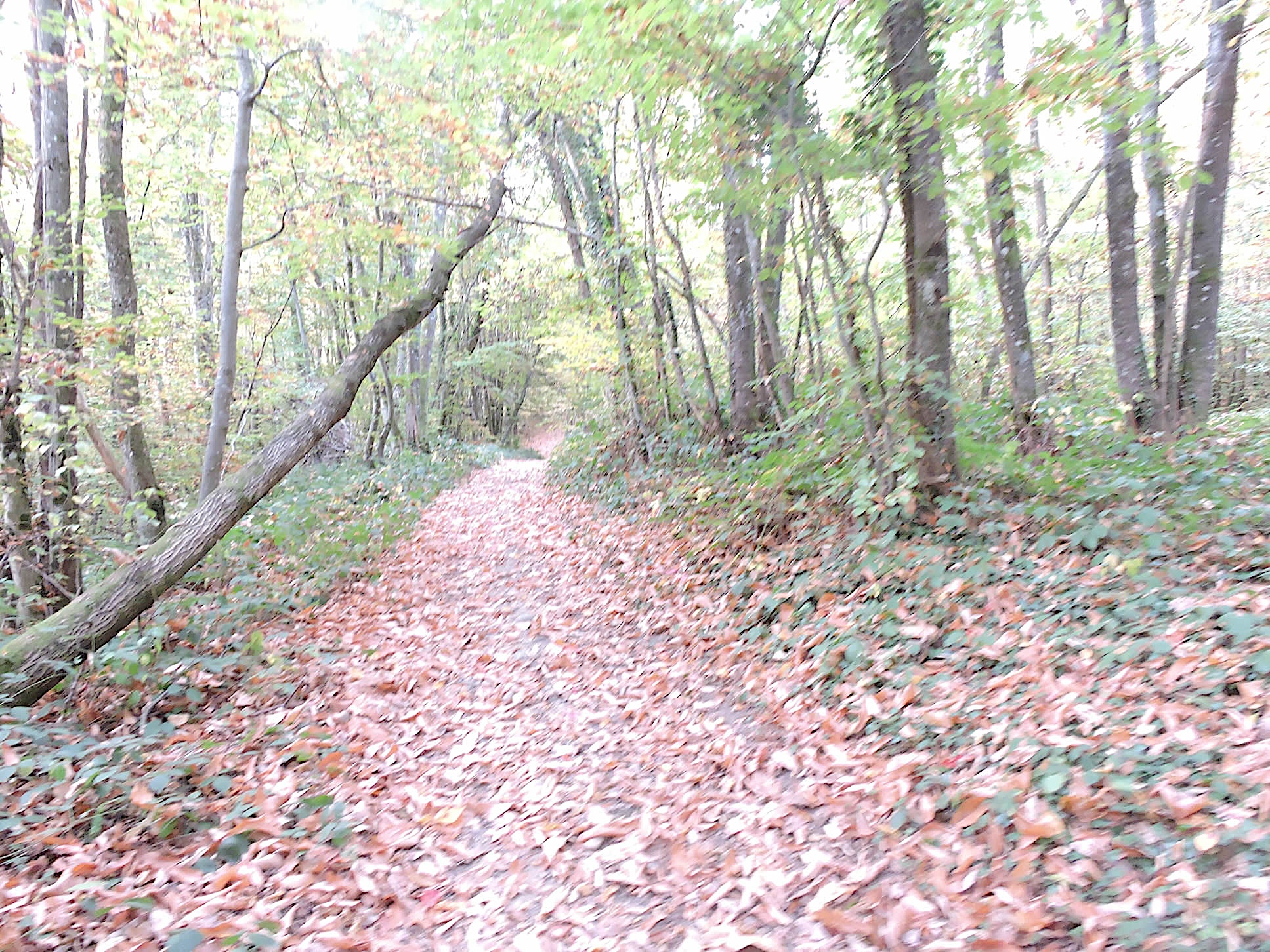
| The path, now nearly flat, stretches through the heart of the Sylve Bénite forest, winding among majestic deciduous trees. The chestnut trees stand proudly, their tall and straight trunks like sentinels guarding this green sanctuary. They dominate the canopy, creating a natural archway that filters the sun’s rays, transforming them into a golden, muted light. The undergrowth is animated by the discreet but essential presence of maples, oaks, and a few beeches, adding shades of green, gold, and bronze to this vegetal symphony. In autumn, the forest becomes a living painting where each fallen leaf tells a story. The varied shapes and vibrant hues of the leaves allow the pilgrim to become an amateur botanist, identifying trees by their imprints on the ground. Walking on a carpet of chestnut husks is to feel the hidden richness of this forest underfoot. Unlike the majestic grafted chestnut trees, here are small, spindly chestnuts, often growing in tight clusters like families united against the rigors of the climate. |
 |
 |
| At the exit of the forest, the path suddenly opens onto the grand site of Sylve Bénite, a breathtaking panorama that seems straight out of a fairy tale. |
 |
 |
| The history of this place is as rich as its landscape. Founded in 1084 by Saint Bruno, a German saint in search of spirituality, the Carthusian Order was born in the Chartreuse massif. This monastic order, a subtle blend of clerics and laymen, resembles in some respects that of Saint Augustine. The Carthusians lead a balanced life between community and hermitage solitude. Their daily life is not limited to distilling the famous herbal liqueurs but extends to a life of prayer, meditation, and manual labor, finding in this alternation a path to spiritual harmony. Driven out by the French Revolution, the order found refuge in Italy, gradually returning to France later. The Charterhouse of Sylve Bénite, founded thirty-two years after the motherhouse of the Grande Chartreuse, has undergone many transformations and destructions. Closed permanently in 1791 due to revolutionary upheavals, it stands today as a silent witness to the region’s tumultuous history. The building, now private, is not open to visitors, but its enclosing wall offers passersby a glimpse of its former grandeur, inviting reverie and contemplation.
The region of Lac de Paladru is steeped in legends and mysteries, notably one linking the Charterhouse’s history to the city of Ars, purportedly submerged under the lake’s waters. Archaeological excavations have confirmed the existence of this village near a major Neolithic site. However, the circumstances of its disappearance remain obscure. Did Ars, meaning « burned, » get destroyed by fire or engulfed by a tragic landslide? Where you may have stopped the previous night, a landslide destroyed an entire village in the late 19th century, reminding us of this ancient land’s fragility and strength. We, who naïvely thought we were crossing a place without history, discover here a land rich with stories and legends, where every stone, tree, and blade of grass whispers the echoes of a glorious and mysterious past. |
 |
 |
From here, you can still glance at the sheets of fog encircling Lac de Paladru and the beautiful surrounding countryside. The mist, like a diaphanous veil, tenderly embraces the lake’s shores, giving this landscape a mystical and enchanting aura. The hills undulate gently, offering a striking contrast between the green meadows and the dense groves.

A winding road escapes from the majestic Chartreuse, snaking through the dense forest to a parking area hidden among the trees.

| The path plunges again into the deep forest, a blessed sylvan realm where gnarled and often stubborn deciduous trees reign. |
 |
 |
While deciduous trees dominate within the woods, spruces appear when the path passes through clearings.

| When the path leaves the forest, it stretches into the plain, a sea of waving grasses and beaten earth, between meadows and cornfields. The Dauphiné then reveals its authentic face, that of a generous and fertile countryside. The Isère is, above all, a vast countryside, a patchwork of crops and pastures where the work of the land blends harmoniously with natural beauty. |
 |
 |
| Everywhere the eye rests, there are well-tended fields, green meadows, and thriving farms. Here, even a deer park adds a touch of tamed wildness to this bucolic landscape. |
 |
 |
| At the end of the descent, the GR65 joins the paved road at the entrance to Blaune, a small farming village nestled in the heart of Isère. Blaune exudes authenticity and rustic simplicity. |
 |
 |
| These villages in Isère do not show signs of ostentatious opulence. Some houses, built of unjointed cement blocks or cob, tell a story of modesty and robustness. Recent villas, sometimes erected haphazardly, stand alongside these old buildings, a testament to a rich agricultural past. |
 |
 |
Even the cross, a symbol of faith and tradition, remains discreet on the wall of a house, like a secret whispering the legends of the past.

| At the village’s exit, the road resumes its way through the meadows in the plain, offering here and there the sight of a solitary oak or a cluster of chestnut trees. These solitary trees, immobile sentinels, punctuate the landscape with intense green touches, their silhouette standing out sharply against the plain’s monotony. |
 |
 |
| The following traverse becomes monotonous and endless, a vast plain stretching as far as the eye can see under your feet. The Dauphiné, with its succession of plains and rolling hills, stretches from north to south like an endless carpet. As you advance, you will see the hill of Fûteau inexorably approaching before you, promising an upcoming climb, breaking the monotony of this infinite plain. |
 |
 |
| Further on, the road changes direction but not the landscape. The plowed fields, cornfields, and meadows continue to stretch as far as the eye can see, punctuated only by a few scattered clusters of trees. These groups of trees, like islands of greenery, offer a visual respite in this vast agricultural expanse. |
 |
 |
| There is not much to see, except for the three crosses standing on the hill of Mollard Rond in the distance. Legend whispers that Clodomir, son of Clovis I, King of the Franks, killed in a battle against the Burgundians, was buried here. But these three crosses, solemn sentinels of the past, will not divert pilgrims from their route. |
 |
 |
Section 3: Towards the hill and forests of Fûteau

Overview of the route’s challenges: The route near the hill of Fûteau is, one might say, quite challenging.

| Under the Three Crosses, at the place called Le Calvaire, the walker, in search of tranquility and escape, is 4.6 km from Grand Lemps. |
 |
 |
| Soon, the discreet murmur of nature is disrupted by the distant roar of highway engines. The route then transforms into a path of stones, a remnant of the glacial era’s alluvium. It is an inhospitable terrain, similar to a battlefield, where vegetation finds a way with admirable resilience. |
 |
 |
| The path becomes more demanding, stones litter the ground, making progress laborious. Tractors, true iron titans, must fight an endless battle against a recalcitrant land. And yet, despite this challenge, corn thrives, standing in tight rows, defying difficult conditions with surprising vigor. |
 |
 |
| Crossing these cornfields, the wide path leads inevitably to the A48 highway, a vital artery linking Grenoble to Lyon. The contrast between the rural calm and the tumult of the fast road is striking, but it adds a new dimension to this mosaic of landscapes. |
 |
 |
|
The GR65 passes under the highway, where the crash of vehicles transforms into a distant, almost unreal symphony. On the other side, a paved road gently slopes upwards, guiding the hiker to the village of Quétan, where crosses, symbols of faith and tradition, line the way, reminding the walker of the spirituality imbued in this land.
|
 |
 |
|
The road stretches through the village, long and winding, gradually revealing the rustic charms of Quétan. The houses are aligned with simplicity, while the dogs, true canine sentinels, howl in unison, a familiar cacophony for those crossing the Dauphiné.
|
 |
 |
| At the village’s top, the road turns into a beaten earth section, a humble prelude to the asphalt that will surely cover it one day. |
 |
 |
| Higher up, the road becomes asphalted again. The slope here is formidable, sometimes exceeding 15%, challenging gravity and walkers. Rare vehicles may struggle in the climb, heading towards the farm standing above. |
 |
 |
| As the road continues its ascent and the slope finally eases, you arrive at the Crêt Farm. There, horses graze peacefully in green pastures, surrounded by forests where trees adorn themselves with their flamboyant autumn colors. The countryside here is strikingly beautiful, a true living painting where nature displays all its richness and splendor. |
 |
 |
| Behind the farm, the gravel path resumes, winding through the countryside. The progress becomes more tough after a brief plateau, as the ascent resumes in earnest. The path, bordered by centuries-old chestnut trees and imposing spruces, becomes more demanding, plunging the walker into an enchanting undergrowth where nature seems immutable and eternal. |
 |
 |
| If you have the chance to pass through here in autumn, you will be lulled by the distant and muffled sound of hunters’ gunshots, a discreet but constant reminder of human activity animating these forests. Though perceptible, these shots are distant enough not to disturb the path’s tranquility. |
 |
 |
| As the ascent continues, the slope becomes increasingly steep. The ground, littered with stones and scree, challenges the walker’s feet, each step requiring effort and endurance. Breathing becomes short, the heart beats harder, but the wild beauty of the place encourages perseverance. |
 |
 |
| At the top of the Fûteau hill, the view opens onto a panorama of undeniable majesty. The altitude conquered, over 150 meters climbed in a short time, offers a radical change of scenery. It’s like entering a new world. The horizon stretches as far as the eye can see, evoking infinity, an invitation to contemplate with renewed humility the Bièvre plateau extending below. Here begins a transcendent experience, whether taking the Via Gebenensis or the Via Adresca, for several days of immersion on the gentle foothills of the Bièvre. |
 |
 |
| The descent from this summit towards the Bièvre plateau is dizzying, a steep slope punctuated by a slight intermediate plateau. The road winds through fields bordered by fences, descending towards the Fûteau Farm. Each step down reveals a new perspective on the raw beauty of this region. |
 |
 |
| The road finally leads to the bottom of this steep descent, ending in the enchanting site of the farm. Just 1.5 kilometers from Grand Lemps in the plain, this place breathes tranquility and authenticity. |
 |
 |
| Once a guesthouse, the Fûteau farm is a true haven, surrounded by greenery and inhabited by peaceful animals. The atmosphere evokes an irrepressible desire to linger, even for a night, though that time seems past. It is a place where you dream of leaving behind the turmoil of the modern world to rediscover simplicity and communion with nature. |
 |
 |

| A dirt path descends winding above the farm, crossing a park where cows graze peacefully. The landscape transforms under the cover of oaks and chestnut trees, creating a gentle transition between the bright light of the meadows and the refreshing shade of the woods. It is a moment of grace to savor, as the challenges ahead promise to be of a different nature. Enjoy the moment, for hell lies below. |
 |
 |
Section 4: A tough descent to the Bièvre plain

Overview of the route’s challenges: a long and demanding descent to Grand Lemps, with rolling pebbles underfoot. From there, vacation begins.

| As the path plunges into the dark forest lining the Violet Valley, the initially calm and serene atmosphere quickly transforms into a true test of resilience. This section of the Camino de Santiago is notorious for being one of the most daunting, and rightly so. From the first steps under the cover of stunted chestnut trees, you feel the isolation and the challenge that awaits. |
 |
 |
| The first few meters seem almost idyllic, but this tranquility is quickly broken by the harshness of the terrain. The trail becomes a slide of slippery pebbles, where each step is a struggle against gravity and the elements. Unstable stones roll underfoot, requiring constant vigilance and perfect balance. |
 |
 |
In this hellish descent, the steep inclination and chaotic surface add a dimension of constant danger. Feet sink among the rocks, seeking uncertain footholds on this rough and hostile path. It is hell, I tell you… Truly an exhausting journey, where each step down seems endless, each stone evoking a flood of emotions mixed with fear and determination.

| Fortunately, as the descent progresses, the slope gradually decreases, and the number of stones reduces. The first signs of relief appear as the landscape becomes more welcoming, signaling the imminent end of this ordeal. |
 |
 |
| Deliverance finally comes as the path reaches the outskirts of Grand Lemps. Emerging from the dense and hostile forest, you return to civilization, feeling a sense of safety after navigating the inherent challenges of this daunting passage. |
 |
 |
| Grand Lemps is a small town of 3,000 inhabitants with all amenities. The Grenoble-Lyon train line passes here. However, the GR65 does not enter the town. On the outskirts of towns, regardless of their size, the Camino de Santiago is often disappointing and bleak. Here, for over 4 kilometers, you are in for a totally mundane journey until Le Mollard. The GR65 first follows the D73 departmental road through the town. |
 |
 |
| At the railway, the GR65 leaves the axis for the outskirts of Grand Lemps, which does not exude luxury. |
 |
 |
| Here, you sometimes find a type of construction common in Dauphiné and Haute-Loire. These are walls or house sections made of large stones aligned and bonded with cement or lime. Here, it is limestone. In Haute-Loire, it will be more noble materials, such as basalt or granite. But the road mostly passes along subdivisions of small simple villas. Here, the Violet stream meanders along the roadside. |
 |
 |
| The road soon leaves the town’s outskirts, with the church spire visible ahead, at the place called Barbaillon. |
 |
 |
| At Barbaillon, the GR65 sneaks along the road towards Bévenais. For a few kilometers, this section offers little distraction, especially under a veiled sky dimming the light. The road winds between meadows, scattered with meager crops and modest farms with simple houses. |
 |
 |
| Beyond a long straight line, the road leads to Le Borgeat, a small peaceful village along the D73 departmental road, which traces its way to La Côte-Saint-André. |
 |
 |
| Further on, the road runs through an area where the houses, mostly plastered in grey and white, exude a rustic charm without pretension, reflecting rural life and its humble beauty. |
 |
 |
| It then heads towards the sprawling village of Bévenais, where amenities are absent, reminding that this region is not geared towards tourism but towards a simple and authentic life. |
 |
 |
Section 5: On the hills of the Bièvre plain

Overview of the route’s challenges: This section is free from difficulties.

|
At the edge of Bévenais, the road winds between modest houses, offering sporadic glimpses of charm where the eye rests upon the solid adobe and polished pebbles, discreet remnants of ancient times that have shaped the landscape. Each bend reveals a new facet of this simple, natural beauty.
|
|
 |
| Further on, the road joyfully escapes the narrow urbanity to plunge into the pastoral tranquility towards La Charrière. Each step beyond the bounds of urban civilization brings a return to the subtle charms of rediscovered countryside. Horizons stretch out like masterpieces painted by a divine hand that blends simplicity with grandeur. |
 |
 |
| The road meanders again through the countryside until reaching the hamlet of Le Mollard. As foretold, the journey from Grand Lemps to this point does not light up your face with joy. The landscapes, far from idyllic descriptions, reveal a terrestrial poetry where each hill and each isolated farm tells its story. Here, where daily life brushes against eternity, the Camino de Santiago teaches patience and contemplation, even when enthusiasm is tinged with the mundane and melancholy. |
 |
 |
Approaching Le Mollard, you are only two kilometers from La Frette.

| Here, the route finally opens up to a pleasant perspective. A wide dirt path replaces the tarmac, stretching along farms with verdant hedges. The fields extend as far as the eye can see, dominated by cereal and maize crops, interspersed with the rare sunflower, an unusual crop in the Bièvre region. |
 |
 |
| The pebbles of the Bièvre cover the path, silent witnesses of a land shaped by centuries of geological activity. Sometimes, paths and fields have been cleared of these obstacles, offering a smooth and harmonious crossing. Further on, the path crosses a small country road before delving into the wooded cover. |
 |
 |
| The path runs alongside hedges bordering a modest stream, where oaks entwine with creeping ivy, creating a natural tapestry of wild beauty, their roots intertwined in a millennial ballet. The once-majestic chestnuts seem merged into the landscape, silent witnesses of a time when untamed nature reigned supreme. |
 |
 |
| The serenity of nature intensifies as the path runs through the gentle market gardens of La Frette. Each garden is a living tableau, where vegetables grow with vitality nourished by the fertile soil and the expert hands of gardeners. |
 |
 |
| Gradually, the dirt path forgets its pebbles, signaling a more civilized approach. Soon, it joins the major D1085 departmental road, near an imposing property with walls made of rolled pebbles, marking the entry into the outskirts of La Frette. Here, the GR65 does not enter the village but gracefully yields to the tranquil grandeur of this welcoming land. |
 |
 |
| Shortly after crossing the departmental road, a small road runs alongside the walls of an elegant house… |
 |
 |
…before reaching the base of La Frette’s church, without entering.

| The GR65 then slopes up behind the church in the grass, under majestic oaks. |
 |
 |
| A little higher up, the path joins a small paved road that, through a majestic avenue under the tall trees, leads to the Château de la Villardière. . |
 |
 |
Castles abound in this region, each adorned with imposing agricultural outbuildings complementing their characteristic manor houses.

| A dirt path then winds along the château walls before gently sinking into the underbrush. Here, oaks dominate the landscape with their majestic stature, accompanied by slender beeches and grafted chestnuts that add a touch of nobility. Spruces complete this verdant scene, forming a harmonious and diverse tableau. |
 |
 |
Section 6: Two ways to reach Le Puy-en-Velay

Overview of the route’s challenges: This section presents no significant difficulties.

| At the end of the underbrush, the GR65 transforms into a winding dirt road that gracefully slopes up towards the hamlet of Le Plantier. As you climb the hill, the giant trees gently close behind you. |
 |
 |
| In these peaceful corners, one must truly open their eyes to appreciate the uniqueness of the dwellings. The Dauphiné, with its modest patrimonial wealth, predominantly features adobe houses—simple yet sturdy witnesses to a history marked by simplicity and resilience. One might surmise that this region has never been wealthy throughout its history. |
 |
 |
| Upon reaching the hamlet, a rocky path greets you with joy, revealing the smooth, time-worn pebbles of the Bièvre beneath your feet. Gracefully descending towards the discreet Biel stream, the landscape suddenly unfurls into a vast canvas where warm hues of fields blend with the green of meadows. Here, the countryside seems to regain its smile, escaping monotony to offer a visual and sensory symphony. |
 |
 |
| Gaining altitude once more, the path meanders up the other side of the valley with calculated nonchalance, marked by pebbles as scattered memories. Among majestic oaks and grafted chestnuts, it’s easy to imagine past centuries and the stories whispered by the wind. |
 |
 |
| Further on, the GR65 briefly accompanies a discreet road descending towards Saint-Hilaire-de-La-Côte before gracefully veering towards the dirt path it knows best. |
 |
 |
|
In a harmonious ballet, it weaves through a changing underbrush, before descending, as if fulfilled, onto a wide path leading to the village…
|
 |
 |
…where it eventually joins the first houses of Saint-Hilaire-La-Côte, near the Château du Bouchet.

|
The road winds through the heights of the village, offering a stunning view of the plain where the main village stretches, close to the Grenoble aerodrome. It crosses a small village square adorned with its ancient church and old cross, silent witnesses to a rich past steeped in history and tradition.
|
 |
 |
| Leaving the village, the road climbs vigorously, cutting its way through the open countryside up to the Chemin de Gondrine. The steep incline offers an unobstructed panorama where the eye can wander into the distant horizon. |
 |
 |
| At the summit of Chemin de Gondrine, at the place known as La Croix de chez Rivat, an iron cross, solitary in its green setting, marks the GR65’s transition from asphalt to a path of earth and grass. |
 |
 |
| The peaceful atmosphere invites contemplation, as the path gently winds through meadows bordered by dense deciduous hedges. Here, cereal fields become rare, revealing a land less amenable to cultivation but generous in verdant pastures. |
 |
 |
| Under the small maples, discreet oaks, and timeless chestnuts, the path eventually joins a small paved road at a place called Le Rondet. |
 |
 |
Before you opens, under the benevolent shade of the tall trees, a wide avenue leading majestically to the Château de Montgontier.

A short distance ahead, just before reaching the Château de Montgontier, the road reaches a strategic crossroads. Here, the Gillonay variant, also known as the Via Adresca, begins. This historic route leads not only to Arles but also to Le Puy-en-Velay, offering an alternative as captivating as the Via Gebennensis, with its passage through the hills of the Ardèche. For those planning their itinerary, we will also detail this route to Le Puy. If you choose the Gillonay variant, you have the option to stay at the Château de Montgontier, provided you book in advance, or continue further on this variant. Otherwise, you might opt to stay at Côte-Saint-André and return here the following day.

Section 7: At Hector Berlioz’s in La Côte-Saint-André

Overview of the route’s challenges: The route is without significant difficulty.

| As you follow the Via Gebennensis towards La Côte-Saint-André, a route favored by most pilgrims, you find yourself near the majestic Château Montgontier, a grand manor surrounded by its agricultural lands. |
 |
 |
| Here, history intertwines with the beauty of the large trees casting shade over the road winding around the estate. |
 |
 |
| Further on, after leaving the estate, a large path plunges steeply into the underbrush. Ancient oaks, imposing chestnuts, beeches, and maples stand proudly amidst a varied flora, creating a true cathedral of greenery where light filters gently through the foliage. |
 |
 |
| The descent is brief but intense, and from the valley floor, a road gracefully climbs through the woods, leading to the Pointière estate. |
 |
 |
| On the way, you will discover a beautiful fountain adorned with rolled pebbles, facing the Castle Pointière. This manor, also surrounded by its agricultural outbuildings, seems frozen in time, enveloped in an aura of serenity and mystery. |
 |
 |
| After traversing the majestic tree-lined avenue of the castle, the GR65 branches off onto Chemin des Vignes, alongside splendid residences. Here begins the first more upscale neighborhood of the stage, offering a different perspective from the outset. |
 |
 |
| A bit further, the road runs by a modest wooden cross at the place known as Belmonière, just over 2 km from La Côte-Saint-André. |
 |
 |
| Below the road, you can spot the spire of the St Maurice church, dominating the vast Bièvre plain with its imposing silhouette. |
 |
 |
| Further along, another cross stands. There are three such numbered crosses. The road then descends towards the very simple church, a small Latin-cross church built at the end of the 19th century, constructed from adobe and rolled pebbles, reflecting the vernacular heritage of the Dauphiné. |
 |
 |
| Continuing along the route, you will reach the church, perched on a height. The GR65 then descends between the church and the cemetery, offering picturesque views of this historically rich site. |
 |
 |
| Beyond the church, the GR65 follows a stretch of road that ends in a cul-de-sac before resolutely engaging on the broad Chemin de la Morelière. This path winds through verdant meadows and groves, following the hedgerows that punctuate the landscape. |
 |
 |
| Here, you walk on the heights of the Bièvre plain, again on moraines formed during the Quaternary Era by glaciers. This explains the countless pebbles scattered along the path, sometimes cleared by farmers from meadows and fields. The path slopes up slightly, offering a magnificent view of Gillonay stretching out in the Bièvre plain, where the variant of the same name runs. |
 |
 |
| Continuing through the meadows, the path then crosses Chemin de Parady. The nature here is of great gentleness, in a preserved and peaceful countryside. |
 |
 |
| At the end of the countryside path, the GR65 joins the suburb of La Côte-Saint-André by taking the road. |
 |
 |
| Moving towards the town, it descends Chemin du Pollard, passing through a nearby suburb where modest villas stand. |
 |
 |
| A bit further, the route crosses the small D71 departmental road and continues on Rue Martel towards the town center. |
 |
 |
The road runs in front of the Château Louis XI, listed as a Historical Monument, which overlooks the town. Built in the 13th century by the Counts of Savoy, this château is famous for having hosted the future King Louis XI in the 15th century, who made it one of his favorite residences, notably for hunting in the Bièvre. Significant renovations were carried out later. The castle can be visited, as can the adjoining Musée Le Paradis du Chocolat. The Berlioz Festival also takes place here, adding to the cultural richness of the site.

| JJust below the château lies the beautiful old mill with its water wheel dating back to the Early Middle Ages, restored over the centuries. |
 |
 |
| Taking a splendid alley, the GR65 leads to a terrace overlooking the town. |
 |
 |
| From this terrace, small squares and stairs cascade down the hill, offering picturesque views of the rooftops. This is the most charming part of the town. |
 |
 |
| In a maze of small staircases, tunnels, and grand walls with incredible charm, the path descends towards the beautiful 13th-century hall. |
 |
 |
| Under its magnificent beams, the market is held weekly. This splendid hall is also listed as a Historical Monument. |
 |
 |
| The hall district is the only part of the town that offers true character. For the rest, in this town of nearly 5,000 inhabitants, activity is mainly concentrated in the long Rue de la République, which traverses the entire town. It is also on this street that the museum dedicated to Berlioz is located. |
 |
 |
Hector Berlioz, considered by many as the greatest French composer, was born here in 1803. His father was a doctor. His birthplace has become the Hector Berlioz Museum. After spending about twenty years here, he built his career primarily in Paris, where he died in 1869. Every August, the Berlioz Festival takes place in the courtyard of Château Louis XI, accommodating over 1,000 spectators.

Official accommodations on the Via Gebennensis
- Le Mas Dauphinois, 172 Chemin Vieux, Le Grand Lemps; 06 08 05 61 90; Guestroom, dinner, breakfast
- Accueil randonneurs, Bévenais; 06 11 47 19 75; Gîte, dinner, breakfast
- Accueil randonneur, 308 Route de l’Église, La Frette; 04 74 56 64 73/ 06 70 16 40 85; Gîte, dinner, breakfast
- La Ceriseraie, St Hilaire-de-La-Côte; 06 68 96 87 96/06 63 06 61 16; Guestroom, dinner, breakfast
- Gîte de Montgontier, Gillonay; 04 74 20 25 78; Gîte, dinner, breakfast
- La Ferme de la Mûre, 985 Ch. du Pré Soldat, La Côte- St- André; 06 83 48 26 66; Guestroom, dinner, breakfast
- Accueil randonneurs, 9 Ch. du Biel, La- Côte- St- André; 06 08 61 06 98; Guestroom, dinner, breakfast
- Hôtel de l’Europe, 20 Rue de la République, La- Côte- St- André; 04 74 20 53 10; Hôtel, dinner, breakfast
- Hôtel de France**, 16 Place St André, La- Côte- St- André; 04 74 20 25 99;Hotel, dinner, breakfast
Pilgrim hospitality/Accueils jacquaires (see introduction)
- Le Grand Lemps (5)
- Bévenais (1)
- St Hilaire-de-la-Côte (1)
- La-Côte-St André (2)
If one takes inventory of the accommodations, lodging does not present major problems on this stage. There are numerous possibilities all along the route, even outside of it. All shops are available in La Côte St André. For more details, the guide of the Friends of Compostela keeps a record of all these addresses, as well as bars, restaurants, or bakeries along the route.
Feel free to add comments. This is often how you move up the Google hierarchy, and how more pilgrims will have access to the site.
|
 |
Next stage : Stage 8: From La Côte St André to Revel-Tourdan |
|
 |
Back to menu |


